Hiking Around Las Vegas, Red Rock Canyon National Conservation Area
 Highway 160 approaching Mountain Springs Trailhead (view NW) |
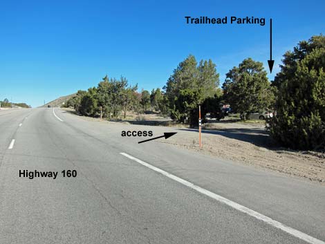
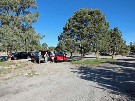
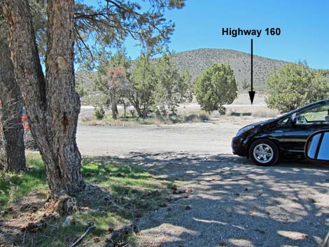
The Mountain Springs Trailhead is located just outside Red Rock Canyon National Conservation Area, about an hour west of Las Vegas, but not in the Scenic Loop Road fee area. The trailhead is located on Highway 160, just east of (before) the town of Mountain Springs. This trailhead is not in the fee area. From town, drive out to Red Rocks. From West Charleston Blvd at the entrance to the Scenic Loop Road (Table 1, Site 0519), continue west on Charleston Blvd (Hwy 159) all the way past Blue Diamond town to Highway 160 (Site 0848). Turn right onto Highway 160, towards Pahrump, and drive west for 9.5 miles. The highway climbs through the Red Rock cliffs following the route of the Old Spanish Trail. Just before reaching the town of Mountain Springs, watch for wooden, double-pole powerlines along the right (north) side of the highway. When the powerlines turn and cross the highway (Site 0549), turn right onto a paved roadside apron and into a dirt parking area (Site 1070). Park here; this is the trailhead. |
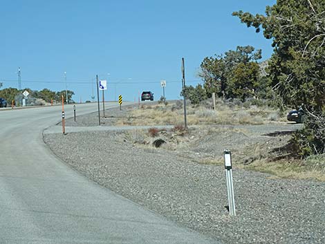
 Highway 160 at Mountain Springs Trailhead (view NW) |
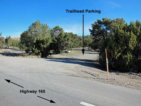
Link to trailhead map. The trailhead is off the road under single-leaf pinyon pine trees. Several dirt roads converge here, so be sure to park under the trees or otherwise out of the roadways. The Mountain Springs Trailhead provides access to the top of the Red Rock cliffs and several miles of strenuous hiking. Trails: Mountain Springs Peak, Hollow Rock Peak, Windy Peak. Vehicle break-ins seem to be increasing at this trailhead, perhaps because of easy access to the highway. Never leaves anything of value visible inside a vehicle. Some suggest leaving the windows down. |
 |
 |
 |
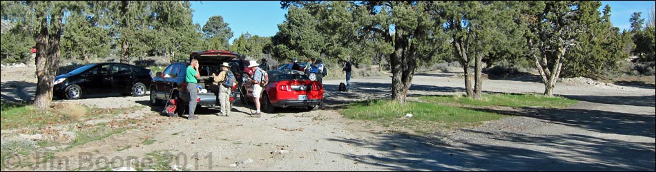
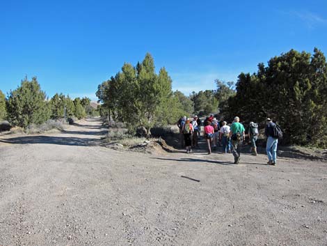 Hikers departing trailhead (view N) |
Table 1. Highway Coordinates (NAD27; UTM Zone 11S). Download Highway GPS Waypoints (*.gpx) file.
| Site | Location | Latitude (N) | Longitude (W) | Easting | Northing | Elevation (ft) | Verified |
|---|---|---|---|---|---|---|---|
| 0519 | Hwy 159 at Scenic Loop Entrance | 36.13183 | 115.42059 | 642120 | 3999525 | 3,681 | Yes |
| 0549 | Hwy 160 at Mt Springs Trailhead Access | 36.01344 | 115.49906 | 635261 | 3986280 | 5,464 | GPS |
| 0848 | Hwy 160 at Blue Diamond Rd | 36.03498 | 115.35801 | 647933 | 3988875 | 3,169 | Yes-2 |
| 1070 | Mt. Springs Parking | 36.01386 | 115.49898 | 635268 | 3986328 | 5,465 | GPS |
Happy Hiking! All distances, elevations, and other facts are approximate.
![]() ; Last updated 240330
; Last updated 240330
| Hiking Around Red Rocks | Hiking Around Las Vegas | Glossary | Copyright, Conditions, Disclaimer | Home |