Hiking Around Las Vegas, Sloan Canyon NCA
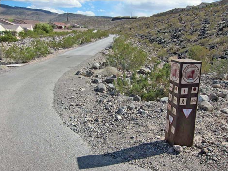 Shadow Canyon Trailhead (view SE) |
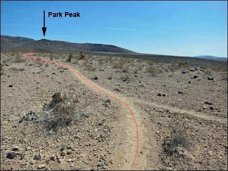
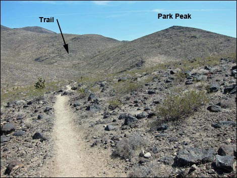
Overview The Park Peak Loop Trail, also called the BLM 403 Trail, provides a fairly strenuous, 5.2-mile loop in the Sloan Canyon National Conservation Area that climbs onto the summit of Park Peak and provides grand views over the Las Vegas Valley. Paved access to the trailhead makes this an easy getaway from town into the black, volcanic mountains that rim the south edge of Las Vegas. These mountains seem to catch a lot of rain, making the Mojave Desert Scrub vegetation fairly robust and diverse in this area. This is the official Park Peak Loop Trail (BLM 403). Another loop trail, the Park Peak Trail, also climbs to the summit of Park Peak. The major difference between these hikes is that the official trail has a long in-and-out with a short loop in the middle (37% loop), while the Park Peak Trail is a long loop (81% loop) with a short in-and-out at the start and end of the hike. Link to map. |
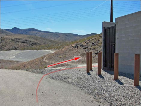 Cinder-block building atop dam (view SE); trail turns right |
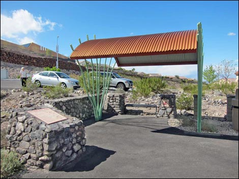
Watch Out Other than the standard warnings about hiking in the desert, ...this hike is fairly safe with no unusual hazards. Be careful walking around on the boulder pile that is the summit. While hiking, please respect the land and the other people out there, and try to Leave No Trace of your passage. Also, even though this hike is short, be sure to bring what you need of the 10 Essentials. Getting to the Trailhead This hike is located in Sloan Canyon NCA, but it is accessed from urban neighborhoods in the Anthem area of Henderson, as described for the Shadow Canyon Trailhead. |
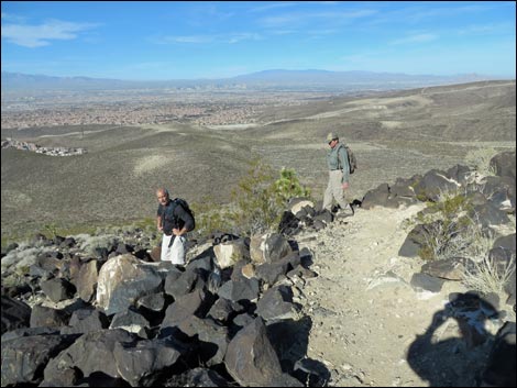
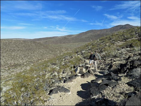
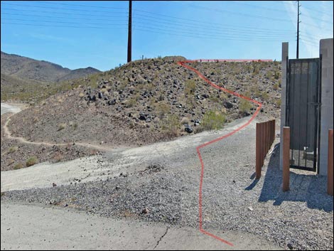 Past the cinder-block building, the trail climbs the ridge (view S) Past the cinder-block building, the trail climbs the ridge (view S) |
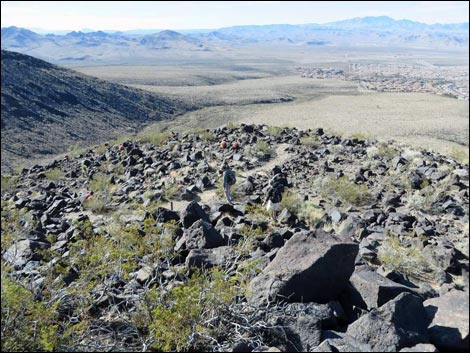
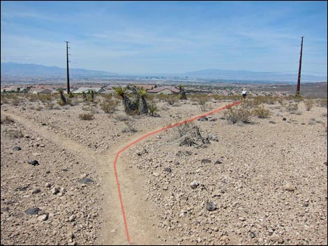
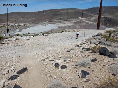
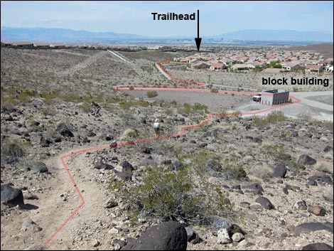
The Hike From the Shadow Canyon Trailhead, (Table 1, Waypoint 01), this loop starts by running southeast on the paved Anthem East Trail in a well landscaped gully bordered by houses. After about 0.28 miles, a paved trail crosses the Anthem East Trail (Wpt. 02), and by this time, hikers can look out in the distance and see a small cinder-block building on a hill ahead. The hill will turn out to be a dam that catches floodwaters before they affect town. The paved trail bends a bit left and then splits (Wpt. 03). Here, hikers can go either way, but it is probably easier to turn right on the Anthem East Trail and follow the pavement to the cinder-block building atop the dam (Wpt. 04). From the cinder-block building (Wpt. 04), trails diverge. The Anthem East Trail turns east to cross the dam, the Black Mountain Trail (BLM 404) continues straight (northeast), and the Park Peak Loop Trail (BLM 403) turns right (southwest). |
 Trail follows powerline road to a fork (view W) |
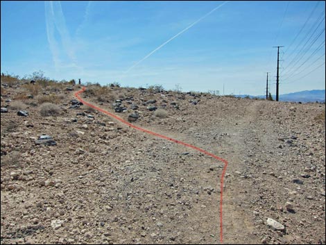
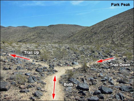
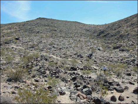
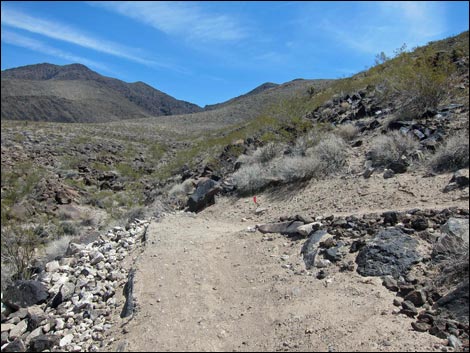
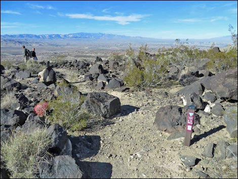
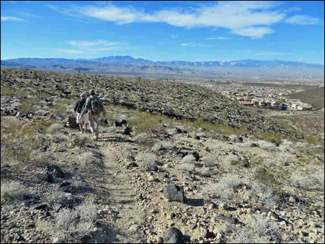
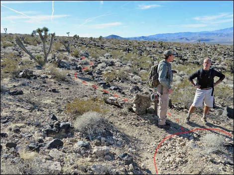
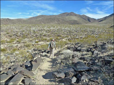
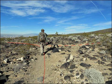
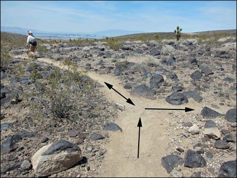
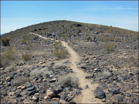
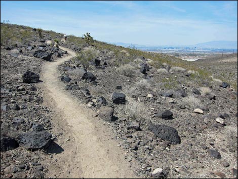
Turning southwest and climbing the steep hill behind the cinder-block building, the trail joins a powerline road atop the ridge. Following the dirt road west, shortly the Park Peak Loop Trail forks off to the left (Wpt. 16), leaving the dirt road, and enters the National Conservation Area as it heads into the wildlands. Beyond the fork, the trail turns south and runs a short distance to a trail junction (Wpt. 15), then continues southeast following the crest of a broad, low ridge. Bypassing the highpoint of the ridge, the trail winds down off the end of the ridge into a wash and arrives at another trail junction (Wpt. 14). Here, the Park Peak Loop Trail continues straight (east). This is, however, the start of the "loop" portion of the trail, and the trail will eventually return via the trail to the right (south) to close the loop at this point. |
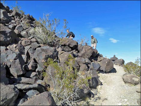
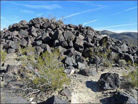
 Trail passes a fork (view S) |
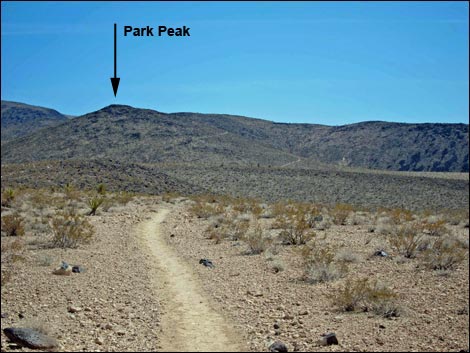
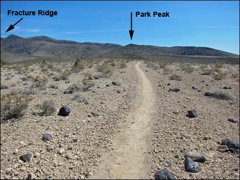
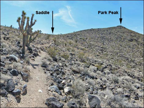
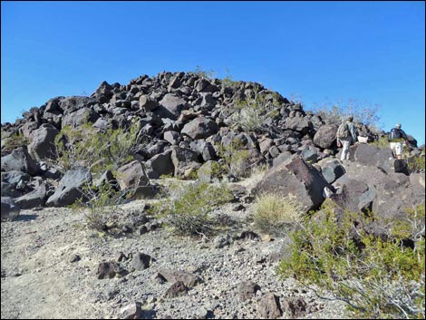
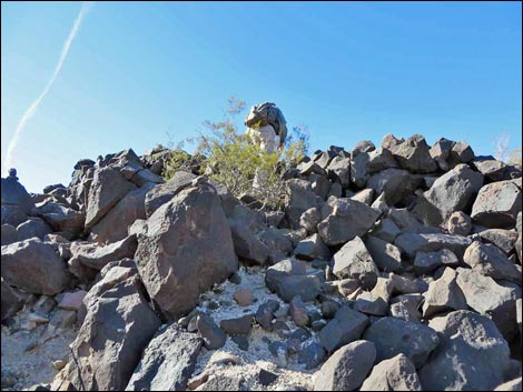
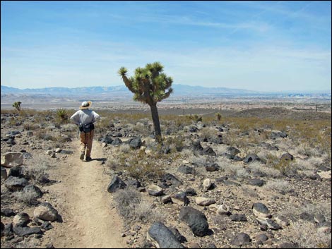
Continuing straight, the Park Peak Loop Trail runs out to a T-intersection (Wpt. 08). Here, the Connector Trail (BLM 402) comes in from the left, while the Park Peak Loop Trail turns to the right. Turning south, the Park Peak Loop Trail crosses a wash and begins to climb the hillside ahead on the left. As the grade steepens, the trail makes seven long switchbacks, runs out to the southwest, makes two more switchbacks, and climbs towards a saddle on the ridgeline (Wpt. 09). From the saddle, which functionally is the toe of Fracture Ridge, the Park Peak Loop Trail climbs west following the East Ridge of Park Peak. Running up the ridge, the well-built trail suddenly ends (Wpt. 10) at the base of a rock pile. Using the plethora of cairns as a guide, hikers can pick their way up through the rocks (barely more than 2nd Class) for the last 25-or-so vertical feet to the summit (Wpt. 11). |
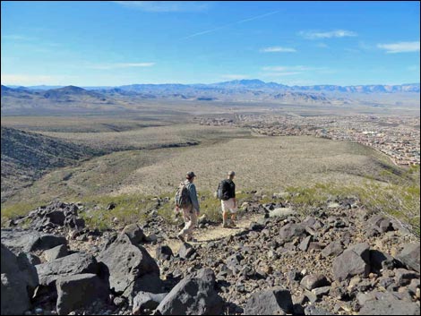
 Following broad, flat ridge (view SE) |
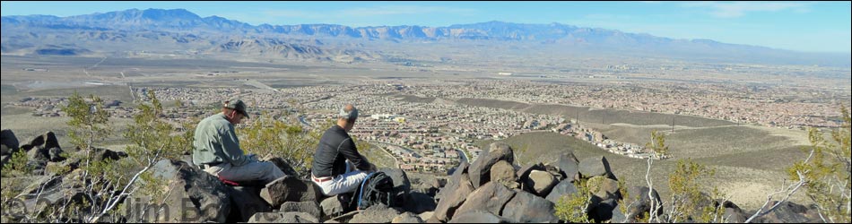
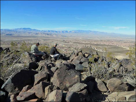
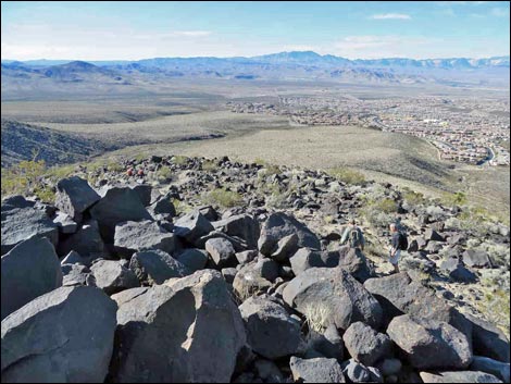
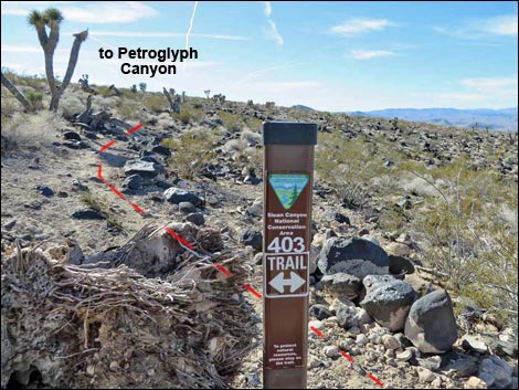
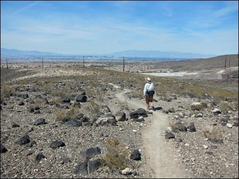
Views from the summit are pretty good for such a low summit. To the west are Mt. Potosi and the Red Rock Canyon cliffs. To the north lie Mt. Charleston, the Sheep Range, the Las Vegas Range, and Frenchman Mountain. Views to the east are short, but give a good vantage of Black Mountain and Fracture Ridge. To the south is a deep canyon and high ridges block much of the long-range view, but the higher peaks in the North McCullough Wilderness are visible to the southwest. Departing the summit, the route continues west across the top of the summit boulder pile, and before long, the well-built trail on the West Ridge comes into view. Climbing down off the boulders (Wpt. 12), the trail starts again and switchbacks down the West Ridge. After several long switchbacks, the Park Peak Loop Trail reaches a trail junction (Wpt. 13) at the turn of the last switchback. Here, the obvious Park Peak Loop Trail switchbacks right to run northeast, while the faint BLM 101 Trail (Petroglyph Canyon Connector Trail) continues off the point of the switchback to run southwest. |
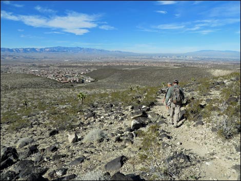
 Following broad, flat ridge (view SE) |
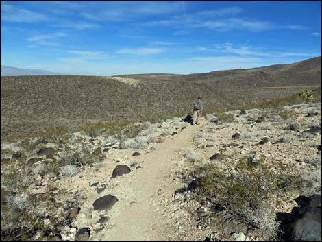
Now running northeast, the Park Peak Loop Trail contours down and across the flanks of Park Peak until dropping into the wash below, turning north, and running out to a T-intersection (Wpt. 14). This point is a bit confusing because the intersection is with the Park Peak Loop Trail; yes, the Park Peak Loop Trail intersects the Park Peak Loop Trail at a T-intersection: this is where the trail closes the loop. To return to the trailhead via a different trail, hikers can turn right to the next trail junction (Wpt. 08), then turn left and follow the Connector Trail north to the Black Mountain Trail, then turn left and head back to the cinder-block building and the trailhead. However, to finish the Park Peak Loop Trail, hikers turn left. Hiking northwest, the trail leads onto a low ridge that eventually bends more to the north. At a fork in the trail (Wpt. 15), the Park Peak Loop Trail stays right and shortly merges with a powerline road (Wpt. 16). Staying right, the trail shortly turns left and drops off the roadway to the cinder-block building below (Wpt. 04). From here, the hike follows the paved Anthem East Trail back to the trailhead. |
 Trail bypasses high point on the ridge (view SE) |
 Trail junction at the start of the official "loop" (view SE) |
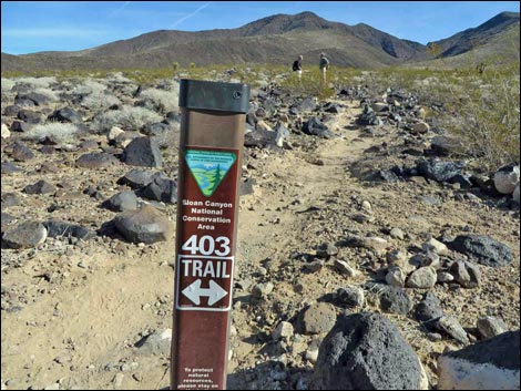 Trail sign at start of the official "loop;" hikers on trail (view E) |
 Trail sign at start of the official "loop;" hikers on trail (view S) |
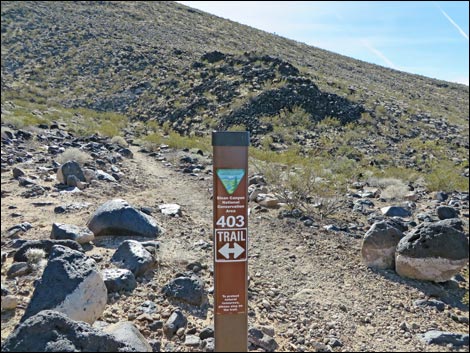
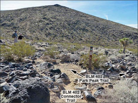 Connector Trail ends at Park Peak Trail junction (view S) |
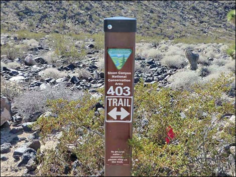 Park Peak Trail (BLM 403) sign (view S) |
 Park Peak Trail starts up hillside (view SE) |
 One of several switchbacks on hillside (view E) |
 Trail climbs towards a saddle and the peak (view SW) |
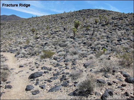 Fracture Ridge (view E from near saddle) |
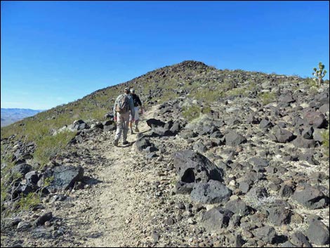 Hikers on East Ridge of Park Peak (view W) |
 Hikers approaching boulder covered summit (view NW) |
 End of built-trail (view NW) |
 Hiker scrambling up boulders towards summit (view W) |
 Hikers on the summit (view NW) |
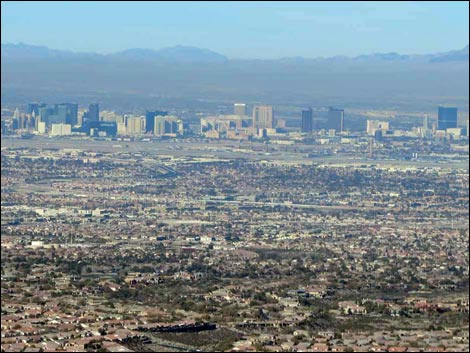 Summit (grand view NW to Las Vegas Strip and Downtown) |
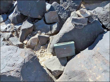 Summit register |
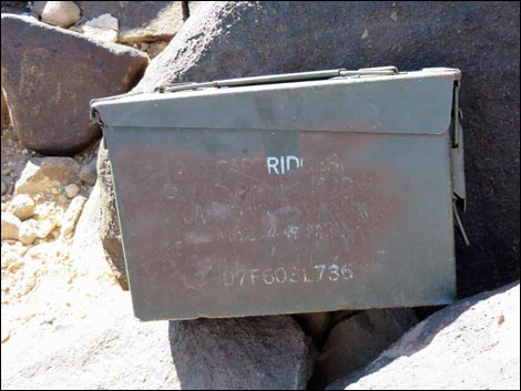 Summit register in old ammo box |
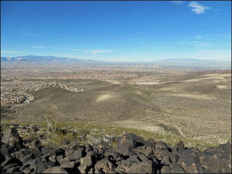 Summit (grand view NW across the Las Vegas Valley) |
 Summit (grand view W towards Mt. Potosi) |
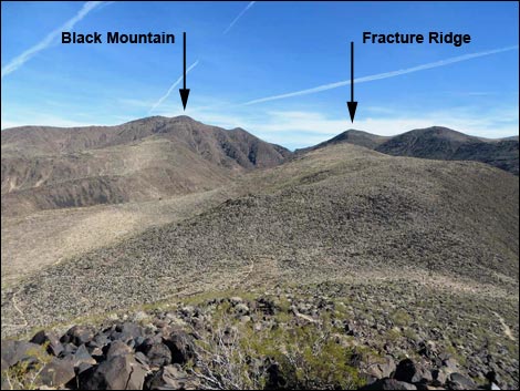 Summit (grand view E to Black Mountain and Fracture Ridge) |
 Park Peak Trail continues off summit across boulder field (view W) |
 Start of built-trail on west side of summit boulders (view NW) |
 Looking back: end of trail on W side of summit boulders (view NW) |
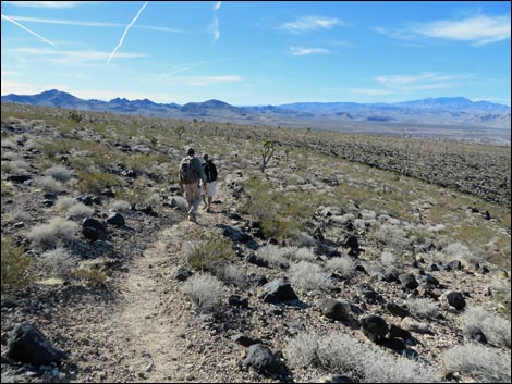
 Hikers on trail (view W) |
 Hikers on trail (view W) |
 Switchback to the north (view N) |
 Switchback to the west (view W) |
 Hikers on trail (view W) |
 Hikers at junction of BLM 403 Trail and BLM 101 Trail (view W) |
 BLM 101 Trail to Petroglyph Canyon (view SW) |
 Hikers switchback and continue on Park Peak Trail (view NE) |
 |
 |
 Park Peak Trail at Park Peak Trail (closing the official loop) |
 Hikers starting on the in-and-out part of the hike (view N) |
Looking back at trail junction sign (view S) |
 Hiker on Park Peak Trail (view NW) |
 Hiker on Park Peak Trail (view N) |
Hiker on Park Peak Trail (view NW) |
 Hiker on Park Peak Trail (view NW) |
 Hiker on Park Peak Trail (view N) |
 Trail junction; Park Peak Trail stays right (view N) |
 Park Peak Trail merges with powerline road (view NE) |
 Park Peak Trail departs road and drops towards cinder-block building |
 Back on the pavement (view N) |
 Returning to the trailhead (view N) |
 More to come ... |
Table 1. Hiking Coordinates and Distances based on GPS Data (NAD27; UTM Zone 11S). Download Hiking GPS Waypoints (*.gpx) file.
| Wpt. | Location | UTM Easting | UTM Northing | Elevation (ft) | Point-to-Point Distance (mi) | Cumulative Distance (mi) | Verified |
|---|---|---|---|---|---|---|---|
| 01 | Trailhead | 673133 | 3979357 | 2,966 | 0.00 | 0.00 | GPS |
| 02 | Trail Junction | 673277 | 3979000 | 2,976 | 0.26 | 0.26 | GPS |
| 03 | Trail Junction | 673415 | 3978839 | 3,021 | 0.13 | 0.39 | GPS |
| 04 | Trail Junction | 673476 | 3978746 | 3,052 | 0.11 | 0.50 | GPS |
| 16 | Trail Junction | 673430 | 3978613 | 3,185 | 0.13 | 0.63 | GPS |
| 15 | Trail Junction | 673393 | 3978473 | 3,212 | 0.10 | 0.73 | GPS |
| 14 | Trail Junction | 674230 | 3977513 | 3,366 | 0.90 | 1.63 | GPS |
| 08 | Trail Junction | 674396 | 3977485 | 3,419 | 0.13 | 1.76 | GPS |
| 09 | Saddle | 674494 | 3977047 | 3,677 | 0.61 | 2.37 | GPS |
| 10 | End of Trail | 674312 | 3977070 | 3,776 | 0.18 | 2.55 | GPS |
| 11 | Park Peak Summit | 674295 | 3977067 | 3,813 | 0.02 | 2.57 | GPS |
| 12 | Start of Trail | 674269 | 3977052 | 3,761 | 0.02 | 2.59 | GPS |
| 13 | Trail Junction | 673827 | 3977210 | 3,373 | 0.64 | 3.23 | GPS |
| 14 | Trail Junction | 674230 | 3977513 | 3,366 | 0.35 | 3.58 | GPS |
| 15 | Trail Junction | 673393 | 3978473 | 3,212 | 0.90 | 4.48 | GPS |
| 16 | Trail Junction | 673430 | 3978613 | 3,185 | 0.10 | 4.58 | GPS |
| 04 | Trail Junction | 673476 | 3978746 | 3,052 | 0.13 | 4.71 | GPS |
| 03 | Trail Junction | 673415 | 3978839 | 3,021 | 0.11 | 4.82 | GPS |
| 02 | Trail Junction | 673277 | 3979000 | 2,976 | 0.13 | 4.95 | GPS |
| 01 | Trailhead | 673133 | 3979357 | 2,966 | 0.26 | 5.21 | GPS |
Happy Hiking! All distances, elevations, and other facts are approximate.
![]() ; Last updated 240330
; Last updated 240330
| Hiking Around Sloan Canyon | Hiking Around Las Vegas | Glossary | Copyright, Conditions, Disclaimer | Home |