Hiking Around Las Vegas, Arrow Canyon Range, Arrow Canyon Wilderness Area
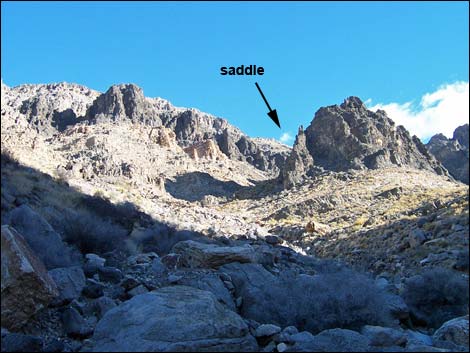
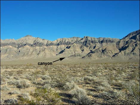 Hidden Peak and access canyon (view E from highway trailhead) |
Overview This is a strenuous route that climbs some 2,600 ft from the valley floor to the summit of Hidden Peak, one of the higher peaks in the Arrow Canyon Wilderness Area. The route crosses the valley, ascends a rocky bajada and canyon to the crest of the range, then follows the loose, rocky ridge north and eastward to Hidden Peak. Upper parts of this route have a little 3rd-class scrambling and lots of loose rock. As with all other peaks in the Arrow Range, views from the summit are spectacular. Link to route map. |
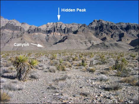 Hidden Peak and access canyon (view E) |
Watch Out Other than the standard warnings about hiking in the desert, ...this is a strenuous route with a little 3rd-class climbing, many pour-overs and loose rocks, and a lot of steep 2nd-class scrambling, but other than potential rock fall, this is a fairly safe route. This route goes into the Arrow Canyon Wilderness Area, so while hiking, please respect the land and the other people out there, and try to Leave No Trace of your passage. There are few cairns on this route; please don't leave any new ones. Also, this is a long hard hike, so be sure to bring the 10 Essentials. |
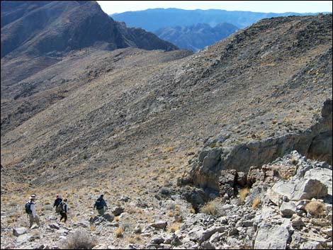
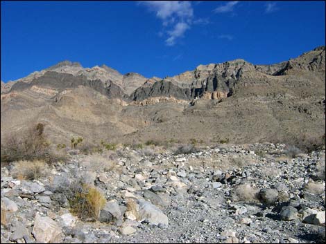 Approaching imposing cliffs (view NE) |
Getting to the Trailhead
This hike is located on the west side of the Arrow Canyon Range, about 45 minutes northeast of Las Vegas. From Las Vegas, drive out to the west side of the Arrow Canyon Range. From the intersection of Interstate-15 and Highway 93, drive north on Highway 93 for 23.1 miles. Stop by Mile Marker 75 (Site 0880), well off the pavement. Park here; this is the trailhead. The Highway Patrol probably will check your vehicle while you are away, so when you return, expect to find a notice on your antenna about abandoned vehicles. |
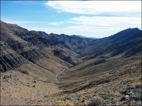
 Canyon, approaching 1st fork (view SE) |
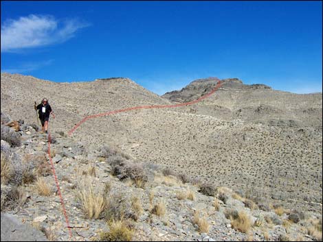
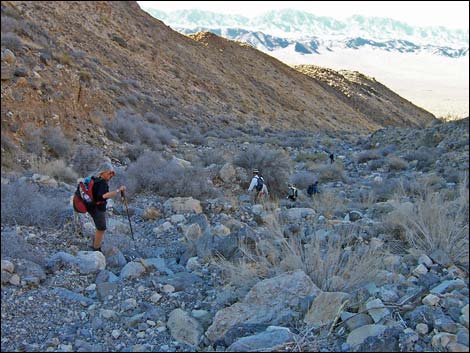
The Hike From the highway trailhead (Table 2, Waypoint 01), the route climbs over the highway fence and runs eastward for about 0.8 miles to a powerline road (Wpt. 02), then continues another 0.9 miles to the mouth of the major canyon (Wpt. 03) that runs diagonally up and right across the face of the range. Most of the canyons on the west side of the Arrow Range run straight up and down the scarf, rather than diagonally. This point (Wpt. 03) also marks the entry into the Arrow Canyon Wilderness Area. Initially, the route winds among vegetation typical of the Upper Sonoran (Mojave Desert Scrub) life zone. Creosote Bush, White Bursage, and Mojave Yucca dominate the landscape, with many other species (including some cactus) mixed in. There is also a lot of cryptogamic (biological soil) crust in the bottom of the valley. The crust is a complex community of bacteria, algae, lichens, mosses, and other stuff that bind loose soil particles together, thereby stabilizing and protecting the soil surface from erosion. The little (1-inch high) peaks in the crust can take a century to develop, and to the extent that we can, we should avoid walking on the crust. |
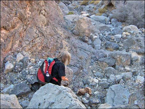
 Canyon, approaching 2nd fork (view SE) |
From the mouth of the canyon (Wpt. 03), the route runs southeast up the canyon all the way up to the saddle on the crest of the ridge. The route stays to the right at the first major fork (Wpt. 04), and to the left at the second major fork (Wpt. 05) in the drainage. The lower canyon is a relatively low-angle, easy hike in the wash. From the second fork (Wpt. 05), the route scrambles up the canyon. This section is steeper with lots of boulders and a few little pour-overs (minimal 3rd-class) to scramble up. Near the middle of the canyon, there is a place where some enormous pieces of quartzite fell from the cliffs and came to rest at the base of a pour-over. In January 2003, there was fresh rock power that appeared never to have been rained on, suggesting that the rocks might have fallen during the previous three weeks (it had snowed here on December 31, 2002) -- an interesting thought to contemplate while hiking in a steep, narrow canyon. |
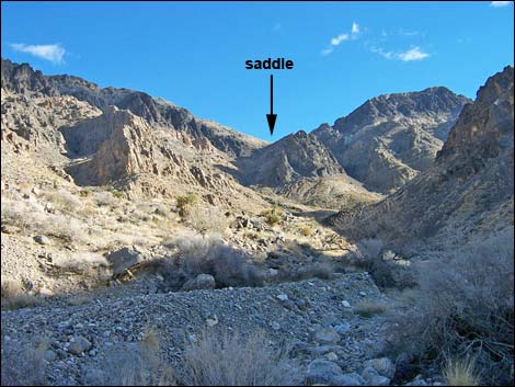
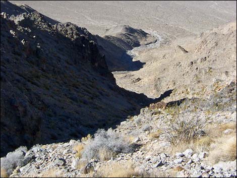
 Canyon, approaching saddle (view SE) |
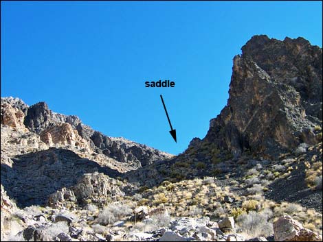
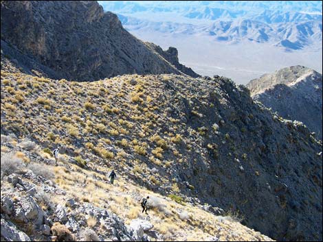
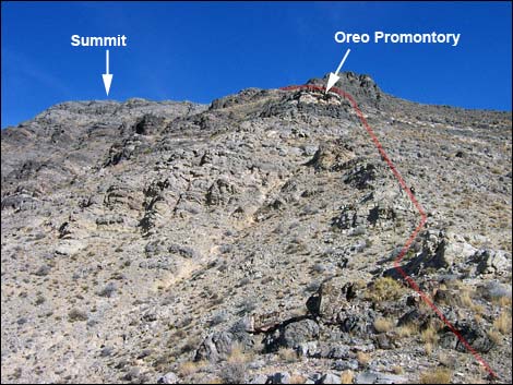
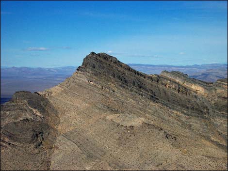
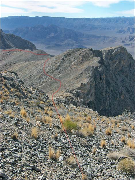
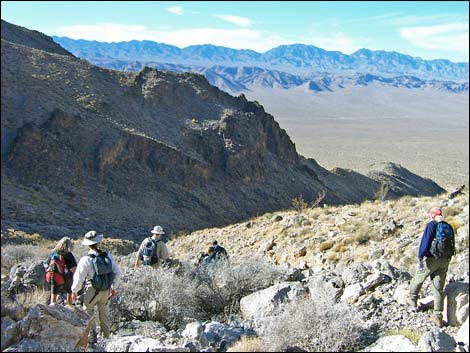
The route continues up the canyon. Near the summit ridge, the canyon opens up above a slot in the cliffs and continues southeast on the lower-angle slopes towards a saddle (Wpt. 06) on the skyline. From the saddle, the route turns north and runs up along the summit ridge. The hiking in this part of the route is easier to the east and south of the actual ridgeline. This bypasses some difficult spots and high points on the ridge, but it causes hiker to traverse rocky sideslopes. Along the way, the route passes another saddle (Wpt. 07), cuts across side slopes (Wpt. 08), passes to the south of a knob, and climbs onto a promontory (Wpt. 09) just below cliffs with interesting thin bands of black and white rock layers (like a stack of Oreo cookies). Higher up, this area still is in the Upper Sonoran (Mojave Desert Scrub) life zone, but here the vegetation is dominated by Blackbrush and bunchgrasses. |
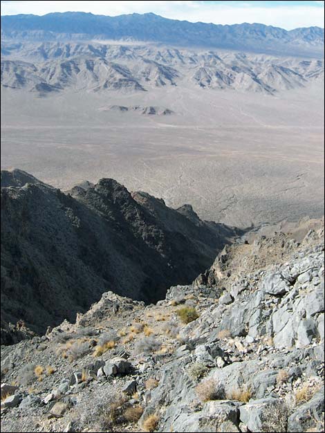
 Steep cliffs of dolomite and quartzite (view N) |
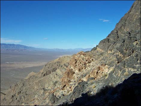
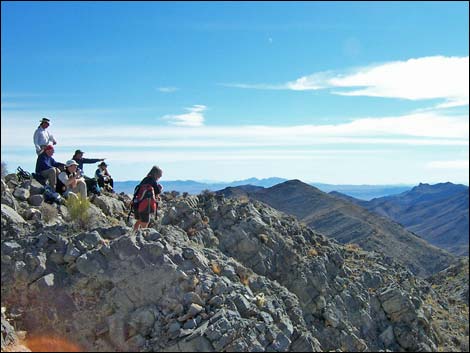
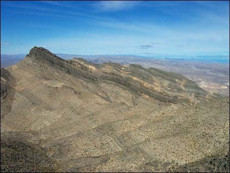
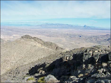
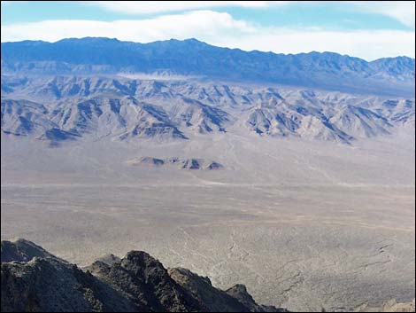
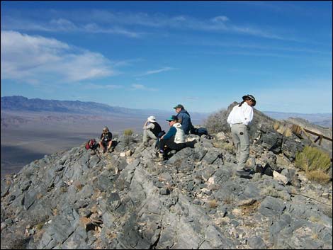
From Oreo Promontory (Wpt. 09), which is only some 200 yards below the summit, the route continues northeast, but crosses a low saddle onto the west side of the ridge. Here, hikers must carefully pick their way across steep, rocky sideslopes and climb through short sections of 3rd-class rock to regain the summit ridge at a point only a few yards from the summit (Wpt. 10). Views from the summit are spectacular. To the east are Mormon Mountain and Moapa Peak, Moapa town, the Virgin Mountains, and peaks up in Utah; to the south is the Lake Mead region and the southern parts of the Arrow Range; to the west are the Las Vegas and Sheep Ranges on the Desert National Wildlife Range, and to the north is the remainder of the Arrow Range and numerous mountain ranges beyond. When ready to depart the summit, retrace your footprints down the ridges and down the canyon to the desert flats below. When departing the summit, be sure to drop down the west side of the summit ridge and hit Oreo Promontory (Wpt. 09); it would be easy to get started on the ridge that runs due south, but this is not the easiest way to get back to the trailhead. |
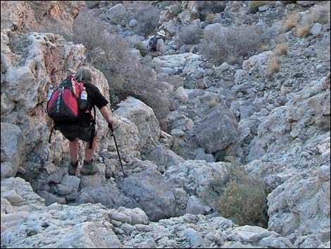
 Steep slopes above the access canyon (view SW) |
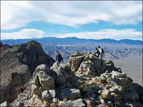
 Traversing long ridge towards summit (view NE) |
 Steep slopes leading to Oreo Promontory (view E) |
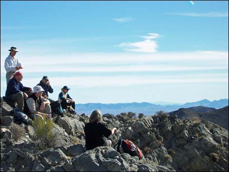
 Hidden Peak summit (view S) |
Summit Photos
 |
 |
 |
 |
 |
 |
The Descent
 Summit; contemplating the descent (view W) |
 On return, descend this steep slope to Oreo Promontory (view SW) |
 Hikers on rocky knob (view W) |
 Hikers traversing side slopes (view SW) |
 The grand views do not stop (view S) |
Hikers approaching the top of the canyon (view SW) |
 Starting down the canyon (view NW) |
 Hiker in rocky canyon (view NW) |
 Hiker in rocky canyon (view NW) |
 Hikers below the steep, rocky parts of the canyon (view NW) |
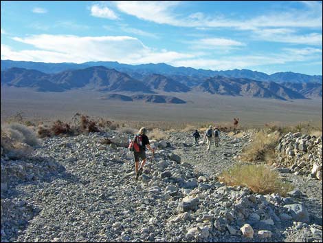
 Hikers low in the canyon (view NW) |
 Hiker approaching mouth of the canyon (view NW) |
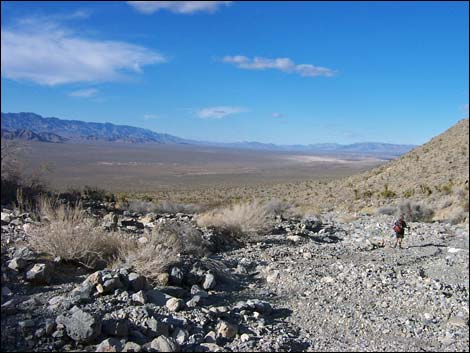
 Hikers descending the bajada (view W) |
 More to come ... |
Table 1. Highway Coordinates based on GPS Data (NAD27; UTM Zone 11S). Download highway GPS waypoints (gpx) file.
| Site | Location | UTM Easting | UTM Northing | Latitude (N) | Longitude (W) | Elevation (ft) | Verified |
|---|---|---|---|---|---|---|---|
| 0880 | Hwy 93 at Hidden Peak Parking | 685272 | 4062093 | 36.68827 | 114.92635 | 2,430 | Yes |
| 1602 | Arrow W Powerline Rd at Peak 5146 TH | 686558 | 4062220 | 36.68916 | 114.91193 | 2,415 | Yes |
Table 2. Hiking Coordinates and Distances based on GPS Data (NAD27; UTM Zone 11S). Download hiking GPS waypoints (gpx) file.
| Wpt. | Location | UTM Easting | UTM Northing | Elevation (ft) | Point-to-Point Distance (mi) | Cumulative Distance (mi) | Verified |
|---|---|---|---|---|---|---|---|
| 01 | Trailhead | 685272 | 4062093 | 2,430 | 0.00 | 0.00 | GPS |
| 02 | Powerline Road | 686550 | 4062219 | 2,419 | 0.82 | 0.82 | GPS |
| 03 | Wilderness Boundary | 687999 | 4062285 | 2,818 | 0.95 | 1.77 | GPS |
| 04 | Fork in the Canyon | 688391 | 4061811 | 3,075 | 0.42 | 2.19 | GPS |
| 05 | Fork in the Canyon | 688467 | 4061576 | 3,261 | 0.18 | 2.37 | GPS |
| 06 | Top of Gully | 689099 | 4061065 | 4,197 | 0.64 | 3.01 | GPS |
| 07 | Saddle | 689219 | 4061608 | 4,505 | 0.37 | 3.38 | GPS |
| 08 | South of Knob | 689394 | 4061771 | 4,617 | 0.22 | 3.60 | GPS |
| 09 | Oreo Promontory | 689761 | 4062057 | 4,877 | 0.32 | 3.92 | GPS |
| 10 | Hidden Peak | 689846 | 4062205 | 5,028 | 0.12 | 4.04 | GPS |
| 01 | Trailhead | 685272 | 4062093 | 2,430 | 4.04 | 8.08 | GPS |
Happy Hiking! All distances, elevations, and other facts are approximate.
![]() ; Last updated 240330
; Last updated 240330
| Arrow Canyon Range | Hiking Around Las Vegas | Glossary | Copyright, Conditions, Disclaimer | Home |