Backroads Around Las Vegas, Arrow Canyon Wilderness Area
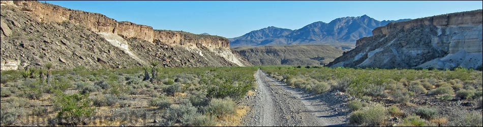
 Highway 168 at Dead Man Wash Road (view SSW) |
Overview Dead Man Wash Road runs 2.7 miles from Highway 168 to the edge of the Arrow Canyon Wilderness Area in Upper Arrow Canyon and provides hiking access to the spectacular deep and narrow Arrow Canyon. This road is an unmaintained two-track, but it is in fairly good condition for the first mile or so. Hikers in sedans probably can drive out 1 mile and park. Beyond there, floods in Fall 2014 washed out the road, although it can be followed 2 miles to Pahranagat Wash and then from some distance downstream. The Pahranagat Wash area was flooded, then heavily silted. The silt gets stirred up in the road, creating a heavy powder that can bog down trucks and create clouds of choking dust. I turned around about 0.6 miles down Pahranagat Wash when the deep dust became muddy. Link to map. |
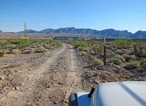 Dead Man Wash Road and route sign (view SSW) |
Watch Out Other than the standard warnings about hiking and driving in the desert, ...this is an easy drive to the edge of Pahranagat Wash. Beyond there, the road can be muddy (deep, sticky mud) or overgrown with weeds. There are no sandy spots on this road. While out, please respect the land and the other people out there, and try to Leave No Trace of your passage. Also, even though this road is short, be sure to bring what you need of the 10 Essentials. Be aware of the weather report and stay out of the wash if rain is expected; you don’t want to get caught in a flash flood or in the mud. |
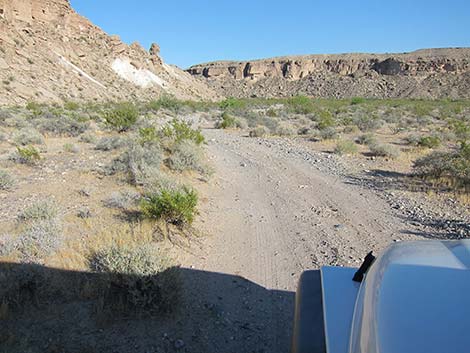
 Road (0.50 miles out; view SSW) |
Getting to the Roadhead This road is located off Highway 168 northwest of Moapa and Glendale, about 1 hour from Las Vegas. From town, out to the Arrow Canyon Wilderness Area. For the quickest route, drive north on Interstate-15 to Glendale (Table 1, Site 0879). Exit the interstate and drive northwest on Highway 168. Drive out 15.8 miles to an unmarked dirt road on the left (Site 1025). This is Dead Man Wash Road. For a more scenic drive, exit Interstate-15 onto Highway 93 (Site 0674). Drive north to Highway 168 (Site 0877). Turn right onto Highway 168 and drive southeast 8.0 miles to Dead Man Wash Road (Site 1025) on the right. |
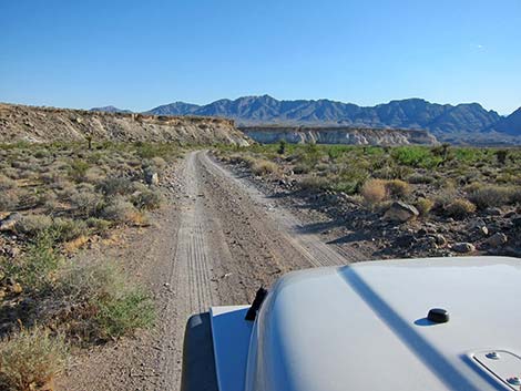
 Road (0.64 miles out; view SW) |
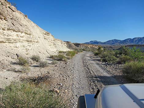
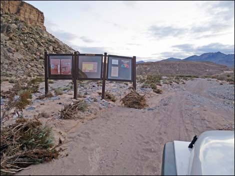
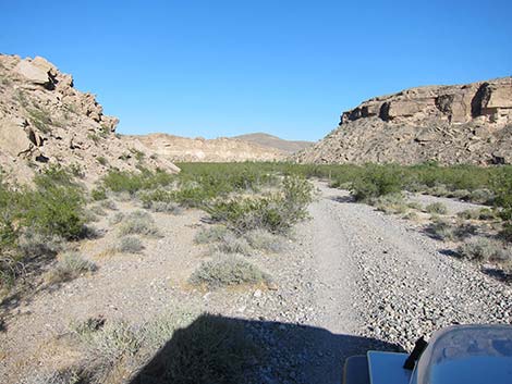
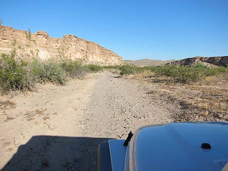
The Road From the pavement (Site 1025), the road runs south-southwest past a BLM carsonite sign that reads "Designated Route, Stay on Designated Routes" and under high-tension power transmission lines. Despite the word "wash" in the name, the road generally runs on firm soils rather than down the wash. As such, the road is fairly smooth with few large rocks. The road runs out across creosote-covered flats, and then runs down a canyon between two mesas. The mesa on the right is Table Mountain, which a 300-acre, disjunct part of the Arrow Canyon Wilderness Area. The road stays east of the wash to about 1.4 miles out, but after that it drops into the wash, although the road surface remains firm. At 1.5 miles out, the road passes an information sign with maps and information about the area. |
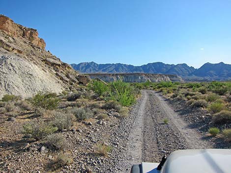
 Road (0.72 miles out; view SW) |
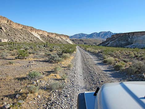
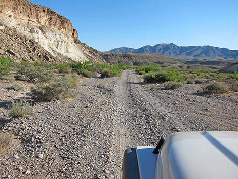
At about 1.6 miles out, the Table Mountain canyon opens onto Upper Pahranagat Wash, and in this area, the road is bending to the southeast (left). Two side roads diverge here to the right. Staying to the left and heading downstream, the road enters an area of deep soils that can become sticky mud when wet. The road was heavily washed out and then silted in 2014, but it remains passable to about 2.5 miles out where it runs in a ditch full of powdery dust (muddy when wet) without possibility of turning around. Historically, a short spur road cut off to the right and ended at a parking area with Wilderness Area boundary signs, but this seems to have been washed away. |
 Road (1.14 miles out; view SSW); wilderness on left |
 Road (1.43 miles out; view SSW); wilderness on left |
 Information sign (1.5 miles out; view SSW) |
 Road (1.72 miles out; view SE); wilderness on left |
 Road (1.91 miles out; view ESE) |
 Road (2.20 miles out; view SE) |
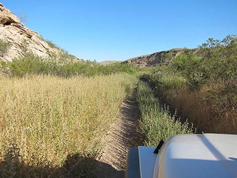 Road (2.42 miles out; view SE) |
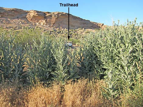
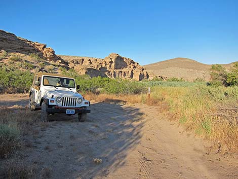 Trailhead Parking (2.71 miles out; view E) |
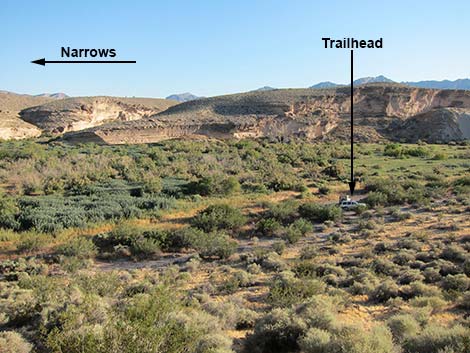 Trailhead (view from edge of cliffs) |
 8-ft tall Bull Thistles block trail |
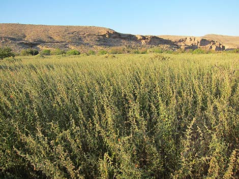 A sea of Narrow-leaf Globemallow obscures the trail |
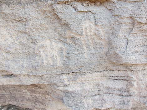
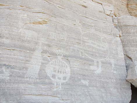 Rock art characters; War Shield Canyon |
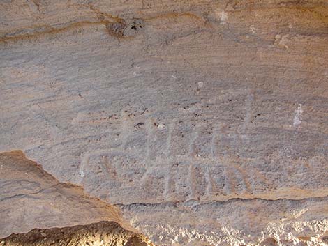 Rock art scorpion? |
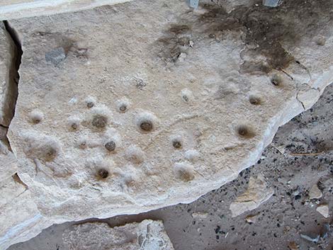 Cupules |
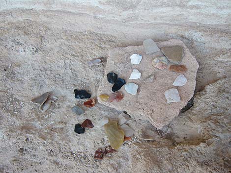 Someone's collection of worked stone fragment |
 Petroglyphs |
Table 2. Backroad Coordinates based on GPS data (NAD27; UTM Zone 11S). Download Highway GPS Waypoints (*.gpx) file.
| Site # | Location | UTM Easting | UTM Northing | Latitude (N) | Longitude (W) | Elevation (ft) | Verified |
|---|---|---|---|---|---|---|---|
| 0631 | Arrow Canyon, Upper Parking | 695696 | 4069051 | 36.74886 | 114.80798 | 2,011 | Yes |
| 0674 | I-15 at Hwy 93 (Apex) | 689188 | 4028063 | 36.38091 | 114.89089 | 2,215 | Yes |
| 0877 | Hwy 93 at Hwy 168 | 683266 | 4074374 | 36.79930 | 114.94584 | 2,532 | Yes |
| 0879 | I-15 at Hwy 168 (Glendale) | 716889 | 4059763 | 36.66059 | 114.57340 | 1,542 | Yes |
| 1025 | Hwy 168 at Dead Man Wash Road | 695423 | 4072324 | 36.77840 | 114.81018 | 2,315 | Yes |
Happy Hiking! All distances, elevations, and other facts are approximate.
![]() ; Last updated 240330
; Last updated 240330
| Backroads Around Lake Mead | Hiking Around Las Vegas | Glossary | Copyright, Conditions, Disclaimer | Home |