Hiking Southern Nevada Wilderness Areas, Backroads
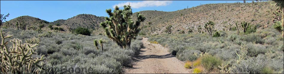
 Pine Spring Road, South Fork, curves to the left |
Overview The South Fork of Pine Spring Road is a 1.6-mile dirt road that runs southwest from Pine Spring Road to a trailhead on the edge of the South McCullough Wilderness Area. The South Fork provides sightseeing, hunting, hiking, and camping opportunities in the wild and remote region below the wilderness area, plus hiking and hunting opportunities inside the wilderness area. The road is in fairly good condition overall, but it is rough in several places. Assuming good weather, the road is suitable for experienced drivers of 2WD high-clearance (2WD-HC) vehicles, but 4WD would be safer in the soft sand. Link to map. |
 |
Watch Out Other than the standard warnings about the desert ... South Fork of Pine Spring Road generally is a good road, but it gets a bit soft in washes, and it runs out into wild and remote country. There are no services or developments of any kind. Cell phones might work, but don't count on it. Bring water and food, a good spare tire, a shovel, tools, a tow rope, bailing wire, and anything you might need to survive a night stuck out in the desert. While hiking, please respect the land and the other people out there, and try to Leave No Trace of your passage. This road runs along Wilderness, so pay particular attention to respecting the land. Be sure to bring the 10 Essentials. For ATVs, spark arresters are required on roads in this area. |
 |
Getting to the Roadhead This road lies between the Wee Thump Joshua Tree Wilderness Area and the South McCullough Wilderness Area, about 1-1/2 hours south of Las Vegas and west of Searchlight. For details of access, see the Pine Spring Road webpage. |
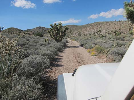 |
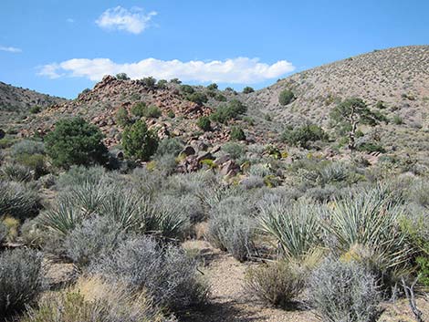
The Road From the 1.5-mile fork on Pine Spring Road (Table 1, Site 1302), the South Fork road runs southwest (left), climbing towards foothills of the South McCullough Range. At about 0.1 miles out, the road forks. The road to the right leads northeast to connect with the main Pine Spring Road. The South Fork Road continues to the left. The South Fork Road climbs gradually, continuing on the broad ridgetop with grand views in all directions where the landscape is thick with blackbrush and Joshua trees. The road is a bit rough in places, but the roadbed is firm and passable in a 2WD-HC vehicle. |
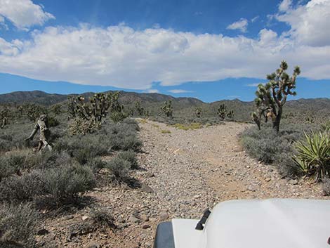
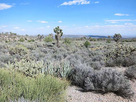 Grand scenery in high-elevation Mojave Desert |
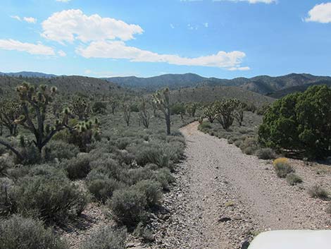
At about 0.8 miles out, the road runs up a sandy wash against the base of a hill. As the road passes the hill (about 1.0 miles out), the road turns hard to the left and out of the wash. The turn is easy to miss, as the broad wash continues. About 100 yards up the wash, the canyon is blocked by natural boulders. Assuming no flash floods, this is a good place to camp. Turning left out of the wash, the road runs over a low hill, then at about 1.3 miles out, drops into a wash. For some distance, the road merely runs in the wash (feels like illegal off-road driving), but soon the old road becomes clear. At 1.6 miles out, the South Fork runs up to the boundary of the South McCullough Wilderness Area, which is marked with a few stones and a carsonite sign planted in the middle of the road. Please respect the wilderness boundary and turn around here. This area is at the bottom of the Pinyon-Juniper Woodland life zone, and trees become thicker farther up the canyon. The closed road leads 0.4-miles to a nice rocky overlook with a grand view to the east across Wee Thump Joshua Tree Wilderness Area. |
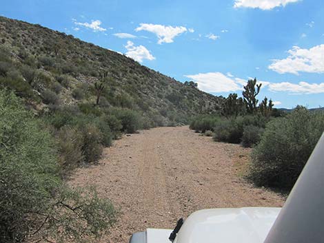 Sandy wash against the base of a hill |
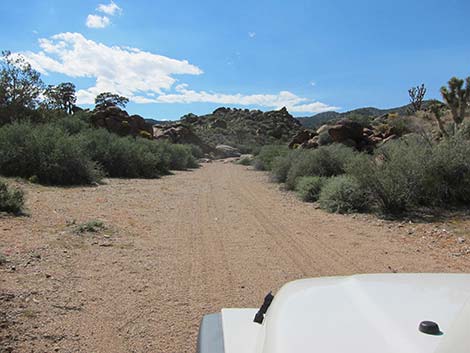 Approaching boulders in the wash and campsite |
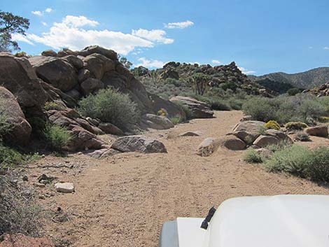 Boulders in wash by campsite on spur road |
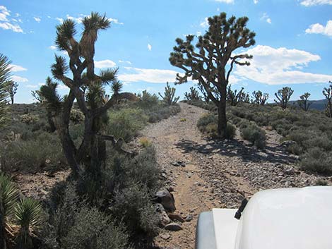
 Grand scenery |
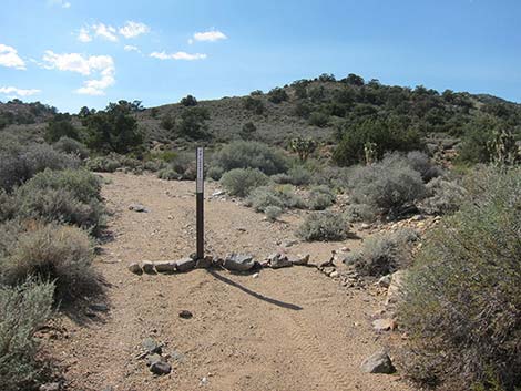 End of the road at the wilderness area boundary |
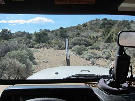 Driving to the edge of wilderness: access for everyone! |
Table 1. Highway Coordinates Based on GPS Data (NAD27; UTM Zone 11S). Download Highway GPS Waypoints (*.gpx) file.
| Site | Location | UTM Easting | UTM Northing | Latitude (N) | Longitude (W) | Elevation (ft) | Verified |
|---|---|---|---|---|---|---|---|
| 1301 | Wee Thump West Rd at Wee Thump North Rd | 672453 | 3937265 | 35.56586 | 115.09710 | 4,560 | GPS |
| 1302 | Pine Spring Rd at Fork | 670165 | 3937004 | 35.56391 | 115.12239 | 4,913 | GPS |
| 1350 | Pine Spring Rd, South Fork Trailhead Parking | 667938 | 3936258 | 35.55756 | 115.14710 | 5,366 | GPS |
Happy Hiking! All distances, elevations, and other facts are approximate.
![]() ; Last updated 240330
; Last updated 240330
| Hiking Around Wilderness Areas | Hiking Around Las Vegas | Glossary | Copyright, Conditions, Disclaimer | Home |