Hiking Around Las Vegas, Zion National Park
 Start of the trail along Echo Creek (view E) |
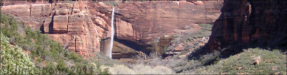
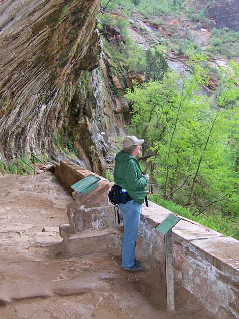
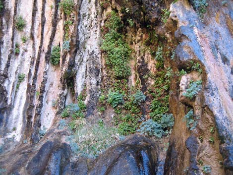
Overview This steep, but pleasant paved trail runs for about 0.25 miles to a rock alcove (shallow cave with a wide mouth) in the wall of the canyon adjacent to a waterfall. The waterfall often is dry, but water seeps out of the rock and drips over the opening of the alcove and down the back wall. This cool, moist area supports a variety of woody plants and spring wildflowers on the hillsides and in the hanging gardens on the canyon walls. The view down the canyon from the alcove is spectacular. Link to map. |
 Middle of the trail in winter (view N) |
Watch Out Other than the standard warnings about hiking in the desert, ...this is a safe, well-maintained trail, but a slip from a couple of places along the trail could result in injury, so be careful and watch your kids. Most of this trail is steep. Hiking here is safe in the rain, but be careful on the wet trail. While hiking, please respect the land and the other people out there, and try to Leave No Trace of your passage. Also, even though this is a short hike, be sure to bring what you need of the 10 Essentials. |
 Approaching Weeping Rock grotto (view N) |
Getting to the Trailhead This hike is located in Zion National Park, about 3 hours northwest of Las Vegas. From town, drive out to Zion National Park. From the Visitor Center (Table 1, Site 863), drive (during winter) or ride the shuttle bus north on Highway 9 for about 1.3 miles to Zion Canyon Road (Site 864). Turn left onto Zion Canyon Road and drive north for about 4 miles to the Weeping Rock parking area (Site 392). Park here; this is the trailhead. |
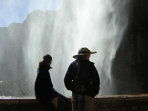 Echo Creek waterfall in front of grotto (view W) |
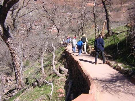
The Hike The shuttle bus stops along the main road, outside the Weeping Rock parking area. From the bus stop, walk up the road under the Cottonwood Trees into the parking lot (about 100 yards). The trailhead is located on the right (south) side of the parking lot. If needed, use the restrooms at the parking area; they usually are clean, and they are the only restrooms in the area. From the trailhead (Table 2, Waypoint 1), a paved trail leads south and across the footbridge over Echo Creek, which flows down past Weeping Rock. Be sure to stop on the bridge and look for the little (3 to 4 inches long) sucker fish that live in the creek; some species of suckers are species of concern, and it is always fun to watch them burrowing into the algae or feeding on the rocks. |
 Birding the treetops during late spring (view S) |
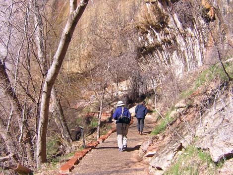
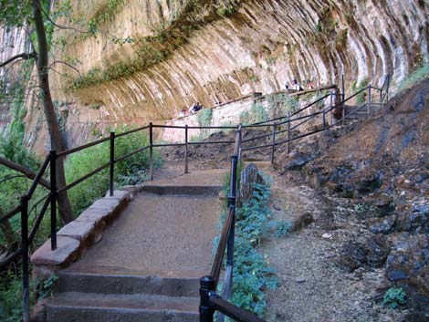
Immediately past the bridge, the trail forks (Wpt. 2). The fork to the left runs east and up along Echo Creek to Weeping Rock. The trail to the right runs south and leads to Hidden Canyon and the high country. From the fork, the paved trail climbs steeply along the hillside above the creek through an area thick with trees. Initially, the trees are Scrub Live Oaks, Gambel's Oaks, Hackberry, and other species adapted to dry hillsides, but higher up, the moist hillsides support Maidenhair Ferns, a variety of flowers (e.g., Golden Columbine, Shooting Stars, and False Soloman-seal), Horsetail (called scouring rush here), and trees that require more water (e.g., Velvet Ash and Cottonwoods). During spring and summer, this area always seems to be full of birds too, and there is a pretty little waterfall on the edge of the trail just before the stairs at the end of the trail. Signs along the trail describe the ecology of the area and identify some of the trees and other plants along the way. Technically oriented biologists with a dry sense of humor might find some of the signs particularly funny. In particular, note the signs about Gambel Oak and Plant Galls. The trail ends (Wpt. 3) by climbing a few metal stairs to a horizontal alcove in the cliff with a man-made stonewall along the edge (so it is safe for kids). Water drips over the lip of the cave, from the ceiling, and down the back wall. When there is enough water, you even have to walk under a small waterfall at the metal stairs to get into the alcove. The main Echo Creek waterfall is beyond the alcove, but close enough to dampen the alcove when the wind is blowing. |
 Hanging garden above the trail (view E) |
The shade provided by the high cliffs and trees, and the moisture provided by the creek and seeps along the canyon walls, make for a cool, moist environment with spectacular scenery and a great variety of plants and bird songs. Return to the trailhead by wandering back down the paved trail to the parking area. |
Table 1. Highway Coordinates (NAD27; UTM Zone 12S). Note that these are UTM-Zone-12 coordinates.
Download Highway GPS Waypoints (*.gpx) file.
| Site | Location | Latitude (°N) | Longitude (°W) | UTM Easting | UTM Northing | Elevation (feet) | Verified |
|---|---|---|---|---|---|---|---|
| 0392 | Weeping Rock parking area | 37.2706 | 112.9377 | 328194 | 4126447 | 4,348 | Yes |
| 0863 | Zion Visitor Center | 37.2000 | 112.9865 | 323702 | 4118706 | 3,940 | Yes |
| 0864 | Highway 9 at Zion Canyon Road | 37.2176 | 112.9736 | 324881 | 4120630 | 4,048 | Yes |
Table 2. Hiking Coordinates Based on GPS Data (NAD27; UTM Zone 12S). Note that these are UTM-Zone-12 coordinates.
Download Hiking GPS Waypoints (*.gpx) file.
| Wpt. | Location | Easting | Northing | Elevation (ft) | Verified |
|---|---|---|---|---|---|
| 01 | Weeping Rock Trailhead | 328188 | 4126483 | 4,348 | GPS |
| 02 | Trail Forks | 328194 | 4126447 | 4,360 | GPS |
| 03 | End of Trail | 328342 | 4126570 | 4,420 | GPS |
Happy Hiking! All distances, elevations, and other facts are approximate.
![]() ; Last updated 240330
; Last updated 240330
| Hiking Around Zion National Park | Hiking Around Las Vegas | Glossary | Copyright, Conditions, Disclaimer | Home |