Week 2: April 10-14, 2006
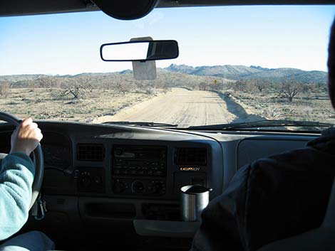 Morning commute |
On my second week with the USGS, we worked in the office on Monday, then headed to Mojave National Preserve (about 2.5 hours south of Las Vegas) for the rest of the week. We camped in Mid Hills Campground in the Pinyon-Juniper Woodland at about 4,500 feet elevation. The area burned in the 71,000-acre Hackberry Fire in June 2005. Most of the campground burned, but there were a few campsites with trees, and we got one of them. Our commute (left) went through part of the burn area. We worked 11- and 12-hour days, so there was little time left in the evening for anything other than eating dinner and going to bed. We forgot part of the stove, so we had cold meals all week. |
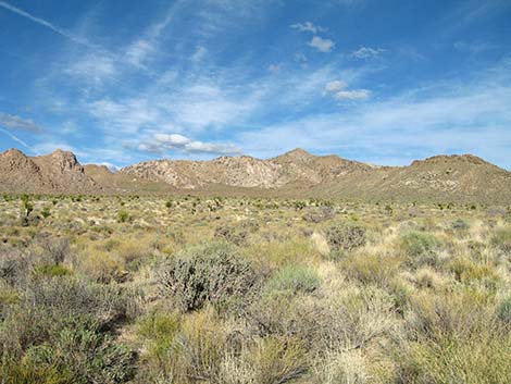 |
This is one of the two study plot areas we worked during the week. We parked at this point and hiked about 20 minutes to the edge of the burn. All of the hills in the background burned. The foreground is what the area looked like before the fire. |
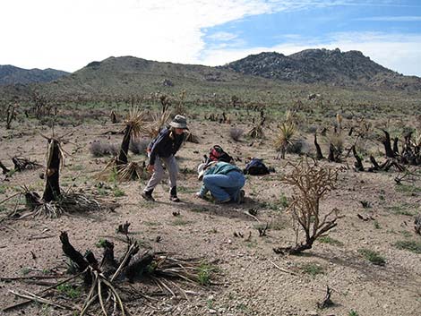 |
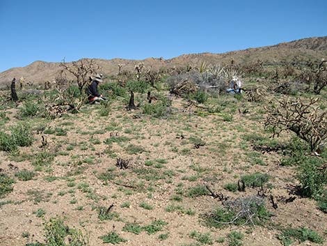
Here, my two bosses are inspecting tiny plants in the burn. The stumps are mostly dead Mojave Yucca and Buckhorn Cholla. The little spots of green on the ground represent dozens of species of spring annual plants (wildflowers) that we have to identify. |
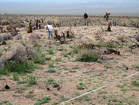 |
Here we are working a study plot. We set up boundaries using 50- and 100-meter measuring tapes. The study plots are 50 meters long and 20 meters wide. We subsample within the boundaries using 1-, 2-, 10-, and 400-square meter subplots, and we also identify every single species of plant growing within the 1,000-square meter total plot. It took all day to do the first plot, but by the end of the week, it was taking about 2.5 hours per plot. |
 |
Every single spot of green has to be identified! |
| Copyright, Conditions, Disclaimer | Jim Boone's Home Page |