Roads Around Las Vegas
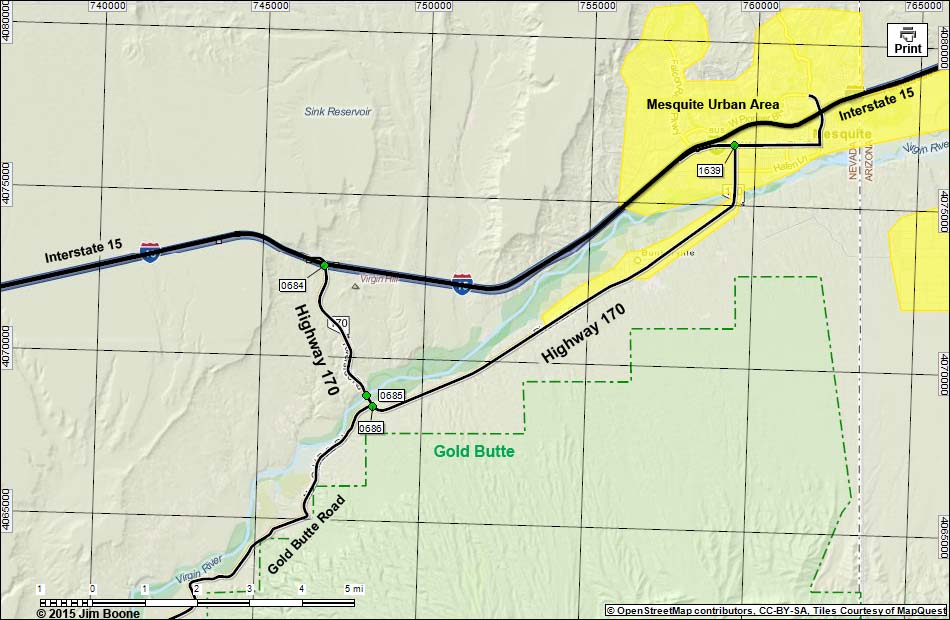
Note: Roads are black (solid = paved; dashed = unpaved; width implies quality). Map based on OpenStreet map. North is at the top. Grid is UTM NAD27 CONUS. Gold Butte (boundaries dashed green, fill light green) based on BLM data. Urban areas (yellow) based on Google Earth (12/2014) image. BLM areas (white) based on BLM data. Download waypoint coordinates from route description page.
Happy Hiking! All distances, elevations, and other facts are approximate.
![]() ; Last updated 150912
; Last updated 150912
| Highway 170 | Hiking Around Las Vegas | Glossary | Copyright, Conditions, Disclaimer | Home |