Rocks and Geology Around Las Vegas
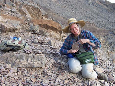 |
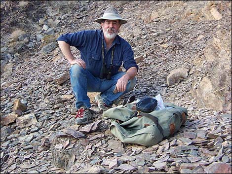
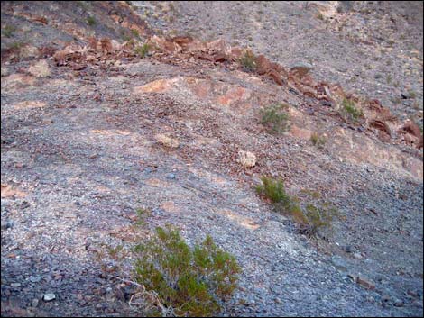
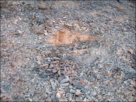
The Chambless Trilobite Quarry, also called the Chambless Rock Collecting Area, lies inside the Trilobite Wilderness Area, is a fairly small site with outcrops of fossil-bearing shale northeast of the ghost town of Chambless. Trilobites here occur in the Latham Shale, a greenish to brownish shale dating from the lower Cambrian (about 518 mya). These trilobites belong to the family Olenellidae (commonly called olenellids). Extinct blue-green algae (genus Girvanella, "oncolites") are common too. Link to additional information about the area. Access to the site is via dirt and sand roads that generally are fine for 2WD vehicles, but conditions change, so walk rather than risk getting stuck. The quarry sites are on hillsides past the end of the access road. The area has been quarried for years, so follow the old road, looking for use-trails and quarry pits. This quarry is inside a wilderness area, so hike in and only use hand tools. Link to map. |
 |
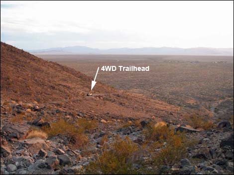
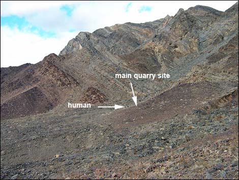
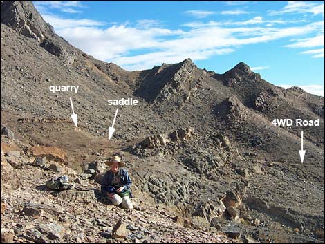
Accessing the site is complicated by levees along Highway 66. On Highway 66, about 200 yards west of Cadiz Road (Table 1, Site 01), turn north onto a dirt road. About 0.5 miles out (Site 02), turn right onto another dirt road. At 1.2 miles out, turn left onto a dirt road (Site 03). At 1.9 miles out, cross a dirt road (Site 04). At 2.2 miles out, stay left at a fork (Site 05). At 2.7 miles out, arrive at the 2WD trailhead parking (Site 06) at the foot of the mountains. On foot or an ATV, continue another 0.25 miles to the 4WD trailhead (Site 07). The trail continues past the end of the road (Site 08), becomes faint, and eventually joins a use-trail near a low saddle behind a knob (Site 09). There is a quarry just above the saddle, but faint use-trails continue across wash and onto next hillside where the main quarry sites (Site 10) are located. This area is a Wilderness Area, so it is possible that collecting is no longer legal here. |
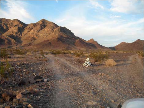
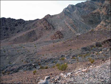
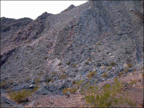
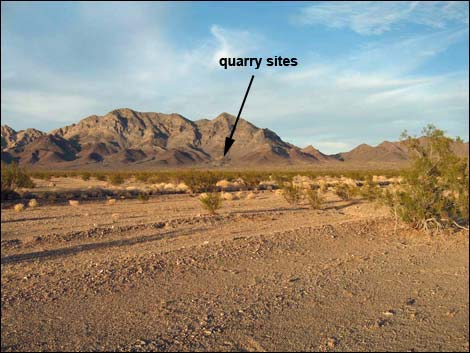 Quarry Sites (view NE from near the highway) |
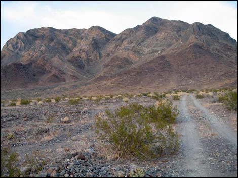
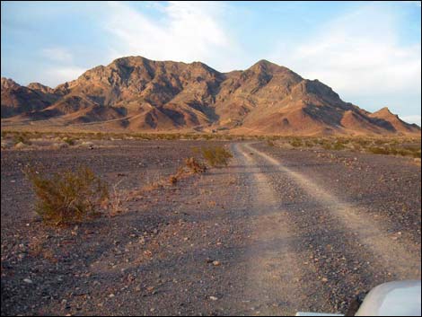 Access Road (view NE from just past cross road) |
 Access Road (view NE at fork in the road) |
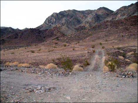
 Access Road approaching 2WD trailhead (view NE) |
 Access Road at 2WD trailhead and campsite (view NE) |
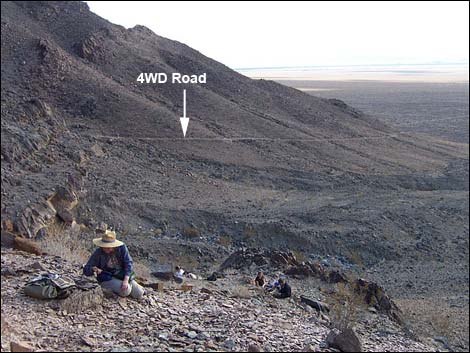
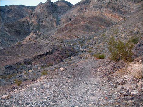 End of Access Road (view NE from 4WD trailhead) |
 |
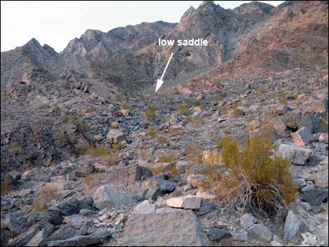 |
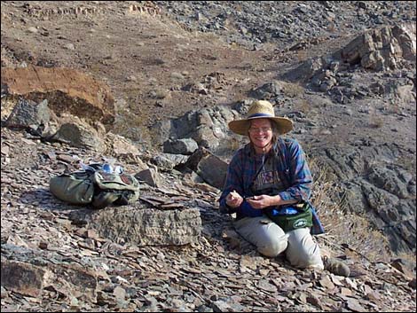
 Quarry site on low saddle |
 Quarry site on low saddle |
 Low saddle (view N towards main quarry area) |
 Returning towards the trailhead (view SW) |
 |
 |
 |
 |
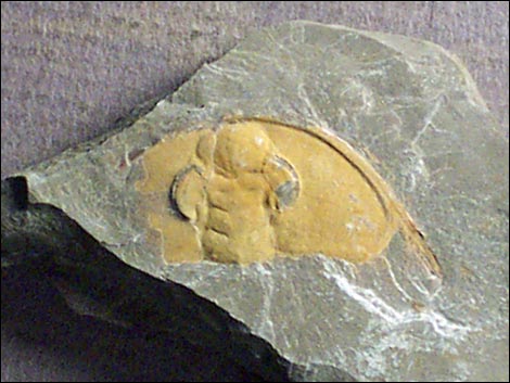 Trilobite |
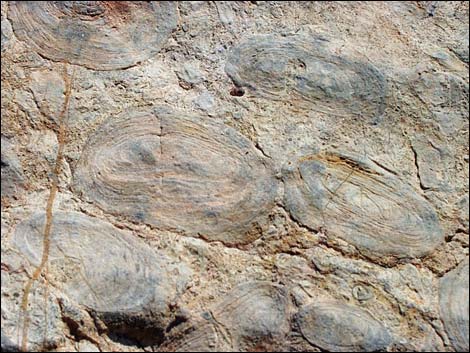 Girvanella, an extinct genus of blue-green algae |
Table 1. Highway and Hiking Coordinates based on GPS Data (NAD27). Download GPS Waypoints (gpx) file.
| Wpt. | Location | UTM Easting | UTM Northing | Elevation (ft) | Point-to-Point Distance (mi) | Cumulative Distance (mi) | Verified |
|---|---|---|---|---|---|---|---|
| 01 | Hwy 66 at Access Road | 34.56184 | 115.54899 | 722 | 0.00 | 0.00 | GPS |
| 02 | Old Farm House | 34.56975 | 115.54893 | 749 | 0.56 | 0.56 | GPS |
| 03 | Road Intersection | 34.56811 | 115.53787 | 757 | 0.65 | 1.21 | GPS |
| 04 | Road Intersection | 34.57229 | 115.52724 | 816 | 0.72 | 1.93 | GPS |
| 05 | Road Forks | 34.57505 | 115.52371 | 869 | 0.28 | 2.21 | GPS |
| 06 | 2WD Trailhead | 34.58103 | 115.51794 | 955 | 0.54 | 2.75 | GPS |
| 07 | ATV Trailhead (outside wilderness) | 34.58432 | 115.51689 | 1,082 | 0.25 | 3.00 | GPS |
| 08 | Old Road Ends (inside wilderness) | 34.58480 | 115.51633 | 1,113 | 0.04 | 3.04 | GPS |
| 09 | Saddle | 34.58586 | 115.51650 | 1,161 | 0.09 | 3.13 | GPS |
| 10 | Quarry Area | 34.58686 | 115.51755 | 1,243 | 0.12 | 3.25 | GPS |
Note: All distances, elevations, and other facts are approximate.
![]() ; Last updated 240331
; Last updated 240331
| Fossils | Rocks and Geology | Hiking Around Las Vegas | Glossary | Copyright, Conditions, Disclaimer | Home |