Southern Nevada Wilderness Areas
 |
Overview The Death Valley Wilderness Area is enormous -- totaling some 3,099,770 acres -- and includes 91% of the land in the National Park. Fourteen other Wilderness Areas lie adjacent to the Death Valley Wilderness Area, and when all are considered, nearly 4 million acres are protected as designated wilderness. Paved and dirt roads crisscross the national park and surrounding areas, subdividing the Death Valley Wilderness Area into 35 sections and the other wilderness areas into 19 subsections, providing exceptional access for hikers, walkers, and even drivers to this wild and scenic desert wilderness. |
 |
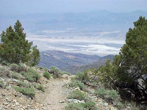
The Death Valley Wilderness Area includes mountain peaks over 11,000 feet in elevation, the lowest spot in North America at 282 feet below sea level, several entire mountain ranges, several sets of sand dunes, more that 1,000 species of plants, 350 species of birds, dozens of mammal and reptile species, vast fields of spring wildflowers, and amazing examples of Native American, pioneer, mining, and other human history. |
 |
Location The Death Valley Wilderness Area is located west-northwest of Las Vegas, about 2.5 hours from downtown. The easiest way to get there from Las Vegas is to drive north on Highway 95 for about 90 miles to Amargosa Valley. Turn left (south) on Highway 373 and drive south into California for about 23 miles to Death Valley Junction. Turn right (west) onto Highway 190, and drive west on Highway 190 for about 30 miles to the Furnace Creek Visitor Center in the heart of the Wilderness Area. Exhibits in the Visitor Center provide a good introduction to the area, and rangers are available to answer questions. Link to Death Valley Wilderness Area map. |
 |
Boundaries The overall boundary of the Death Valley Wilderness Area essentially is the boundary of the National Park. However, roads throughout the park dissect the Wilderness Area, so effectively the boundaries are all of the legal roads. |
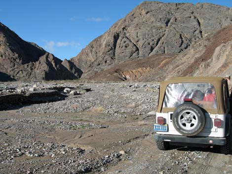 |
Access Access is via the many paved and dirt roads that crisscross the National Park. Many cherry stem roads penetrate deep into the wilderness. Link to map. |
 |
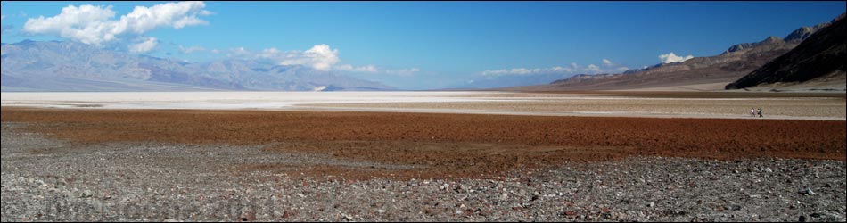
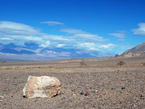
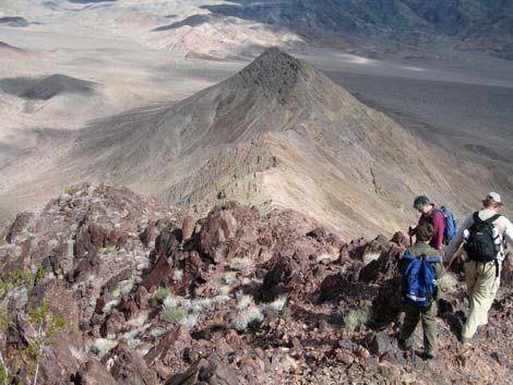
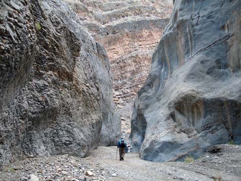
Terrain Terrain in the Wilderness Area ranges from flat valley bottoms to high and rugged mountain peaks. Vast areas are covered by salt flats, sand dunes, mud hill badlands, bajadas, and desert pavement. Steep and rugged mountains are cut by earthquake faults, and these cracks are widened by storm water to create deep and narrow slots canyons. Mountain ranges range from soft and rounded peaks or steep and rugged cliffs. |
 |
Habitat Type With great differences in elevation, temperature, and rainfall throughout the Wilderness Area comes great differences in vegetation. The high-temperature salt flats at the lowest elevations come as close to lifeless as anywhere on earth. Slightly higher than the salt flats, the seemingly lifeless valley bottoms come to life after winter storms with endless fields of wildflowers. Higher yet, habitat types range from low elevation Creosote-Bursage Flats (Lower Sonoran Life Zone) to middle elevation Mojave Desert Scrub and Pinyon-Juniper Woodlands (Upper Sonoran Life Zone). Higher up, forests of Bristlecone Pine and Limber Pine (Hudsonian Life Zone) cloak the landscape. If you hike in wilderness areas, help protect them by learning about and reporting noxious and invasive weeds. |
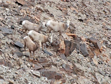 |
Wildlife Bighorn sheep are fairly common in the Mountains, and desert tortoise occur at lower elevations. Several species of carnivores (including coyote, kit fox, ringtail cats, and bobcat) occur in the canyons. Small mammals include valley pocket gopher, kangaroo rats, and deer mice. Lizards in the area include side-blotched Lizards, banded geckos, and leopard lizards; snakes include sidewinders, speckled rattlesnakes, common kingsnakes, and long-nosed snakes. Birds are common, especially during migration when a variety of species can be found around water. Golden Eagle, Great Horned Owl, Black-tailed Gnatcatchers, Say's Phoebe, White-crowned Sparrow, Gambel's Quail, Loggerhead Shrike, Rock Wren, Ruby-crowned Kinglet, Common Ravens, and even Mountain Chickadee use the wilderness area. |
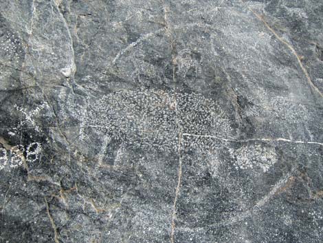 |
Archaeology There are extensive petroglyph panels on the rock walls in many parts of the Wilderness Area. Some of the petroglyphs are on rock walls that lack patina (e.g., limestone walls), which is unusual. Other evidence of prehistoric use includes agave roasting pits, shelter caves, rock alignments, lithic scatters, stone scrapers, and broken arrowheads. The Timbisha Shoshone Indian Tribe lives in Death Valley, and they and their ancestors have used the Wilderness Area for centuries. White people arrived in the late 1800s, and the Wilderness Area is strewn with historical items of the pioneer and mining days. |
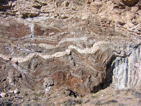 |
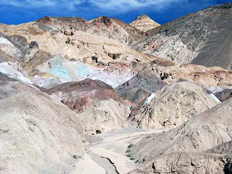
Geology One of the most interesting things about the Death Valley Wilderness Area is that so little of it is covered with dirt and plants, effectively leaving bare the rocks and minerals that make up the earth. In other places, dirt would cover earthquake faults and other evidence of change, but here they are laid bare for all to see. The oldest rocks in the Wilderness Area, dating to 1.7 billion years ago (Precambrian), can be found on the slopes above Badwater. Cambrian age limestone, dating to 500 million years ago (mya), can be found in Titus Canyon and show signs of early life on earth. During the Mesozoic (225-65 mya), the sea receded, and the land erupted with volcanoes, uplifting mountains, compressional thrusting, and erosion. Even in nearly modern times, the geology continues to change: the Ubehebe Crater exploded only 2,000 years ago and flash floods rearrange the land every few years. |
Note: All distances, elevations, and other facts are approximate.
![]() ; Last updated 240331
; Last updated 240331
| Wilderness Areas | Hiking | Guide Services | Glossary | Copyright, Conditions, Disclaimer | Home |