Southern Nevada Wilderness Areas
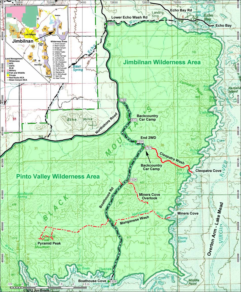
Note: Roads are black (solid = paved; dashed = unpaved). Trails and routes are red (solid = main; dashed = adjacent or alternate). Map based on USGS 15 minute topo map. North is at the top. Grid is UTM NAD27 CONUS. Wilderness Area boundaries (solid green) based on BLM data. National Park boundaries (dashed green) based on NPS data.
Table 1. Highway Coordinates Based on GPS Data (NAD27; UTM Zone 11S). Download Highway GPS Waypoints (*.gpx) file.
| Site | Location | UTM Easting | UTM Northing | Latitude (N) | Longitude (W) | Elevation (ft) | Verified |
|---|---|---|---|---|---|---|---|
| 0513 | Boathouse Rd at Camp | 726950 | 4014704 | 36.25242 | 114.47414 | 2,140 | GPS |
| 0660 | Northshore Rd @ Echo Wash Rd | 725514 | 4020768 | 36.30737 | 114.48835 | 1,444 | Yes |
| 0787 | Cleopatra Wash Trailhead at Camp | 727859 | 4012947 | 36.23638 | 114.46455 | 2,001 | Yes |
| 0789 | Northshore Rd at Boathouse Cove Rd | 726253 | 4015970 | 36.26399 | 114.48152 | 1,909 | Yes |
| 0790 | Northshore Rd at Echo Bay Rd | 725261 | 4023942 | 36.33602 | 114.49025 | 1,703 | Yes |
| 1231 | Boathouse at Cleopatra 2WD Trailhead | 727358 | 4013334 | 36.23998 | 114.46999 | 2,044 | GPS |
| 1324 | Boathouse Rd at Miners Cove Wash | 726868 | 4010946 | 36.21859 | 114.47614 | 2,159 | GPS |
| 1325 | Boathouse Cove | 725667 | 4004522 | 36.16101 | 114.49133 | 1,141 | GPS |
Note: All distances, elevations, and other facts are approximate.
![]() ; Last updated 120923
; Last updated 120923
| Jimbilnan Wilderness | Southern NV Wilderness Areas | Hiking | Copyright, Conditions, Disclaimer | Home |