Southern Nevada Wilderness Areas
 |
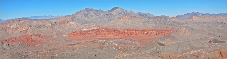
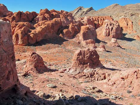
Overview Muddy Mountains Wilderness Area is a large (48,019 acres) area that includes the west end of the Muddy Mountain Range. The boundary essentially follows the base of the mountains at elevations ranging from about 2,500 to 3,300 feet, staying west of Bitter Springs Road. The area includes Muddy Peak (5,387 feet) and Peak 5432 (5,432 feet), the highest peak in the range. The east end of the wilderness area includes Bitter Ridge, block fault ridge with striking vertical cliffs standing up from the desert floor. In the southern part of the area, tilted and folded sedimentary rocks are cut by the Anniversary Narrows. Fire-red Aztec sandstone outcrops occur in the appropriately-named Bowl of Fire, and smaller sandstone outcrops occur in the northeastern parts of the wilderness area. |
 |
If you hike in wilderness areas, help protect them by learning about and reporting noxious and invasive weeds. Link to map of the wilderness area. Location This wilderness area is located about 28 air-miles east of Las Vegas. It lies north of Lake Mead and south of Interstate-15. |
 |
Boundaries The boundary of this wilderness area is complex, but essentially, it includes all of the high elevation land surrounding Muddy Mountain south and east of the Bitter Spring Backcountry Byway. To the east, the wilderness area extends out to include Bitter Ridge. To the south, the area extends to include the Bowl of Fire and Lovell Canyon (almost to Northshore Road). To the west, the wilderness area extends to the western edge of the Gale Hills, then cuts north until angling northeast along the north side of the Muddy Mountains. Buffington Pockets, an area of eroded sandstone outcrops, lies just outside the wilderness area near the northern-most point. |
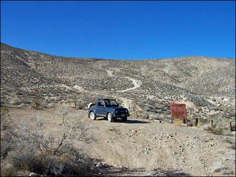 |
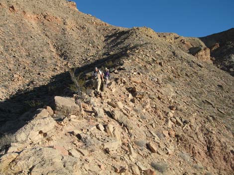
Access The Muddy Mountain region is accessible from the Bitter Springs Backcountry Byway (a rough dirt road), dirt roads off Northshore Road in Lake Mead National Recreation Area, and from rough dirt roads along the western boundary, including Colorock Road, which leads to the Hidden Valley section of the wilderness area. |
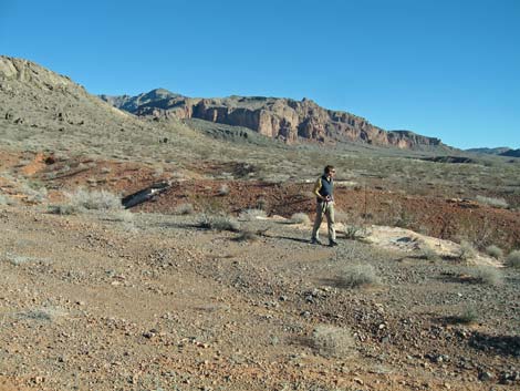 |
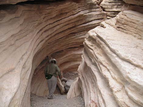
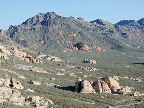
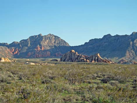
Terrain From Las Vegas, the Muddy Mountains appear to a be one mountain massif, that is, a single mountain that stands above the surrounding flats. Actually, what we see from Las Vegas is the west end of a rugged carbonate ridge that generally is orientated east-west. However, we do see the tallest part, so even from this side, the Muddy Maintains have a "mountain massif" appearance. When we get close enough, we see that there are a couple of major mountain peaks. The range is deeply cut by canyons. The southern part of the wilderness area includes flats and washes that extend south from the Muddys. In the southwest corner of the wilderness area, considerable tilting and uplifting of sedimentary rocks creates steep, narrow ridges that are cut through by washes. In the southeast corner of the wilderness area, brilliant red sandstone occurs in a jumble of rock piles and deep, narrow canyons. |
 |
Habitat Type The vegetation is dominated by Mojave Desert Scrub, where white bursage, creosote bush, other low-desert shrubs, grasses, blackbrush, and Mojave yucca are common. |
 |
Wildlife A large variety of wildlife live in or use the wilderness area. Mammals include desert bighorn sheep, wild burros, valley pocket gopher, Merriam's kangaroo rat, kit fox, and coyote. Reptiles include desert tortoise, chuckwalla, banded gecko, side-blotched lizard, collared lizard, and Great Basin whiptail. Birds seen in the area include Red-tailed Hawk, Say's Phoebe, Rock Wren, and Phainopepla. |
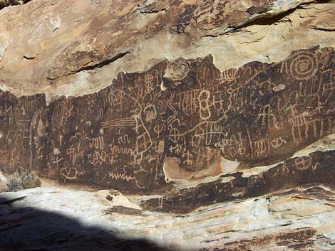 |
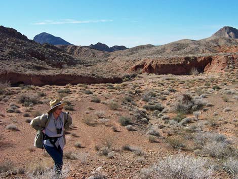
Archaeology For at least 4,000 years, people have lived in these hills. Rock art panels, agave roasting pits, rock shelters, stone flakes, and pot shards can be found. There are some nice petroglyphs in the Colorock Area and in Hidden Valley. Buffington Pockets, located just outside the wilderness area, contains amazing rock art. |
 |
Geology Much of the Muddy Mountains area is formed of the Tertiary Horse Spring Formation. The peaks are Cambrian through Pennsylvanian sedimentary rocks, and there is a bit of Permian rock and Jurassic Aztec sandstone. The northern part of the area has been subjected to overthrust faulting, but in Hidden Valley the older overburden (carbonates) eroded away to reveal the younger rocks (sandstone) below. Cliffs in the conglomerate Gale Hills formation reach to 600-foot high at the West End Wash cliffs. The southern part of the wilderness area is influenced by faulting, with some amazing evidence of twisting and tilting recorded in the rocks. |
Note: All distances, elevations, and other facts are approximate.
![]() ; Last updated 240331
; Last updated 240331
| Wilderness Areas | Hiking | Guide Services | Glossary | Copyright, Conditions, Disclaimer | Home |