Southern Nevada Wilderness Areas
 |
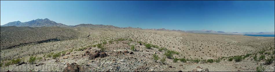
Overview Nellis Wash is a small (16,423 acres) wilderness area that includes the bajadas on the northeastern slopes of the Newberry Mountains. The western boundary of the wilderness area follows the Lake Mead boundary, and in doing so, captures the sides of two mountains with elevations to about 3,500 feet. Several major washes, including Nellis Wash, cross the wilderness area and flow into the Colorado River. Spirit Mountain and the Newberry Mountain peaks form a scenic background above the bajada. The southern end of the wilderness area includes steep, nearly barren ridges separated by deep, well-vegetated washes, while the northern end is a gently rolling bajada. The wilderness area does not include any of the Newberry Mountains peaks, and so cannot be seen from the west (for example, not from Highway 95). From the east side of the Newberry Mountains (for example, along the Colorado River), the landform is a gently sloping bajada leading to a steep, rugged ridge cut by deep canyons. |
 |
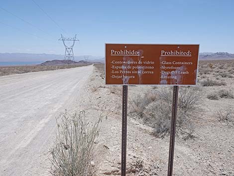
The Nellis Wash wilderness area is separated from the Spirit Mountain Wilderness Area by a dirt road, which is separated from the Bridge Canyon Wilderness Area by another dirt road. Combined, these three wilderness areas are fairly large, protecting nearly 58,000 acres of designated wilderness interrupted only by two dirt roads. If you hike in wilderness areas, help protect them by learning about and reporting noxious and invasive weeds. Link to map of the wilderness area. Location This wilderness area is located about 60 air-miles south of Las Vegas, between Searchlight and Laughlin, and east of Highway 95. |
 |
Boundaries This wilderness area is triangular shaped. The western boundary is coincident with the boundary of Lake Mead National Recreation Area. The northeastern boundary follows a powerline corridor from the Lake Mead boundary to Empire Wash. The southern boundary is the Empire Wash Road, which is also the northern boundary of the Spirit Mountain Wilderness Area. |
 |
Access Access to the wilderness area is from dirt roads, either Mead-Davis Powerline Road on the east side or Empire Wash Road on the south side. To get there, drive south from Las Vegas on Highway 95 for about 35 miles to Searchlight. For Mead-Davis Powerline Road, turn left (east) onto Cottonwood Cove Road (Highway 164). Drive east 6.8 miles to Mead-Davis Powerline Road, which is just past the Lake Mead entrance station. Watch for the high-tension powerlines. Mead-Davis Powerline Road (Lake Mead Road #30) runs along the northeast edge of the wilderness area. A short way out, signs announce entry into Lake Mead National Recreation Area. |
 |
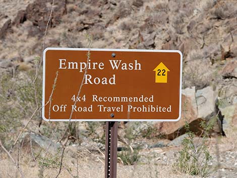
The Powerline Road is graded dirt and can be badly washboarded, but it is otherwise pretty good out to Nellis Cove Road (Road #24). Beyond Nellis Cove Road, the road is rough, rocky, and steep in places, and it should be driven in a 4WD, high-clearance vehicle. The road might be passable in a 2WD, high-clearance vehicle when freshly graded. Past Nellis Cove Road, the road winds around the ridges and eventually reaches a T-intersection with Empire Wash Road. The powerline road turns left and eventually dead-ends. Empire Wash Road is to the right and runs up along the south side of the wilderness area and eventually reaches the pavement in Cal-Nev-Ari. From Searchlight, drivers can also continue south on Highway 95 for 10 miles to Cal-Nev-Ari. At the north edge of Cal-Nev-Ari, turn left onto Loran Station Road. Loran Station Road eventually becomes Empire Wash Road. |
 |
Empire Wash Road is a narrow 2-track road that runs down Empire Wash following along the south edge of the wilderness area. There are a few rocky places, but generally the road is suitable for a 2WD, high-clearance vehicle when freshly graded. This road can be badly washboarded and sandy, and a 4WD vehicle would be safer. Loran Station Road is a rough, paved road out to the abandoned Navy facility, then becomes as wide, graded road. When the road bends hard to the south (right), continue straight onto a lesser road, which is Empire Wash Road. The road continues generally easterly, heads over a low saddle, and starts down Empire Wash. About 3 miles from Loran Station Road, the road enters Lake Mead National Recreation Area, which also is the boundary of the wilderness area. From here to Powerline Road, everything north of the road is Nellis Wash Wilderness Area, and everything south of the road is Spirit Mountain Wilderness Area. |
 |
Terrain The area includes a small portion of the east side of the rugged Newberry Mountains, but most of the wilderness area includes the drainages and bajadas that extend east from the mountains toward Lake Mohave. There are three basic landforms in the wilderness area: the rugged Newberry Mountains, the steep and nearly barren ridges in the southeast portion of the area, and the gently rolling bajada in the northern portion of the wilderness area. The east side of the Newberry Mountains is steep, rugged, rocky, and cut by deep canyons. The hillsides are steep and rocky, with lots of boulders and short cliffs. This landform is best seen from the Empire Wash Road. |
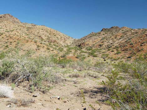 |
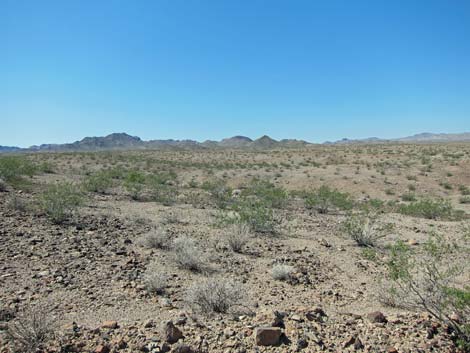
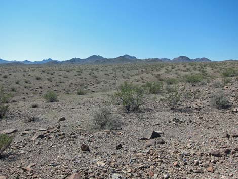
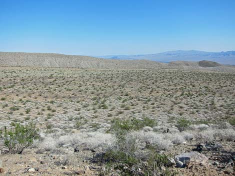
The terrain in the southeastern section of the wilderness area is formed by ridges and washes that extend from the mountains to the lake. The ridgelines are not steep, but the sides of the ridges are steep and nearly barren. The washes generally are narrow at the base with steep sides or short cliffs along the edges. The terrain in the northeastern section of the wilderness area is formed by a gently sloping bajada that extends from the mountains, which are low and rounded this far north, to the lake. Numerous washes run down the bajada, but the washes are shallow and the sides slope gently. From a distance, this area gives the impression of smooth, gently sloping desert flats. |
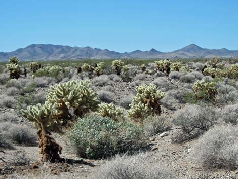 |
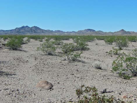
Habitat Type The overall habitat type is Mojave Desert Scrub, dominated by creosote bush, white bursage, Mojave yucca, and a few other low-growing, sparse, desert shrubs and grasses. In the Newberry Mountains, barrel cactus and Mojave jointfir are common on the steep, rocky hillsides. In the washes, the vegetation is more diverse. In Empire Wash, catclaw acacia is common and highly parasitized by mistletoe, plus there are numerous other shrubs and buckhorn cholla. On the southeastern ridges, the vegetation is sparse, stunted creosote bush with little else mixed in. In some areas, however, patches of teddybear cholla blanket the hillside. On the northeastern bajada, creosote and bursage dominate, but they are more dense, less stunted, and other shrubs also are common. Mojave yucca, teddybear cholla, and buckhorn cholla occur here too. |
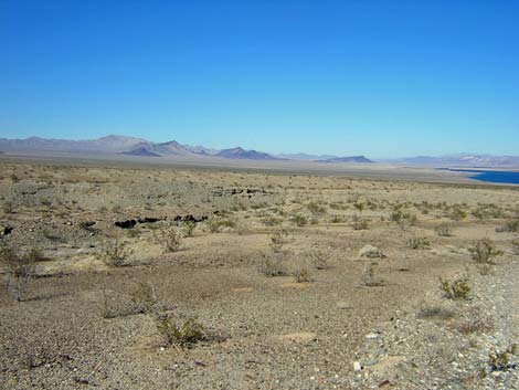
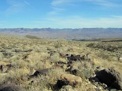 Looking down towards Lake Mohave from along Empire Wash (view E) |
Wildlife Mammals that use the area include wild burros, coyotes, black-tailed jackrabbits, white-tailed antelope squirrels, kangaroo rats, desert woodrats, and other small rodents. Reptiles include side-blotched lizards, rattlesnakes, desert tortoise, and horned lizards. Birds include Red-tailed Hawk, American Kestrel, Black-throated Sparrow, Say's Phoebe, and Gambel's Quail. Archaeology I have no knowledge of prehistoric use by humans, but this wilderness area is adjacent to the Spirit Mountain Wilderness Area, so people undoubtedly used this area. |
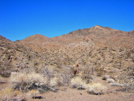
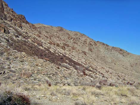 Rocky hillside adjacent to Empire Wash (view NE) |
Geology As elsewhere in this part of the state, the geology is complex. The Newberry Mountains are composed of older metamorphic (1.7 billion years) and granitic rocks (1.4 billion years), overlain by Tertiary volcanic basalt flows and ash-fall tuffs that date to only about 6-17 million years ago. Below the mountains, the bajada is composed of Quaternary alluvial deposits. Notes There are a number of old mining sites along Empire Wash. Open mine shafts are always interesting, but remember, stay out and stay alive. |
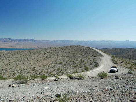
 Mead-Davis Powerline Road (view S) |
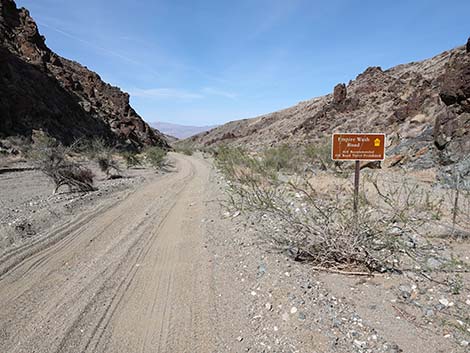 Lake Mead NRA boundary on Empire Wash Road (view E) |
 Empire Wash Road (view E) |
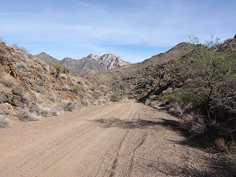 Empire Wash Road (view SE towards Spirit Mountain) |
Note: All distances, elevations, and other facts are approximate.
![]() ; Last updated 240331
; Last updated 240331
| Wilderness Areas | Hiking | Guide Services | Glossary | Copyright, Conditions, Disclaimer | Home |