Southern Nevada Wilderness Areas
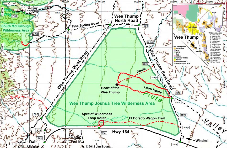
Note: Roads are black (solid = paved; dashed = unpaved). Trails and routes are red (solid = main; dashed = adjacent or alternate). Map based on USGS 15 minute topo map. North is at the top. UTM Grid is NAD27 CONUS. Wilderness Area boundaries (solid green) based on BLM data.
Note: All distances, elevations, and other facts are approximate.
![]() ; Last updated 121006
; Last updated 121006
| Wee Thump Joshua Tree | Southern NV Wilderness Areas | Hiking | Copyright, Conditions, Disclaimer | Home |