Rock Art Around Las Vegas

Rock art is a precious resource. Please help protect and preserve these sites.
 |
Overview Keyhole Canyon is an amazing Archeological area with many petroglyphs and a few pictographs (collectively referred to as Rock Stories). Most of the images are geometric symbols rather than representations of physical things, but a few petroglyphs depict bighorn sheep, lizards, and humans. In most petroglyph sites, the rock stories are fairly close to the ground, but here many are unusually high on the cliffs. Keyhole Canyon cuts into the side of a granitic ridge that juts so abruptly out of the desert flats that visitors can drive right up to the edge of cliffs and park at the mouth of Keyhole Canyon. The mouth of the canyon, about 50 yards wide, narrows abruptly, and about 500 ft up the canyon, a 50-ft, water-sculpted and water-polished pour-over blocks easy progress up the canyon. The short canyon creates the feeling of being in a deep alcove in the cliffs rather than being in a canyon in the mountains. Link to Site Map. |
 |
Many rock faces, especially those facing south and west, are covered in desert varnish, a naturally occurring dark patina that forms on the surface of rocks in the desert. Native peoples created petroglyphs by pecking away the desert varnish to reveal the underlying light-colored rock. Native peoples also used pigments to paint images, a few of which can still be seen. There are also some unusual petroglyphs that are actually carved into softer parts of the rock; some of these appear to be extremely old. There are many rock faces (panels) in the area with petroglyphs that are easily accessible from the ground; other petroglyphs are high on the canyon walls. Most of the petroglyphs are located on the north wall of the canyon and along the west-facing cliffs north of the mouth. At the mouth of the canyon on the north side, large boulders provide surfaces for many fine petroglyphs. At the mouth of the canyon on the south side, there are some nice petroglyphs on the west-facing wall just above the parking area. There are a few more petroglyphs farther south along the cliffs. |
 |
There are so many petroglyphs at or near ground level that there is little need to climb the walls to get close-up views of the higher petroglyphs. If you do climb to the higher ones, don't climb on the petroglyphs, and keep in mind that granite is very slick compared to the limestone and sandstone that are common in southern Nevada. I saw one kid slip and take a pretty long slider into the wash; fortunately, he landed in soft gravel and walked away. |
 |
Location Keyhole Canyon is located on BLM land between Boulder City and Searchlight off highway 95. A carefully driven sedan can usually get to near the trailhead, but a medium-clearance vehicle would be better. For a description of the road and driving instructions, see Keyhole Canyon Road. Hours Keyhole Canyon is always open, as is the well-used camping area at the mouth of the canyon. There are no established campsites, but several large campfire rings are scattered about. In the old days, an outhouse was located at the parking area, but it is long gone. Fees None. |
Main Canyon
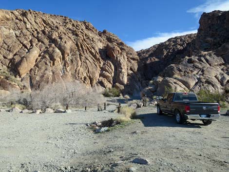 Trailhead parking (view E) |
 Hiker walking through the trailhead gate (view E) |
 General information signs |
 Archeological information sign |
 Hiker in the wide mouth of the canyon (view E) |
 |
 |
 |
 A narrow spot that separates the upper and lower areas (view E) |
 |
 |
 |
 |
 Entering the upper part of the canyon (view E) |
 |
 Continuing into the upper part of the canyon (view E) |
 Approaching the end of the canyon (view E) |
 |
 Nicely sculpted and polished granite (view E) |
 Hiker at the end of the canyon (view E) |
 |
 We're not climbing that one today (view E) |
 Hiker below the pour-over (view E) |
 Water dripping down the rock (view up) |
 Upper part of the canyon, heading down (view W) |
 Narrows that separates the upper and lower sections (view W) |
 |
 |
Shaman's Workshop
 |
 |
 |
 |
 |
 |
 Shaman's outdoor workbench with many cupules |
 Shaman's outdoor workbench with many cupules |
 A particularly interesting spot: shaman's indoor workbench |
 Shaman's indoor workbench with many cupules |
 Shaman's indoor workbench with many cupules |
 Shaman's indoor workbench with many cupules |
 |
 |
North End
 |
 |
 |
 |
 |
|
Miscellaneous Photos from throughout the area
 Unusual carved petroglyph |
 A common symbol here |
 |
 |
 |
 |
 |
 |
 |
 |
Table 1. Hiking Coordinates based on GPS data (NAD27; UTM Zone 11S). Download Hiking GPS Waypoints (*.gpx) file.
| Wpt. | Location | UTM Easting | UTM Northing | Elevation (ft) | Point-to-Point Distance (ft) | Cumulative Distance (ft) | Verified |
|---|---|---|---|---|---|---|---|
| 01 | Keyhole Trailhead (gate) | 687631 | 3954174 | 2,894 | 0 | 0 | GPS |
| 02 | Keyhole Pour-Over | 687759 | 3954089 | 2,891 | 533 | 533 | GPS |
Happy Hiking! All distances, elevations, and other facts are approximate.
![]() ; Last updated 240323
; Last updated 240323
| Petroglyphs | Glossary | Copyright, Conditions, Disclaimer | Home |