Birding Around Las Vegas, Desert National Wildlife Range
Area Map | Site Map
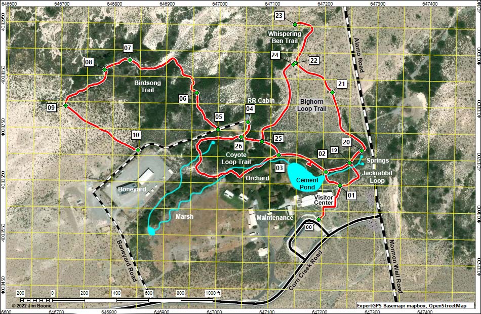
Note: Map based on true-color aerial photography. North is at the top. Grid is UTM NAD27 CONUS. Trails and routes are red (solid = main; dashed = adjacent or alternate). Roads are black (solid = paved; dashed = unpaved; width implies quality). Water is blue. Download waypoint coordinates from route description page.
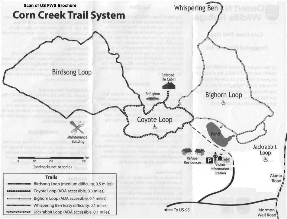
US FWS Brochure Map
Note: All distances, elevations, and other facts are approximate.
Happy birding!
| Corn Creek | Desert National Wildlife Range | Birding Around Las Vegas | Copyright, Conditions, Disclaimer | Home |