and Warm Springs Natural Area
Birding Around Las Vegas, Outside the Las Vegas Valley
Overview | Site
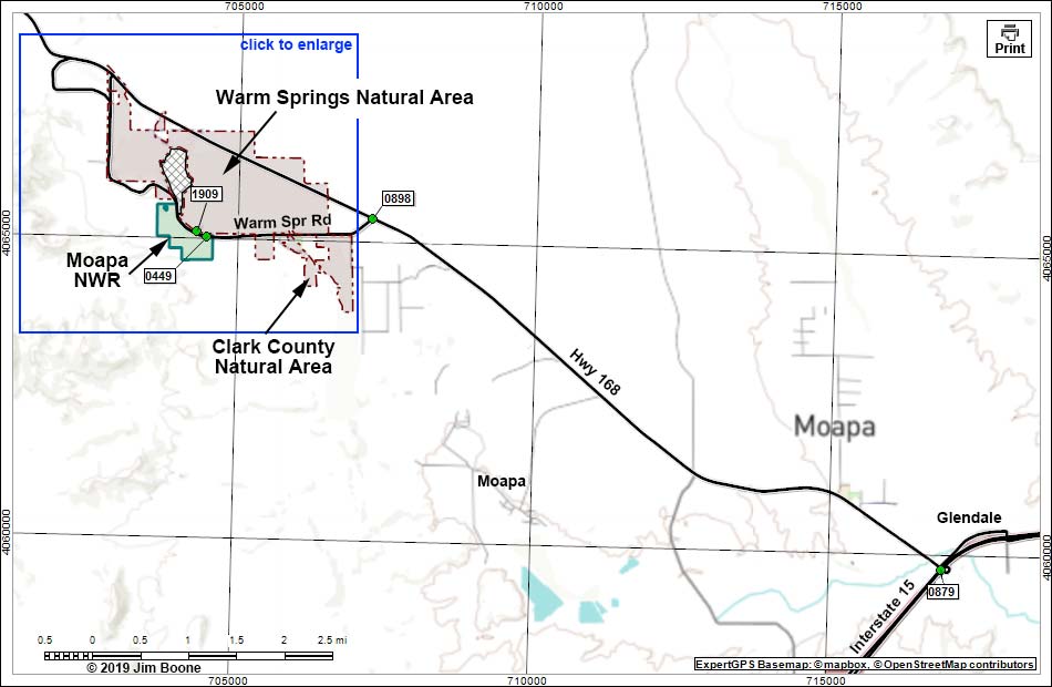
Note: Roads are black (solid = paved; dashed = unpaved). Trails and routes are red (solid = main; dashed = adjacent or alternate). Map based on USGS 7.5 minute topo map, which may have red grid lines and various numbers. North is at the top. Grid is UTM NAD27 CONUS. National Wildlife Refuges (boundaries solid green, fill light green) based on USFWS data. Warm Spring Natural Area (boundaries dashed brown, fill light green) based on map data. Clark County Natural Area (boundaries dashed brown, fill light green) based on map data. Private land (crosshatch gray) based on map data. BLM areas (white) based on BLM data. Download waypoint coordinates from route description page.
Happy birding! All distances, elevations, and other facts are approximate.
![]() ; Last updated 190507
; Last updated 190507
| Moapa NWR | Birding Around Las Vegas | Copyright, Conditions, Disclaimer | Home |