
Birding Around Las Vegas, Outside the Las Vegas Valley, Pahranagat Valley

 Trailhead parking (view N) |
Description Pahranagat National Wildlife Refuge protects 5,380 acres of shallow lakes, brushy thickets, marshes, grassy meadows, and cottonwood trees that support a great variety of wildlife. Upper Lake Dam Accessible Trail provides access to some of this habitat. The Upper Lake Dam Accessible Trail is paved (concrete) and runs out atop the Upper Lake dam providing big views up across the lake. Hikers should watch for birds in the trees, the shrubs along the trail, the muddy shallows at the edge of the lake, and the open water. About 500 ft out, the concrete trail ends at a bench with an interpretive sign and a telescope. The trail is partially shaded by cottonwood trees, but the bench is in full sun. For those who want to hike farther, the Upper Lake Trail continues across the dam and up along the west side of the lake before looping east and back around to the trailhead. Link to map. |
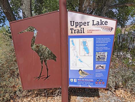 Trailhead sign (view N) |
Watch Out Other than the standard warnings about hiking in the desert, ...this hike is pretty safe when the weather is cool. If the weather is hot, this area can be surprisingly hot. Also, the fact that the trail is almost entirely smooth and level creates a tripping hazard because you forget to watch where you are walking. While hiking, please respect the land and the other people out there, and please try to Leave No Trace of your passage. This walk is so short that you don't need to bring the 10 Essentials. Getting to the Trailhead Pahranagat NWR is located about 90 miles northeast of Las Vegas on Highway 93 in Lincoln County. From town, drive north on Interstate 15 and Highway 93 to the Pahranagat Visitor Center. |
 Start of the trail; note gate only blocks the service road (view W) |
From the Visitor Center turnoff, continue north on Highway 93. The highway soon approaches Upper Lake Dam (visible on the left), but the access road is from north of the Lake. At about 3.2 miles north of the Visitor Center turnoff, turn left onto Upper Lake Road, which is unpaved. Upper Lake Road runs west, but soon bends back to the south running between Highway 93 and Upper Lake. Follow Upper Lake Road south past the picnic area, past several campsites, past vault toilets, to the end of the road. The road ends at a large turn-around loop, but when entering the loop, notice the trailhead sign on the right. For those with Handicapped Parking Permits, park at to the trailhead. Others should park on the far side of the turn-around loop. Park here; this is the trailhead. Unfortunately, the reserved parking is not paved, and those in wheel chairs will need to unload in the gravel and then climb the 2-inch lip to get onto the concrete trail. |
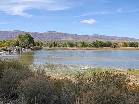 Early view of the lake (view W) |
The Hike From the trailhead (Table 1, Waypoint 01), the fully accessible trail runs west to pass through a gate that blocks vehicles from driving onto the dam. The trail curves gently to the left under towering cottonwood trees and growing views north across the lake. This corner of the lake used to be open water, but in recent years, the corner has been filling with soil to create a shallow marsh and muddy islands. While perhaps not the best for water managers, this does provide habitat for shorebirds and wading birds. Keep an eye out for Great Blue Herons and Great Egrets, Black-necked Stilts, and other wetland birds in the shallows. Farther out, views up across the lake open up, and hikers now get big views of the lake and surrounding mountains. Refuge managers manipulate the lake level to improve shoreline habitat around the lake, so shoreline habitat along the dam can be broad and muddy or narrow. Depending on the amount of shoreline vegetation, hikers might see more shorebirds or more ducks and diving birds. |
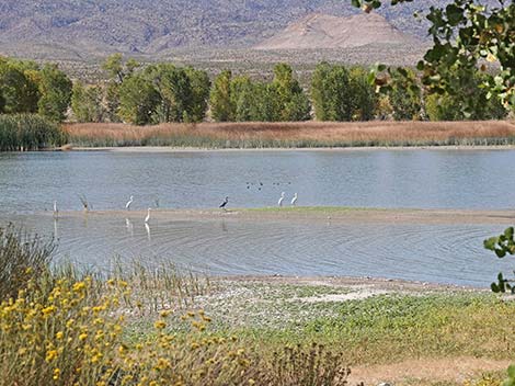 Wading birds and ducks in the lake (view W) |
Keep an eye out for coots, ducks, geese, swans, and grebes. While all of these might look like "ducks" to the uninitiated, they are different groups of birds with different life stories. Watching them from a distance where they feel safe is a good way to start learning about their individual habits. At about 500 ft out, the concrete trail ends at a bench with an interpretive sign and a telescope (Wpt. 02). This is a good place to sit quietly and let the birds come in closer. For hikers who want to go a little farther, the drainpipe for the dam is a few yards farther out. It is fenced and there is nothing new to see, but somehow structures are always interesting. For hikers who want to go much farther, The Upper Lake Trail (easy but not fully accessible) continues across the dam and up along the west side of the lake. This trail returns over the North Marsh Dike to Upper Lake Road at the picnic area, and then returns south to the trailhead (Wpt. 01). |
 Wading birds and ducks in the lake (view W) |
 Great Egrets, a Great Blue Heron, and several Ruddy Ducks (view W) |
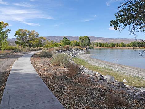 The trail continues onto the dam (view W) |
 Big view across Upper Lake with low water levels (view N) |
 Low water levels provide habitat for wading birds (view N) |
 The trail continues onto the dam (view W) |
 Big view across Upper Lake (view NE) |
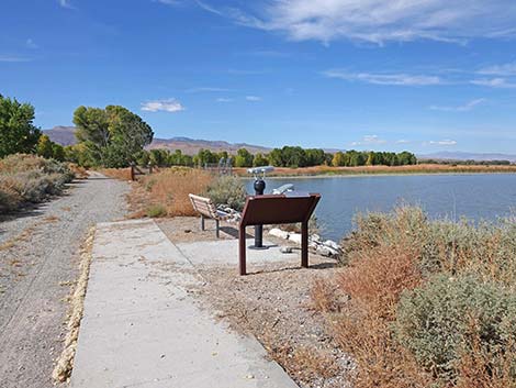 Approaching the end of the concrete trail (view W) |
 Bench, telescope, and sign at the end of the concrete trail (view N) |
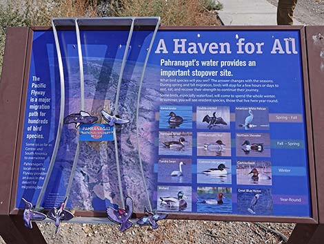 Interactive sign about migratory birds |
 No longer fully accessible, trail continues across the dam (view W) |
 Water control structure (drain pipe) for the lake (view NW) |
 Water control structure is fenced (view N) |
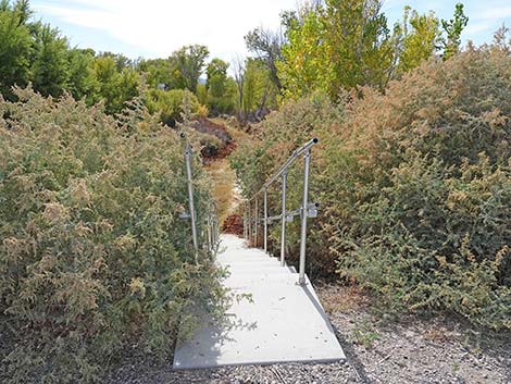 Opposite the drain, stairs lead off the dam to visitor center (view S) |
Table 1. GPS Coordinates for Highway Locations (NAD27; UTM Zone 11S). Download Hiking GPS Waypoints (*.gpx) file.
| Wpt. | Location | UTM Easting | UTM Northing | Elevation (ft) | Point-to-Point Distance (mi) | Cumulative Distance (mi) |
|---|---|---|---|---|---|---|
| 01 | Trailhead | 666841 | 4128176 | 3,353 | 0.00 | 0.00 |
| 02 | End of Trail | 666698 | 4128142 | 3,355 | 0.10 | 0.10 |
| 01 | Trailhead | 666841 | 4128176 | 3,353 | 0.10 | 0.20 |
Happy birding! All distances, elevations, and other facts are approximate.
![]() ; Last updated 241130
; Last updated 241130
| Birding Around Las Vegas | Southern Nevada Birds | Guide Service | Copyright, Conditions, Disclaimer | Home |