Backroads Around Las Vegas, Avi Kwa Ame National Monument
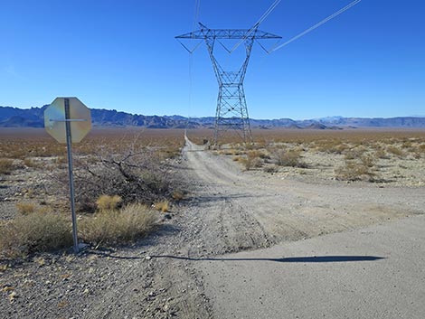 Edge of pavement and stop sign along Highway 95 (view W) |
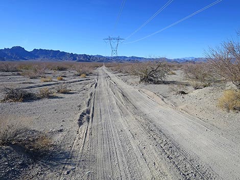
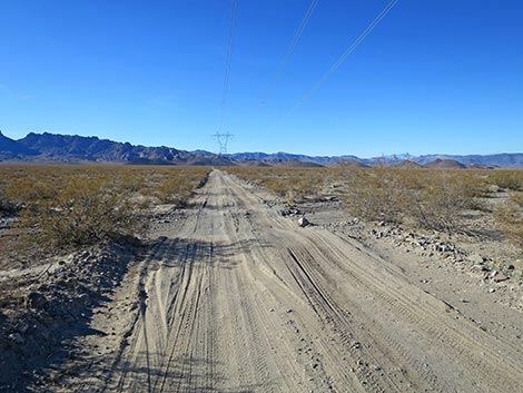
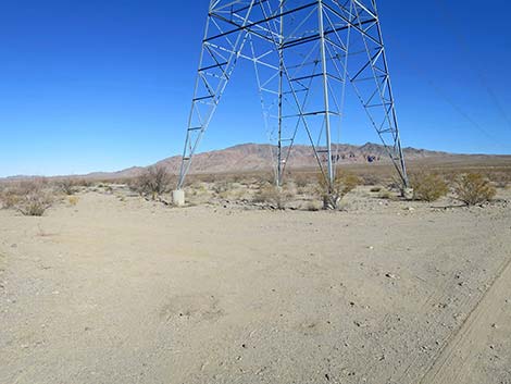
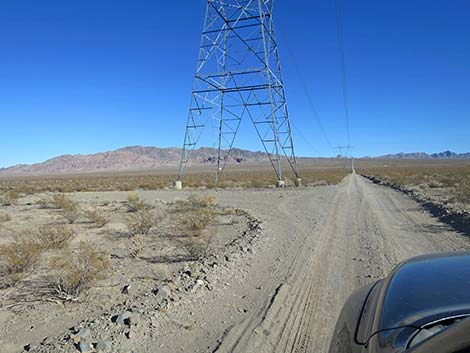
Overview Highland Range North Road is a graded road that runs east-west across Eldorado Valley connecting Highway 95 with the north end of Highland Range East Road. It then runs northwest through foothills of the Highland Range to end at an intersection with Wee Thump West Road. Highland Range North Road is a high-tension powerline service road. As such, it follows a line of power towers across the desert. There are 10 power towers, each about 0.3 miles apart, stretching across Eldorado Valley, and each has a flat pull-out area (a work pad) where visitors can stop to enjoy the scenery, eat a picnic lunch, or camp. Most work pads are big enough for two, medium-sized camper rigs. The road runs through part of the Boulder City Conservation Area where camping is prohibited, but farther out over the hills, there is at least one more nice, legal campsite. Link to campsites map. |
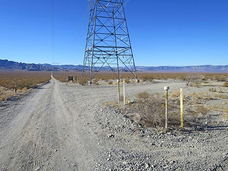
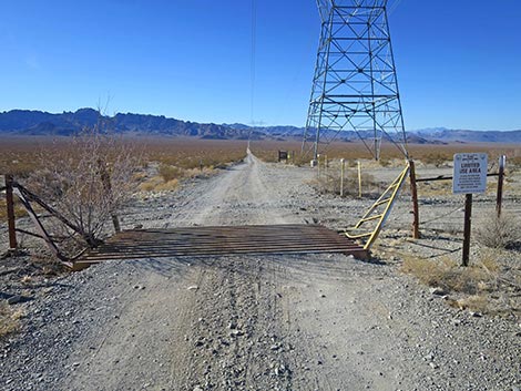 Highland Range North Road at Cattle guard and sign (view W) |
Watch Out Other than the standard warnings about driving in the desert, ... Highland Range North Road is pretty safe when the weather is cool. If the weather is hot, this place can be unbelievably hot. This area is also used by shooters. The road is subject to flash floods in several areas, especially in the wash at the bottom of Eldorado Valley, and there are several ditches cross the road. Flash floods can create soft, sandy conditions where the road crosses washes. There is one particularly rocky spot in the hills; however, careful drivers should have no trouble in medium-clearance vehicles. The campsites are on power tower work pads, so if the power company needs to work, campers must move. While out, please respect the land and the other people out there, and please try to Leave No Trace of your passage. Be sure to bring what you need of the 10 Essentials. |
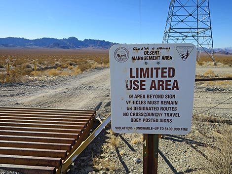 Sign: Limited Use Area -- vehicles only on designated roads |
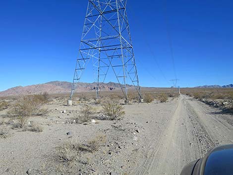
Getting to the Roadhead Highland Range North Road is located north of Searchlight, Nevada, about 40 minutes south of downtown Las Vegas. From town, drive south on Highway 95 (Interstate-11) through Henderson. After leaving the Las Vegas Valley, exit I-11 staying on Highway 95 towards Searchlight. From I-11, continue south 20 miles. The highway passes the turnoff to Nelson on the left, passes the last of the solar farms on the right, passes the Avi Kwa Ame National Monument boundary sign, and then arrives at high-tension powerlines crossing the highway. Exit here to the right onto Highland Range North Road (Site 1974), which is graded dirt. Watch for a stop sign at the intersection. From the roadhead, visitors can see power towers marching across the valley. There is a campsite at the base of each tower. |
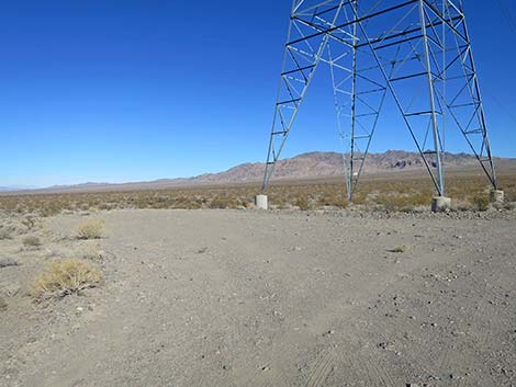
 Loop road around the first power tower (view W) |
The Road and Campsites From the pavement (Table 1, Site 1974), Highland Range North Road crosses a cattle guard at the highway fence and quickly arrives at the first power tower. At the far side of the tower, a BLM sign provides limited information about the area. There is a loop road around this power tower, and although it is close to the highway, it is often used as an overnight campsite with enough space for several large camper rigs. Continuing west 0.3 miles, Highland Range North Road drops to arrive at the next power tower where there is a work pad. Behind the power tower, drivers have recently created illegal, two-track roads leading out onto desert pavement areas with campsites. These sites are illegal because vehicles are required to stay on designated roads. |
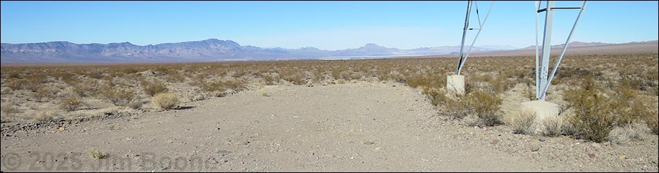
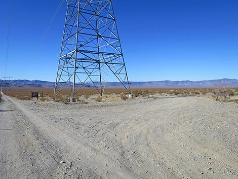 Large, pull-through campsite at first power tower (view NW) |
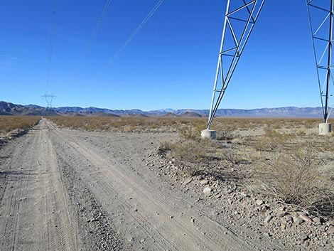
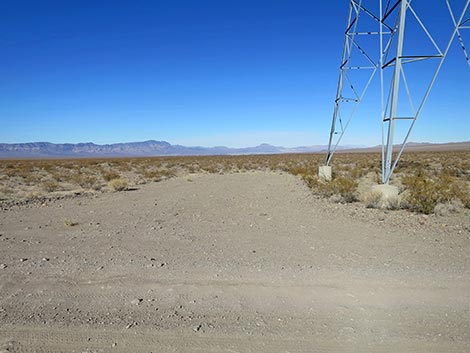
Dropping into the bottom of Eldorado Valley, the Highland Range North Road crosses Eldorado Wash. After storms, this broad wash can be washed out and sandy. The third power tower is located in Eldorado Wash. Beyond the bottom of the valley, the road climbs gently towards the Highland Range, passing seven more campsites. Here the road crosses ditches, which may be washed out, but the road is not sandy. Approaching the base of the Highland Range, Highland Range North Road passes a T-intersection (Site 1973; 2.9 miles out) at the north end of Highland Range East Road. This road follows powerlines, some with nice work pads, along the east edge of the Highland Range all the way south to Highway 164. |
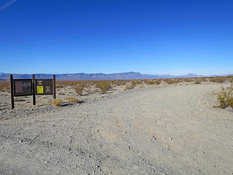 Exit from pull-through campsite; information kiosk (view N) |
Just past the T-intersection, Highland Range North Road bends hard to the right. Now heading north, Highland Range North Road passes through a fenceline with a sign announcing entry into the Boulder City Conservation Area. Until the next sign, this is a no camping zone. The Highland Range North Road winds around and climbs over two low ridges before again descending onto desert flats. On this undulating landscape, there are more power towers adjacent to the road, at least one of which makes a nice campsite. Highland Range North Road eventually ends at a triangular intersection (Site 1972; 6.0 miles out) with Wee Thump West Road. |
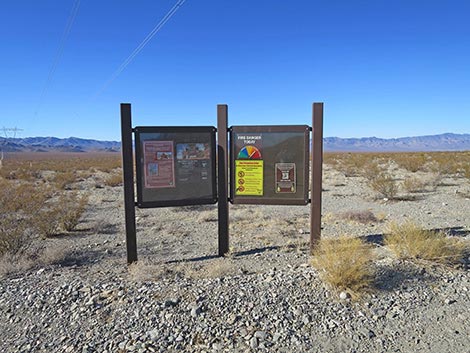 Information kiosk (view W) |
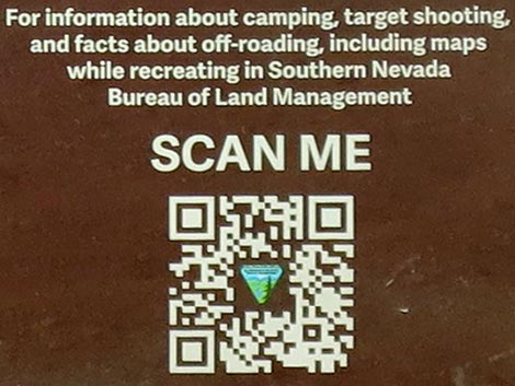 Scan for Southern Nevada District Recreation Information |
 Highland Range North Road crossing a sandy wash (view W) |
 Approaching another power tower with a campsite (view W) |
 Work pad (campsite) at base of power tower (view N) |
 Road continues towards next power tower (view W) |
 Campsite at power tower on far side of valley (view E) |
 Campsite at power tower on far side of valley (view NE) |
 Campsite at power tower in the middle of the valley (view E) |
 Campsite at power tower in the middle of the valley (view E) |
Table 1. Hiking Coordinates Based on GPS Data (NAD27, UTM Zone 11S). Download GPS Waypoints (*.gpx) file.
| Site | Location | UTM Easting | UTM Northing | Latitude (N) | Longitude (W) | Elevation (ft) |
|---|---|---|---|---|---|---|
| 1973 | Highland E Rd at Highland Access Rd | 680095 | 3949435 | 35.67418 | 115.01011 | 2,658 |
| 1974 | Hwy 95 at Highland Access Rd | 684754 | 3948990 | 35.66930 | 114.95876 | 2,685 |
| 2035 | campsite | 684666 | 3949022 | 35.66960 | 114.95972 | 2,674 |
| 2036 | campsite | 684186 | 3949063 | 35.67007 | 114.96501 | 2,638 |
| 2037 | campsite | 683679 | 3949105 | 35.67054 | 114.97061 | 2,612 |
| 2038 | campsite | 683258 | 3949156 | 35.67108 | 114.97524 | 2,593 |
| 2039 | campsite | 682777 | 3949193 | 35.67150 | 114.98055 | 2,591 |
| 2040 | campsite | 682333 | 3949238 | 35.67199 | 114.98544 | 2,592 |
| 2041 | campsite | 681810 | 3949284 | 35.67250 | 114.99121 | 2,598 |
| 2042 | campsite | 681310 | 3949332 | 35.67302 | 114.99671 | 2,617 |
| 2043 | campsite | 680843 | 3949380 | 35.67354 | 115.00186 | 2,635 |
| 2044 | campsite | 680341 | 3949431 | 35.67409 | 115.00739 | 2,652 |
| 2045 | campsite | 677334 | 3953034 | 35.70710 | 115.03980 | 2,568 |
Happy Hiking! All distances, elevations, and other facts are approximate.
![]() ; Last updated 250207
; Last updated 250207
| Avi Kwa Ame | Backroads Around Las Vegas | Glossary | Copyright, Conditions, Disclaimer | Home |