
from Hermits Rest (6,642 to 5,680 ft)
Hiking Around Las Vegas, Grand Canyon National Park

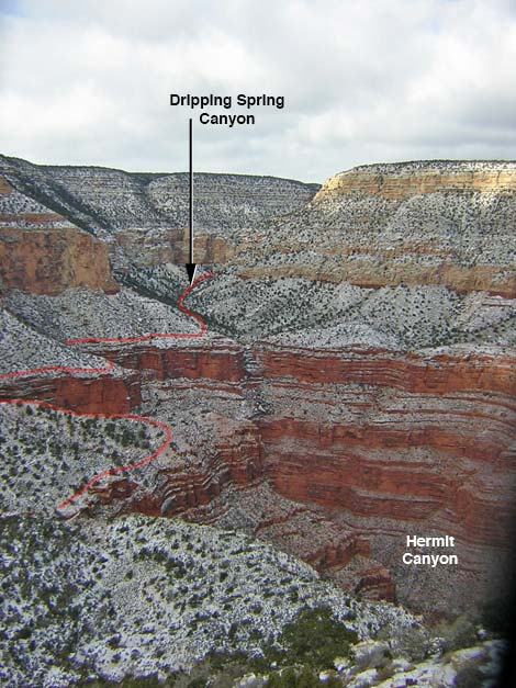 Dripping Spring Canyon and the head of Hermit Canyon (view W from above Waldron Basin) |
Overview This 3-mile (one-way) trail starts at Hermits Rest and follows the Hermit Trail to Waldron Basin. The trail then runs concurrently with the Boucher Trail into Dripping Springs Canyon, running on precipitous slopes across the head of Hermit Canyon. When the trail enters Dripping Springs Canyon, the Boucher Trail forks off to the north, and the Dripping Springs Trail runs west up the side canyon to the spring which is under an overhang at the base of the Coconino cliffs. Link to map. Watch Out Other than the standard warnings about hiking in the desert, ...this trail runs along steep hillsides with precipitous drop-offs, and while not a dangerous trail, falls from many places would be fatal. Be sure to treat the water at the spring. While hiking, please respect the land and the other people out there, and try to Leave No Trace of your passage. This is a fairly long hike, so be sure to bring the 10 Essentials. Be sure that you are physically fit and that you choose routes of the appropriate difficulty for your skills and endurance. |
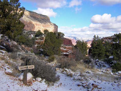 Waldron Basin at the Hermit-Dripping Spring-Boucher trail junction (view N; Dripping Spring trail goes left) |
Getting to the Trailhead This hike is located on the South Rim of the Grand Canyon, about 5 hours southeast of Las Vegas. From Las Vegas, drive out to the South Rim of Grand Canyon National Park. From the South Rim Visitor Center (Table 1, Site 811), ride the shuttle bus or drive to the Hermits Rest trailhead (Site 815), which is at the end of the road west of the South Rim Village area. The trailhead is just west (past) of the Hermits Rest buildings. When the shuttle bus is running (spring through fall), take it to Hermits Rest. Walk past the tourist facilities and past the housing area to the end of the road. Either walk past the restrooms and down the gravel road, or walk past the Hermits Rest building and out the trail along the rim. It is about 0.25 miles from the bus stop to the trailhead. When the shuttle is not running, drive to the trailhead or arrange for a taxi. |
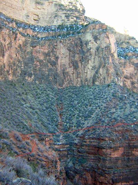 Trail across steep hillside at the head of Hermit Canyon (view SW) |
The Hike From the trailhead (Table 2, Waypoint 01), the trail runs off the edge of the rim and starts down a side canyon, switchbacking quickly into the Kaibab Limestone. It takes about 5 minutes to get to the best of the Kaibab fossils (check the ledges north of the trail for brachiopods, corals, and sponges), and in another 5 minutes, hikers round a corner and suddenly the expanse of the Grand Canyon opens up. This part of the trail is steep and rocky, but there are lots of fossils and some wonderful views along the trail. The vegetation is pinyon-juniper forest, so there is a fair bit of shade along the trail. Below the Kaibab Limestone, the trail descends at a moderate grade through the Toroweap Formation. About 30 minutes out, the trail runs out to a ridgeline and start down into the Coconino Sandstone on a long series of steep switchbacks paved with sandstone blocks. There are some nice sandstone cliffs near here, but the trail passes through a broken, slabby section of the Coconino. About a 1.2 miles out, the trail passes an area with fossilized tracks in sandstone slabs adjacent to the trail (Wpt 02), and tracks from several species of animals can be seen from the trail. One track looks like it was made by an alligator-like creature (big heavy footprints and a tail drag), and others were made by smaller creatures with claws who didn't drag a tail. Some very tiny tracks are said to have been made by insects. The fossils are on a long, straight section of trail paved with sandstone blocks. Look for a low wall of rocks built above the trail. Please don't walk on the slabs because you will cause the fossils to erode more quickly. I've checked around, and the best tracks are immediately adjacent to the trail, so hikers don't need to leave the trail to see the best. |
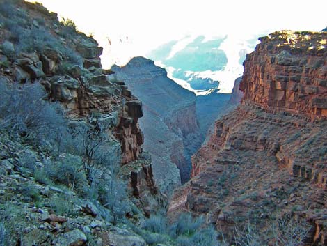 Hermit Canyon (view N from the trail) |
A few minutes below the fossil tracks, the rocky trail drops below the Coconino Sandstone and runs out on dirt (Hermit Shale) as it enters Waldron Basin, a fairly broad, open, basin in the bottom of Hermit Canyon. After hiking through the rocky hillsides above, this area feels forested. The vegetation is a pinyon-juniper forest with lots of shrubs, including Mormon tea, yucca, cliffrose, shrub live oak, and an upright species of prickly pear. Below the Coconino, the trail soon intersects the Waldron Trail (Wpt 03), which runs up the canyon (right) and hits the rim to the west of Hermits Rest; this is another way to start the hike into Hermit Canyon. Below the Waldron Trail junction, the Hermit Trail hits the bottom of the canyon, then turns north and runs downhill along the wash. Near the bottom of Waldron Basin, the Dripping Springs and Boucher trails split from the Hermit Trail (Wpt. 04). The Hermit trail continues down the wash for about 30 yards to the top edge of the Supai cliffs, while the Dripping Springs and Boucher trails turn west and climb the low hillside out of Waldron Basin. |
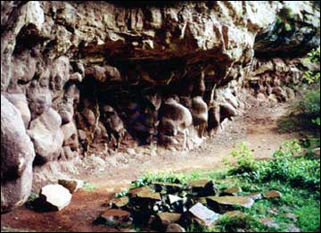 Water drips from the top of the overhang (view NW) |
The Dripping Springs and Boucher trails run west around the head of Hermit Canyon. The trail is narrow and rocky with lots of exposure and several steep little up-and-downs to get around rocks, bushes, and other obstructions; but overall, the trail is fairly level as it runs along the top of the Supai Cliffs. Along these shady, north-facing cliffs, there are many shrubs and some small, broadleaf trees. The trail crosses two major gullies before starting up Dripping Springs Canyon. At the Dripping Spring-Boucher trail junction (Wpt XX), the trail continues southwest and up the forested canyon for about 0.75 miles to the spring, which is under an overhang at the base to the Coconino Sandstone. The water is good for drinking, but it should be filtered. Other options are available, but the sensible one is to return to the trailhead by retracing your footprints back to Hermits Rest (Wpt. 01). |
Table 1. Highway Coordinates (NAD27, UTM Zone 12S). NOTE: This is UTM Zone 12. Download Highway GPS Waypoints (*.gpx) file.
| Site # | Location | Latitude (°N) | Longitude (°W) | UTM Easting | UTM Northing | Elevation (feet) | Verified |
|---|---|---|---|---|---|---|---|
| 811 | Visitor Center, Canyon View Information Plaza | 36.05897 | 112.10848 | 400166 | 3990857 | 7,092 | Yes |
| 815 | Hermits Rest trailhead | 36.06044 | 112.21170 | 390870 | 3991131 | 6,642 | Yes |
Table 2. Hiking Coordinates based on GPS data (NAD27; UTM Zone 12S). Download Hiking GPS Waypoints (*.gpx) file.
| Wpt. | Location | Time | Time | Easting | Northing | Elevation (ft) | Point-to-Point Distance | Cumulative Distance |
|---|---|---|---|---|---|---|---|---|
| 01 | Hermits Rest | 7:25 | 0:00 | 390877 | 3991146 | 6,642 | 0.00 | 0.00 |
| 02 | Reptile Tracks | 8:04 | 0:39 | 390220 | 3990547 | 5,658 | 1.20 | 1.20 |
| 03 | Waldron Trail | 8:13 | 0:09 | 390082 | 3990539 | 5,420 | 0.30 | 1.50 |
| 04 | Hermit Trail | 8:23 | 0:10 | 389772 | 3990625 | 5,203 | 0.25 | 1.75 |
| 05 | Boucher Trail | 8:57 | 0:34 | 388709 | 3991145 | 5,270 | 1.00 | 2.75 |
| 06 | Dripping Spring | . | . | 388149 | 3991402 | 5,600 | 0.50 | 3.25 |
Happy Hiking! All distances, elevations, and other facts are approximate.
![]() ; Last updated 240326
; Last updated 240326
| Hiking the Grand Canyon | Hiking Around Las Vegas | Glossary | Copyright, Conditions, Disclaimer | Home |