
Hiking Around Las Vegas, Grand Canyon National Park

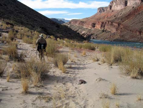 |
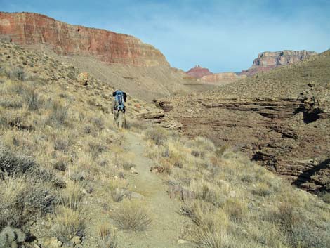
Overview The Tonto is a truly spectacular trail that runs through the Grand Canyon for some 90 miles from Red Canyon in the east to Bass Canyon in the west. Other trails lead even farther in both directions. In many places, the trail runs along the lip of the Inner Gorge, providing great views of the Colorado River; and from everywhere, there are great views of the rock walls towering above the trail. The logistics can be complicated, but this is a delightful hiking trail. The Tonto Trail is divided into two parts, the Tonto East Trail (Red Canyon to Bright Angel Canyon; 40 miles) and the Tonto West Trail (Bright Angel Canyon to Bass Canyon; 50 miles). I've hiked the entire Tonto Trail, and I've organized my description into canyon-to-canyon segments. Link to map. Download Entire Route Waypoint (gpx) file. |
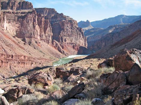 |
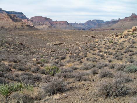
The Tonto East Trail generally stays on the Tonto Platform, running in and out of every side canyon and every little gully along the way. There is little overall elevation change on the Tonto Platform, but there is a tremendous amount of up and down on the trail. Few parts of the trail are truly strenuous. Unlike the Tonto West Trail, the Tonto East is easy to follow for all but a few yards of the route. Much of the trail is rocky, making it difficult to set a good stride and make good time on the trail. The Tonto Trail has a reputation for being obscure and difficult to follow. This is true for the Tonto West Trail between Boucher Canyon and Bass Canyon where the trail always is faint, but the Tonto East Trail generally is easy to follow. Much of the trail is well-worn, but cairns help in a few places. |
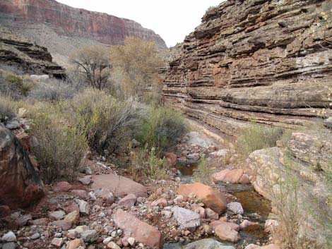 |
It seems that fair numbers of people hike the Tonto East, so plan ahead and reserve backcountry permits early. The backcountry use-zones east of the South Kaibab Trail all have at-large camping (you can camp anywhere). Permanent water is available near the trail only in a few places: the Colorado River at Red Canyon (Hance Rapids), Hance Canyon, Cottonwood Canyon, Grapevine Canyon, Pipe Canyon, and Havasupai Garden Campground. Water may be available in the other major side canyons during winter and spring, but don't ever count on finding water in Mineral or Cremation canyons. |
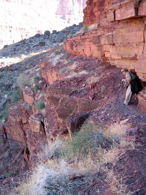 |
Watch Out Other than the standard warnings about hiking in the desert, ...the Tonto Trail is a wild and remote place. Don't expect to see a ranger or anyone else to offer help if you get in trouble. Don't go there if you don't know how to stop arterial bleeding or splint broken bones. Heart attack or heat stroke: kiss your ass goodbye. There are many places to stumble off the trail, fall into the abyss, and never be seen again. Carry enough water to travel between permanent water sources unless you get specific and timely information about seasonal streams. The inner canyon can be very hot; plan accordingly. Be sure to find a campsite before it gets dark because there is too much brush and cactus to camp in most places; even sleeping on the trail is out of the question in many places. Most campsites along the trail are noted in the descriptions of the individual trail segments. While hiking, please respect the land and the other people out there, and please try to Leave No Trace of your passage. This is a long hike, so be sure to bring the 10 Essentials. Cell phones don't work down in the canyon, so bring a signal mirror, beacon, or satellite phone. Make sure this trail is of the appropriate difficulty for your skills. |
 |
Getting to the Trailhead This hike is located at the South Rim of the Grand Canyon, about 5 hours southeast of Las Vegas. From Las Vegas, drive out to the South Rim of Grand Canyon National Park. From the South Rim Visitor Center (Table 1, Site 811), ride the shuttle bus or drive to one of the four trailheads: Red Canyon Trailhead (Site 954) -- This trailhead is located along East Rim Drive (Hwy 64, the road to Desert View), about 14-15 miles east of the south Rim village area. The trailhead, but not the parking, is a wide spot on the shoulder of the road at the bottom of a long dip in the road marked with No Parking signs. Drop off hikers and packs here, then park at Moran Point (1.3 miles east) or at a dirt road 0.6 miles to the west. |
 |
Grandview Trailhead (Site 953) -- This trailhead is located off East Rim Drive (Hwy 64, the road to Desert View), about 13 miles east of the south Rim village area. The trailhead is adjacent to Grandview Overlook. For details, see the Grandview Hike. South Kaibab Trailhead (Site 955) -- This trailhead is located on Yaki Point, about halfway from the highway to the overlook. Ride the shuttle bus or drive to the parking area. The trailhead signs are atop the little hill just north of the parking area. Bright Angel Trailhead (Site 814) -- Ride the shuttle bus or drive to the Bright Angel Lodge bus stop or the Village Transfer bus stop. The Bright Angel trailhead is located on the rim of the canyon between these two shuttle bus stops. The trailhead is marked with signs and a round, stone corral for the mules. The closest public parking is a few minutes walk to the southeast, across the road and railroad tracks from the Bright Angel Lodge. |
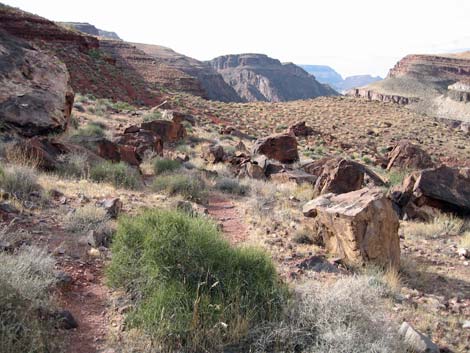 |
The Hike 1. Red Canyon to Mineral Canyon Overview: From Hance Rapids at the confluence of Red Canyon and the Colorado River, it is about 2.5 miles and 1.75 hours to the wash crossing in Mineral Canyon. Water is available only at Hance Rapids. This segment of the trail climbs from the river to the Tonto Plateau and is fairly strenuous and rocky in places, but it provides many grand views. There is one precarious spot on a narrow ledge where you have to duck low to get under an overhang; some people crawl across this section and drag their pack along the trail. Red Canyon and the Hance Rapids sand dunes are in Backcountry Use Zone BD9 (camping at-large), and Mineral Canyon is in Zone BE9 (camping at-large). (details) |
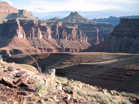 |
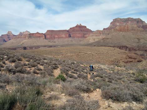
2. Mineral Canyon to Hance Canyon Overview: From the wash crossing in Mineral Canyon, it is about 3.9 miles and 2.5 hours to Hance Canyon. There is no drinkable water along this segment. This segment of trail runs out the west side of Mineral Canyon, loops around a side canyon beneath Ayer Point, and runs back into Hance Canyon. Except for one short bit of 2nd-class scrambling, the trail generally is fast, wide, easy, and provides many grand views above and below the trail. Mineral Canyon is in Zone BE9 (camping at-large), and Hance Canyon is in Zone BE9 (camping at-large). (details) |
 |
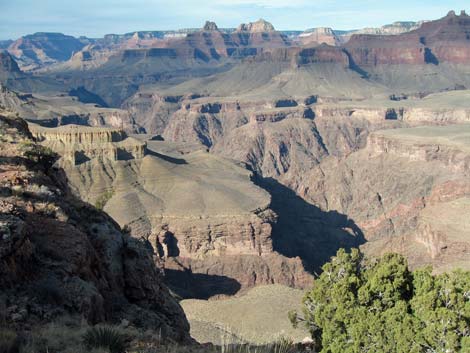
3. Hance Canyon to Cottonwood Canyon Overview: From Hance Canyon, it is about 5.0 miles and 3 hours to Cottonwood Canyon. This segment of the trail runs out the west side of Hance Canyon, loops around both arms of Horseshoe Mesa, and then runs up into Cottonwood Canyon. The trail is fairly slow getting out of Hance (many rocky spots), but the views above and below the trail are truly spectacular; the rest of the trail is fast and easy. Hance Canyon is in Backcountry Use Zone BE9 (camping at-large), and Cottonwood Canyon is in Zone BG9 (camping at-large); the wash between the two arms of Horseshoe Mesa separates the two zones. (details) |
 |
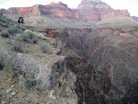
4. Cottonwood Canyon to Grapevine Canyon Overview: From Cottonwood Canyon, it is about 5.5 miles to Grapevine Canyon, the next water source to the west. This segment of the trail runs out of Cottonwood Canyon, around the long narrow ridge that comes down from Grandview Point, and back into Grapevine Canyon. Water is available at Cottonwood Spring and Grapevine Creek. Cottonwood Canyon is in Backcountry Use Zone BG9 (camping at-large), and Grapevine Canyon is in Zone BH9 (camping at-large). (details) |
 |
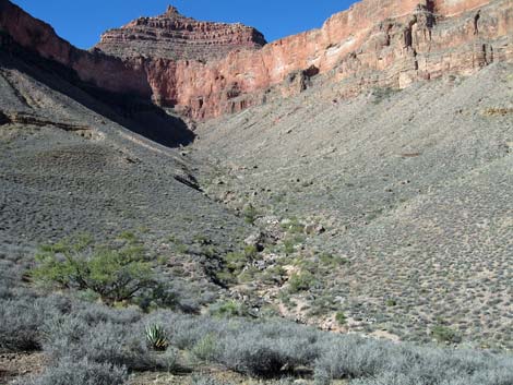
5. Grapevine Canyon to Boulder Canyon Overview: From Grapevine Canyon, it is about 5.6 miles to Boulder Canyon. This segment of the trail runs around Lyell Butte and back into Boulder Canyon. Water is available at Grapevine Creek, and it may be available in Boulder Canyon. Grapevine Canyon is in Backcountry Use Zone BH9 (camping at-large), and Boulder Canyon is in Backcountry Use Zone BH9 (camping at-large). (details) |
 |
6. Boulder Canyon to Lonetree Canyon Overview: From Boulder Canyon, it is about 3.0 miles to Lonetree Canyon. This segment of the trail runs out of Boulder Canyon, around a major side canyon below Newton Butte, and back into Lonetree Canyon. Water may be available in Boulder and Lonetree canyons. Boulder Canyon is in Backcountry Use Zone BH9 (camping at-large), and Lonetree Canyon is in Zone BJ9 (camping at-large). (details) |
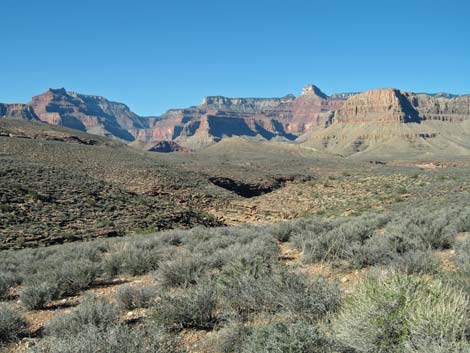 |
7. Lonetree Canyon to Cremation Canyon Overview: From Lonetree Canyon, it is about 3.5 miles to Cremation Canyon. This segment of the trail runs out of Lonetree Canyon, runs around Pattie Butte, and back into Cremation Canyon. Water may be available in Lonetree Canyon. Lonetree Canyon is in Backcountry Use Zone BJ9 (camping at-large), and Cremation Canyon is in Zone BJ9 (camping at-large). (details) |
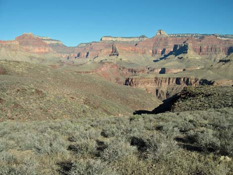 |
8. Cremation Canyon to South Kaibab (Tipoff) Trail Junction Overview: From Cremation Canyon, it is about 2.4 miles to the South Kaibab Trail junction (called "The Tipoff"). This segment of the trail runs out of Cremation Canyon and climbs to meet the South Kaibab Trail at the base of the ridge below O'Neill Butte. Water may be available in Lonetree Canyon, but Cremation Canyon usually is dry. Cremation Canyon is in Backcountry Use Zone BJ9 (camping at-large), and the Tipoff is a no-camping zone. (details) |
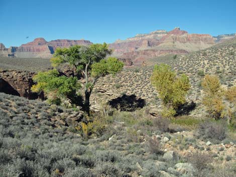 |
9. South Kaibab (Tipoff) Trail Junction to Pipe Canyon Overview: From the South Kaibab Trail junction, it is about 2.0 miles to Pipe Canyon. This segment of the trail runs from out on the point at tip of O'Neill Butte (The Tipoff) back into Pipe Canyon. Water is available at Burro Spring and Pipe Creek. This section of the trail is closed to camping. (details) |
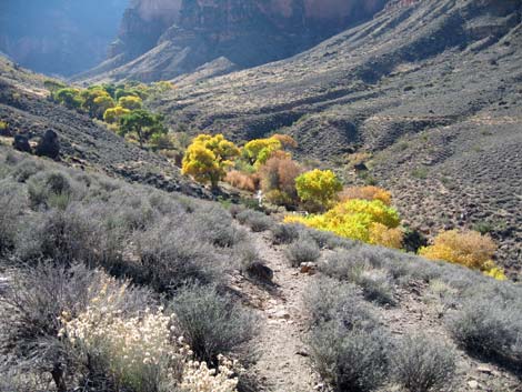 |
10. Pipe Canyon to Havasupai Garden Campground Overview: From Pipe Canyon, it is about 1.9 miles to the Bright Angel Trail, and then another 0.4 miles to Havasupai Garden Campground. This segment of the trail runs out of Pipe Canyon, around the ridge below Yavapi Point, and back into Bright Angel Canyon. Water is available at Pipe Spring and in the campground. On this section, camping is permitted only in the campground, which is in Backcountry Use Zone CIG. (details) |
Table 1. Highway Coordinates (NAD27, UTM Zone 12S).
| Site # | Location | Latitude (°N) | Longitude (°W) | UTM Easting | UTM Northing | Elevation (feet) | Verified |
|---|---|---|---|---|---|---|---|
| 811 | Visitor Center, Canyon View Information Plaza | 36.05897 | 112.10848 | 400166 | 3990857 | 7,092 | Yes |
| 814 | Bright Angel Trailhead | 36.0574 | 112.1429 | 397067 | 3990721 | 6,870 | Yes |
| 953 | Grandview Point parking area | 35.9979 | 111.9870 | 411039 | 3983967 | 7,418 | Yes |
| 954 | Red Canyon (New Hance) Trailhead | 35.9909 | 111.9350 | 415721 | 3983144 | 7,020 | Map |
| 955 | South Kaibab Trailhead | 36.05337 | 112.08278 | 402472 | 3990209 | 7,211 | GPS |
Happy Hiking! All distances, elevations, and other facts are approximate.
![]() ; Last updated 240326
; Last updated 240326
| Hiking Around Grand Canyon | Hiking Around Las Vegas | Glossary | Copyright, Conditions, Disclaimer | Home |