
Backroads Around Las Vegas, Lake Mead National Recreation Area

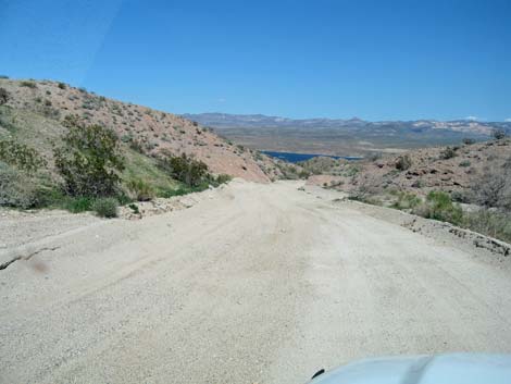 Telephone Cove Rd approaching Lower Grapevine Canyon Rd (view NE) |
This road is closed forever, but hikers can still walk up the canyon. Text and most photos by Mark Petterson, Henderson Overview Lower Grapevine Canyon Road is a backcountry road in southern Lake Mead National Recreation Area near Laughlin. The road runs up Grapevine Canyon for two miles from Lake Mohave to an impassable narrows. As the road runs up the canyon, the walls press inward with a fascinating geological mix of coarse-grained granitic rocks and terraced deposits of white alluvial gravel. A diversity of plants can be found, including some not found farther north around Las Vegas, and at the end of the road, the canyon draws hikers deeper to explore the narrow gorge filled with extraordinary geologic features and ultimately a "hidden waterfall" inside the Spirit Mountain Wilderness Area. Link to Area Map. |
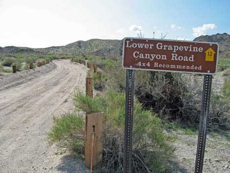 Just above the start of Grapevine Road (view west) |
There are vault toilets at Nevada Telephone Cove beach, where this road actually begins, but otherwise there are no structures or services of any kind along this road. Many people are familiar with the upper portion of Grapevine Canyon where ancient petroglyphs can be found, but Lower Grapevine Canyon is spectacular and well worth a visit. Watch Out Other than the standard warnings about hiking in the desert, ... the graded portion of this road is safe. Getting to the roadhead via Nevada Telephone Cove Road is a bit bumpy, but it should be fine for a passenger vehicle. Cars should also be able to negotiate the lower (graded) half of Lower Grapevine Canyon Road. However, a high clearance vehicle is required (possibly 4WD) in the upper sections where the road is not graded and where there are several soft, sandy spots and short but steep climbs in and out of the wash. In wet weather, road conditions can change rapidly, and all bets are off. |
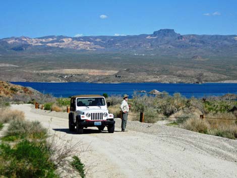 Lake Mohave and well graded road (Photo 1993) |
While out, please respect the land and the other people out there, and try to Leave No Trace of your passage. Also, even though this road is short, be sure to bring what you need of the 10 Essentials. Be aware of the weather and stay out of this area if rain is expected; you don’t want to get caught in a flash flood. Within Lake Mead NRA, watch for brown backcountry signs with numbered yellow arrows and sometimes road names. Approved roads are signed with yellow arrows. The number in the yellow arrow is the road number. Driving on roads or trails not marked with a yellow arrow is prohibited. Driving off roads, in washes, or cross country damages the fragile desert soil and is prohibited. Please check with local rangers on the road conditions before driving into the backcountry. Maps of approved backcountry roads are available online and at the Alan Bible Visitor Center. |
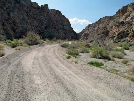 Well graded road into the first narrows (Photo 1989) |
Getting to the Roadhead This road is located in Lake Mead National Recreation Area near Laughlin, about 75 miles south of Las Vegas (5 miles west of Laughlin). From Las Vegas, drive south towards Laughlin. From the intersection of Highway 93 and 95 (Table 1, Site 0914), drive south on Highway 95, past Searchlight and Cal-Nev-Ari, for 54 miles to Highway 163 (Site 0826). Turn left onto Highway 163 towards Laughlin and drive east for 13.5 miles to an unmarked turnoff on the north side of the highway. This point is 1.7 miles past (east of) the turnoff to Christmas Tree Pass Road (Site 0823) and about 5 miles before the bridge in Laughlin. |
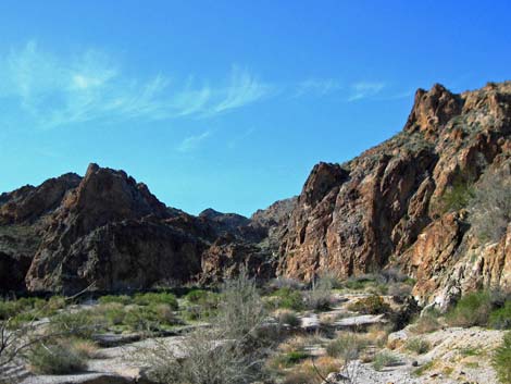 Open canyon (Photo 2033) |
From the pavement (Site 1253), turn northeast onto the unsigned and unpaved Nevada Telephone Cove Road and follow it as it runs northeast and runs all the way to the shores of Lake Mohave (passing Road 14 [Site 1254] and Grapevine Canyon Road [Site 1255] by a short distance). The beach at Nevada Telephone Cove is scenic, secluded, and pleasant. Take a few moments to enjoy the calm waters lapping at the shore. For details of this road, see the description of Nevada Telephone Cove Road. Note that all along the access road, the lands to the left (northwest) are in the Spirit Mountain Wilderness Area and protected from development forever. Stop anywhere and wander into the wilderness area -- you don't have to walk far as this wilderness area is accessible to almost everyone. When finished at the cove, retreat a short distance back up Nevada Telephone Cove Road and turn west at the tiny brown sign showing a yellow arrow with road number 13 inside the arrow (Site 1255). Around the first corner, a brown sign confirms that this is Lower Grapevine Canyon Road (Road 13). At this point, the road penetrates Spirit Mountain Wilderness Area as a "cherry stem road." |
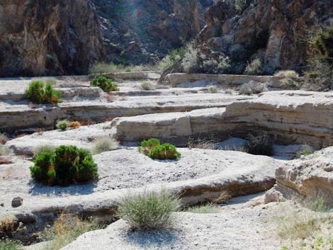 Better Homes and Gardens (Photo 2002) |
The Road The lower portion of Lower Grapevine Canyon is broad and sandy, but the road is well graded and suitable for any vehicle. Soft sands to the sides of the road are guarded by post-and-cable fencing, which also keep vehicles out of the Spirit Mountain Wilderness Area. After 0.55 miles, the canyon begins to narrow, but before it does, stop and turn around to look back east for lovely views of Lake Mohave and the Black Mountains across the lake in Arizona (Photo 1993). Soon the road enters the canyon, and tall cliffs of dark, rugged granitic rock begin to close in on both sides (Photo 1989). In this area (Site 1256), the graded portion of the road ends and 4WD vehicles should be used beyond this point, as the road drops down a short hill and becomes noticeably rougher. |
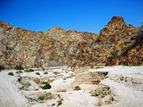 Wash in upper portions (Photo 2003) |
The canyon widens briefly (Photo 2033), then the flat wash transitions into sculptured terraces of white gravel that have been washed down from the upper reaches of the canyon. With various green plants growing in the terraces, it looks like an intricately designed rock garden out of Better Homes and Gardens magazine (Photos 2002, 2003). After a couple of climbs in and out of the wash, the road ends (Photo 2007) (Site 1257). However, at this point, the adventure has only begun. Park your vehicle and walk up the wash into the Spirit Mountain Wilderness Area. You will be surrounded by towering cliffs of multi-colored rocks, with several tiers of beautifully sculptured terraces on the south side of the canyon (Photo 2009). Hiking deeper into the canyon, the walls become taller and narrower, and you are now in a "slot canyon" of sorts (Photo 2026). As the canyon takes a bend to the right, look on the north wall for a spectacular geologic phenomenon that may leave you in awe of the incredible forces of nature. Two dikes of jet-black rock intrude into cracks in the granitic bedrock, and the boundary between the rocks is as sharp as a knife (Photo 2011). |
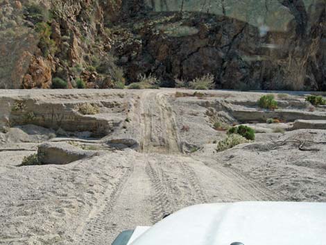 Crossing the wash; it is steeper than it looks |
Continue further up the canyon and you may start to see some water flowing, then hear the distinct sound of a waterfall. As you come around another bend, you will see a huge boulder that has fallen into the canyon and created a partial dam (Table 2, Waypoint 01). The boulder is held up by the narrow canyon walls and forms a small cave (Photo 2017) that contains a small hidden waterfall. The presence of the waterfall, of course, depends on the amount of rainfall in the preceding days, so it may not always be flowing. A short but tricky climb to the right of the boulder allows access to the canyon beyond, but the authors did not explore that area extensively. Conceivably, this wash could be followed west all the way to the petroglyphs area beyond Christmas Tree Pass Road, but the conditions in that stretch are unknown. |
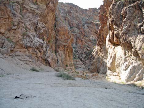 End of the road; entrance to narrows (Photo 2007) |
When you have completed your exploration of Lower Grapevine Canyon, return to Highway 163 the way you came. The return trip provides stunning views, including Lake Mohave framed by the rugged walls of the canyon (banner photo). Back at Highway 163, turn west and return to Las Vegas via U.S. Highway 95, which is the shorter option, or make a loop trip by turning east, crossing the bridge at Laughlin, turning left onto eastbound Arizona Highway 68, turning north onto U.S. 93 near Kingman, and following 93 over Hoover Dam, through Boulder City, and back to Las Vegas. Alternatively, with a high clearance vehicle, consider returning via Christmas Tree Pass Road (Site 0823) to U.S. Highway 95. |
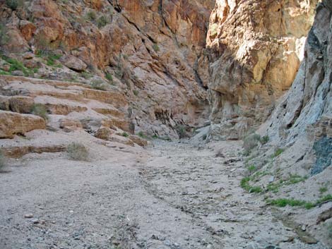 Terracing in narrows (Photo 2009) |
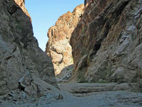 Narrow canyon (Photo 2026) |
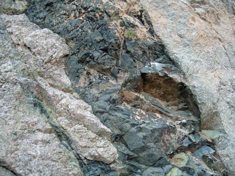 Black dikes in granitic rock (Photo 2011) |
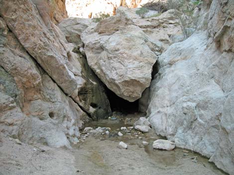 The cave with hidden waterfall (Photo 2017) |
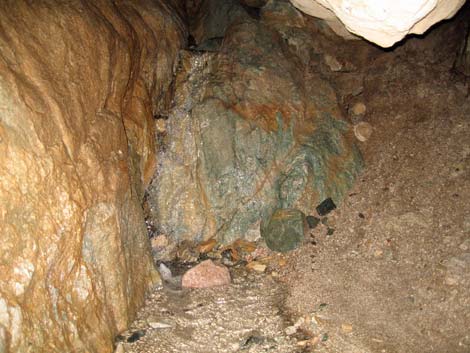 Waterfall inside the cave |
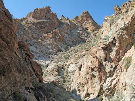 Beyond the narrows ... |
Table 1. Highway Coordinates Based on GPS Data (NAD27; UTM Zone 11S). Download Highway GPS Waypoints (*.gpx) file.
| Site | Location | UTM Easting | UTM Northing | Latitude (N) | Longitude (W) | Elevation (ft) | Verified |
| 0823 | Hwy 163 at Christmas Tree Rd | 712306 | 3897607 | 35.20082 | 114.66796 | 1,952 | Yes |
| 0826 | Hwy 95 at Hwy 163 | 695527 | 3896339 | 35.19280 | 114.85245 | 2,516 | Yes |
| 0914 | Hwy 95 at Hwy 93 | 689922 | 3982187 | 35.96744 | 114.89381 | 2,340 | Yes |
| 1253 | Hwy 163 @ NV Telephone Cove Rd | 714872 | 3896749 | 35.19254 | 114.64002 | 1,536 | GPS |
| 1254 | NV Telephone Rd at Road 14 | 716990 | 3898842 | 35.21094 | 114.61623 | 1,111 | GPS |
| 1255 | NV Telephone Rd at Road 13 | 718860 | 3900921 | 35.22927 | 114.59514 | 698 | GPS |
| 1256 | L_Grapevine Rd; End Grading | 717137 | 3900690 | 35.22756 | 114.61412 | 1,016 | GPS |
| 1257 | L_Grapevine Rd; End 4WD Rd | 716014 | 3900532 | 35.22638 | 114.62649 | 1,165 | GPS |
| 1258 | Nevada Telephone Cove | 718994 | 3901292 | 35.23258 | 114.59357 | 679 | GPS |
Table 2. Hiking Coordinates Based on GPS Data (NAD27; UTM Zone 11S). Download Hiking GPS Waypoints above.
| Wpt. | Location | Easting | Northing | Elevation (ft) | Point-to-Point Distance (mi) | Cumulative Distance (mi) | Verified |
|---|---|---|---|---|---|---|---|
| 01 | Hidden Waterfall | 715881 | 3900572 | 1,218 | 0.10 | 0.10 | GPS |
Happy Hiking! All distances, elevations, and other facts are approximate.
![]() ; Last updated 250318
; Last updated 250318
| Backroads Around Las Vegas | Hiking Around Las Vegas | Glossary | Copyright, Conditions, Disclaimer | Home |