Hiking Around Las Vegas, Red Rock Canyon National Conservation Area
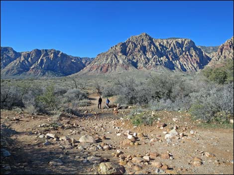
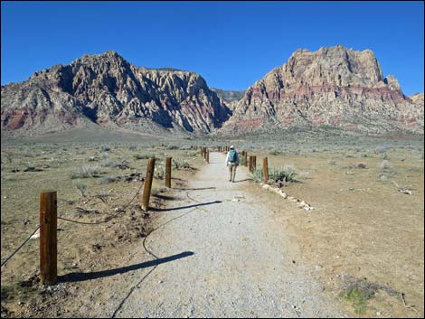
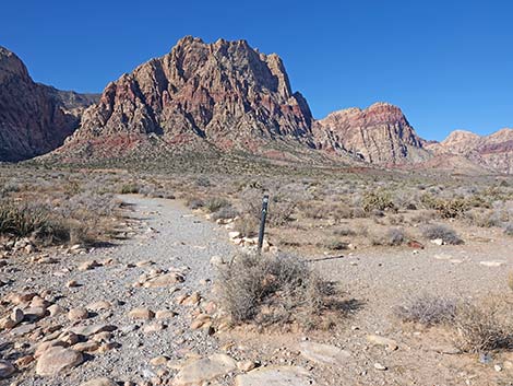
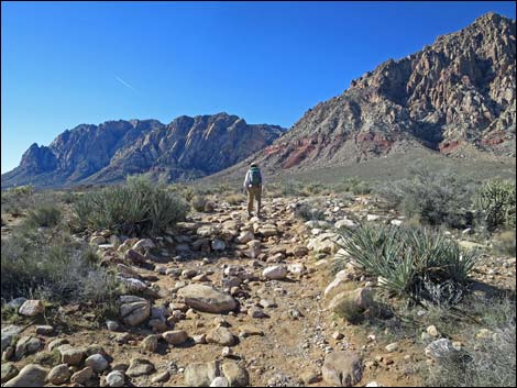
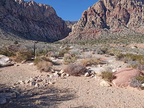
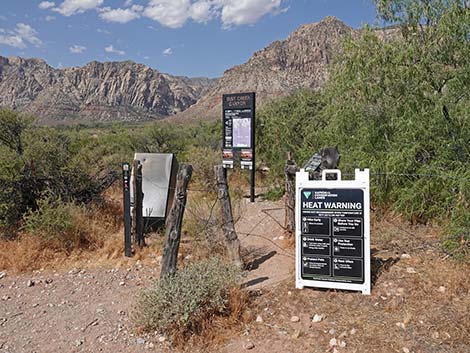 First Creek trailhead (view W) |
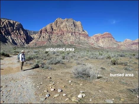
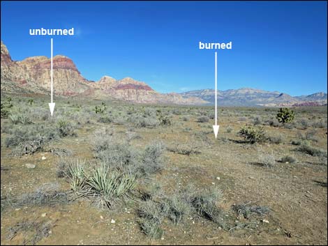
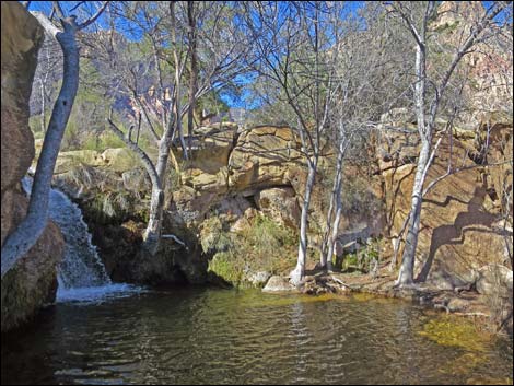
Overview The hike to First Creek Falls is a pleasant 2.2-mile walk (round trip) across a desert valley beneath towering red-and-white sandstone cliffs. Near the beginning of the trail, a wildfire fire in 2006 burned 42-acres, so shrubby vegetation is sparse, but farther out the landscape is heavily vegetated with plants typical of the Mojave Desert Scrub. It is interesting to see what has, and has not, grown back after more than a decade. The trail runs across desert flats until dropping into a deep gully cut by first creek into the landscape. The trail ends at a little waterfall with tall Velvet Ash trees, Narrowleaf Willow, and other shade trees around a large plunge pool cut into interesting conglomerate rock. Except for the last few yards, the hike follows a well-defined trail. Getting down to the falls, the route follows a use-trail down the side of the wash into the canyon. As with other falls in the area, First Creek often is dry, but there usually is water in the plunge pool that is important for birds, frogs, and other creatures. Link to map. |
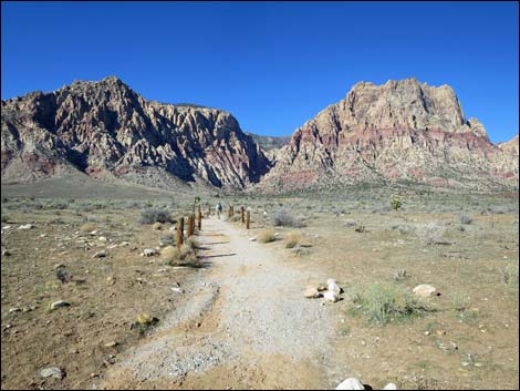
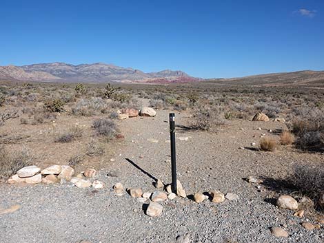
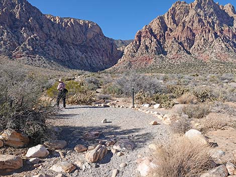
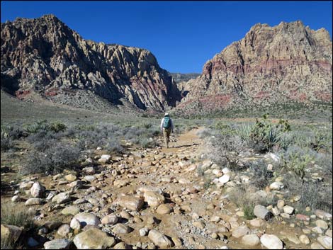
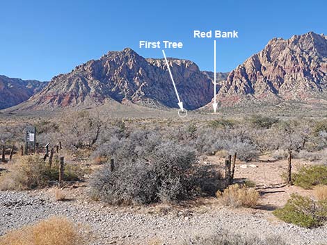 Landmarks as seen from the trailhead parking area (view W) |
The main trail does not go to the falls, there are no signs indicating the falls, and there are lots of confusing wild burro trails and other use-trails that cross the main trail, so it is important to use GPS coordinates or landmarks to find the turnoff from the main trail. In particular, watch for the first Singleleaf Pinyon Pine tree on the south side (left) of the trail, which with binoculars, can be seen from the trailhead parking area. After visiting the falls, consider continuing up the trail into First Creek Canyon, where hikers can scramble up the canyon as far as they want. The main trail splits into many use-trails, but they all go in the same general direction, so the choice of use-trails doesn't matter because as the sandstone walls close in, the main trails only go up the canyon, although there are some lesser trails that climb steeply up to rock climbing routes on the cliffs. |
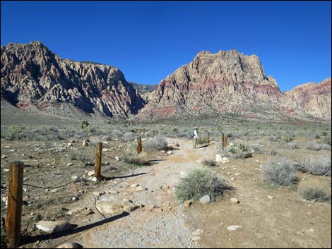
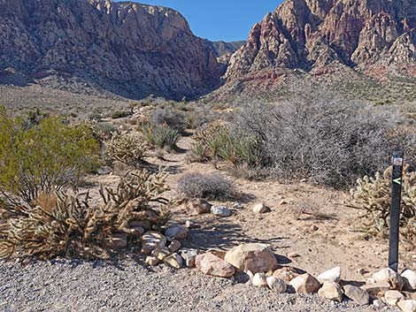
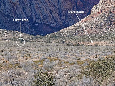 Landmarks as seen from the trailhead parking area (zoom; view W) |
Watch Out Other than the standard warnings about hiking in the desert, ...this is a safe hike, even for kids. The last bit down to the creek is a bit harder, but be careful and it shouldn't be a problem. Watch for slippery rocks along the creek during summer, and watch for ice during winter. In and around desert washes, always be aware of the potential for flash floods. While hiking, please respect the land and the other people out there, and try to Leave No Trace of your passage. Also, even though this is a short hike, be sure to bring what you need of the 10 Essentials. |
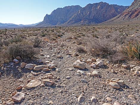
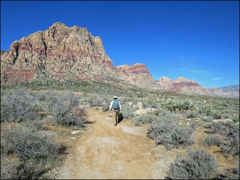
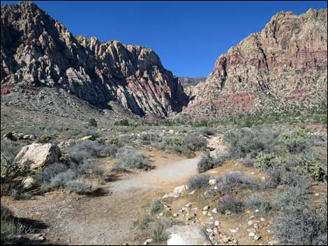
 Approaching Oak Creek Wash (view W) |
Getting to the Trailhead
First Creek Falls is located in Red Rock Canyon National Conservation Area, about 40 minutes from downtown, but not on the Scenic Loop Road. Drive out West Charleston Blvd, pass the entrance to and exit from the Scenic Loop Road, and continue to the First Creek Trailhead. Park here; this is the trailhead. The Hike From the trailhead (Table 1, Waypoint 1), the trail winds through a gate, then bends southwest and crosses Oak Creek Wash. Water flows in the wash after wet winters, but usually it is dry; a sign advises hikers to stay out of the water during floods. The trail then bends to the west and heads out towards the Wilson (Red Rocks) Cliffs and First Creek Canyon. |
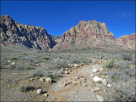
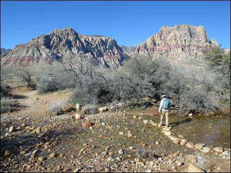 Hiker crossing Oak Creek Wash during winter (view W) |
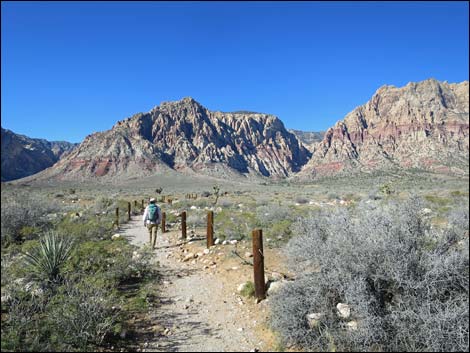
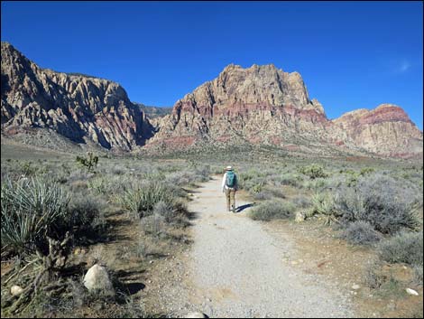
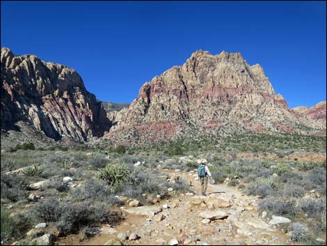
Across the wash, the trail strolls westward across the gently sloping valley. About 400 feet out (Wpt. 02), the trail enters an area that burned in a 2006 wildfire. Most of the Joshua trees and other shrubby vegetation is gone, but other things are growing back. To help the land recover, the BLM installed post-and-cable fencing along the trail to encourage people to stay on the trail and avoid trampling the new vegetation. They did a nice job: they put fencing only on one side of the trail at any one point, but alternated the sides of trail so that hikers are guided in the right direction but never feel hemmed in. It will be interesting to watch the vegetation come back over the years. Beyond the fire (Wpt. 03), the trail wanders among the Eastern Joshua trees, Mojave yucca, creosote bush, blackbrush, and a variety of other shrubs. Along this section, hikers can see First Creek Wash a few hundred yards off to the north (right). Through here, the trail generally runs straight towards the mouth of First Creek Canyon while slowly angling closer to the wash. |
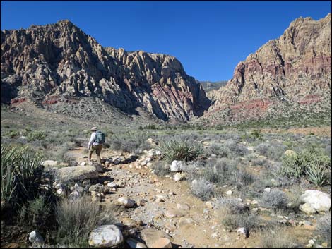
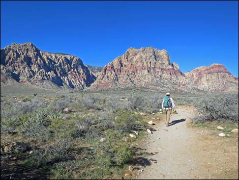 Trail beyond Oak Creek Wash (view W) |
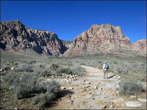
At about 0.44 miles out (Wpt. 04), the trail crosses a north-south trending use-trail. This trail runs south leads to Spring Mountain Ranch State Park, and north to connect with a network of trails in the Oak Creek Canyon area. At about 0.63 miles out, the trail suddenly veers off to the south (left), away from the wash, and winds through a big S-shaped curve as it crosses a broad, rocky, shallow, side-wash and climbs the low bank on the far side. After that, the trail abruptly bends back to the west (right), continues towards the mouth of the canyon, and slowly angles back towards First Creek Wash. |
 Hiker entering the 2006 42-acre burn area (view W) |
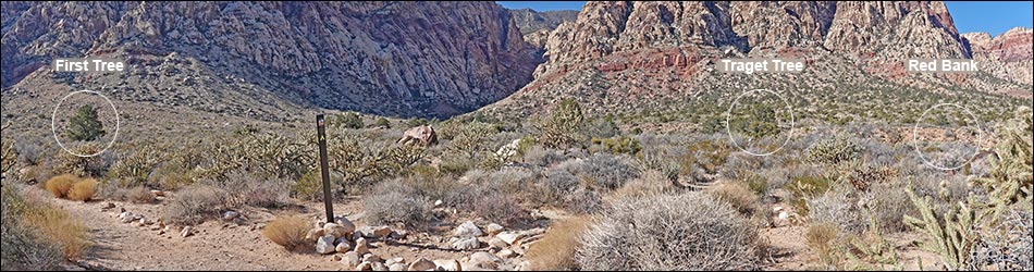
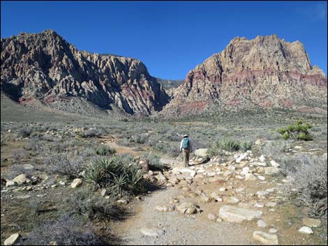
After the S-curves, hikers can start getting their bearings on the falls (see banner photo). Look for the first pine tree on the south (left) side of the trail (Wpt. 08) and a yellowish rocky outcrop across First Creek Wash at the far end of a red stream bank. Both points are about 0.3 miles ahead. The falls lie between these two landmarks. About 100 yards before getting to the first pine tree on the south side of the trail, an unmarked use-trail (Wpt. 05) angles off to the northwest towards another pine tree about 100 yards out at the edge of a cliff overlooking the wash (see banner photo). Follow the use-trail to the Singleleaf Pinyon Pine at the edge of the cliff (Wpt. 06). From the tree, a use-trail starts down over the edge into the gully. The route runs down and west across the slope following a narrow use-trail. Scrambling straight down the purple-dirt embankment below the pine tree is not a better way to go. |
 Staggered cable fencing defines trail in burn area (view W) |
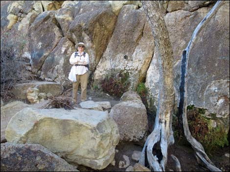
Winding around interesting conglomerate boulders of Triassic-age Shinarump Conglomerate and tall trees, the trail reaches the bottom of the shady canyon and the base of the waterfall (Wpt. 7). The total elevation change here is only about 25 vertical feet. The canyon below the falls is a small, quiet place where the canyon walls and tall trees provide lots of shade. Be sure to take a few minutes to enjoy the solitude while listening to the falling water, songbirds, and Baja California Treefrogs, and please respect the solitude of other people in the area. Vegetation at the falls includes Velvet Ash trees, Narrowleaf Willow, Singleleaf Pinyon Pine, Utah Juniper, Ashy Silktassel, Shrub Live Oak, Arizona Grape vines, and California Buckthorn. To return to the trailhead, retrace your steps in the dust back to the trailhead. However, before you go, consider hiking up into First Creek Canyon. Trails and use-trails lead onto the canyon, but eventually hikers end up boulder-hopping up the wash and winding through the brush. |
 Burn area (view W) |
 Hiker exiting the 2006 42-acre burn area (view W) |
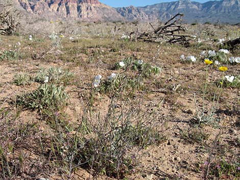 During spring, the burn area can have lots of wildflowers (view N) |
 Hiker at the edge of the burn area (view W) |
 Edge of the burn area (view N) |
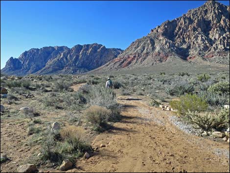
 Hiker in the unburned area (view W) |
 Hiker at trail junction (view W) |
 Trail marker at trail junction (view W) |
 Cross-trail (view S towards Spring Mtn Ranch State Park) |
 Cross-trail (view N towards Calico Hills) |
 Hiker continuing up First Creek Falls Trail (view W) |
 Hiker continuing up First Creek Falls Trail (view W) |
 Hiker passing rehabilitated use-trail (view W) |
 Rehabilitated use-trail (view W) |
 Hiker entering into S-curves (view S) |
 Hiker in S-curves (view S) |
 Hiker exiting S-curves (view W) |
 Well defined trail past burn area (view W) |
 Hiker continuing up First Creek Falls Trail (view W) |
 Passing another rehabilitated use-trail (view W) |
 Continuing up First Creek Falls Trail (view W) |
 Hiker continuing up First Creek Falls Trail (view W) |
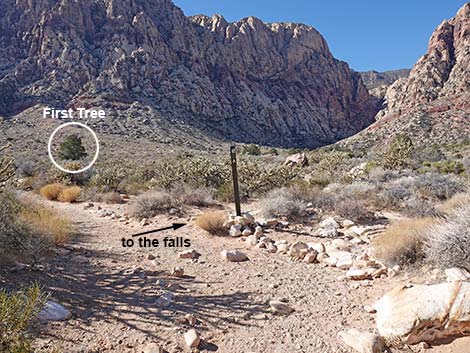 Trail junction to the falls; note First Tree (view W) |
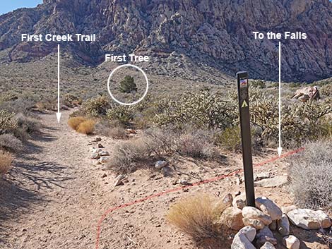 First Creek Trail continues towards First Tree; right to falls (view SW) |
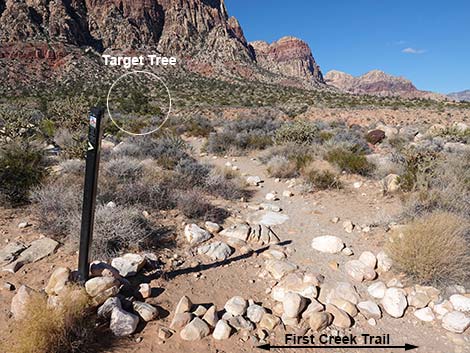 Side-trail to the falls (view NW from First Creek Trail) |
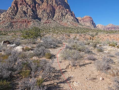
 Site-trail to falls stays right at fork towards Target Tree (view NW) |
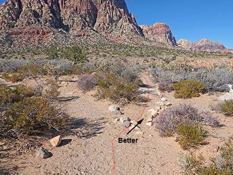 Staying right at fork is better (view NW) |
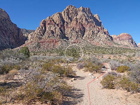
 Side-trail to the falls (view NW) |
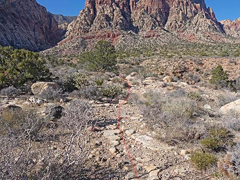 Side-trail to the falls (view W) |
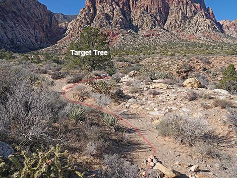 Side-trail to the falls joins another use-trail (view W) |
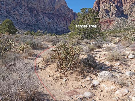 Side-trail to falls continues towards Target Tree (view NW) |
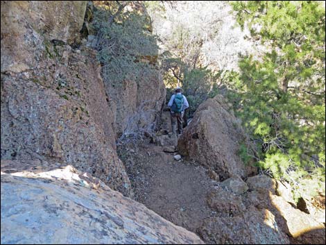
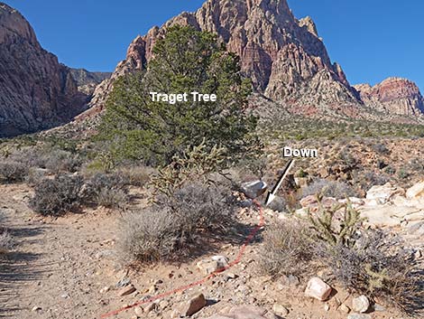 In front of Target Tree, Side-trail to falls drops over steep edge |
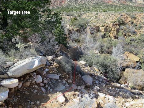 Steep start to trail down to the base of the falls (view NW) |
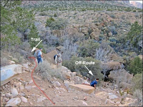 Trail stays high (upper hiker on trail; lower hikers off route; view NW) |
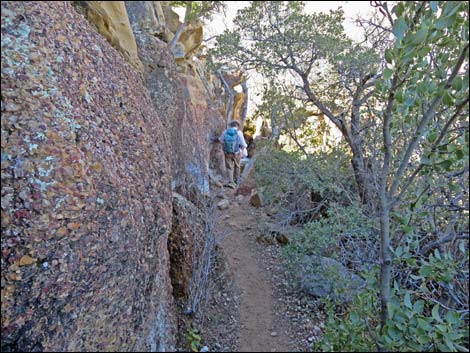
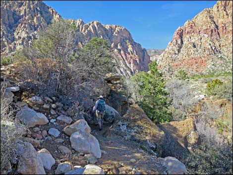 After steep start, gentle trail leads to the falls (view W) |
 Trail and Shinarump Conglomerate rocks (view E) |
 Hiker approaching base of the falls (view W) |
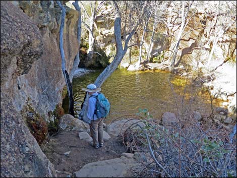 Hiker on overlook at base of the falls (view W) |
 Hiker on overlook at base of the falls (view S) |
 First Creek Falls in spring (view W) |
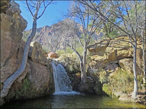 First Creek Falls in spring (view W) |
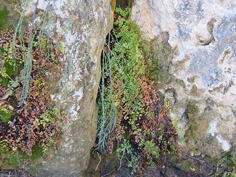 Ferns and mosses growing on limestone cliff (view S) |
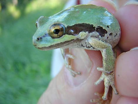 Green-phase Baja California Treefrog at First Creek Falls |
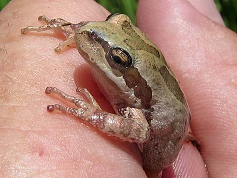 Brown-phase Baja California Treefrog at First Creek Falls |
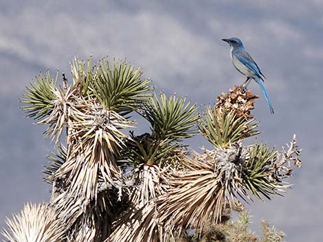 Woodhouse's Scrub-Jay in an Eastern Joshua Tree |
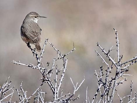 Bewick's Wren in a Desert Almond shrub during winter |
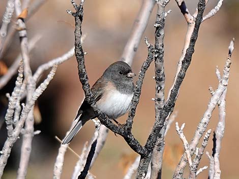 Dark-eyed Junco in a Singleleaf Ash tree during winter |
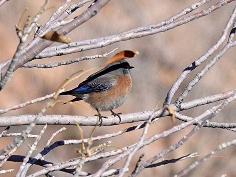 Western Bluebird (male) in a Singleleaf Ash tree during winter |
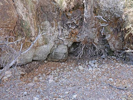 The plunge pool dries out during drought |
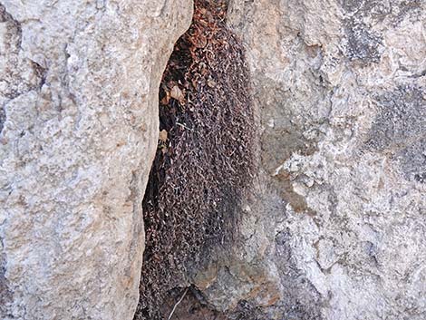 Maidenhair Fern drying up during drought |
Table 1. Hiking Coordinates Based on GPS Data (NAD27; UTM Zone 11S). Download Hiking GPS Waypoints (*.gpx) file.
| Wpt | Location | Easting | Northing | Elevation | Point-to-Point Distance (mi) | Cumulative Distance (mi) | Verified |
|---|---|---|---|---|---|---|---|
| 01 | Trailhead | 639812 | 3993885 | 3,661 | 0.00 | 0.00 | GPS |
| 02 | East Edge of Fire | 639704 | 3993848 | 3,647 | 0.08 | 0.08 | GPS |
| 03 | West Edge of Fire | 639278 | 3993775 | 3,695 | 0.28 | 0.36 | GPS |
| 04 | Use-Trail Junction | 639136 | 3993779 | 3,718 | 0.08 | 0.44 | GPS |
| 05 | Use-Trail Junction | 638333 | 3993726 | 3,825 | 0.56 | 1.00 | GPS |
| 06 | Pine at Edge of Cliff | 638266 | 3993767 | 3,843 | 0.07 | 1.07 | GPS |
| 07 | Waterfall | 638228 | 3993774 | 3,831 | 0.03 | 1.10 | GPS |
| 08 | First Pine | 638270 | 3993671 | 3,846 | . | . | GPS |
Happy Hiking! All distances, elevations, and other facts are approximate.
![]() ; Last updated 240721
; Last updated 240721
| Hiking Around Red Rocks | Hiking Around Las Vegas | Glossary | Copyright, Conditions, Disclaimer | Home |