Hiking Around Las Vegas, Red Rock Canyon National Conservation Area
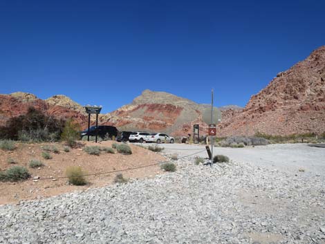
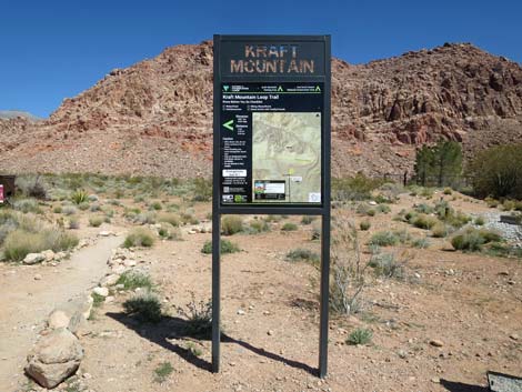
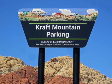 Kraft Mountain Trailhead parking sign (view W) |
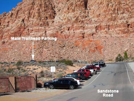
Kraft Mountain provides parking for four trailheads: Both ends of the Kraft Mountain (aka Gateway Canyon) Loop Trail, Ash Spring Trail, and Girl Scout Trail. A number of unnamed trails crisscross the area, providing access to the sandstone cliffs, several springs, and miles of relatively flat walking. Kraft Mountain Parking is located in the Calico Basin area of Red Rock Canyon National Conservation Area, about 35 minutes west of Las Vegas. From town, drive out towards Red Rocks. From West Charleston Blvd at Highway 215 (Table 1, Site 516), drive west on Charleston 3.8 miles to Calico Basin Road (Site 0520). Turn right onto Calico Basin Road and drive northwest, past the turnoff to Red Springs Picnic Area, for 1.9 miles to the end of Sandstone Drive. Turn left through a gate and onto a gravel spur road (Site 0971). Park here; this is the trailhead. Trails: Ash Spring Loop, Ash Canyon, Calico Hills Loop, Girl Scout Trail, Gray Cap Peak, Kraft Mountain Loop (Gateway Canyon), and the Kraft Boulders. Link to trailhead map. |
 Spill-over parking along Sandstone Road (view N) |
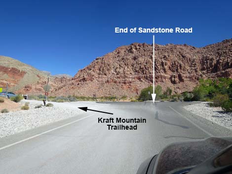 Sandstone Road at entrance to Kraft Mountain parking (view N) |
 Sandstone Road at entrance to Kraft Mountain parking (view NW) |
 Sandstone Road at entrance to Kraft Mountain parking (view NW) |
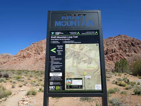
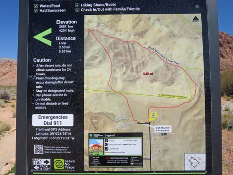
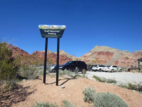 Kraft Mountain parking sign (view W) |
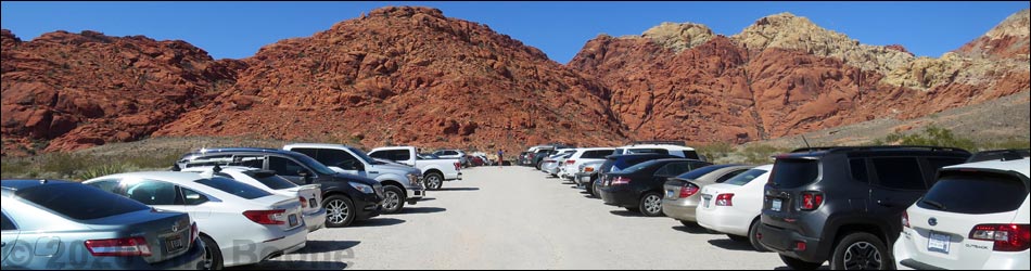
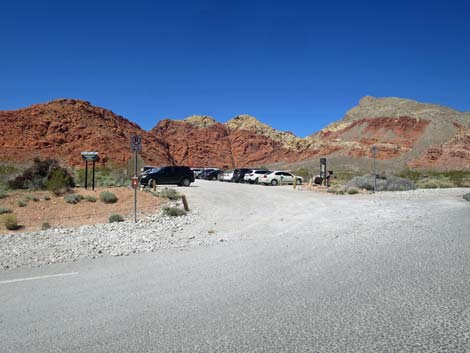
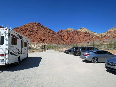
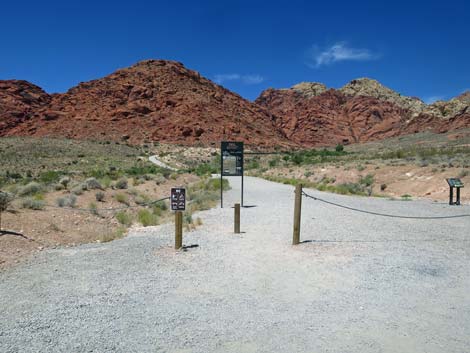
 Kraft Mountain Trailhead parking (view W) |
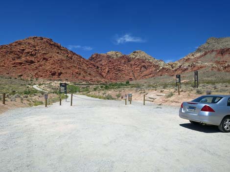
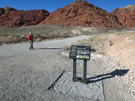
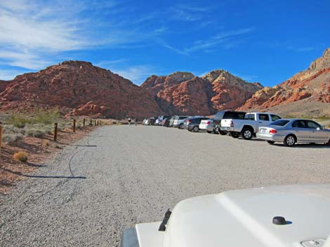 Kraft Mountain Trailhead on a quiet day (view W from near entrance) |
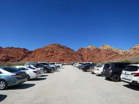
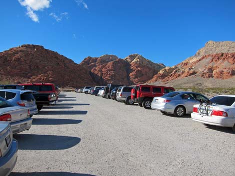 Kraft Mountain Trailhead on a busy day (view W from near middle) |
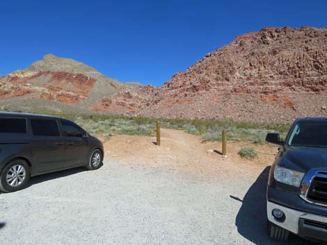 Alternate start for Kraft Mountain Loop Trail (view N) |
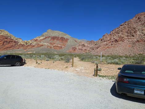 Another Alternate start for Kraft Mountain Loop Trail (view N) |
 |
 |
Northeast Trailhead: Kraft Mountain Loop (counter-clockwise; upstream through Gateway Canyon) and Kraft Boulders
 |
 |
 |
 |
 |
 |
 |
 |
West Trailheads: Girl Scout Trail, Ash Spring Trail, and Kraft Mountain Trail
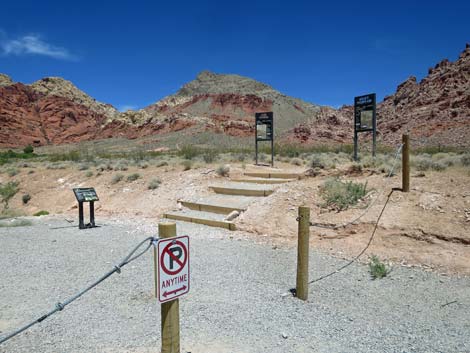
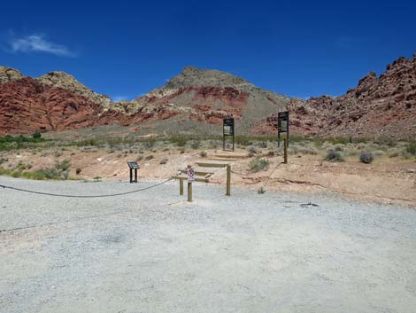
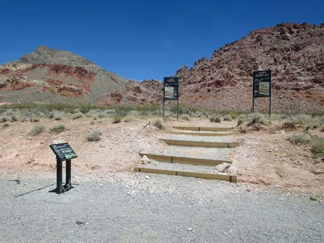
West end of Kraft Mountain parking: three trailheads (view W) |
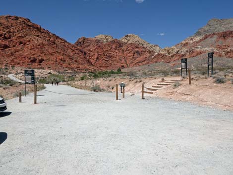 West end of Kraft Mountain parking: three trailheads (view W) |
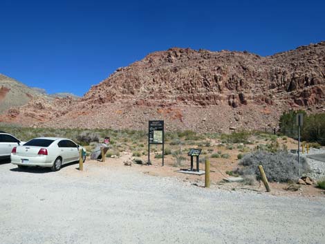
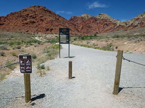
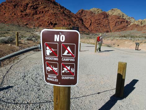 Information sign about regulations (view W) |
 On the right: Ash Spring Trail and Kraft Mtn trailhead signs (view NW) |
 On the left: Girl Scout Trailhead sign (view W) |
 On the right: Ash Spring Trail and Kraft Mtn trailhead signs (view NW) |
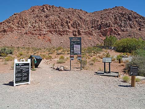
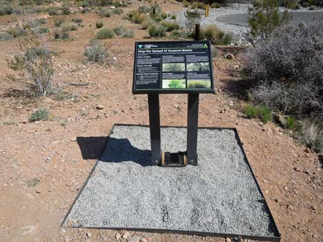
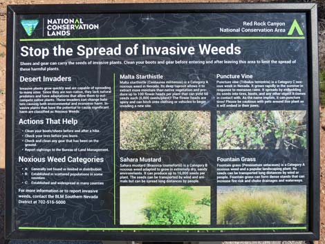
 Information sign about weeds (view W) |
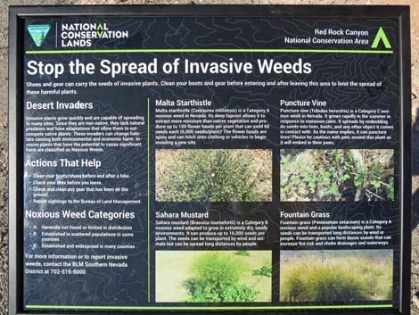 Information sign about weeds (view W) |
West Trailhead: Ash Canyon Trail
 |
 |
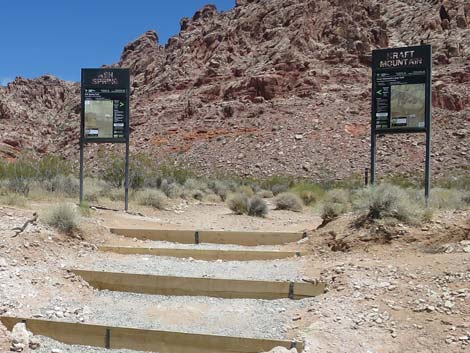 Ash Spring and Kraft Mountain trailhead signs (view N) |
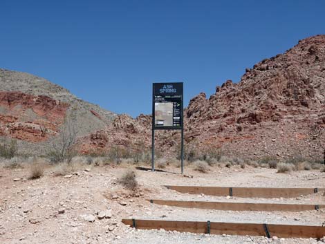 Ash Spring Trail trailhead sign (view N) |
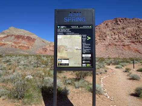 Ash Spring Trail trailhead sign (view N) |
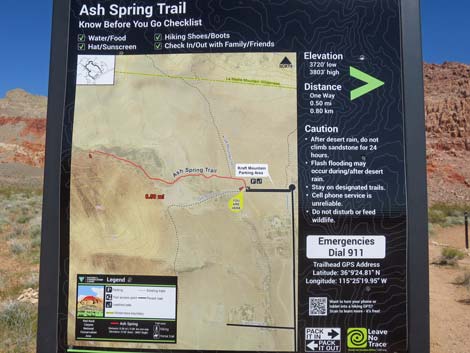 Ash Spring Trail trailhead map (view N) |
West Trailhead: Kraft Mountain Loop (Clockwise; up Hell Hill and downstream through Gateway Canyon)
Ash Spring and Kraft Mountain trailhead signs (view N) |
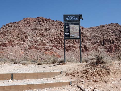 Kraft Mountain trailhead sign (view N) |
 Kraft Mountain trailhead sign (view N) |
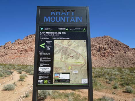
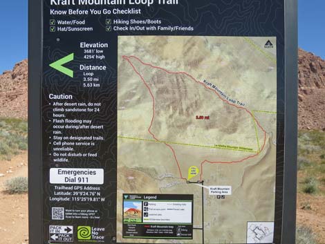 Kraft Mountain trailhead map (view N) |
West Trailhead: Girl Scout
 Girl Scout Trailhead sign (view W) |
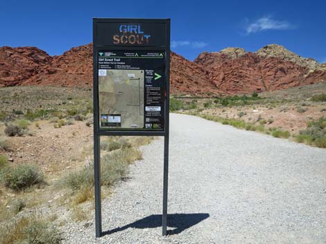 Girl Scout Trailhead sign (view W) |
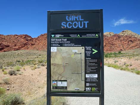 Girl Scout Trailhead sign (view W) |
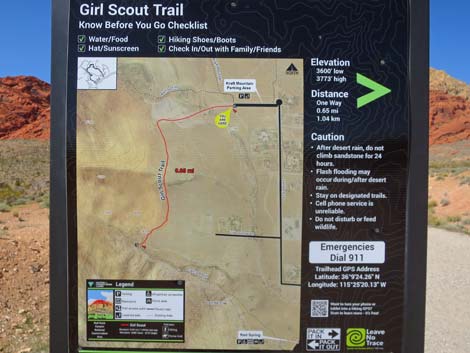 Girl Scout Trailhead sign (view W) |
More to come ... |
Table 1. Highway Coordinates (NAD27; UTM Zone 11S). Download Highway GPS Waypoints (*.gpx) file.
| Site # | Location | Latitude (N) | Longitude (W) | UTM Easting | UTM Northing | Elevation (feet) | Verified |
|---|---|---|---|---|---|---|---|
| 0516 | Charleston at Hwy 215 | 36.15910 | 115.33661 | 649626 | 4002676 | 3,070 | Yes |
| 0520 | Charleston at Calico Basin Rd | 36.14184 | 115.39871 | 644071 | 4000667 | 3,506 | Yes |
| 0971 | Kraft Mountain Trailhead | 36.15682 | 115.41927 | 642194 | 4002299 | 3,711 | Yes |
Happy Hiking! All distances, elevations, and other facts are approximate.
![]() ; Last updated 240330
; Last updated 240330
| Hiking Around Red Rocks | Hiking Around Las Vegas | Glossary | Copyright, Conditions, Disclaimer | Home |