
Hiking Around Las Vegas, Red Rock Canyon National Conservation Area

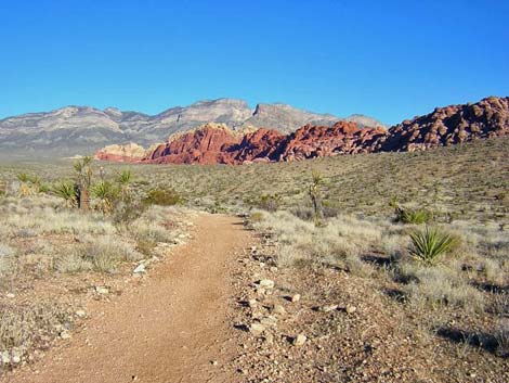 Scenic country along the Calico Hills Trail (view N) |
Overview There are a number of trails in the Visitor Center area that, singly or in combination, make for good, short hikes in the open desert with interesting rocks, fossils, birds, a variety of vegetation types, and grand scenery all around. If you only have a few minutes to hike, or if you are new to hiking in the desert. The purpose of this page is to present a variety of hiking possibilities that start at the Entrance Station (or the Visitor Center) and use the Calico Hills Trail, the Moenkopi Trail, and several connecting trails to make loops. The shortest walk is from the Entrance Station to the Visitor Center and back, a nice 0.6-mile walk in the desert. The longest hike included here is from the Entrance Station to the Calico II parking area and back, a route of 4.1 to 4.5 miles, depending on how you hike it. Hikers might consider getting dropped off at the Calico I or Calico II parking areas and walking downhill on the trails for 1 or 2 miles, respectively, to the Entrance Station. By the time the driver makes it around the Scenic Loop and back to the Entrance Station, the hiking party could be waiting |
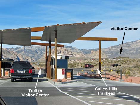 Entrance Station fee booths and Visitor Center (view NW) |
Link to overview map. Links to maps for individual routes are given below. Watch Out Other than the standard warnings about hiking in the desert, ...these hikes are safe, even for kids, but as always, there are ways to hurt yourself if you try. Most of the trails are well groomed, relatively free of rocks, and make for easy walking. Be careful crossing or walking on the roads. While hiking, please respect the land and the other people out there, and try to Leave No Trace of your passage. Also, even though these hikes are short, be sure to bring what you need of the 10 Essentials. |
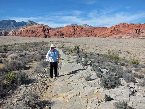 Moenkopi Trail near Moenkopi summit (view S) |
Getting to the Trailhead This hike is located along the Scenic Loop Road in Red Rock Canyon National Conservation Area, about 30 minutes west of Las Vegas. Drive out to Red Rocks, pay the fee, then drive forward and turn left onto the exit road and left again into the Entrance Station Trailhead behind the fee booths. Park here; this is the trailhead. Alternatively, park at the Visitor Center Trailhead or one of the other places along the Scenic Loop Road that access this trail system: Calico I Trailhead or Calico II Trailhead. These alternative trailheads add variety to the hiking possibilities and provide places to drop hikers off and pick them up later. |
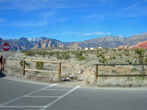 Entrance Station to Visitor Center trail (view NW) |
The Hikes Entrance Station -- Visitor Center Trail (0.6 miles) This short trail runs from the Entrance Station to the Visitor Center, then returns over the same trail. Not wilderness, but a nice walk among desert shrubs and Joshua trees. Consider parking along Charleston Blvd. and hike to the Visitor Center without paying the entrance fee. This trail starts at the intersection of the Scenic Loop Road and the Visitor Center exit road (northwest corner of the 4-way intersection). Link to a page with a map and table of trail distances. |
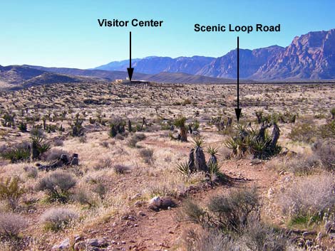 Calico Hills to Visitor Center connector trail as seen from Calico Hills Trail (view SW) |
Entrance Station -- Visitor Center Loop (1.3 miles) This route starts at the Entrance Station and runs northeast on the Calico Hills Trail to a trail junction. The route then turns left onto a trail that crosses the Scenic Loop Road and runs west to signed junction with the Moenkopi Trail. The route then turns left onto the Moenkopi Trail, crosses a wash, and climbs the hill on the other side to run southeast to the Visitor Center parking lots and back to the Entrance Station. From the Entrance Station parking lot, this route starts across the entrance road from the fee booths (the northeast corner of the 4-way intersection). The trailhead is marked by a large Calico Hills Trail System sign. Link to a map and table of trail distances. For details of this route, including information on fossils and vegetation, see the descriptions of the Calico Hills Trail and the Moenkopi Trail. |
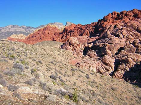 Calico Hills near Calico I parking area (view N) |
Entrance Station -- Calico I -- Visitor Center Loop (2.8 miles) This route starts at the Entrance Station, runs northeast on the Calico Hills Trail to the Calico I parking area, crosses the road and runs west to the Moenkopi Trail, then turns south on the Moenkopi Trail and runs down the bajada to the Visitor Center. From the Visitor Center parking lots, the route follows the road back to the Entrance Station. From the Entrance Station parking lot, this route starts across the entrance road from the fee booths (the northeast corner of the 4-way intersection). The trailhead is marked by a large Calico Hills Trail System sign. Link to a map and table of trail distances. For details of this route, including information on fossils and vegetation, see the descriptions of the Calico Hills Trail and the Moenkopi Trail. |
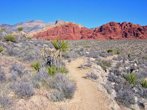 Calico I to Moenkopi Hill connector trail (view NE) |
Entrance Station -- Calico I -- Moenkopi Hill Loop (3.1 miles) This route starts at the Entrance Station, runs northeast on the Calico Hills Trail to the Calico I parking area, crosses the road and runs west to the Moenkopi Trail, then turns right and runs southwest to the summit of Moenkopi Hill. The route follows the Moenkopi Trail back to the Visitor Center. From the Visitor Center parking lots, the route follows the road back to the Entrance Station. From the Entrance Station parking lot, this route starts across the entrance road from the fee booths (the northeast corner of the 4-way intersection). The trailhead is marked by a large Calico Hills Trail System sign. Link to a map and table of trail distances. For details of this route, including information on fossils and vegetation, see descriptions of the Calico Hills Trail and the Moenkopi Trail. |
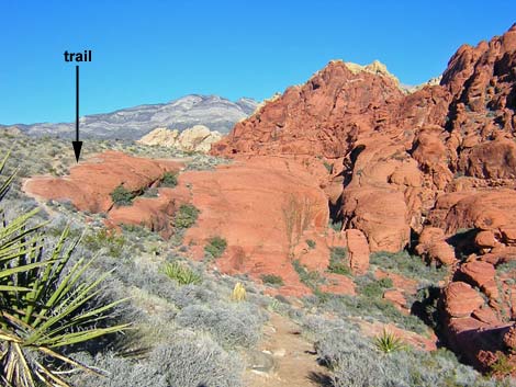 Calico Hills trail near Calico II parking (view N) |
Entrance Station -- Calico II -- Moenkopi Hill Loop (4.1 or 4.5 miles, depending on how you hike it) This route starts at the Entrance Station and runs northeast on the Calico Hills Trail to the Calico II parking area. From there, walk back to Calico I on the road (watch the traffic). From Calico I, the route runs west to the Moenkopi Trail and follows the Moenkopi Trail back to the Visitor Center. From the Visitor Center parking lots, the route follows the road back to the Entrance Station. From the Entrance Station parking lot, this route starts across the entrance road from the fee booths (the northeast corner of the 4-way intersection). The trailhead is marked by a large Calico Hills Trail System sign. Link to a map and table of trail distances. For details of this route, including information on fossils and vegetation, see the descriptions of the Calico Hills Trail and the Moenkopi Trail. |
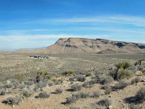 Visitor Center (view SE from summit of Moenkopi Hill) |
Entrance Station -- Moenkopi Hill Loop (2.5 miles) This route starts at the Entrance Station, runs northwest up the Visitor Center exit road, then follows the entire Moenkopi Loop Trail and returns to the Visitor Center. From the Visitor Center parking lots, the route follows the road back to the Entrance Station. This is a very pleasant loop in the open desert. This trail starts at the intersection of the Scenic Loop Road and the exit road from the Visitor Center (northwest corner of the 4-way intersection). Link to a map and table of trail distances. For details of this route, including information on fossils and vegetation, see the description of the Moenkopi Trail. |
Happy Hiking! All distances, elevations, and other facts are approximate.
![]() ; Last updated 240330
; Last updated 240330
| Hiking Around Red Rocks | Hiking Around Las Vegas | Glossary | Copyright, Conditions, Disclaimer | Home |