Hiking Around Las Vegas; Tule Springs Fossil Beds National Monument
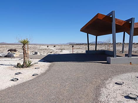
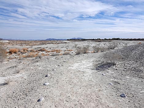
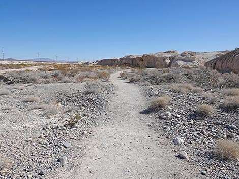
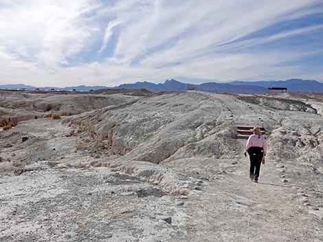
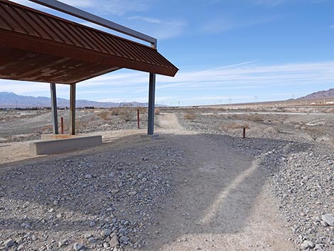
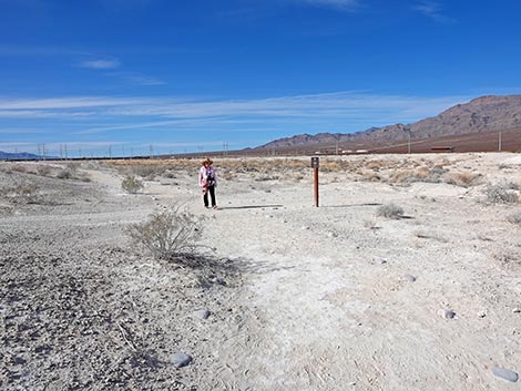
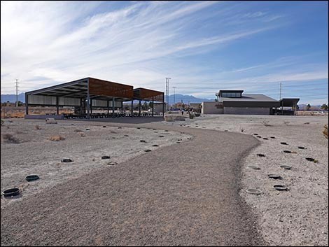
 Trailhead at the edge of the parking lot (view E) |
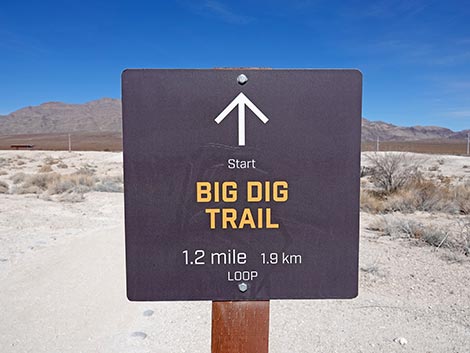
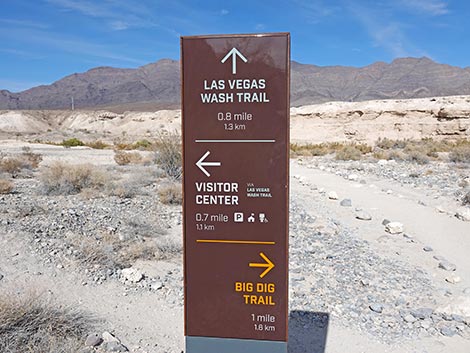
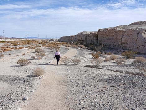
Overview Ice Age Fossils State Park was established in 2017 and opened to the public in 2024. This small (315 acre) state park is tucked up against the much larger (22,650 acres) Tule Springs Fossil Beds National Monument. Together, they protect the paleontologically rich Upper Las Vegas Wash, but in particular, the State Park protects the major paleontological excavation sites. As described by the State Park, the Big Dig Trail is a 1.2-mile trail that begins and ends at the Trench K Trailhead. However, it requires a 0.5-mile hike to get to the Trench K Trailhead, so this is actually a 2.2-mile trail that begins and ends at the Visitor Center. The trail runs out a dusty, dirt trail over fairly level terrain, then loops down through Trench K and other Big Dig sites in the mud hills, and returns to the Visitor Center. Signs provide information about the environment and scientific discoveries made by the Tule Springs and other expeditions. Two structures provide shade. Link to Trail Map or State Park Map. |
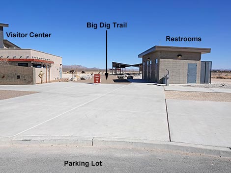
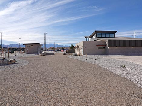
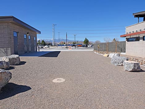
 Trail starts between Visitor Center and Restrooms Building (view E) |
Watch Out Other than the Standard Warnings about hiking in the desert, this trail is fairly safe, but there are stairs and other places where hikers could trip and fall, so alway watch your footing. While visiting the area, please Respect the land and the other people out there, and try to Leave No Trace of your passage. Also, even though this area is not remote, be sure to bring what you need of the 10 Essentials. |
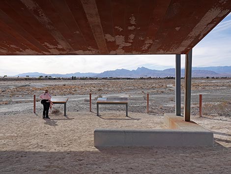
 Trail approaching the picnic shelter (view E) |
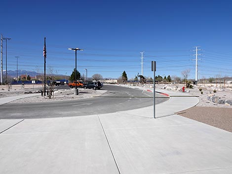
Getting to the Trailhead Ice Age Fossils State Park is located on the north edge of the Las Vegas urban area. From downtown, drive north on Highway 95 towards Reno. Towards the northwest edge of town, take Exit 91A onto Clark County 215 (Northern Beltway). Now driving east, continue 3 miles to Exit 41 (Decatur Blvd). Turn left onto Decatur and drive north about 3.2 miles to Ice Age Fossils State Park, on the right. There is no big entrance sign, but watch for the Monumental Mammoth. Turn right into the parking lot. |
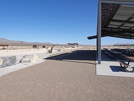 Trail at the picnic shelter (view E) |
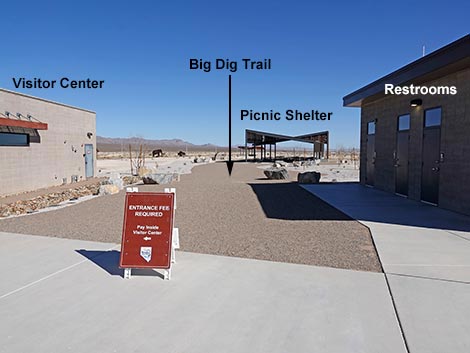
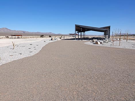
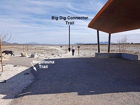
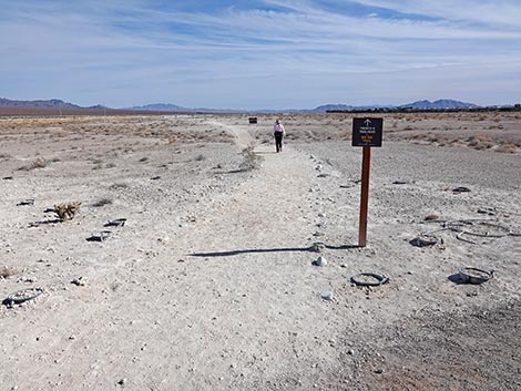
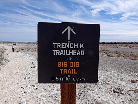
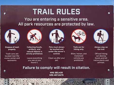
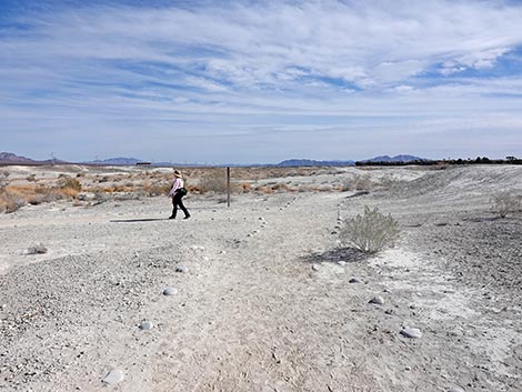
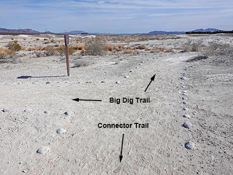
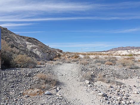
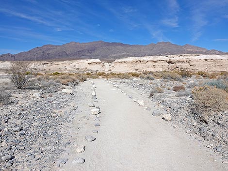
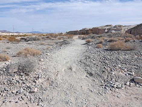
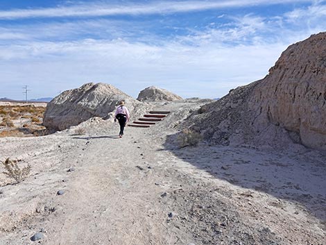
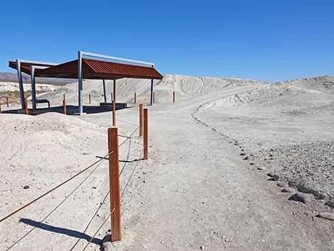
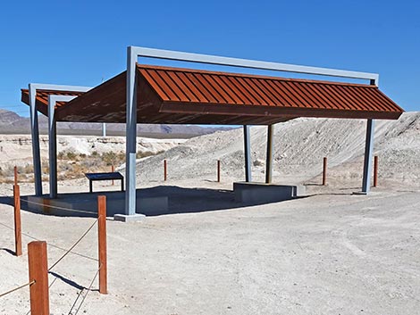
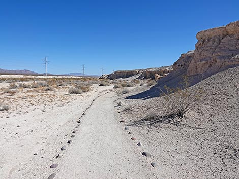
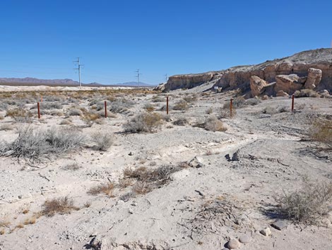
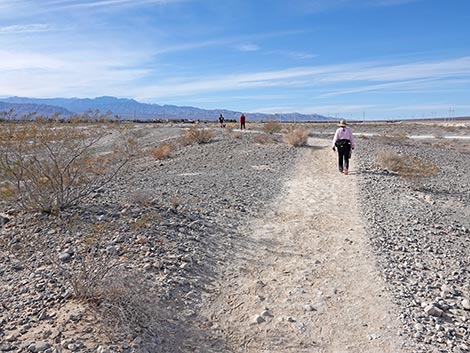
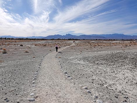
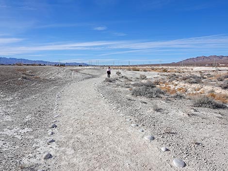
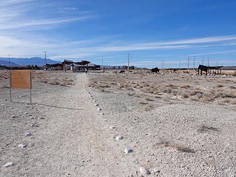
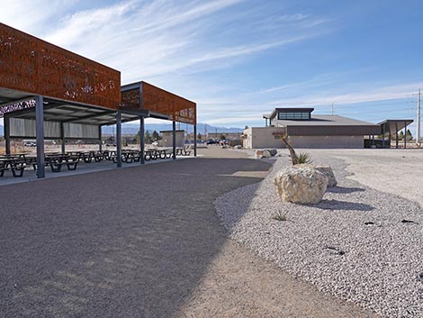
The Hike From the trailhead (Table 1, Waypoint 01) at the edge of the parking lot adjacent to the Visitor Center, the Big Dig Trail starts by heading due east between the Visitor Center and the Restroom Building. Technically, this is the end of the Megafauna Trail. Passing the Restroom Building, the Megafauna Trail heads east to a large shade structure that covers two dozen of picnic tables. Continuing past the picnic area, the Megafauna Trail runs east to a smaller shade structure and a trail junction (Wpt. 04). Here, hikers finishing the Megafauna Trail come in from the left, while the Big Dig Connector Trail continues straight. A small trail sign a few yards past the shade structure announces that the Trench K Trailhead and Big Dig Trail lie 0.5 miles ahead. The distance is actually only 0.37 miles. Heading east over fairly flat terrain, the Big Dig Connector Trail passes a large "Trail Rules" sign. Note, in particular, people are not allowed to dig up fossils, and hikers must stay on trails to avoid crushing microfossils on the surface of the ground. Oh, and don't leave little bags of dog poop along the trail. |
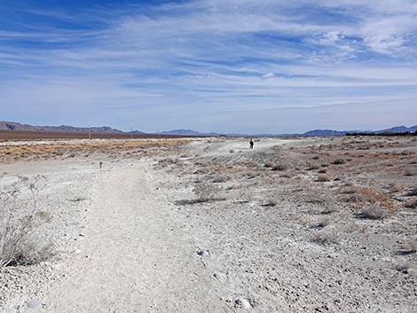
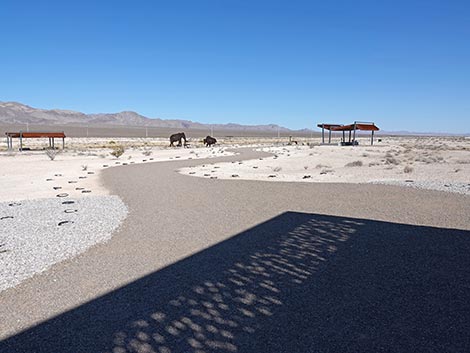 Trail exiting shadow of the picnic shelter (view E) |
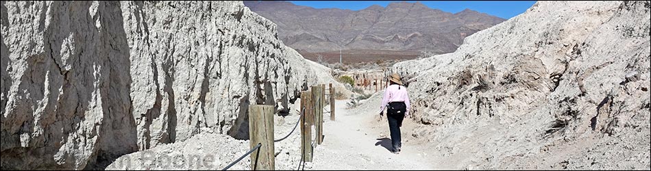
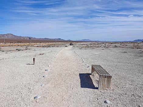
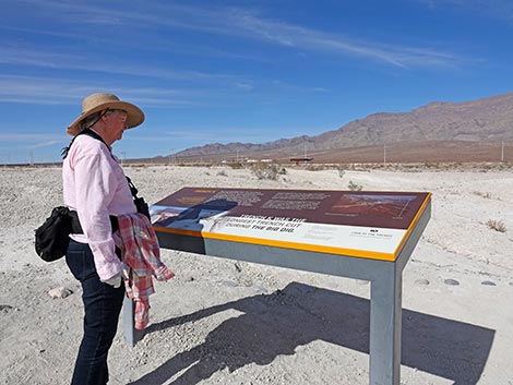
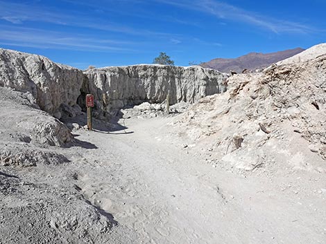
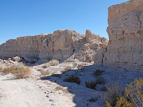
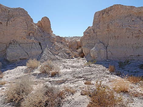
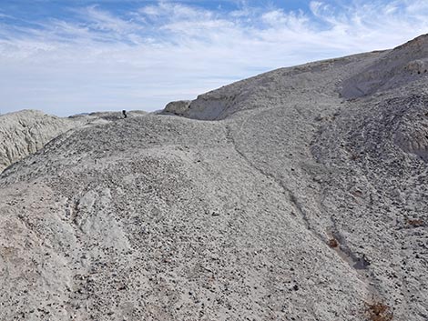
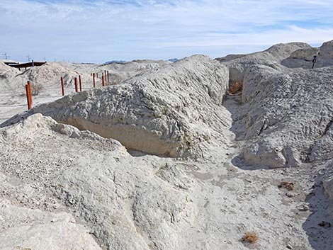
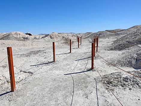
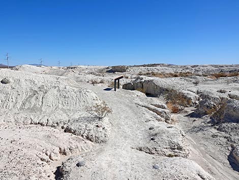
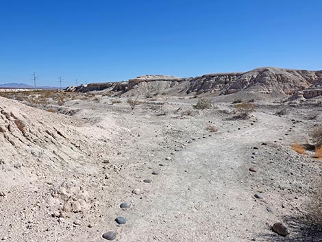
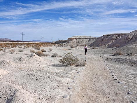
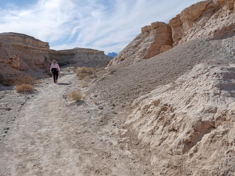
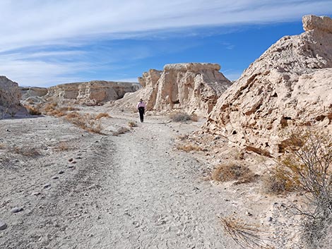
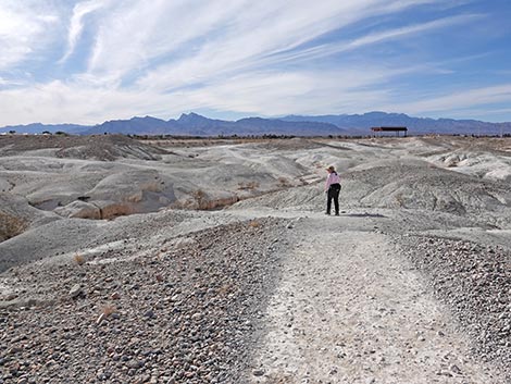
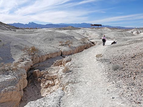
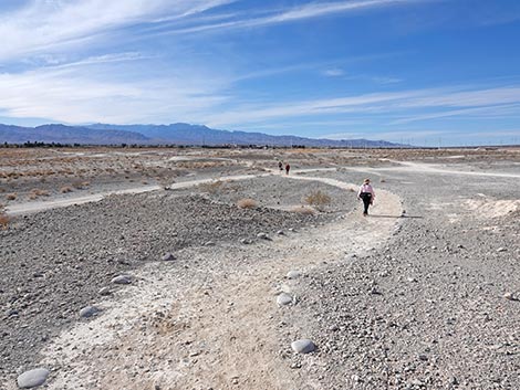
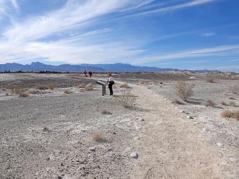
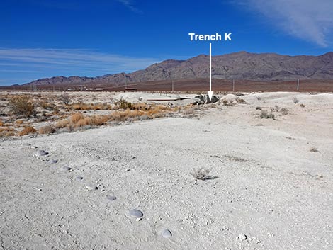
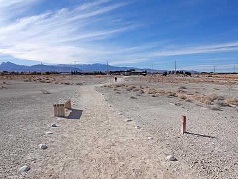
The Big Dig Connector Trail soon passes a nice wooden bench with a grand view to the north for those who choose to sit and relax. Perennial vegetation on these open flats is mostly stunted Creosote Bush and White Bursage, with a few Nevada Ephedra and Spiny Menodora mixed in. The trail continues east over slightly rolling terrain and at about 0.48 miles out, arrives at a T-intersection (Wpt. 05) marked with a trail sign. Here, the official Big Dig Trail turns left to head north towards Trench K. This is the start of a loop, however, so hikers are welcome to walk the loop in either direction. Now heading north, the Big Dig Trail climbs onto a low hilltop with a large information sign. Approaching the sign, hikers will notice a ditch ahead on the right; this is Trench K. Trench K was the longest (about 0.6 miles) and west-most of 10 trenches dug by the Tule Springs Expedition (i.e., The Big Dig) during the winter of 1962-1963. Trench K was the least important trench and was used to keep the earth-moving equipment active when there wasn't anything more useful for them to do, but it still produced fossils. Most of the other trenches were much shorter, although Trench A, the east-most trench, was also quite long at about 1/4 miles. |
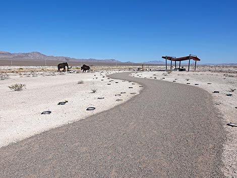 Trail runs towards next shade structure (view E) |
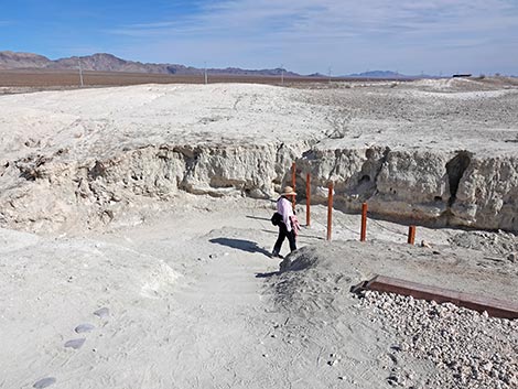
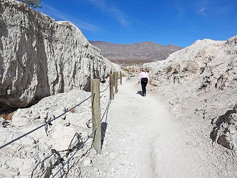
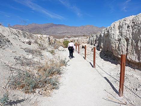
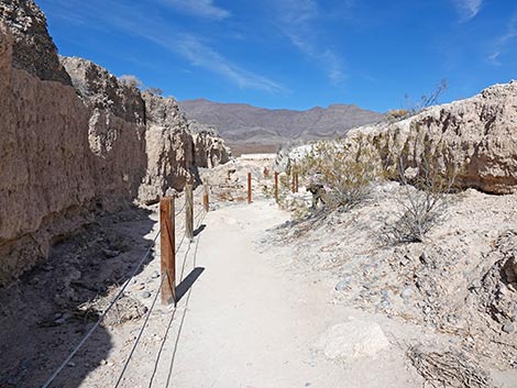
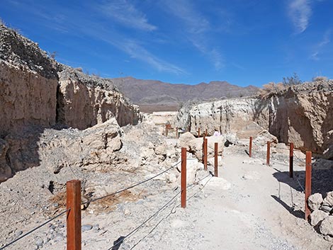
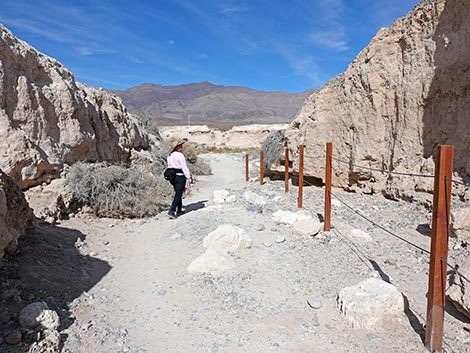
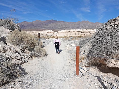
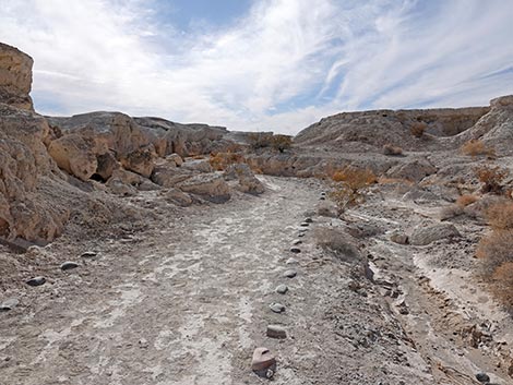
From the sign, the trail turns right and descends stairs into Trench K. For the next 300 yards, the trail runs north up the trench winding around cave-ins and bushes. The walls of the trench show layers of muds and gravels. Most of the way through, an information sign gives a good overview of the layering in the walls of the trench. Watch for fossils; apparently there are still some exposed through here. I saw fossil snail shells, but not mammal fossils. Vegetation in the trenches is more robust than vegetation atop the mud hills because water accumulates here and because wind is muted and there is some shade. Watch for Creosote Bush and Mojave Rabbitbrush, plus there are lots of Desert Princesplume. At about 0.66 miles out, the Big Dig Trail exits Trench K and arrives at a 4-way trail junction on the edge of Las Vegas Wash (Wpt. 06). Here, the Big Dig Loop and the Las Vegas Wash Trail meet. Looking out from the end of Trench K, the Las Vegas Wash Trail continues straight or turns left. Note that the trail direction sign here is somewhat confusing. The Las Vegas Wash Trail is a loop, and both directions lead back to the Visitor Center. As shown on the sign, the Big Dig Trail turns right to head up along the edge of Las Vegas Wash. |
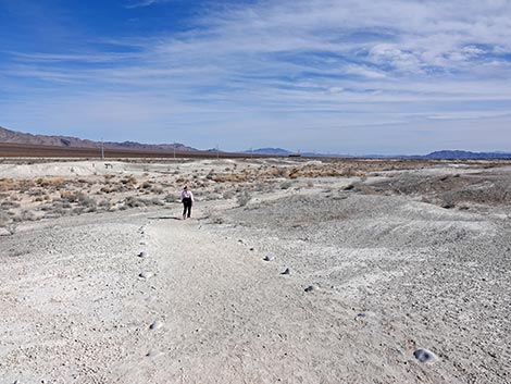
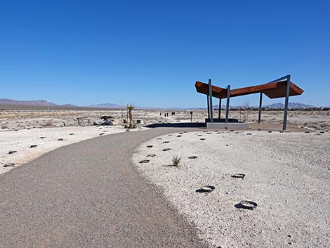 Trail approaching the next shade structure (view E) |
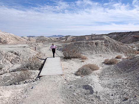
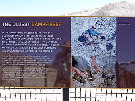
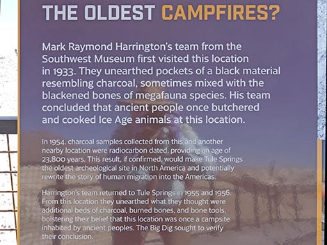
While hiking up the wash, visitors will notice the relatively lush vegetation compared to the mud hills. This is because there is more water in the wash than in the mud hills, and because the soils are better in the wash. Here, Creosote Bush, White Bursage, Mojave Rabbitbrush, and Cattle Saltbush are common. Also watch for Catclaw Acacia, Sweetbush, and Smooth Threadleaf Ragwort. After about 150 yards in Las Vegas Wash, the trail passes a gap in the cliffs on the right. This gap is the north end of Trench J. In another 50 yards in the wash, the trail climbs a few stairs to get back into the mud hills. The trail crosses a wooden bridge, which is Trench I. The trail winds around a bit, and at about 0.86 miles out, arrives at one of the main excavation sites (Wpt. 07) during the Big Dig. The trail becomes concrete, and there are railings on both sides. Just before stepping onto the concrete, hikers are standing in Trench G, one of the shortest trenches. The concrete trail with railings protects an area where researchers found campsite charcoal and stone flakes (debris from making stone tools). They hoped the artifacts would support the idea that humans hunted megafauna here, but alas, they found no evidence to support their hypothesis. |
 Trail arriving the next shade structure (view E) |
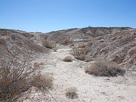
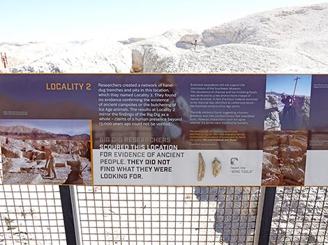
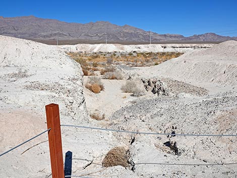
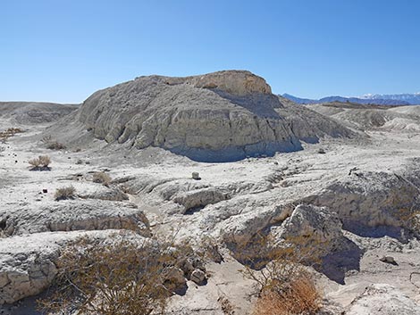
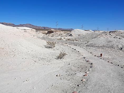
In contrast to the main trenches, the researches dug these trenches by hand, so they are narrower and shallower than the big trenches. Three signs explain what the paleontologists found and didn't find here. Leaving the concrete trail, hikers quickly cross Trench E, and at another low point, cross Trench D. Continuing across the mud hills, the trail passes two more information signs and drops back into Las Vegas Wash. The first sign provides information about finding Dire Wolf bones in a low bluff, and the second provides information about Stone Flakes, leftover materials from making stone tools. This second sign is located in the north end of Trench A. Shortly, a post-and-cable fence stretching across Las Vegas Wash comes into view, which marks the east edge of the State Park. Beyond the fence, the land is protected from development by Tule Springs Fossil Beds National Monument. Just before reaching the boundary fence, the trail turns right and heads up into a large side-wash (Wpt. 08; 1.11 miles out). This is the east-most point on the trail, and it now begins to loop back towards the trailhead. This side-wash looks much like an excavation trench with eroded walls, but this one is natural with nicely sculpted walls and low buttes. |
 Trail junction at the small shade structure (view E) |
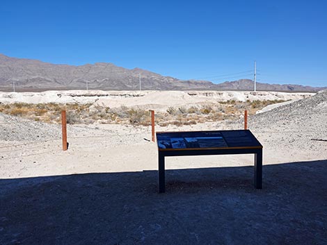
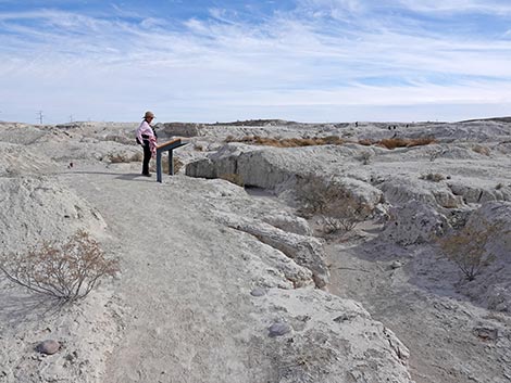
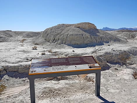
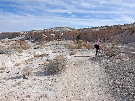
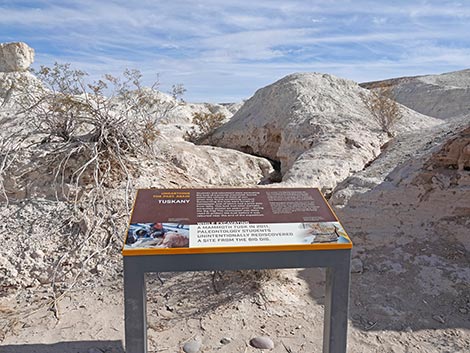
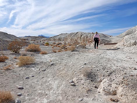
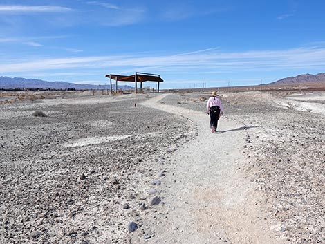
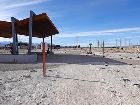
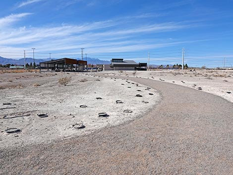
The trail runs up the side-wash to another information sign, this one about finding mastodon tusks in the mud hills. The trail then turns to climb out of the wash with a few stairs. The trail dips into what is left of Trench A, then climbs a few more stairs to regain the higher ground. Traversing rolling terrain, the trail eventually arrives at a second shade structure (Wpt. 09; 1.36 miles out) on a low bluff with views to the south. This spot overlooks the site of the Big Dig campsite, and signs here provide information about the camp and about the changing landscape. Sixty years ago during the Big Dig expedition, the edge of urban Las Vegas was some 10 miles away, but it is now a mere 1/4-mile away. It's good that these historical sites were set aside when they were because otherwise they would be covered with urban sprawl, and we would have lost these historical and recreational opportunities. From the low bluff under the shade, the trail runs down onto open desert flats and crosses a low point with a dirt service road used by park staff. Crossing the dirt road, the trail runs up across low-lying mud hills past the last of the information signs along the Big Dig Trail. |
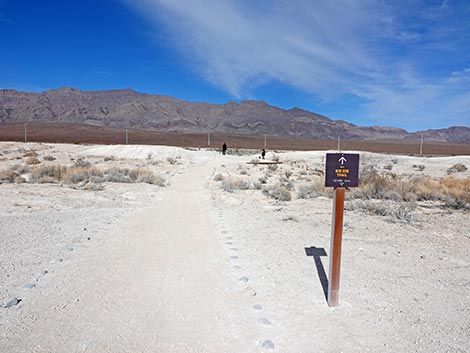
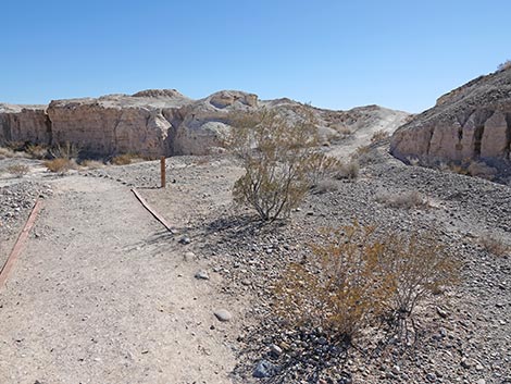
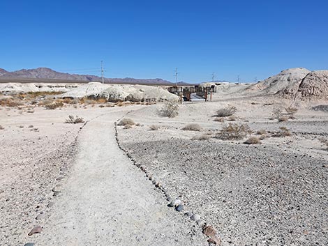
 Official start of the Big Dig Connector Trail (view E) |
From higher points in this low, rolling terrain, the Visitor Center can be seen in the distance. Before long, hikers looking ahead to the right will notice a deep gully. This is the south end of Trench K, and soon hikers return to the Trench K trailhead junction (Wpt. 05), marked with a trail sign. This ends the official Big Dig Loop Trail. Some hikers might want to turn north into Trench K and return to the Visitor Center using either of Las Vegas Wash trail segments (turning left or going straight), but the more direct route back to the visitor center is to continue straight (west) past this trail junction (Wpt. 05). Now on the Big Dig Loop Connector Trail, the trail climbs onto low mud hills to head northeast across gently rolling terrain with the view of the Visitor Center getting closer and closer. The trail bends more due west and continues across fairly flat mud hills terrain. The trail eventually passes the wooden bench and the Trail Rules sign to arrive at the trail junction with the Megafauna Trail (Wpt. 04). After most of a mile, hikers might take advantage of the shade structure here. Heading west on the Megafauna Trail, hikers pass the large picnic area, pass between the restrooms and the Visitor Center, and return to the trailhead (Wpt. 01) at the edge of the parking lot. |
 Trailhead sign for the Big Dig Connector Trail (view E) |
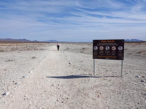 Trail approaching "Trail Rules" sign (view E) |
 Trail Rules (view SE) |
 Wooden bench along the trail (view E) |
 Grand scenery (view NNW from the wooden bench) |
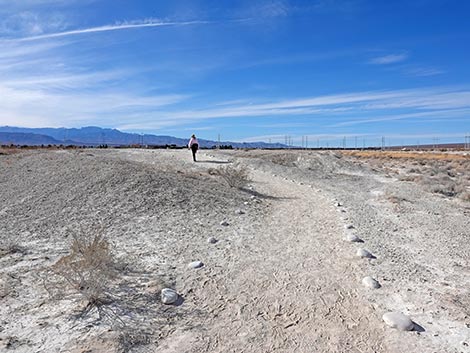
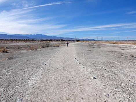
 Big Dig Connector Trail (view E) |
 Big Dig Connector Trail (view E) |
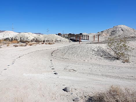
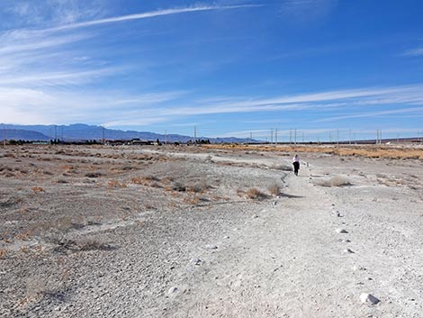
 Approaching a trail junction (view E) |
 Trail junction (view E) |
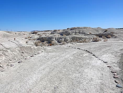
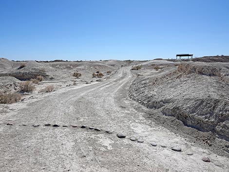
 The Big Dig Trail is a loop: hikers can continue east (view E) |
Big Dig Loop Trail - Trench K
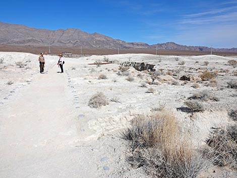
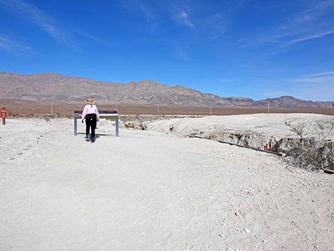
 Trail sign at junction (view N) |
 Trail sign (view N) |
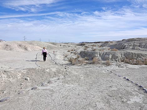
 Start of the Big Dig Loop (view N) Start of the Big Dig Loop (view N) |
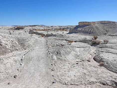
 Approaching an information sign (view N |
 Looking down Trench K (view N) |
 Information sign about Trench K (view NW) |
 Stairs lead down into Trench K (view E) |
 Bottom of Trench K (view N) |
 Bottom of Trench K (view N) |
 Bottom of Trench K (view N) |
 Bottom of Trench K (view N) |
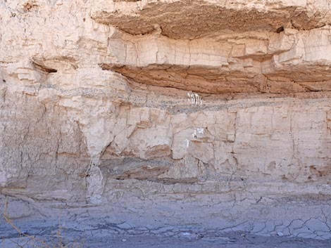
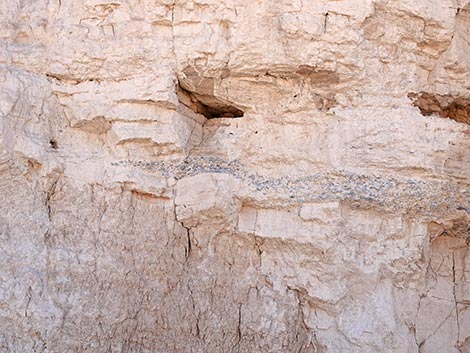
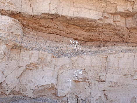
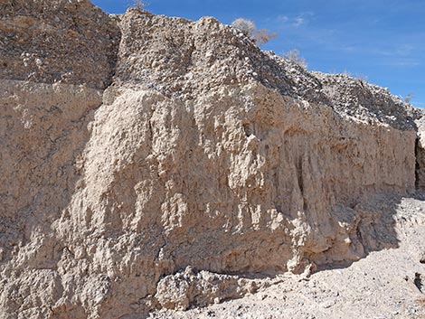 Layers of time in the walls of Trench K (view N) |
 Bottom of Trench K (view N) |
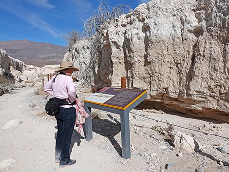 Hiker at information sign in the bottom of Trench K (view N) |
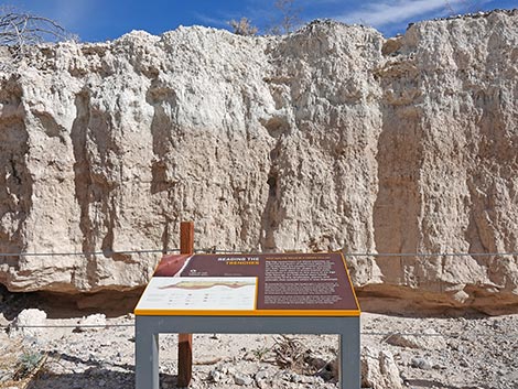 Information sign about layers of time in the wall of Trench K (view N) |
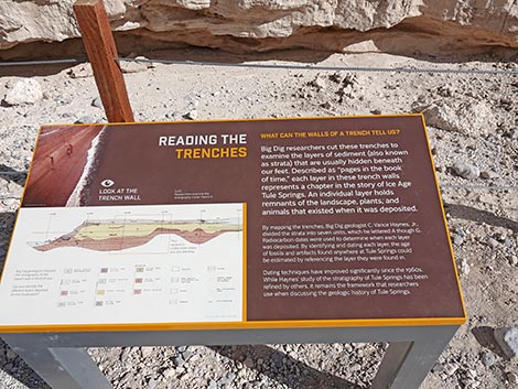 Sign: Reading the Trenches (view E) |
 Hiker continuing through Trench K (view N) |
 Hiker exiting Trench K (view N) |
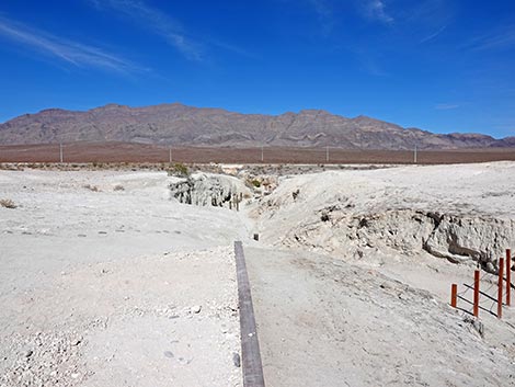
 Hiker at trail junction outside Trench K (view N) |
 Sign at trail junction outside Trench K (view N) |
 Las Vegas Wash Trail continues towards Visitor Center (shorter; view W) |
 Las Vegas Wash Trail continues towards Visitor Center (longer; view N) |
Big Dig Loop Trail -- Continuing past Trench K
 Big Dig Trail departs the trail junction (view E) |
 Big Dig Trail continues east running down Las Vegas Wash (view E) |
 The trail crosses a service road (view SE) |
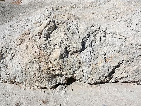
 Behind a fence, eroding, overhanging cliff face with lots of layers (view S) |
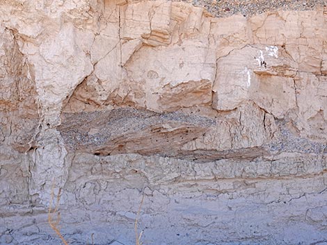 Layers of muds and gravels (view S) |
 Layers of muds and gravels (view S) |
 A bird, perhaps a Say's Phoebe, likes the overhang (view S) |
 Big Dig Trail runs down Las Vegas Wash (view E) |
 Approaching a gap in the cliffs, which is Trench J (view SE) |
 Trench J (view S) |
 Stairs lead out of Las Vegas Wash (view E) |
 Bridge leads over a small wash, which is Trench I (view E) |
 Trench I (view S) |
 The trail is well marked (view NE) |
 Passing another service road, which runs up Trench H (view E) |
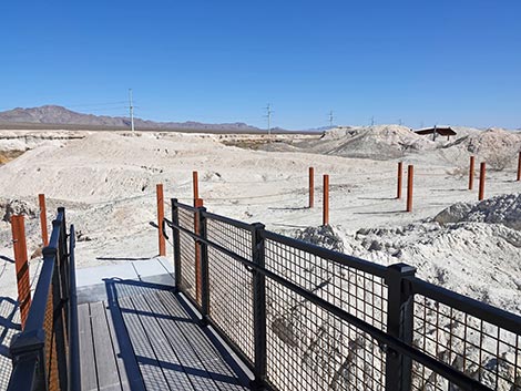
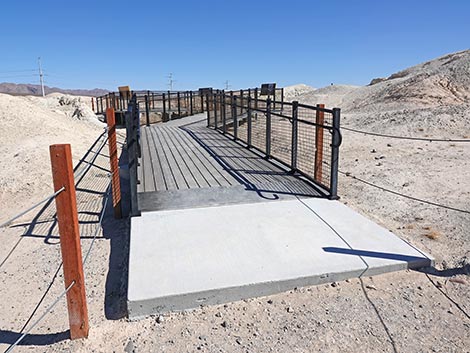 Start of boardwalk to the Big Dig site (view E) |
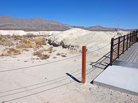 To the side of the boardwalk, Trench G (view NE) |
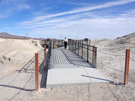 Hiker continuing onto the Big Dig boardwalk (view E) |
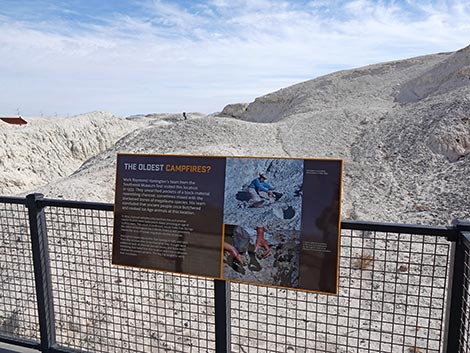 Approaching an information sign (view SE) |
 |
 Looking for signs of humans hunting prehistoric megafauna (view SE) |
 Dig site (view SE) |
 Approaching another information sign (view SE) |
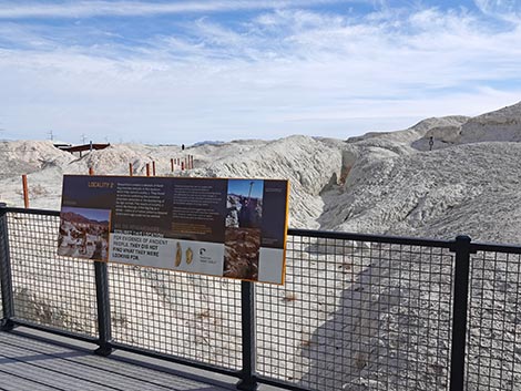
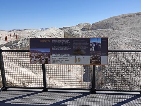 Sign Locality 2 (view SE in front of the trenches) |
 Locality 2 sign (view SE) |
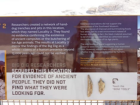 Locality 2 sign (view SE) |
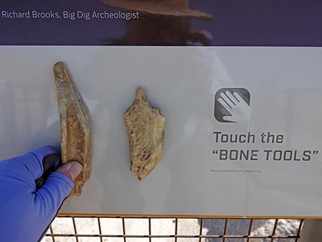 Locality 2: touch the bone tools (view SE) |
 Hand-dug Locality 2 trenches (view SE) |
 Yet another information sign (view W) |
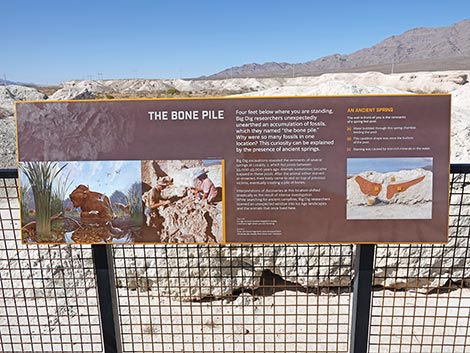 Sign: The Bone Pile (view W) |
 The Bone Pile (view W and down) |
 Approaching the end of the boardwalk (view NE) |
 End of the boardwalk: Trench F (view NE) |
 Trail departing the dig site (view E) |
 Approaching a shade structure - use it to cool off (view E) |
 Shade structure (view NE) |
 Sign in the shade (view NE) |
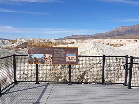
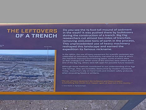 Information sign: The Leftovers of a Trench (view NE) |
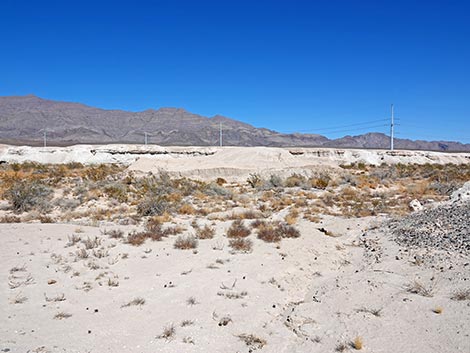 Out in the wash: a mound of Trench Leftovers (view NE) |
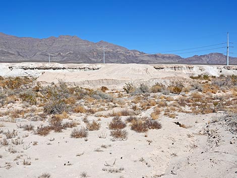 Out in the wash: a mound of Trench Leftovers (zoom; view NE) |
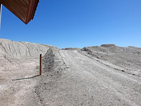 Departing the shade structure on a service road (view SE) |
 Stones guide hikers off the service road (view SE) |
 The service road comes down Trench D (view S) |
 Hiker crossing over Trench D (view E) |
 Trail crosses the south end of Trench C (look left; view SE) |
 Approaching the next information sign (view E) |
 Hiker at information sign (view SE) |
 Sign: Dire Wolf Hill (view E) |
 Dire Wolf Hill (view SW) |
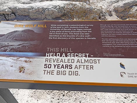 Sign: Dire Wolf Hill (view SW) |
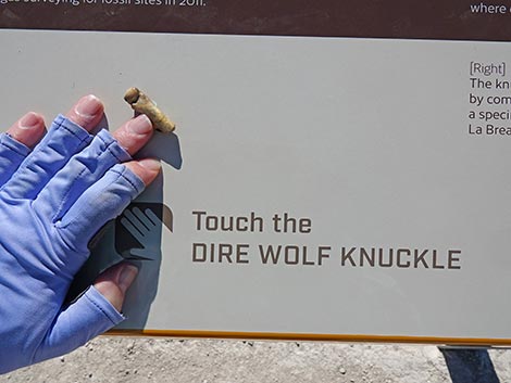
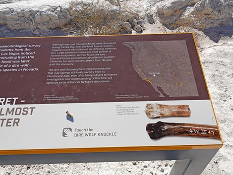 Dire Wolf Hill sign: Touch the Dire Wolf Knuckle (view SW) |
 It's just a model, but this is kind of cool (view SW) |
 Winding through the landscape (view E) |
 The trail always is well marked (view NE) |
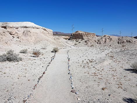
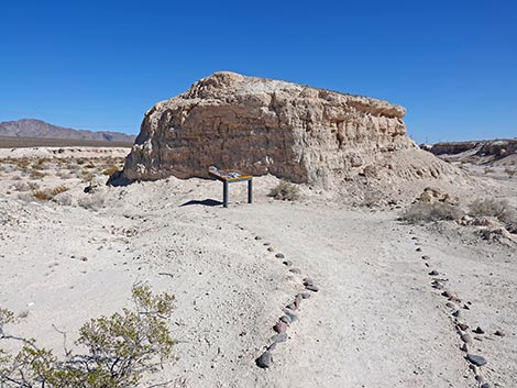 Trail approaching another information sign (view E) |
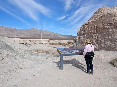 Hiker at information sign set in Trench A (view NE) |
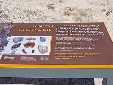 Information sign: Locality 1 (the Flake Site; view NE) |
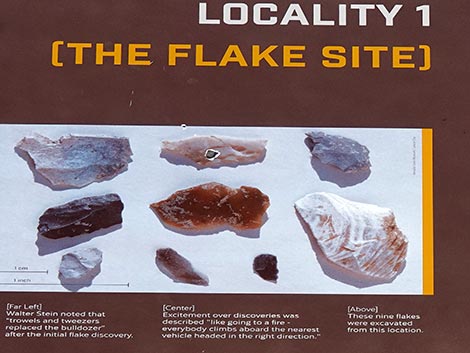 Stone flakes found at this site |
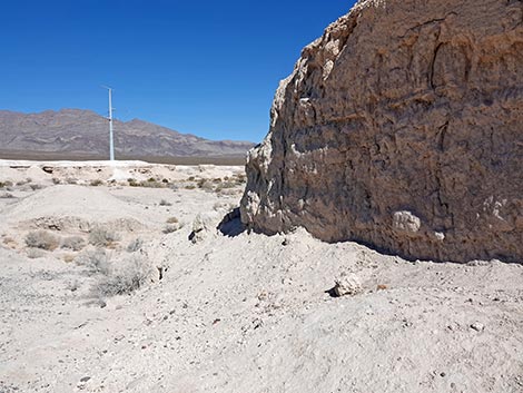 Wall of Trench A (view NE) |
 The trail continues past Locality 1 (view E) |
 Hiker on trail along the edge of Las Vegas Wash (view E) |
 The trail continues along the edge of Las Vegas Wash (view E) |
 At State Park boundary, trail turns right (view E) |
 State Park boundary fence crosses Las Vegas Wash (view E) |
 Trail turns up a wash (view S) |
 Nice erosion features in the gully (view S) |
 Trail continues up the gully (view S) |
 Sign: finding a Mammoth tusk up this little gully (view E) |
 The trail exits the gully with a few stairs (view SW) |
 A few more stairs as the trail re-crosses Trench A (view SW) |
 Big Dig Trail runs over rolling mud hills (view W) |
 Big Dig Trail runs down through rolling mud hills (view W) |
 Approaching another shade structure (view W) |
 Shade structure (view W) |
 Information signs under the shade structure (view S) |
 The trail continues past the shade structure (view NW) |
 Big Dig Trail winds across the landscape (view NW) |
 Hiker reading another information sign (view W) |
 Big Dig Trail winds across the landscape (view SW) |
 Big Dig Trail winds across the landscape (view NW) |
 Big Dig Trail returning towards Trench K (view NW) |
 Hiker returning to the Big Dig Trailhead sign (view NW) |
Return over the Big Dig Connector Trail
 Hiker departing the Big Dig Trailhead sign (view NW) |
 Big Dig Connector Trail winds across open country (view NW) |
 Big Dig Connector Trail winds across open country (view NW) |
 Big Dig Connector Trail returning past the wooden bench (view NW) |
 Big Dig Connector Trail returning past the Rules sign (view NW) |
 Big Dig Connector Trail returning to the Megafauna Trail (view NW) |
 At shade structure, trail turns right towards visitor center (view W) |
 Approaching the shaded picnic tables (view W) |
 Trail passes the shaded picnic tables (view W) |
 Trail returns towards the visitor center (view W) |
 Trail ends at entrance to visitor center at edge of parking lot (view W) |
 Returning to the trailhead parking lot (view W) |
Table 1. Hiking Coordinates and Distances based on GPS Data (NAD27; UTM Zone 11S). Download Hiking GPS Waypoints (gpx) file.
| Wpt. | Location | UTM Easting | UTM Northing | Elevation (ft) | Point-to-Point Distance (mi) | Cumulative Distance (mi) |
|---|---|---|---|---|---|---|
| 01 | Trailhead | 661154 | 4020574 | 2,343 | 0.00 | 0.00 |
| 04 | Trail Junction | 661332 | 4020575 | 2,339 | 0.11 | 0.11 |
| 05 | Big Dig Official Trailhead | 661892 | 4020470 | 2,323 | 0.37 | 0.48 |
| 06 | Trail Junction | 661965 | 4020724 | 2,315 | 0.17 | 0.66 |
| 07 | Big Dig Sites | 662259 | 4020638 | 2,303 | 0.20 | 0.86 |
| 08 | Trail Turns Up Gully | 662603 | 4020548 | 2,300 | 0.25 | 1.11 |
| 09 | Shade Structure | 662272 | 4020464 | 2,310 | 0.25 | 1.36 |
| 05 | Big Dig Official Trailhead | 661892 | 4020470 | 2,323 | 0.25 | 1.61 |
| 04 | Trail Junction | 661332 | 4020575 | 2,339 | 0.37 | 1.98 |
| 01 | Trailhead | 661154 | 4020574 | 2,343 | 0.11 | 2.09 |
Happy hiking! All distances, elevations, and other facts are approximate.
![]() ; Last updated 250307
; Last updated 250307
| Hiking Tule Springs | Hiking Ice Age Fossils | Hiking Around Las Vegas | Glossary | Copyright, Conditions, Disclaimer | Home |