
Hiking Around Las Vegas, Arrow Canyon Range, Arrow Canyon Wilderness Area

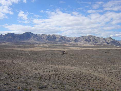
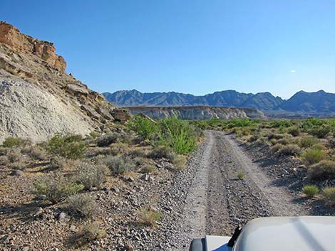 Deadman Road (view from near Hwy 168) |
Overview In the Arrow Canyon Wilderness Area, the Upper Pahranagat Wash refers to Pahranagat Wash above the dam and narrows of Arrow Canyon. The area harbors grand scenery, unusual rock art, an old dam, and an overlook that surveys the entire area, including the narrows. The far end of the access road gets muddy and washed out in Pahranagat Wash, so the "trailhead" is as far down the canyon as you can safely drive, staying on designated roads, of course. The hike to the dam involves bushwhacking down the wash, and the route to the overlook follows an old road and off-trail hiking. Link to map. |
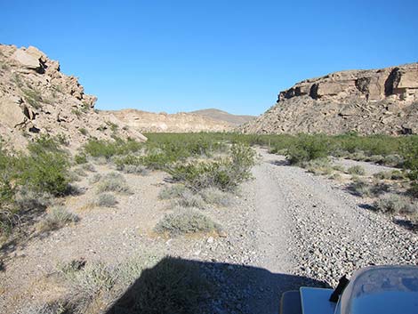 Deadman Road entering Pahranagat Wash (view SE) |
Watch Out Other than the standard warnings about hiking in the desert, ...stay out of the canyon if it looks like flash floods might be possible. This would be indicated by thunderstorms in the Arrow Canyon Range or in other mountains to the north. Otherwise, this is a pretty safe hike if you stay in the bottom of the canyon. There is a 3rd or 4th class route into the canyon below the dam, so if you try the route, be extra careful because a rescue from the canyon could be a real pain. This is a wilderness area, so while hiking, please respect the land and the other people out there, and try to Leave No Trace of your passage. There are no cairns on this route; please don't leave any new ones. Also, even though this hike is fairly short, it is remote, so be sure to bring the 10 Essentials. |
 |
Getting to the Trailhead This hike is located on the north side of the Arrow Canyon Wilderness Area, about 1 hour northeast of Las Vegas. From Las Vegas, drive out to the Arrow Range area. From the intersection of Highway 93 and Highway 168 (Coyote Springs), turn right and drive east for about 8.0 miles to an unmarked dirt road to the right (Table 1, Site 1025), which is Deadman Road and runs down Dead Man Wash. |
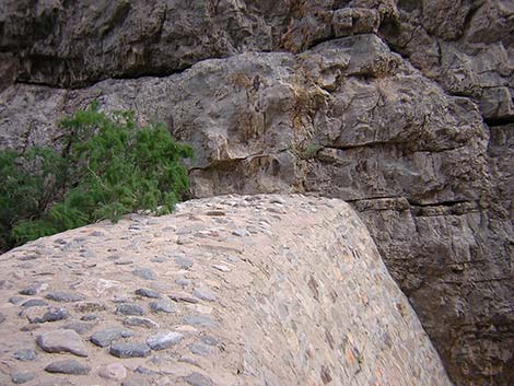 Top of the old dam |
Turn right and drive south (downhill) on Deadman Road. The road should be fairly good all the way to Pahranagat Wash. Driving down the wash, the mesa to the west of the road is Table Mountain, which is part of the Arrow Canyon Wilderness Area, although it is separated from the main part of the wilderness area by a dirt road corridor. At Pahranagat Wash, Deadman Road bends to the left and starts down the wash. While driving, the goal would be to get as close to the narrows as possible (staying on designated roads), but the road is unpredictable, so just park where it seems reasonable (e.g., Site 01). The distances here are short, so walking a little farther doesn't matter too much, so just park here; this is the trailhead. |
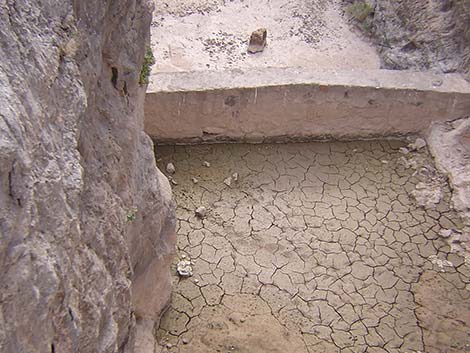 Mud and small check dam below the old dam |
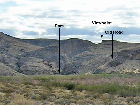
The Hike From the trailhead area (Table 2, Waypoint 01), wander along old roads, down the wash bottom, or just bust through the saltcedar thickets heading downstream. Along the way, notice the old road that cuts up the sandy hillside on the south side of the wash (see photo); this is the start of the route to the viewpoint. Continuing down the wash, the canyon narrows abruptly, and then shortly the old dam (Wpt. 02) appears. The face of the dam is quite steep, and there is no easy way to climb down the dam or to climb around it. Hikers who want to bypass the dam should try scrambling along ledges high above the dam on the northeast (left facing downstream) side. Backtrack up the canyon, then pick a safe place to scramble up onto the ledges. Expect at least 3rd-class scrambling. |
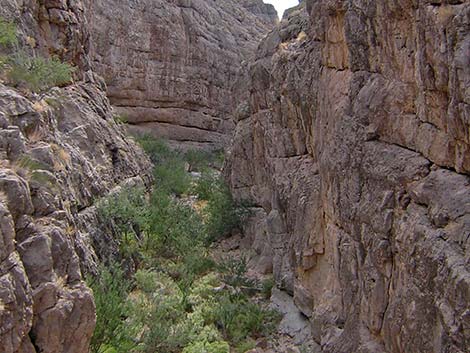 Arrow Canyon beyond the dam |
After visiting the dam, consider hiking up to the viewpoint. Heading back up the wash, look for the old road that cuts steeply up the cliffs on the side of the wash. The start of the old road catches blow sand from the wash, so it could be completely covered with sand. With a visible road or not, hike up the sandy hillside to the old road and the flats above. Atop the cliffs, continue east and south to the ridgeline overlooking the canyon. Hiking off-trail, follow limestone ledges and the ridgeline to the top of the hill (Wpt. 03); this is the viewpoint. |
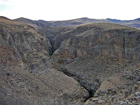 Arrow Canyon narrows from Viewpoint |
Views from the viewpoint are grand. The narrows of Arrow Canyon stretch out downstream (southeast), and the broad flats of Pahranagat Wash stretch out in the other direction with the north end of the Sheep Range in the background. To the southwest lies the Arrow Canyon Range. From this side, it looks like any other limestone ridge, but from the other side, it is one of the most beautiful mountain ranges in Nevada. Relax and enjoy the view and solitude. When ready to leave, wander back down the ridge and old road following your footprints in the dust. |
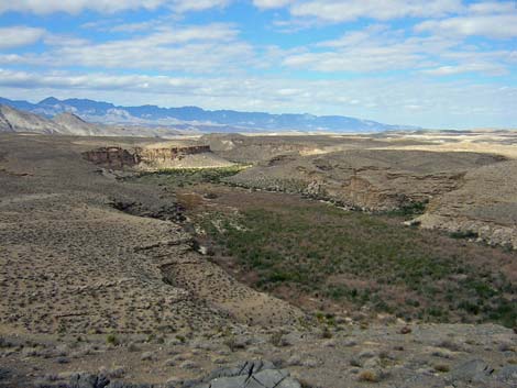 Pahranagat Wash and Sheep Range (view NW from viewpoint) |
 Arrow Canyon Range (view W from viewpoint) |
Table 1. Highway Coordinates (NAD27; UTM Zone 11S).
| Site # | Location | Latitude (N) | Longitude (W) | UTM Easting | UTM Northing | Elevation (feet) | Verified |
|---|---|---|---|---|---|---|---|
| 01 | End of Road (depends on conditions) | 36.74885 | 114.80795 | 695698 | 4069050 | 2,024 | GPS |
| 1025 | Hwy 168 at Access Road | 36.77838 | 114.81021 | 695421 | 4072322 | 2,315 | GPS |
Table 2. Hiking Waypoints Based on GPS Data (NAD27, UTM Zone 11S). Download GPS Waypoints (*.gpx) file.
| Wpt. | Location | Easting | Northing | Elevation (ft) | Verified |
|---|---|---|---|---|---|
| 01 | End of Road (depends on conditions) | 695698 | 4069050 | 2,024 | GPS |
| 02 | Dam | 696353 | 4068693 | 2,040 | GPS |
| 03 | Viewpoint | 696366 | 4068567 | 2,242 | GPS |
Happy Hiking! All distances, elevations, and other facts are approximate.
![]() ; Last updated 240330
; Last updated 240330
| Arrow Canyon Range | Hiking Around Las Vegas | Glossary | Copyright, Conditions, Disclaimer | Home |