
McCullough Mountain, Ridges Route
Hiking Around Las Vegas, Southern Nevada Wilderness Areas, Hiking the Wilderness Areas

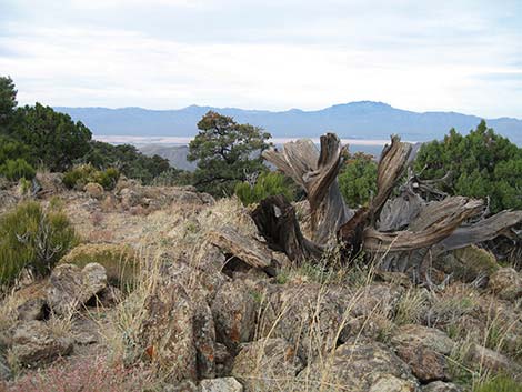 Cloudy morning on the summit (view NE) |
Overview This route is an alternative to the regular route for climbing McCullough Mountain in the South McCullough Wilderness Area. This is not a particularly good route to the summit, but if used for the descent, it makes the route into a big figure-8-loop with only a few minutes of backtracking. From the summit, this route runs east on the summit ridge to the crest of the range, then turns south along the crest, crosses the McCullough Mountain Washes Route, and continues south along the crest. Ridges to the east lead to washes, and a bit of ridge hopping ends at Pine Spring and the end of the dirt road. This route is less efficient than the regular route and adds about 1 mile to the hike, but it follows ridges with spectacular views rather than closed-in washes. As with the McCullough Mountain Washes Route, the complex topography of these mountains requires a bit of orienteering skills. |
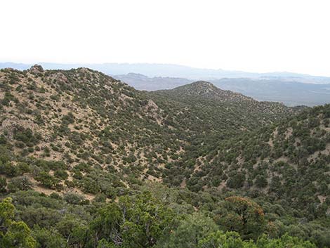 Ridge and Wash routes (view E from near summit) |
Because this is not a good route to climb the mountain, I have described it from top to bottom as a descent route. Therefore, the route starts in Pinyon-Juniper Woodlands (Upper Sonoran Life Zone) and descends into Mojave Desert Scrub (Upper Sonoran Life Zone). On the ridges, the trees, mats of Pricklypear Cactus, and Banana Yucca make for considerable winding around and slow, careful going. Link to roads map, hiking map, or elevation profile. |
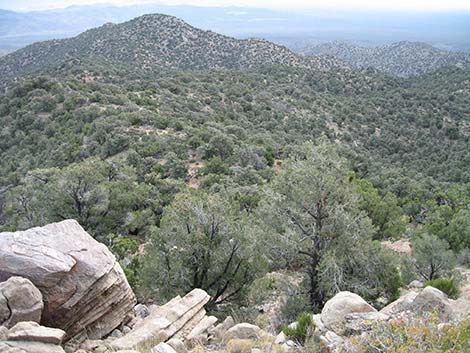 Route along the ridge (view E) |
Watch Out Other than the standard warnings about hiking in the desert, ... this is a fairly safe hike. The ridges and sidehills are steep with loose rocks, but there are no cliffs or other unusual obstacles. The rocky outcrops look like good rattlesnake country. The major concern on this hike is the loose footing among dense Banana Yucca and pricklypear cactus. While hiking, please respect the land and the other people out there, and try to Leave No Trace of your passage. This hike goes into the South McCullough Wilderness Area, so pay particular attention to respecting the land. This hike runs off-trail where nobody will find you, so be sure to bring the 10 Essentials. Cell phones work from ridges high on the east side of the crest, but I could not call out from the summit or ridges where I could see down the west side of the mountains to civilization. |
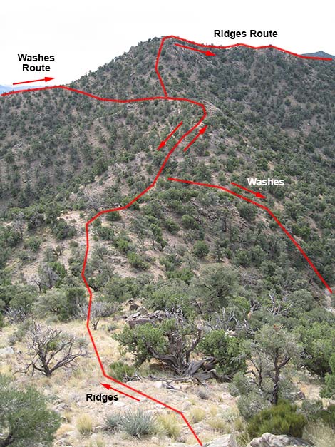 The routes share a short piece of ridge (view S) |
Getting to the Trailhead This hike is located in the McCullough Range, about 1.5 hours southeast of Las Vegas between Searchlight and Primm. Under the best of conditions, the access road does not require 4WD, but there is a steep hillside and two long, sandy washes. I drove the road in 2WD, but with the comfort of knowing that I could shift into 4WD at any time. For directions, see the McCullough Mountain Washes Route. The Hike From the summit (Table 1, Waypoint 15), the route runs east along the east summit ridge to a saddle (Wpt. 16). If descending via the McCullough Mountain Washes Route, this is a place to cut down to the wash below to the south. From the saddle (Wpt. 16), the ridges route continues east along the ridge, skirting one side or the other of several rocky knobs. Although it doesn't look like it on the ground, about 0.6 miles from the summit (Wpt. 17), the east summit ridge ends where it connects with the crest of the range. From that point, the route continues eastward along the crest for to another rocky knob (Wpt. 19) where (although it doesn't look like it on the ground) the crest turns south. |
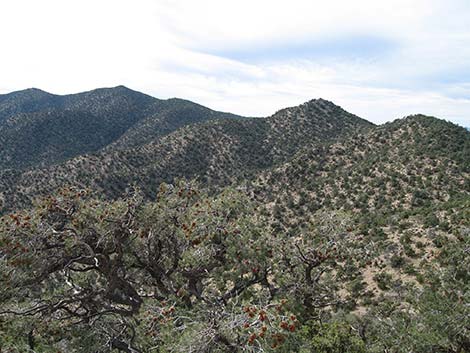 |
From the rocky knob (Wpt. 19), the route turns almost due south along the crest on a broad, gently sloping ridgetop with lots of trees, yucca, and pricklypear. The lay of the land looks like you should head southeast, but stay on the ridge (Wpt. 20) to the south. The route continues south staying on the ridgeline. At about 2 miles out, the route crosses the saddle (Wpt. 21) where the McCullough Mountain Washes Route drops into the wash to the west. From the saddle (Wpt. 21), the Ridges Route continues south along the crest, climbing steeply along the ridge and passing along the east edge of a rocky outcrop to gain the top of a high knob (Wpt. 22). |
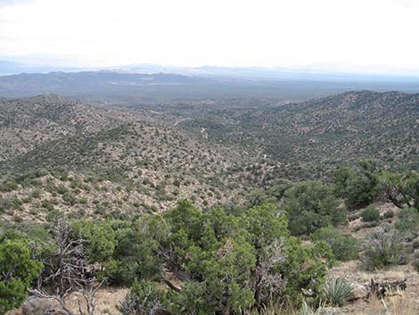 Ridges route descends ridges, drops into wash, runs up over ridges to Pine Spring (view SE) |
From that highpoint (Wpt. 22), the route runs southwest along the crest, passing two highpoints. As the route approaches a third highpoint, a major side ridge runs to the east. When the ridgeline below the third highpoint steepens (Wpt. 23), the route leaves the crest, turns southeast to traverses the northeast side of the highpoint, and emerges onto the ridge to the east (Wpt. 24) near a rocky outcrop. |
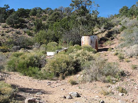 Pine Spring and the end of the road (view NW) |
The route now descends the ridge to the east, passing rocky knobs (Wpt. 25, Wpt. 26) to a saddle (Wpt. 27) where the wash to the south is not far below. The route drops steeply off the hillside into the wash (Wpt. 28), and then follows the wash southeast for about 1/2 miles, passing an unusual cabin structure (Wpt. 29) in the wash along the way. When the wash curves to the east (Wpt. 30), cow trails can be followed over the low ridge to the south and down into the next wash (Wpt. 31). This wash is followed for short distance to a large, round water trough (Wpt. 32) on the edge of the wash. The route climbs the hillside behind the trough to a ridge (Wpt. 33), and then it drops into the wash on the other side, which if all went well, is Pine Spring (Wpt. 34) and the end of the dirt road (Wpt. 35). The road is followed back to the trailhead (Wpt. 01). |
Table 1. Hiking Coordinates Based on GPS Data (NAD27; UTM Zone 11S). Download Hiking GPS Waypoints (*.gpx) file.
| Wpt. | Location | UTM Easting | UTM Northing | Elevation (ft) | Point-to-Point Distance (mi) | Cumulative Distance (mi) | Verified |
|---|---|---|---|---|---|---|---|
| 15 | Summit | 664939 | 3941228 | 6949 | 0.00 | 0.00 | GPS |
| 16 | Saddle | 665194 | 3941387 | 6832 | 0.20 | 0.20 | GPS |
| 17 | Knob on Ridge | 665763 | 3941433 | 6897 | 0.40 | 0.60 | GPS |
| 18 | Rocky Knob | 665960 | 3941510 | 6834 | 0.16 | 0.76 | GPS |
| 19 | Rocky Knob, turn south | 666242 | 3941473 | 6685 | 0.19 | 0.95 | GPS |
| 20 | Small Outcrop on Ridge | 666282 | 3941324 | 6587 | 0.09 | 1.04 | GPS |
| 21 | Saddle | 666264 | 3940180 | 6183 | 0.83 | 1.87 | GPS |
| 22 | Top of Knob | 666271 | 3939841 | 6434 | 0.25 | 2.12 | GPS |
| 23 | Start Across Sidehill | 665469 | 3939191 | 6419 | 0.75 | 2.87 | GPS |
| 24 | Ridge East | 665549 | 3939023 | 6435 | 0.12 | 2.99 | GPS |
| 25 | Rocky Overlook | 665656 | 3938978 | 6415 | 0.08 | 3.07 | GPS |
| 26 | Rocky Knob on Ridge | 666071 | 3938868 | 6071 | 0.32 | 3.39 | GPS |
| 27 | Saddle | 666382 | 3938873 | 5826 | 0.22 | 3.61 | GPS |
| 28 | Wash | 666357 | 3938727 | 5665 | 0.11 | 3.72 | GPS |
| 29 | Old Cabin | 666547 | 3938526 | 5618 | 0.20 | 3.92 | GPS |
| 30 | Leave Wash | 666854 | 3938307 | 5499 | 0.26 | 4.18 | GPS |
| 31 | Next Wash | 666918 | 3938249 | 5506 | 0.06 | 4.24 | GPS |
| 32 | Metal water tank | 667052 | 3938179 | 5442 | 0.12 | 4.36 | GPS |
| 33 | Ridge Above Water Tank | 667084 | 3938072 | 5514 | 0.07 | 4.43 | GPS |
| 34 | Pine Spring | 667155 | 3937999 | 5482 | 0.08 | 4.51 | GPS |
| 35 | End of Road | 667193 | 3937991 | 5442 | 0.03 | 4.54 | GPS |
| 01 | Trailhead | 667728 | 3937955 | 5294 | 0.39 | 4.93 | GPS |
Happy Hiking! All distances, elevations, and other facts are approximate.
![]() ; Last updated 240330
; Last updated 240330
| Hiking Around Wilderness Areas | Hiking Around Las Vegas | Glossary | Copyright, Conditions, Disclaimer | Home |