Birding Around Las Vegas, Desert National Wildlife Range
Area Map | Site Map
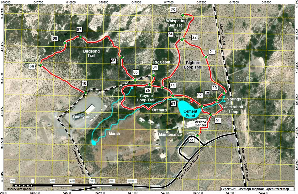
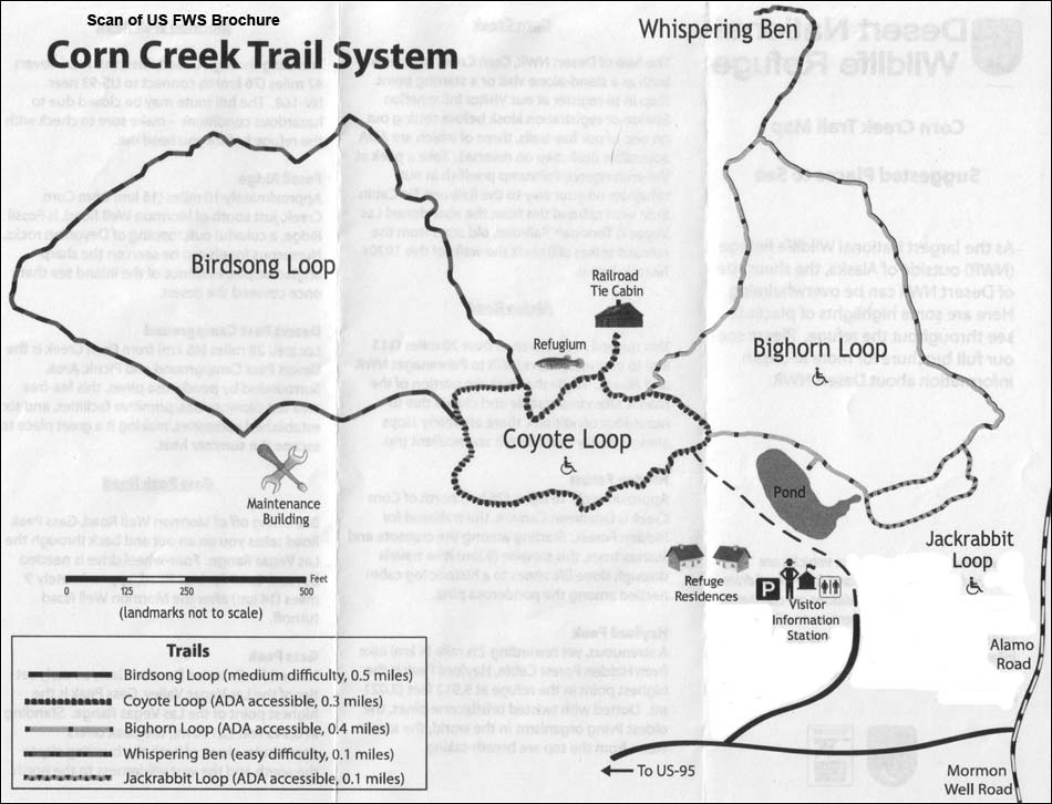
US FWS Brochure Map
Note: All distances, elevations, and other facts are approximate.
Happy birding!
| Corn Creek | Desert National Wildlife Range | Birding Around Las Vegas | Copyright, Conditions, Disclaimer | Home |