Birding Around Las Vegas, Desert National Wildlife Range
Area Map | Site Map
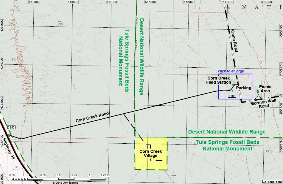
Note: Roads are black (solid = paved; dashed = unpaved). Trails and routes are red (solid = main; dashed = adjacent or alternate). Map based on USGS 7.5 minute topo map. North is at the top. UTM Grid is NAD27 CONUS.
Happy birding! All distances, elevations, and other facts are approximate.
![]() ; Last updated 160410
; Last updated 160410
| Corn Creek | Desert National Wildlife Range | Birding Around Las Vegas | Copyright, Conditions, Disclaimer | Home |