birdandhike.com logo
Home | Birds | Birding | Outside the Las Vegas Valley | Shoshone | Overview Map
Shoshone Area Birding Map - North
Birding Around Las Vegas, Outside the Las Vegas Valley
Overview | North | South
Torrance Ranch
Note: Roads are black (solid = paved; dashed = unpaved). Trails and routes are red (solid = main; dashed = adjacent or alternate). Map based on USGS 7.5 minute topo map, which may have red grid lines and various numbers. North is at the top. Grid is UTM NAD27 CONUS. Urban areas (yellow) based on Google Earth (2/2014) image. BLM areas (white) based on BLM data. Download waypoint coordinates from route description page.

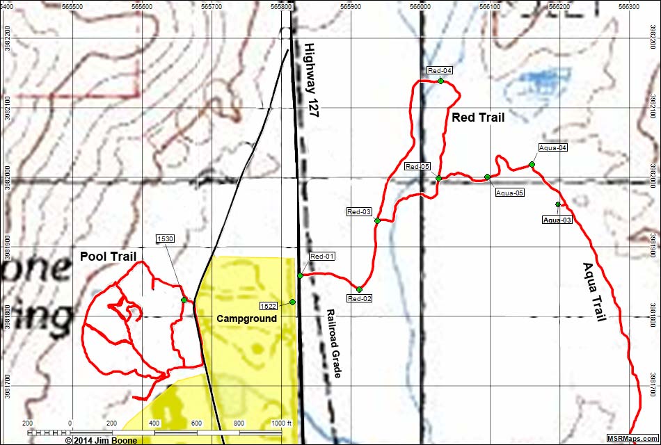
Happy birding! All distances, elevations, and other facts are approximate.
copyright; Last updated 140303

Overview Map Shoshone Birding Around Las Vegas Copyright, Conditions, Disclaimer Home
Google Ads