Birding Around Las Vegas, Outside the Las Vegas Valley
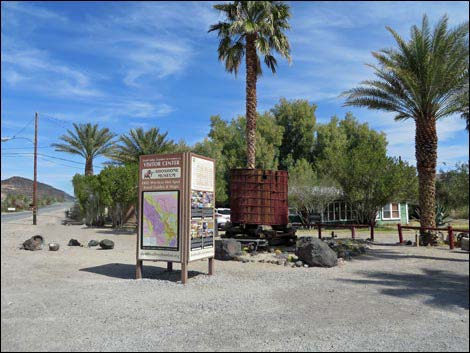
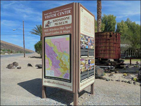
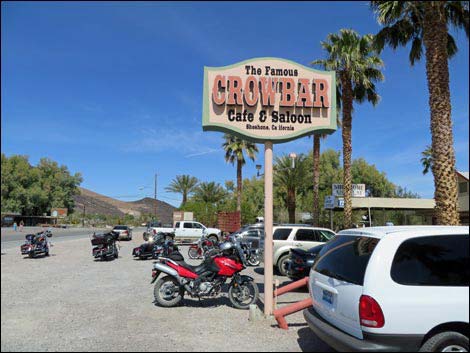
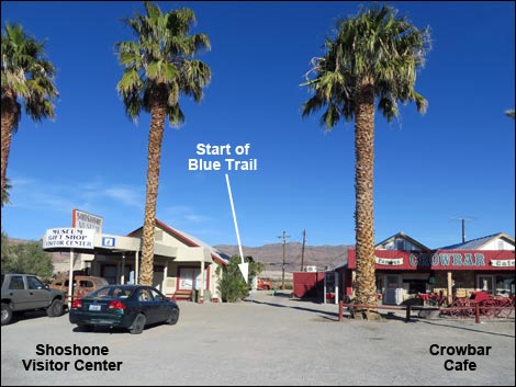 Visitor Center and Crowbar Cafe at start of Blue Trail |
Description Shoshone is a small town with a bit of water and green amid a very arid piece of desert. This isn't a birding destination, but it is a nice place for traveling birders to stop for the night and do some evening and morning birding. Shoshone sits on the edge of the Amargosa River (note, this a desert river - don't expect to go swimming) in an area with several springs. Five trails provide birders the opportunity to explore the area. The main trails are the Red Trail and the Blue Trail, both of which are loop on the east side of town that wander down along the Amargosa River. The Aqua Trail runs on the far side of the river connecting the two loops. The short Swimming Pool Trail provides access to a wet marsh behind the town swimming pool, and the White Trail runs west from town into the open desert, looping back in about 3 miles following the high school running trail. When birding in this area, be sure to bird Tecopa Marsh and China Ranch Date Farm. Link to map. |
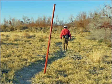
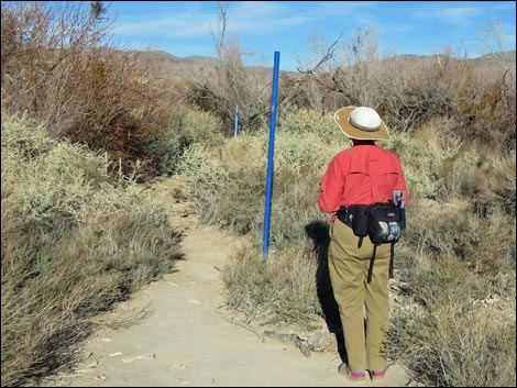 Birder on the Blue Trail (note blue trail marker) |
Location Shoshone is located about 2.5 hours west of Las Vegas. The easiest way to get there from Las Vegas is to drive north on Highway 95 for about 90 miles to Highway 373 at Amargosa Valley (Table 1, Site 0689). Turn left onto Highway 373 and drive south. At the California-Nevada state line, the road changes to Highway 127. Continue south on Highway 127 past the town of Death Valley Junction to Shoshone (Site 1521). An alternate route is to drive out of the Las Vegas valley on Highway 160 towards Pahrump. Before getting to Pahrump, turn left onto the Old Spanish Trail Highway (Site 0708). Drive southwest, across the desert, over the mountains, and down into Tecopa. In "downtown" Tecopa (Site 0709), turn right at the triangle-intersection and drive north on the paved road to Highway 127 (Site 0704). Turn right and drive north to Shoshone (Site 1521). If taking this route, be sure to bird the Tecopa Marsh. |
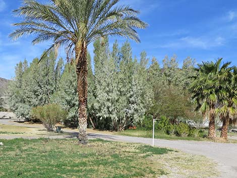 White Trail (not white trail marker) |
Hours Always open, but the area should be considered Day-Use only with a bit of dusk and dawn to listen for birds of the night. Fees None, but consider visiting the local businesses and thanking them for sharing their town with birders. For More Information The town of Shoshone maintains these trails. Visit the Amargosa Conservancy or the Shoshone Village websites. |
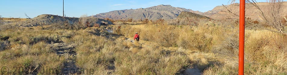
 Birder on the Red Trail (note red trail marker) |
The Birding Trails Red Trail. At the north end of town, the Red Trail makes a loop (0.65 miles) out around the head of a spring. If the water is up, shoes might get wet when crossing the creek. Blue Trail. From downtown, this trail makes a modified figure-8 loop (0.94 miles) out into the saltbrush and mesquite to the edge of the Amargosa River. Aqua Trail. Running along the east side of the Amargosa River, this trail (about 1/2 miles) connects the Red Trail and the Blue Trail. White Trail. This trail uses the High School Track Team's 3-mile loop to head west into the desert, passing historic sites and providing access to hard-core desert birds and grand views. Swimming Pool Trail. This short trail runs behind the swimming pool to a marshy area with mesquite trees, willows, and a small stream with pools that makes for a nice place to relax, listen to songbirds, and spot a few speckled dace. |
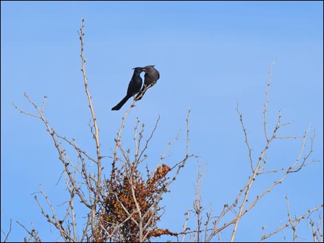 Phainopeplas courting (male feeding female) during late-February |
Specialties This is an area to look for resident desert birds and migrants. Resident birds include Phainopepla, Anna's Hummingbird, Crissal Thrasher, Black-tailed Gnatcatcher, Verdin, Bewick's Wren, Greater Roadrunner, Say's Phoebe, Eurasian Collared Dove, Common Raven, House Finch, House Sparrow, and Loggerhead Shrike. Breeding birds include Bell's Vireo, Ash-throated Flycatcher, Lucy's Warbler, Yellow-breasted Chat, Hooded Oriole, Western Kingbird, Blue Grosbeak, and Indigo Bunting. During spring and fall migration, keep an eye out for odd-balls, as this area is a migrant trap where everything shows up once in a while, including Rose-breasted Grosbeak, Swamp Sparrow, Townsend's Warbler, Magnolia Warbler, Wood Thrush, and Brown Creeper. Wintering birds include Northern Mockingbird, Western Bluebird, American Robin, Cedar Waxwing, Cooper's Hawk, White-crowned Sparrow, and Northern Flicker. |
 |
 |
 |
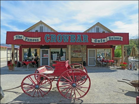 |
Table 1. Highway Coordinates based on GPS data (NAD27; UTM Zone 11S). Download Highway GPS Waypoints (*.gpx) file.
| Site | Location | UTM Easting | UTM Northing | Latitude (N) | Longitude (W) | Elevation (ft) | Verified |
|---|---|---|---|---|---|---|---|
| 0174 | Hwy 127 at Hwy 178 (Shoshone) | 565854 | 3980972 | 35.97275 | 116.26960 | 1,573 | Yes |
| 0689 | Hwy 95 at Hwy 373 | 553687 | 4055319 | 36.64375 | 116.39942 | 2,660 | Yes |
| 0704 | Hwy 127 at Tecopa Rd N | 566982 | 3972860 | 35.89954 | 116.25777 | 1,362 | Yes |
| 0708 | Hwy 160 at Old Spanish Trail Hwy | 610996 | 3992528 | 36.07282 | 115.76738 | 1,025 | Yes |
| 0709 | Old Spanish Tr at Tecopa Hot Springs Rd | 569944 | 3967216 | 35.84845 | 116.22545 | 1,329 | Yes |
| 1521 | Shoshone Town | 565879 | 3981209 | 35.97488 | 116.26930 | 1,684 | Yes |
| 1522 | Red Trail Parking | 565816 | 3981821 | 35.98040 | 116.26995 | 1,609 | Yes |
| 1530 | Pool Trail Trailhead | 565660 | 3981824 | 35.98044 | 116.27168 | 1,585 | Yes |
| 1531 | White Trail Trailhead | 565660 | 3981508 | 35.97759 | 116.27171 | 1,591 | Yes |
Happy birding! All distances, elevations, and other facts are approximate.
![]() ; Last updated 240323
; Last updated 240323
| Birding Around Las Vegas | Southern Nevada Birds | Guide Service | Copyright, Conditions, Disclaimer | Home |