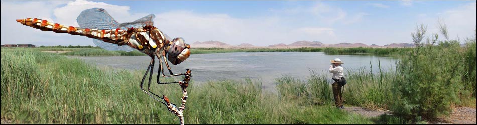
| Dragonflies Around Las Vegas... who would have thought? | What's New? | Support this website! |
Despite the image of a dry, barren landscape, the desert around Las Vegas is a vibrant land full of life. Many species of resident and migrant Odonates occur in the desert, and their numbers can be quite high. The few marshy and riparian areas tend to attract and concentrate Odonates, and therefore the better watching is associated with wetlands. Different species occur in different habitats, so visit the desert, riparian corridors, lakes, and mountains to experience the diversity of Odonates around Las Vegas. This guide provides information on the best places to watch dragonflies around Urban Las Vegas. Beyond urban Las Vegas, good nearby sites include Corn Creek on the Desert National Wildlife Range, the marsh fringe of lakes on the Pahranagat National Wildlife Refuge, and the springs and water impoundments at Ash Meadows National Wildlife Refuge, the Overton Wildlife Management Area, and marshy areas on the shores of Lake Mead National Recreation Area.
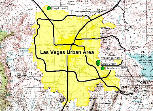 |
Wetlands Park Nature Preserve. Wetlands along Las Vegas Wash. Trails wind through the area and provide access to marsh vegetation, stream channels, and open ponds. Duck Creek. Wetland ponds with good marshy fringe provide habitat for Odes. Behind the wetland ponds, Las Vegas Wash provides flowing water habitat. Floyd Lamb Park at Tule Springs. Trees, lakes, desert, and the typical grassy urban-park areas. This place can be full of fishermen, but the dragonflies don't seem to mind. Henderson Bird Viewing Preserve. Trails run among shrub-lined ponds and marshes that are designed to provides bird watchers with a superb experience; fortunately the Odes like the area too. |
General Notes
Directions
Directions to the sites give distances "from Las Vegas" or "from downtown." These distances are measured from the Spaghetti Bowl (the intersection of Interstate-15 and U.S. Highway 93/95). These distances are about the same as distances from the Downtown and Strip casinos. All of the distances are approximate; if something seems wrong, assume it is and send me a note.
GPS Coordinates
To help people using global positioning (GPS) devices, I provide longitude and latitude coordinates for the birding sites and various waypoints along the way. Two map datums (different coordinate systems) are commonly used in this area: NAD27 and WGS84. The distinction is important because the same longitude and latitude coordinates refer to different spots on the ground (that is, 36.4383ºN; 115.3575ºW under NAD27 is one spot on the ground, while the same coordinates are a different spot on the ground under WGS84). I use NAD27 (set your GPS to NAD27 CONUS), an older system, because it matches the USGS topographic maps for this area. The difference between the two datums is about 200 yards, so given the precision necessary to find intersections and parking areas, the map datum doesn't matter that much.
Personal Risks
Travel in the desert, especially during the heat of summer, carries risks. Always carry water, even in town. Any desert travel off the main highways carries extra risks: carry lots of water, food, gas, and tell someone where you are going and when you will be back. Don't assume your vehicle air conditioner will keep you cool. Don't assume your cell phone will work. Before you head out, consider what you would do if your vehicle broke down. Check the Watch Out hiking webpage for more information on hazards in the desert.
Thanks for coming to visit!
© 2012 Jim Boone; Last updated 240323
| So. Nevada Birds | Guide Service | Glossary | Copyright, Conditions, Disclaimer | Jim Boone's Home Page |