Rock Art Around Las Vegas
Rock art is a precious resource. Please help protect and preserve these sites.
 |
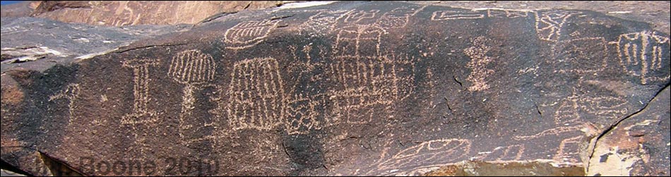
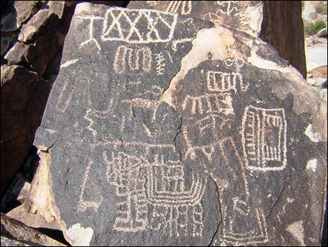
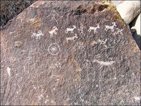
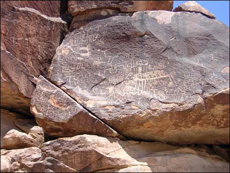
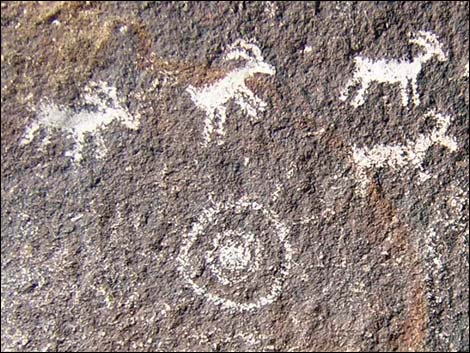
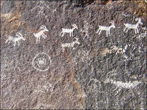
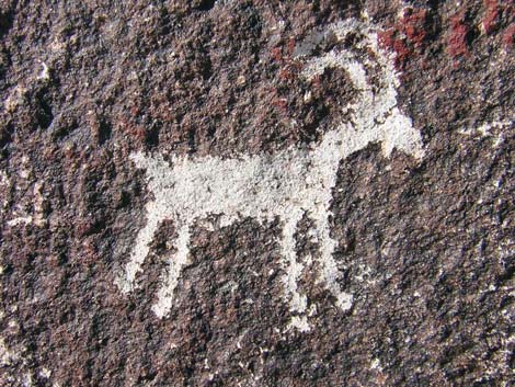
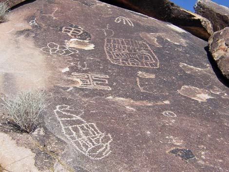
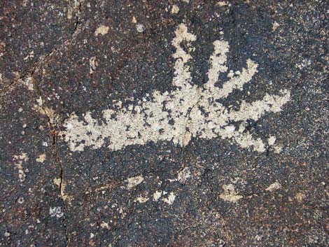
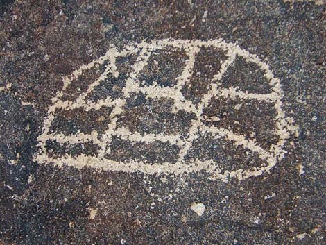
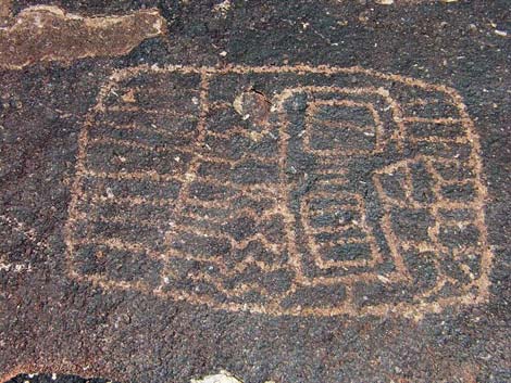
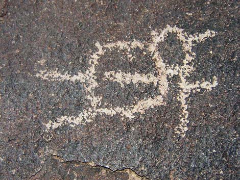
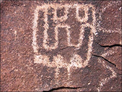
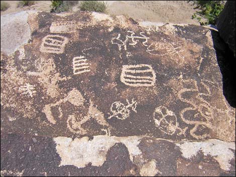
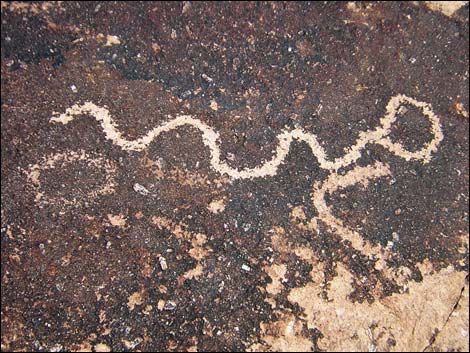
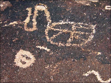
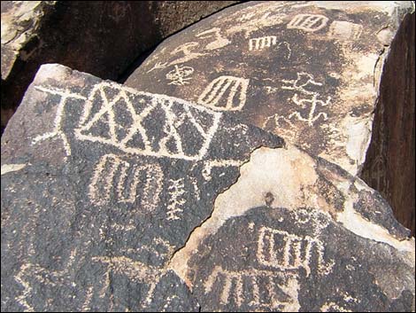
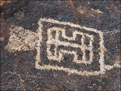
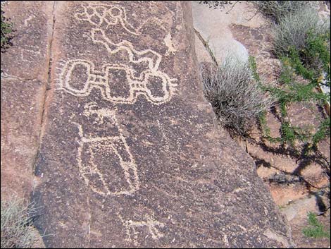
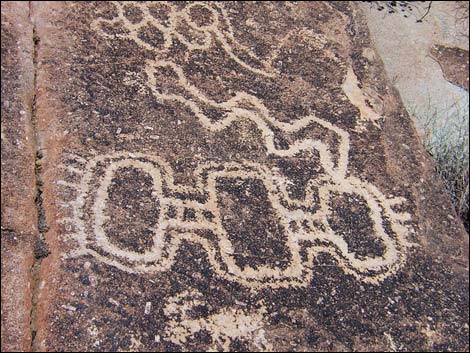
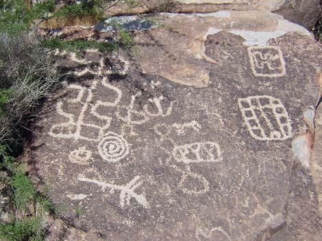
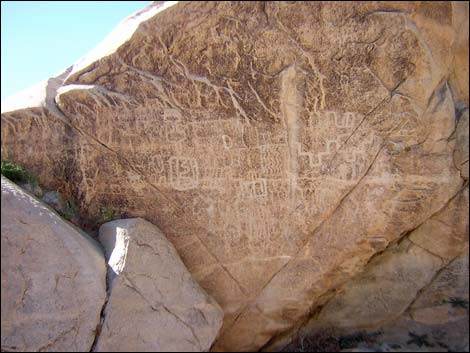
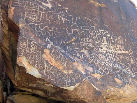
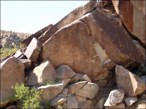
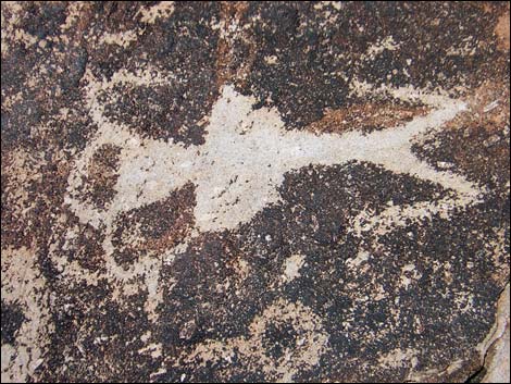
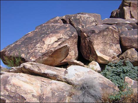
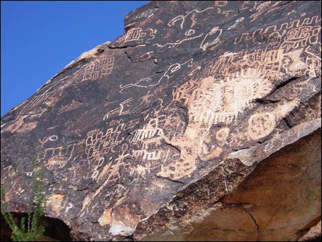
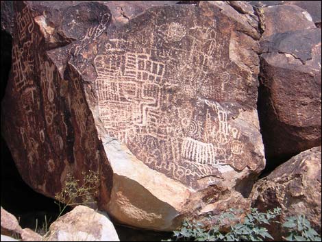
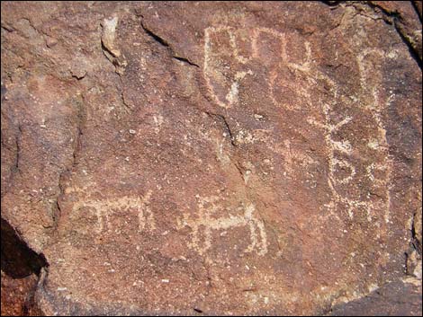
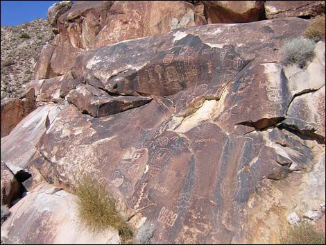
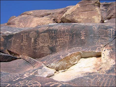
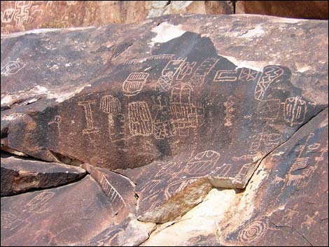
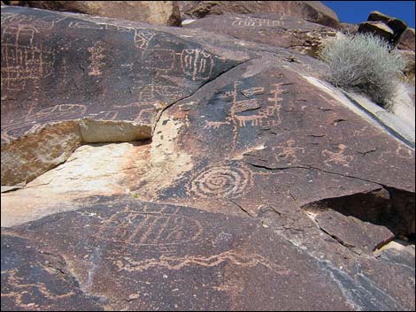
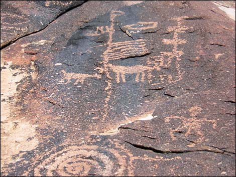
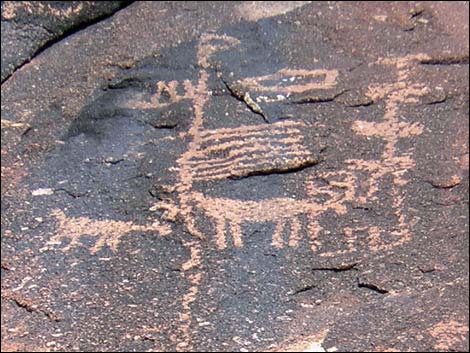
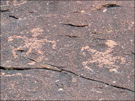
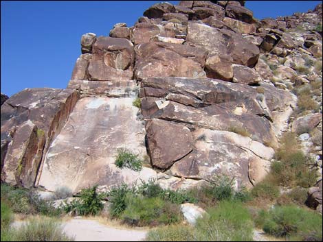
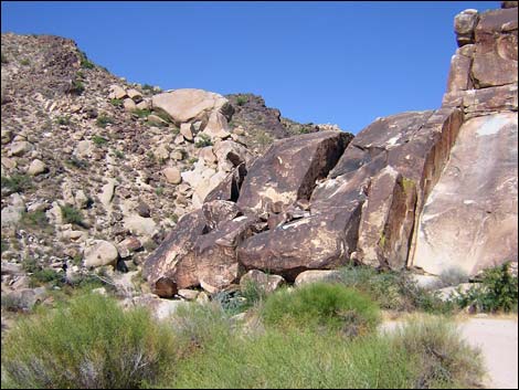
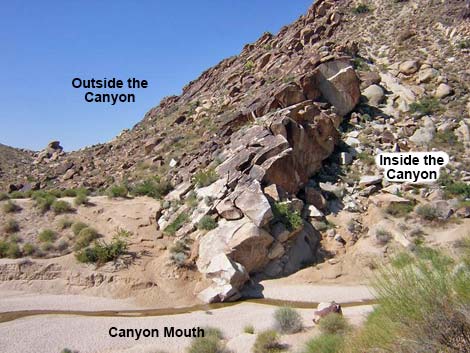
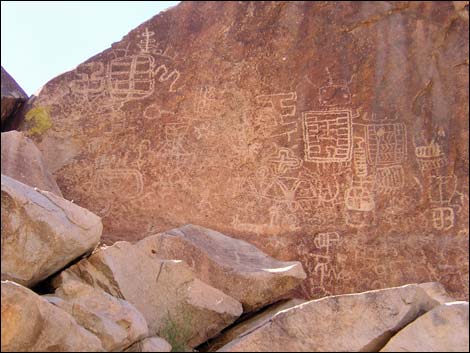
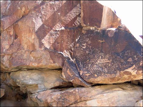
Overview The Grapevine Canyon Petroglyph Area has a spectacular assemblage of petroglyphs pecked into a ridge of hard granite at the mouth of Grapevine Canyon. The vast majority of petroglyphs are within 1-2 minutes of the mouth of the canyon, but rock art can be found scattered up the canyon. Most of the petroglyphs are abstract symbols rather than representations of physical things, but a few petroglyphs depict bighorn sheep, atlatls (a device used to throw spears with great force), and humans. The mountains in the area are formed of relatively soft granite incised by bands and outcrops of harder granite. At the mouth of the canyon, the softer granite has eroded more rapidly than the harder granite, and the harder granite forms a narrow entrance to the canyon. |
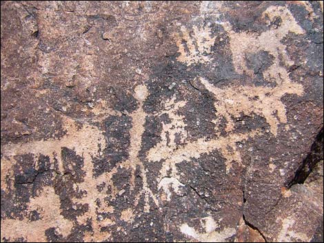 |
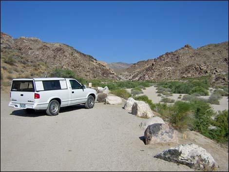
The rock faces on both sides of the mouth of the canyon are covered in desert varnish, a naturally occurring dark patina that forms on the surface of rocks in the desert. Native peoples created petroglyphs here by pecking away the desert varnish to reveal the underlying light-colored granite rock. Some of the rock art here is so old that it is being covered over again by desert varnish. Most of the petroglyphs are fairly close to the ground, but some are located higher on the cliffs. Access to the trailhead is via good dirt roads that are suitable for sedans. Beyond the trailhead turnoff, the main road gets a bit steep and rough. From the trailhead parking area, the 0.3-mile trail is easy and nearly level. There are so many petroglyphs at and near ground level that there is little need to climb the walls to get close-up views of the petroglyphs farther up. If you do climb to the higher ones, don't climb on the petroglyphs, and keep in mind that the granite here seems unusually slick compared to the limestone and sandstone that are more common in southern Nevada. |
 |
Location The Grapevine Canyon Petroglyphs Area is located about 75 air-miles south of Las Vegas, about 7 miles west of Laughlin. Links to Area Map and Site Map. From Las Vegas, drive south towards Laughlin. Drive south on Highway 95 for about 54 miles, past Searchlight and Cal-Nev-Ari, to Highway 163 (Table 1, Site 826). Turn left onto Highway 163 towards Laughlin and drive east for 12.8 miles to Christmas Tree Pass Road (Site 823). Watch for a small sign indicating a left turn. |
 |
Alternatively, from the bridge in Laughlin, drive west on Highway 163 towards Las Vegas for about 6.7 miles to Christmas Tree Pass Road (Site 823). Watch for a small sign indicating a right turn. On Christmas Tree Pass Road, drive north on the well-graded dirt road for 1.8 miles to a T-intersection with the Grapevine Canyon access road (Site 824). Turn left (west) and drive west for about 0.15 miles to the parking area at the end of the road (Site 825). Park here; this is the trailhead. |
 |
Hours The area is always open, but it should be considered day-use only. There are no campsites. There is an outhouse at the trailhead. Fees None. |
|
 |
 |
 |
 |
 |
 |
 |
 |
 |
 |
 |
 |
|
 |
 |
 |
 |
 |
 |
 |
 |
 |
 |
 |
 |
 |
 |
 |
 |
 |
 |
 |
 |
 |
 |
 |
 |
 |
 |
 |
 |
Table 1. Highway Coordinates based on GPS data (NAD27; UTM Zone 11S). Download Highway GPS Waypoints (*.gpx) file.
| Site # | Location | UTM Easting | UTM Northing | Latitude (N) | Longitude (W) | Elevation (ft) | Verified |
|---|---|---|---|---|---|---|---|
| 0823 | Hwy 163 at Christmas Tree Rd | 712306 | 3897607 | 35.20082 | 114.66796 | 1,952 | Yes |
| 0824 | Christmas Tree Rd at Grapevine Cyn | 711331 | 3900326 | 35.22553 | 114.67796 | 2,325 | Yes |
| 0825 | Grapevine Canyon Parking | 711079 | 3900353 | 35.22582 | 114.68072 | 2,341 | Yes |
| 0826 | Hwy 95 at Hwy 163 | 695527 | 3896339 | 35.19280 | 114.85245 | 2,516 | Yes |
| 1219 | Hwy 93 @Christmas Tree Pass Rd | 693735 | 3904630 | 35.26787 | 114.87016 | 2,535 | Yes |
Table 2. Hiking Coordinates Based on GPS Data (NAD27; UTM Zone 11S). Download Hiking GPS Waypoints (*.gpx) file.
| Wpt. | Location | UTM Easting | UTM Northing | Elevation (ft) | Point-to-Point Distance (mi) | Cumulative Distance (mi) | Verified |
|---|---|---|---|---|---|---|---|
| 01 | Grapevine Canyon Trailhead | 711068 | 3900355 | 2,366 | 0.00 | 0.00 | GPS |
| 02 | Petroglyphs | 710648 | 3900449 | 2,420 | 0.28 | 0.28 | GPS |
Happy Hiking! All distances, elevations, and other facts are approximate.
![]() ; Last updated 240323
; Last updated 240323
| Petroglyphs | Glossary | Copyright, Conditions, Disclaimer | Home |