Hiking Around Las Vegas, Basin and Range National Monument
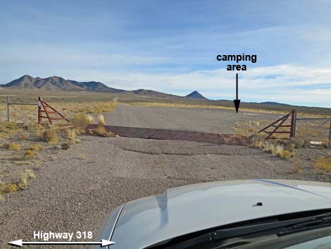
 Highway 318 at campsite access road (view N) |
Overview There is one developed campground in Basin and Range National Monument (Mt. Irish Campground). Otherwise, there are no facilities of any kind, but primitive camping is legal everywhere along existing roads and trails, and there are a number of traditional campsites scattered throughout the area. The campsite along Highway 318 at Timber Mountain Pass Road is a traditional campsite that has space for several trailers and RVs and sometimes is used by 18-wheelers, but this site probably is more of a place to stop in the evening before moving deeper into the National Monument the next day. Campsites farther in have less traffic passing by (less dust; more privacy) and provide more pristine scenery. Pack it in - Pack it out. Link to map. |
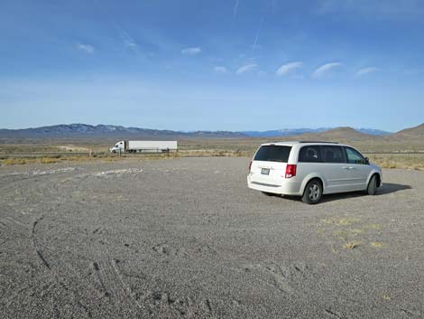
 Turning onto campsite access road (view NE) |
Getting to Camp This campsite is located along Highway 318 at Timber Mountain Pass Road, but on the east side of the highway, northeast of Basin and Range National Monument, about 2-1/2 hours (156 miles) northeast of Las Vegas. From Las Vegas, drive north on Interstate-15 for 21 miles to Highway 93. Drive north on Highway 93 past the towns of Alamo and Ash Springs to Highway 318. Turn left onto Highway 318 and drive north for 49.2 miles (just past mile marker LN-49) to Timber Mountain Pass Road on the left. At Timber Mountain Pass Road, turn right (away from the national monument) onto the campsite access road and then drive northeast past the cattle guard. Immediately on the right, the road widens into a broad gravel parking area. I usually drive to the far side to ensure that I am a few yards farther from highway noises. |
 Campsite with Highway 318 in background (view W) |
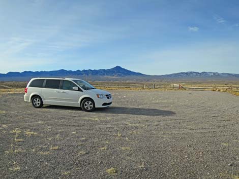 Campsite with Highway 318 in background (view SW) |
Table 1. Highway Coordinates based on GPS data (NAD27; UTM Zone 11S). Download Campsite GPS Waypoints (*.gpx) file.
| Site | Location | UTM Easting | UTM Northing | Latitude (N) | Longitude (W) | Elevation (ft) |
|---|---|---|---|---|---|---|
| Hwy 318 | Highway 318 at Timber Mtn Pass Rd Campsite | 675402 | 4224703 | 38.15502 | 114.99812 | 5,427 |
Happy Hiking! All distances, elevations, and other facts are approximate.
![]() ; Last updated 240323
; Last updated 240323
| Basin and Range Campsites | Hiking Around Las Vegas | Glossary | Copyright, Conditions, Disclaimer | Home |