Hiking Around Las Vegas, Basin and Range
There are one developed campground in Basin and Range National Monument (Mt. Irish Campground). Otherwise, there are no facilities of any kind, but primitive camping is legal everywhere along existing roads and trails, and there are a number of traditional campsites scattered throughout the area. I tend to stop and camp where I am when the sun goes down (including wide spots on dirt roads) but there are a fair number of traditional campsites scattered throughout the National Monument. Presented here is information on the location and condition of several traditional sites. There is also one developed campground at Kirch Wildlife Management Area, which can be used to access northern portions of the National Monument.
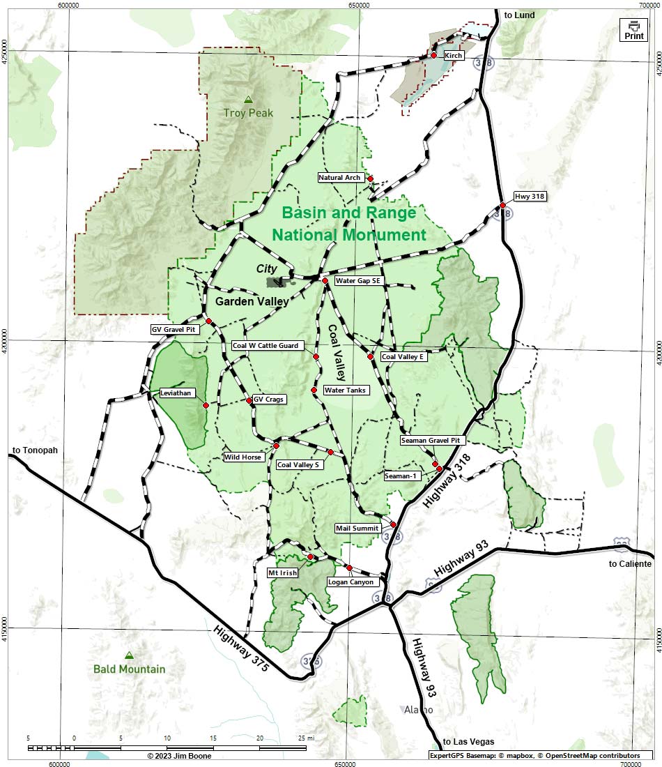
Note: Campsites are red. Map based on USGS 7.5-minute topo map, which may have red grid lines and various numbers. North is at the top. Grid is UTM NAD27 CONUS. Roads are black (solid = paved; dashed = unpaved; width implies quality). Wilderness Areas (boundaries solid green, fill light green) based on BLM data. National Monument Areas (boundaries dashed green, fill light green) based on BLM data. National Forest areas (boundaries dashed brown, fill light green) based on USFS data. State Wildlife Management Area (boundaries dashed brown, fill light blue) based on NDOW data. Private land (crosshatch gray) based on NPS data. BLM areas (no overlay) based on BLM data.
| Developed Campsites | Primitive Campsites | Backroad Primitive Campsites |
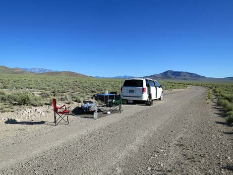 Roadside campsite |
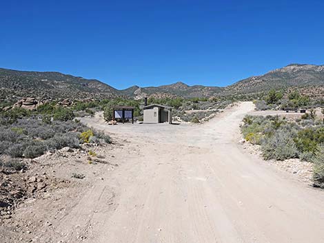 Mt. Irish Campground |
 Mt. Irish area |
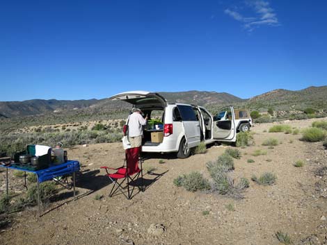
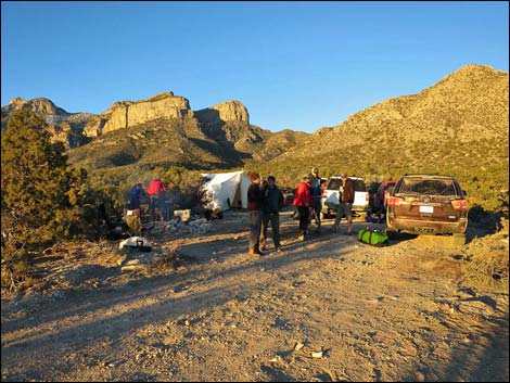 Leviathan Trailhead |
Table 1. Highway Coordinates based on GPS Data (NAD27; UTM Zone 11S). Download Highway GPS Waypoints (gpx) file.
| Site | Location | UTM Easting | UTM Northing | Latitude (N) | Longitude (W) | Elevation (ft) |
|---|---|---|---|---|---|---|
| Coal Valley E | Seaman Wash Road at Cattle Guard in Coal Valley | 653085 | 4198043 | 37.91887 | 115.25926 | 4,984 |
| Coal Valley S | Mail Summit Road at Coal Valley Campsite | 646409 | 4181410 | 37.77012 | 115.33856 | 5,259 |
| Coal W Cattle Guard | Coal Valley West Road at Cattle Guard | 643606 | 4197893 | 37.91906 | 115.36710 | 4,954 |
| GV Crags | Mail Summit Road at Garden Valley Crags | 632129 | 4190066 | 37.85028 | 115.49906 | 6,043 |
| GV Gravel Pit | Mail Summit Road at Garden Valley Gravel Pit Camp | 624892 | 4203718 | 37.97431 | 115.57893 | 5,564 |
| Hwy 318 | Highway 318 at Timber Mtn Pass Rd Campsite | 675402 | 4224703 | 38.15498 | 114.99898 | 5,427 |
| Kirch | Wayne E. Kirch WMA Dave Deacon Campground | 662998 | 4250335 | 38.38820 | 115.13458 | 5,223 |
| Leviathan | Leviathan Trailhead Parking | 624610 | 4189190 | 37.84345 | 115.58465 | 6,349 |
| Leviathan 1 | Leviathan 1 campsite | 626163 | 4189739 | 37.84818 | 115.56691 | 5,889 |
| Leviathan 2 | Leviathan 2 campsite | 625898 | 4189639 | 37.84732 | 115.56994 | 5,938 |
| Leviathan 3 | Leviathan 3 campsite | 625840 | 4189618 | 37.84713 | 115.57060 | 5,964 |
| Leviathan 4 | Leviathan 4 campsite | 625385 | 4189508 | 37.84620 | 115.57579 | 6,089 |
| Logan 1 | Campsite along Logan Canyon Road | 655798 | 4159571 | 37.57182 | 115.23665 | 3,921 |
| Logan 2 | Campsite along Logan Canyon Road | 653860 | 4160084 | 37.57676 | 115.25849 | 4,081 |
| Logan 3 | Campsite along Logan Canyon Road | 648878 | 4161892 | 37.59387 | 115.31452 | 4,783 |
| Logan 4 | Campsite along Logan Canyon Road | 645111 | 4162864 | 37.60323 | 115.35698 | 5,374 |
| Logan Canyon | Logan Canyon campsites | 650064 | 4161361 | 37.58890 | 115.30120 | 4,593 |
| Logan Pass | Campsite along Logan Canyon Road at Logan Pass | 640486 | 4165419 | 37.62697 | 115.40886 | 7,228 |
| Mail Summit | Mail Summit Road at Parking Area | 657607 | 4169029 | 37.65672 | 115.21415 | 4,255 |
| Mt Irish | Mt Irish Archeological District | 644280 | 4162833 | 37.60312 | 115.36554 | 5,488 |
| Natural Arch | Natural Arch Campsite | 652438 | 4228826 | 38.19629 | 115.26007 | 5,409 |
| Seaman Gravel Pit | Seaman Wash Rd Gravel Pit | 664660 | 4179632 | 37.75100 | 115.13183 | 4,331 |
| Seaman-1 | Seaman Wash Road at First Intersection | 665390 | 4178792 | 37.74330 | 115.12374 | 4,239 |
| Silver Canyon | Campsite along Silver Canyon Road | 644953 | 4164571 | 37.61863 | 115.35843 | 5,663 |
| Water Gap SE | Campsite on SE corner of Water Gap | 644924 | 4211059 | 38.03747 | 115.34945 | 5,052 |
| Water Tanks | Coal Valley So. Water Tanks Campsite | 643300 | 4192064 | 37.86659 | 115.37173 | 4,980 |
| Wild Horse | Wild Horse Valley Shepherd's Camp | 636915 | 4182275 | 37.77938 | 115.44615 | 5,883 |
Happy Hiking! All distances, elevations, and other facts are approximate.
![]() ; Last updated 240323
; Last updated 240323
| Basin and Range NM | Hiking Around Basin and Range | Glossary | Copyright, Conditions, Disclaimer | Home |