Hiking Around Las Vegas, Basin and Range National Monument
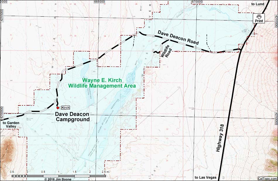
Note: Campsites are red. Map based on USGS 7.5-minute topo map, which may have red grid lines and various numbers. North is at the top. Grid is UTM NAD27 CONUS. Roads are black (solid = paved; dashed = unpaved; width implies quality). Trails and routes are red (solid = main; dashed = adjacent or alternate). Wilderness Areas (boundaries solid green, fill light green) based on BLM data. National Monument Areas (boundaries dashed green, fill light green) based on BLM data. National Forest areas (boundaries dashed brown, fill light green) based on USFS data. State Wildlife Management Area (boundaries dashed brown, fill light blue) based on NDOW data. Private land (crosshatch gray) based on NPS data. BLM areas (no overlay) based on BLM data. Download waypoint coordinates from route description page.
Happy Hiking! All distances, elevations, and other facts are approximate.
![]() ; Last updated 161005
; Last updated 161005
| Kirch Camp | Hiking Around Las Vegas | Glossary | Copyright, Conditions, Disclaimer | Home |