Hiking Around Las Vegas, Other Areas
 Whipple Cave (view E from Hwy 318) |
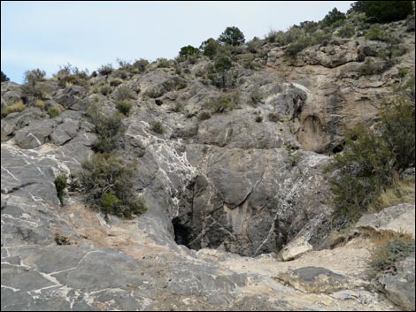
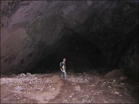
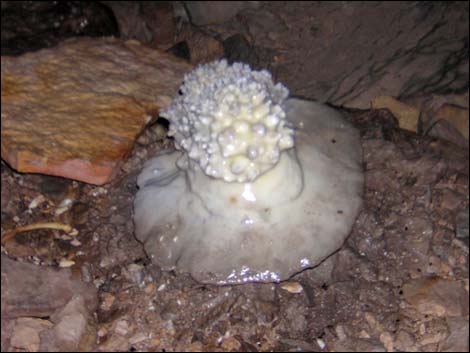
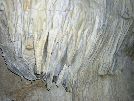
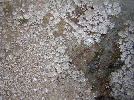
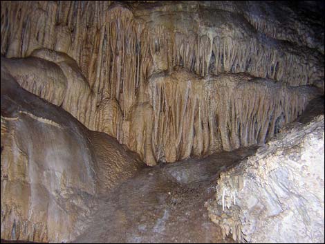
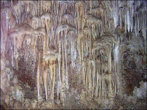
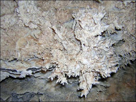
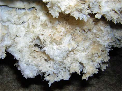
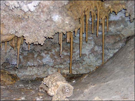
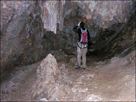
Overview From Las Vegas, this is a long drive and a short walk to a big hole in the ground. The mountains are limestone, and over the millennia, moving water dissolved out a long tubular cave that is about 900-ft long, 70- to 90-ft wide, and 60- to 70-ft high. Water continues to move through the mountain and seep into the cave, creating a vast array of weird and wild cave formations: stalagmites, stalactites, columns, flow stone, soda straws, cave bacon, popcorn, and various crystals. Truly amazing! At the west end of the cave, near the surface, the roof collapsed and created a sinkhole that serves as the entrance. Getting into the cave requires an 80-ft rappel, the last 15 feet of which are overhanging. Getting back out, obviously, requires technical rope-climbing techniques, which are most difficult due to the overhang. Towards the middle of the cave, a squeeze through a hole and a short downclimb are easier and safer with a short rope. |
 Trailhead parking and cave entrance (view N) |
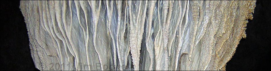
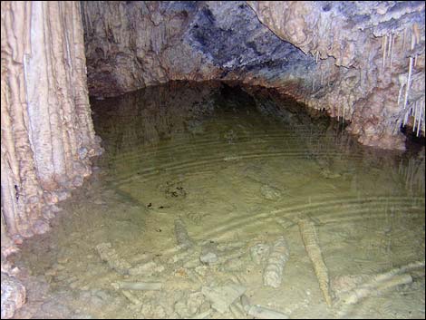
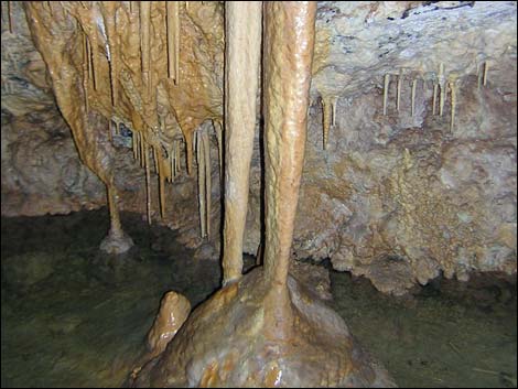
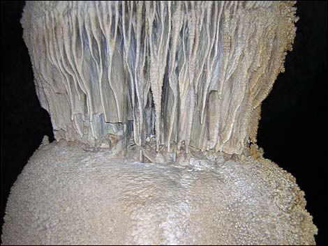
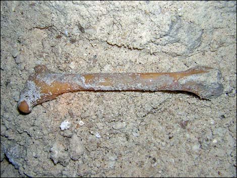
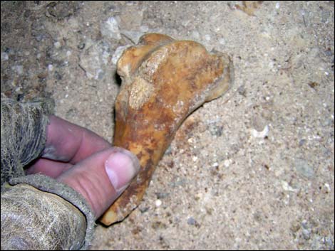
There is considerable breakdown rubble (huge boulders) to climb around, but much of it supports stalagmites, flowstone, and popcorn formations. The walls of the cave and side chambers support many delicate formations, including some that have grown against gravity. The back of the cave hides a huge column, a number of water-filled pools, lots of beautiful flowstone, and amazing crystals growing out of the walls. Dirt and animal bones at the far end of the cave suggest that the end isn't really the end. Link to map. |
 |
Watch Out Other than the standard warnings about hiking in the desert, especially the section about holes in the ground, ...this is a technical cave that requires an overhanging rappel. Getting into the cave provides a variety of places to fall and get hurt, as vertical rockcraft always is dangerous, and cave rescues are complicated, difficult, and painful. The floor is slippery in wet portions of the cave. Watch for hard things hanging down from the ceiling waiting to bash your head. This route requires ropes. If you don't know how to use ropes, go with someone who does, get some training, or visit a walk-in cave. This cave isn't interesting enough to risk getting hurt, let alone suffer a slow and painful rescue. |
 |
While hiking, please respect the land and the other people out there, and try to Leave No Trace of your passage. Rescue would be time consuming and difficult in this cave, so bring the 10 Essentials, a hard hat, and 3 sources of light per person. Make sure this route is of the appropriate difficulty for your skills. This cave is in the Far South Eagens Wilderness Area, so pay particular attention to respecting the land. Caves are delicate places: don't touch cave formations because the oils on your hand will hinder or change the growth patterns. Don't break any formations; don't bring back any souvenirs from the cave. Broken cave formations just appear as dull pieces of rock outside the cave. Townsend's Big-eared Bats roost in the cave and may use it as a maternity cave, so please do what you can to reduce disturbing the bats. |
 |
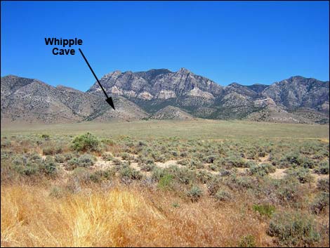
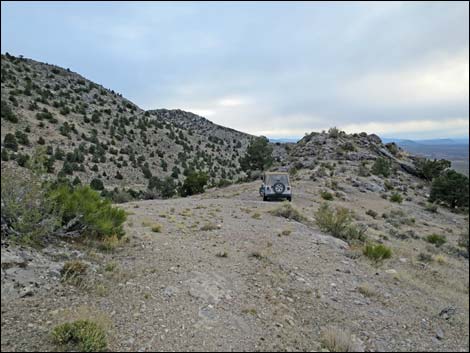
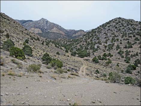
Getting to the Trailhead Whipple Cave is located on the west side of the Far South Egan Range, northeast of Sunnyside (way north of Alamo and Hiko), about 200 miles north of Las Vegas. From Las Vegas, drive north on Interstate-15 for 21 miles to Highway 93 (Exit 64). Exit the interstate onto Highway 93 and drive north 81 miles to Ash Spring, which has the last gasoline before the cave. From Ash Spring, drive north on Highway 93 for 2 miles to Highway 318. Turn left onto Highway 318 and drive north 72.9 miles to Whipple Cave Access Road. Pass the wire-fence gate and continue northeast, then southeast, to the edge of the mountains and the trailhead at the end of the road. |
 |
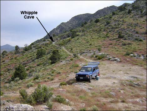
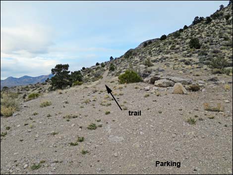
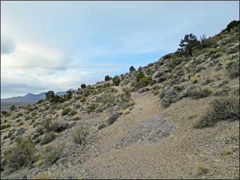
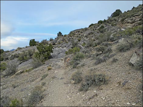
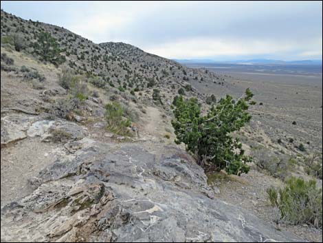
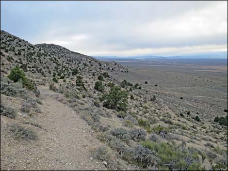
The Hike The trailhead (Table 1, Waypoint 01) is located on a saddle at the bottom edge of the Pinyon-Juniper Woodland (Upper Sonoran Life Zone) with grand view out over the sagebrush flats to the west. The trees are Singleleaf Pinyon Pine and One-seed Juniper. Shrub species include cliffrose, apache plume, banana yucca, Mormon tea, and bunchgrasses. From the trailhead, a use-trail runs north into the Far South Eagens Wilderness Area. The cave entrance (Wpt. 02) is about 125 yards up the trail. |
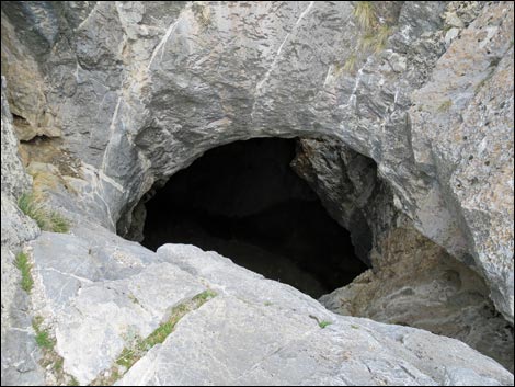 |
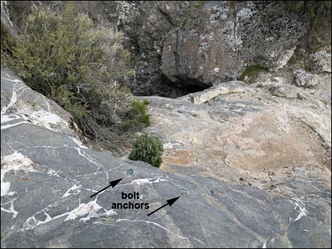
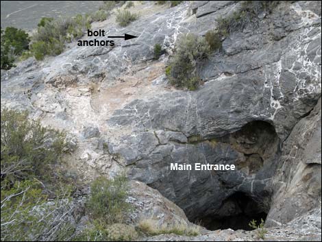
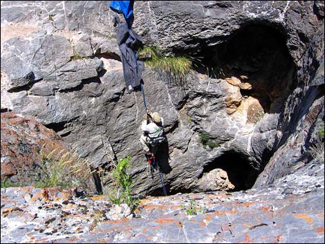
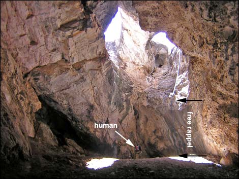
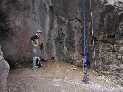
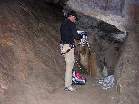
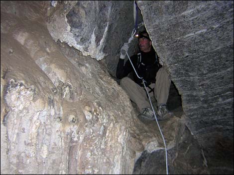
The Cave There is a 2-bolt anchor set above a ledge at the edge of the abyss. Using short ropes or long pieces of webbing, trees and large shrubs can be used as backup anchors. A 165-ft rope, doubled over and tied separately to the two bolts, is just long enough to reach the bottom. Other than a few carabiners and some webbing, no other hardware is needed for the anchor. Enter the cave by rappelling about 70 feet, the last 15 feet of which are overhanging. The bottom of the rappel is fairly flat, about 60-ft wide, at the top of a large, dirty scree slope that slides off into the darkness. Sign-in at the register located near the bottom of the rappel. Note: Cave dimensions are based on a map produced by Steven Ross in 1993, which is available through the Utah Timpanogos Grotto of the National Speleological Society. |
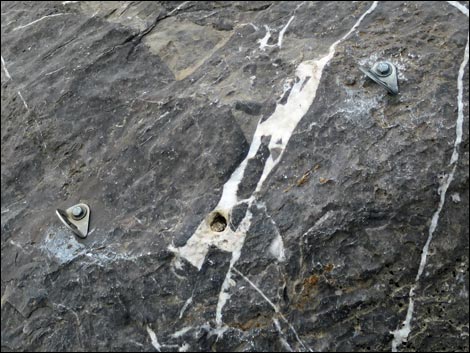 Two expansion bolts for anchors (plus tree backup) |
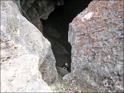
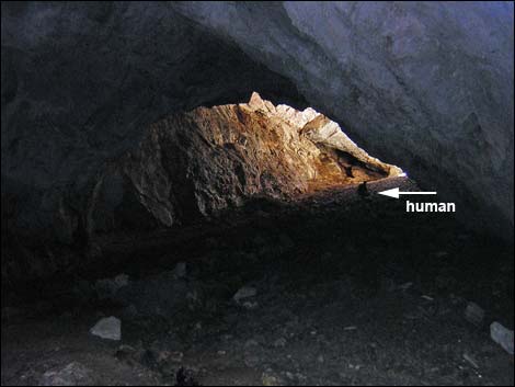
Start into the darkness by hiking (sliding) down the steep scree slope. At the bottom of the scree slope, about 200 feet in, a side tube runs northeast (left). The formations inside this tube are some of the most remarkable in the cave. The main cave at this point is about 5-ft wide and the ceiling is about 60-ft high. The most direct line through the cave runs along the north (left) wall, but don’t miss the formations and flowstone among the breakdown rubble and along the south (right) wall. Staying along the north wall until about 475 feet out, the cave pinches down to a narrow crawl hole between the wall and huge breakdown boulders (this is a hole, not a tube). Immediately before the crawl hole, the cave is about 90-ft-wide and the ceiling is about 55-ft-high. Getting into the back section of the cave requires squeezing backwards (feet first) through the narrow crawl hole and dropping onto a flat-topped boulder without falling into the 18-inch-wide slot directly below the crawl hole (space between breakdown boulders). This is a bit of a stretch and a good place for a short, 10- to 12-ft rope. Use webbing to tie off the chockstone boulder above the crawl hole, and use the rope to rappel (or just as a handline) to safeguard getting onto the flat-topped boulder. There are no good footholds. |
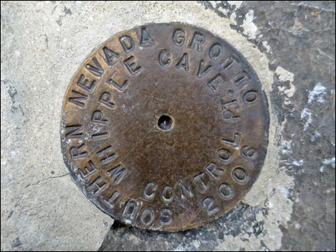 Whipple Cave Control Point |
Squeezing through the hole puts you atop a flat-topped boulder in the back half of the cave. At this point, the cave is about 70-ft-wide and the ceiling is about 55-ft high. The end of the cave is another 420 feet back. From the top of the flat-topped boulder, slide off the overhanging south (right) side onto a sloping wall, but don’t fall into the small, deep hole at the bottom of the sloping wall. This is another good spot for a short rappel or a hand-line, especially when the sloping wall is dripping wet. When I go back, I'll just rappel through the hole and off the southeast (far right) side of the flat-topped boulder using my 60-ft rope (30 ft probably would be sufficient). |
 Bold anchors and mouth of the cave |
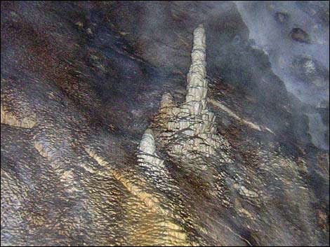
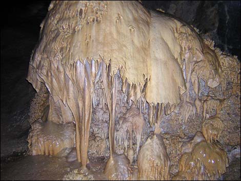
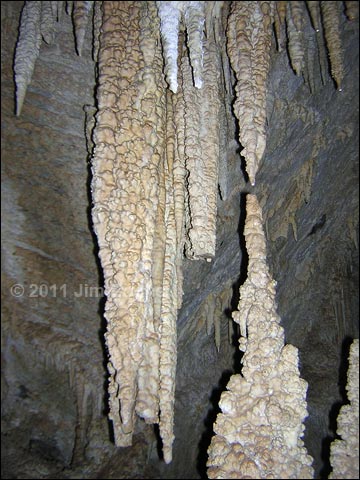
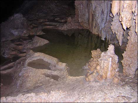
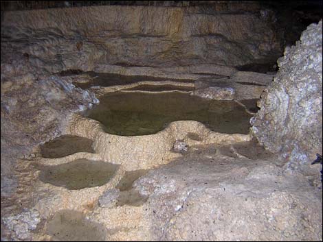
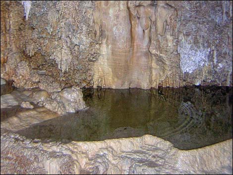
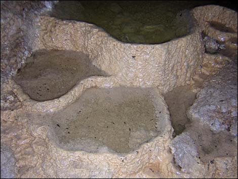
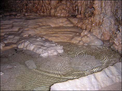
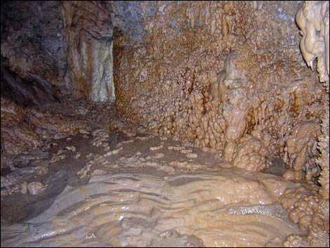
After getting off the flat-topped boulder, scramble among the breakdown rubble to the massive column, a huge structure standing in the center of the cavern. The column is huge, looking taller than the reported 30 ft. Based on the cave map, the column should be about 70-ft tall. Beyond the column are rimstone pools, amazing flowstone on the walls, crystals growing out and up from the wall, lots of popcorn, and other amazing cave formations. At the far end of the cave, dirt and animal bones provide ample material for speculation. When ready, follow your footprints in the mud and dust back to the crawl-hole and eventually the base of the ropes. Tired cavers should be extra careful jumaring out of the cave -- double check the knots! |
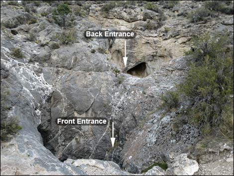 Front and back entrances |
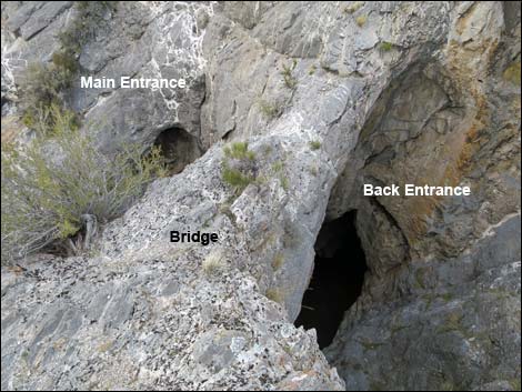 Bridge separating the two entrances (view N) |
 Main entrance (view NW from bridge) |
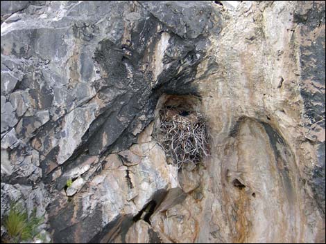 Common Raven nest with nestling |
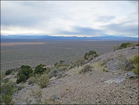 Grand Scenery (view NW from cave entrance) |
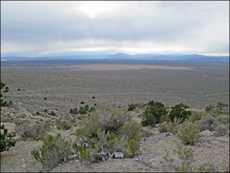 Grand Scenery (view W from cave entrance) |
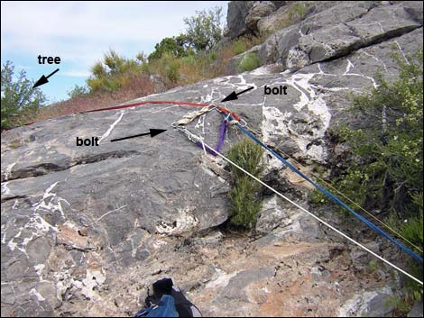 Two-bolt anchor and tree backup (view N) |
 Blanket protects rope from abrasion (view N) |
 |
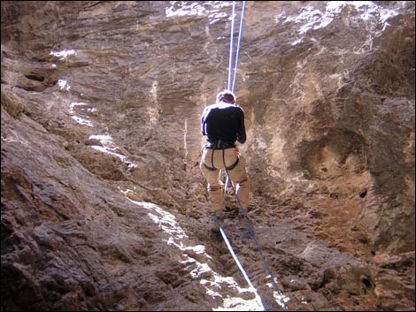 |
 On rappel (view W) |
 Inside mouth of cave (view W) |
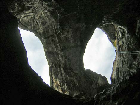 Two entrances and bridge (view up) |
 Bottom of the rappel (view W) |
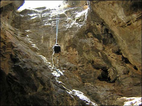
 Descending into the abyss (view E) |
 Looking back at the last sunlight (view W) |
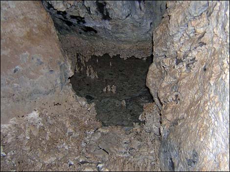
 Outer Cave |
 Outer Cave |
 Outer Cave |
 Outer Cave |
 Outer Cave |
 Outer Cave |
 Outer Cave |
 Outer Cave |
 Outer Cave |
 Outer Cave |
 Outer Cave |
 Outer Cave |
 Dropping into the inner cave (view N) |
 Between two worlds |
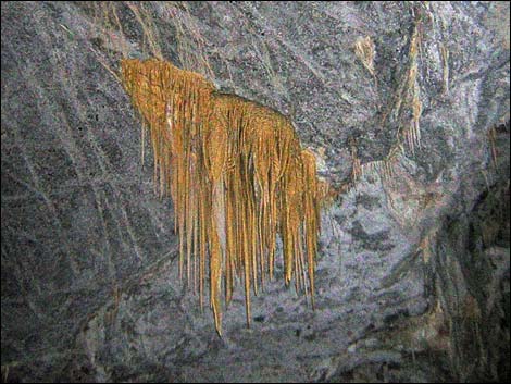
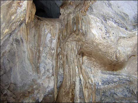
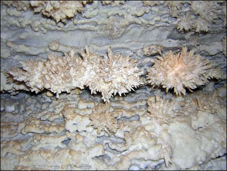
 Inner Cave |
 Inner Cave |
 Inner Cave |
 Inner Cave |
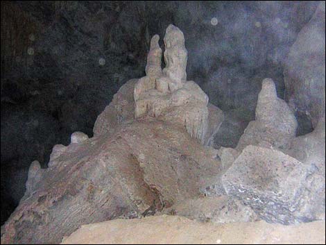
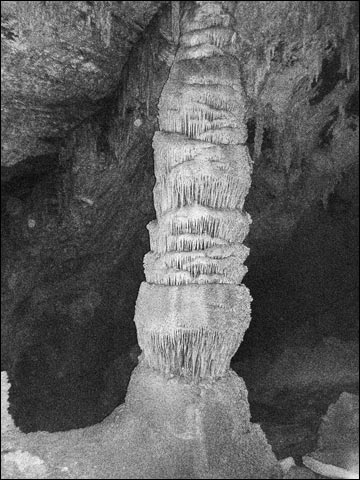 The column (view northeast) |
 Stalagmites and stalagmites - almost a column |
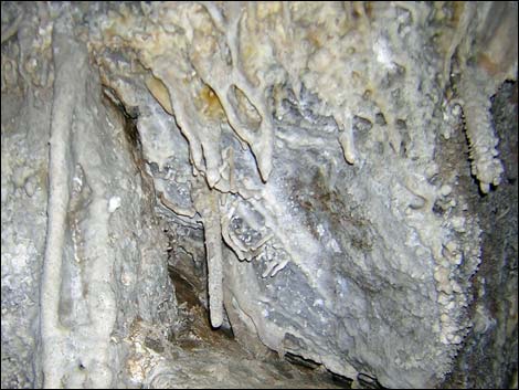
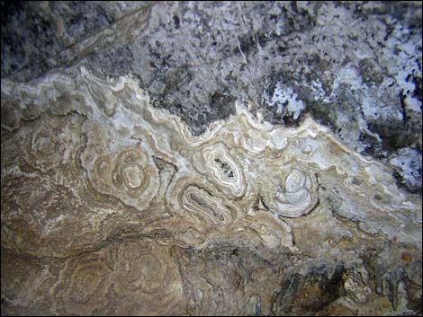
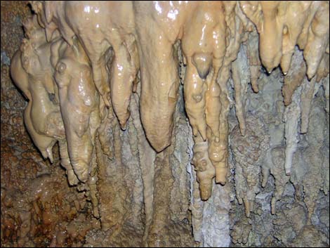
 Inner Cave |
 Inner Cave |
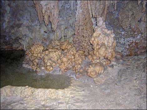 Inner Cave |
 Inner Cave |
 Inner Cave |
 Inner Cave |
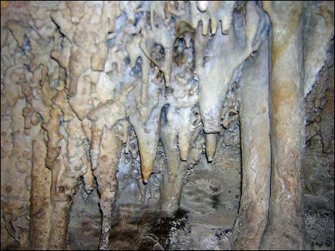
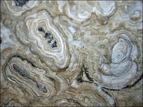
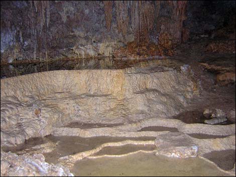
 Back of the inner cave |
 Back of the inner cave |
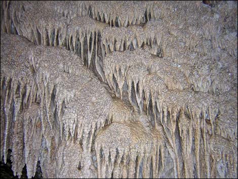
 Inner Cave |
 Inner Cave |
 Inner Cave |
 Inner Cave |
 Inner Cave |
 Inner Cave |
 Inner Cave |
 Inner Cave |
 Inner Cave |
 Inner Cave |
 Inner Cave |
 Inside the cave |
 Returning to the trailhead (view S from cave entrance) |
 Returning to the trailhead (view S) |
 Approaching the trailhead (view S) |
 Trailhead (view SE back down the access road) |
Table 1. Hiking Coordinates based on GPS data (NAD27; UTM Zone 11S). Download Hiking GPS Waypoints (*.gpx) file.
| Wpt. | Location | UTM Easting | UTM Northing | Elevation (ft) | Point-to-Point Distance (mi) | Cumulative Distance (mi) | Verified |
|---|---|---|---|---|---|---|---|
| 01 | Trailhead | 677092 | 4264404 | 6,147 | 0.00 | 0.00 | GPS |
| 02 | Whipple Cave | 677123 | 4264516 | 6,185 | 0.07 | 0.07 | GPS |
Happy Hiking! All distances, elevations, and other facts are approximate.
![]() ; Last updated 240324
; Last updated 240324
| Hiking Around Las Vegas | Glossary | Copyright, Conditions, Disclaimer | Home |