Hiking Around Las Vegas, Hiking Around Death Valley National Park
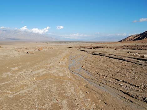
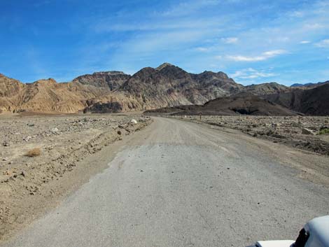
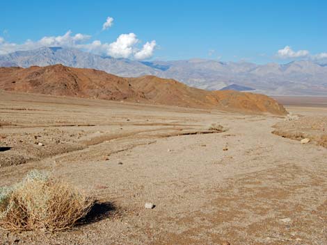
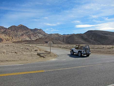 Badwater Rd at Desolation Canyon Rd (view SE) |
Overview This is an easy walk up a narrow canyon into some colorful, if stark, muddy badlands in the Death Valley Wilderness Area. There are a couple of little pour-overs and scramble-ups high up the canyon, but they are easy and above the best parts of the canyon. The route ends at the base of a pour-over or on a promontory overlooking the pour-over, depending on how you choose to finish the route. This route makes for a nice 1.5-hour round-trip walk in an interesting canyon. Link to map. |
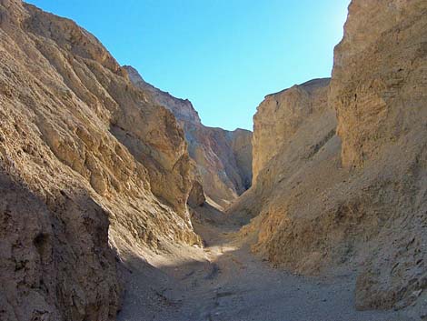
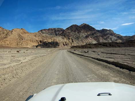
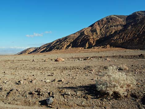
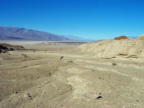
 Desolation Canyon Trailhead (view NE) |
Watch Out Other than the standard warnings about hiking in the desert, ...this hike is safe, but stay out of the canyon if it is raining or threatens to rain because of flash flood dangers. This canyon would be a real mess when muddy. There are a couple of short 3rd-class pour-over scramble-ups with water-polished rocks that are covered with dust and gravel, so there is greater than usual risk of slipping on these otherwise easy climbs. While hiking, please respect the land and the other people out there, and please try to Leave No Trace of your passage. Also, this is a fairly short hike, so just bring what you need of the 10 Essentials. |
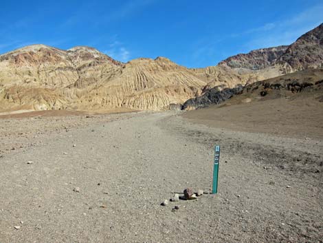 Desolation Canyon Trailhead (view NE) |
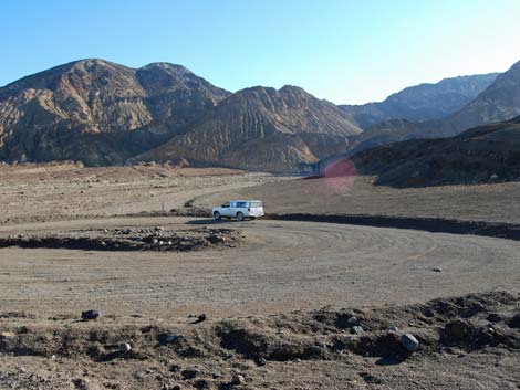
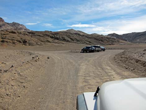
Getting to the Trailhead This hike is located in Death Valley National Park, about 3 hours northwest of Las Vegas. From town, drive out to Death Valley. From the Furnace Creek Visitor Center (Table 1, Site 0712), drive south on Highway 190 for about 1.25 miles to the Badwater (Highway 178) turnoff (Site 0741). Turn south (right) towards Badwater, and drive for 3.8 miles to a dirt road leading east (Site 0743). Turn east (left) towards the mountains and drive for 0.5 miles to a loop parking area at the end of the road (Site 0744). Park here; this is the trailhead. |
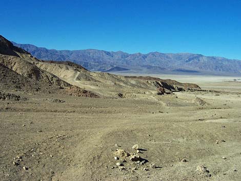
 Trailhead View NW into northern Death Valley |
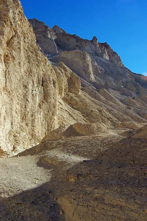
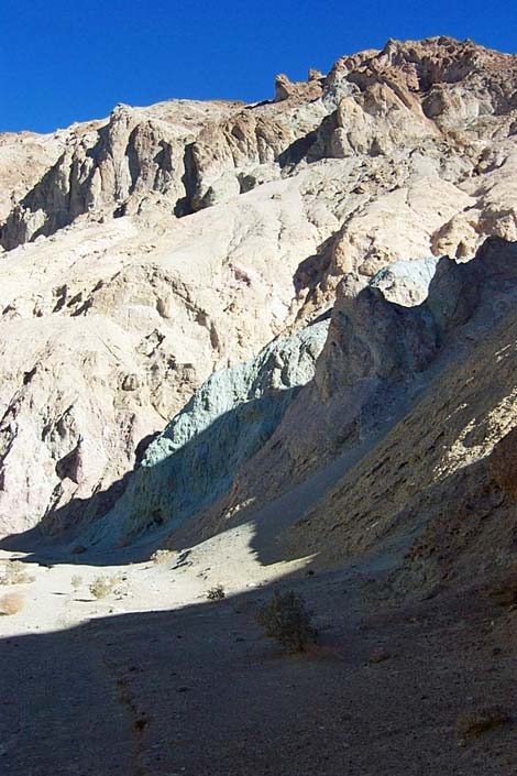
The Hike From the trailhead, the trail runs northeast a few yards towards the toe of a low hill (Wpt. 17), rounds the toe, turn southeast, and drops into the main wash (Wpt. 19) below Desolation Canyon. The route then follows the main wash towards the canyon. From the wash (Wpt. 19), spectacular views down the canyon spread out towards northern Death Valley. The north wall of the canyon is a high, colorful mountain streaked with stark erosion canyons coming straight down the face. The south side of the canyon is lower, eroded pastel-colored mud hills. There is almost no vegetation on the mud hills; the only vegetation is a few scattered desert holly and some old dead stems of an annual that grew along the wash. This place really is desolate. |
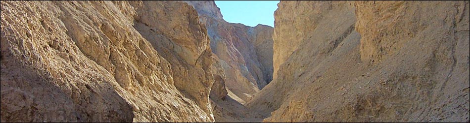
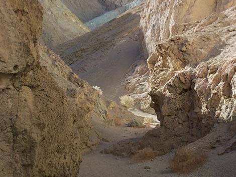
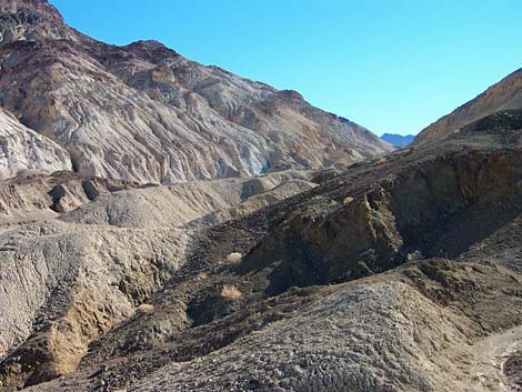
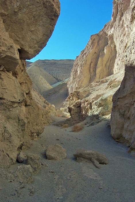
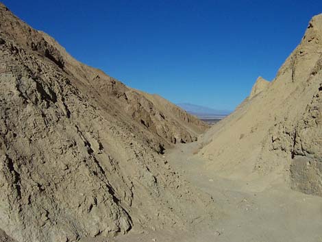
 Desolation Canyon (view E) |
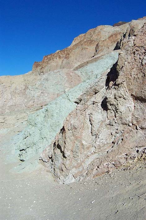
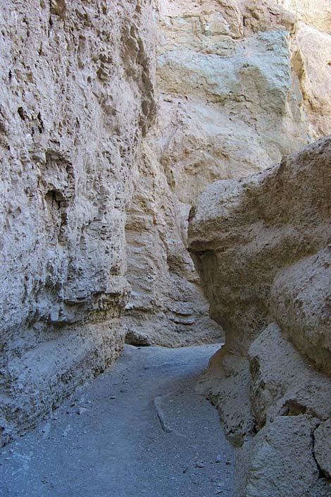
A few minutes up the wash, the canyon narrows (Wpt. 25) to just a few feet wide. The walls of the narrow cliffs are not very high, but they are various earth-tone shades of solidified mud. The bottom of the wash is also mud, which at least when dry, is easy to walk on (like a concrete sidewalk). The mud hills are not just piles of mud, they are composed of thin layers of mudstones and shales with hues of yellow, gray, and brown, with some patches of blue-gray, purple, and green mixed in. In most places, the shale-surface is covered with a layer of mud so that the hill looks like a pile of unconsolidated mud, but holes in the mud reveal the shale underneath. In some places, you can see where mud has run down the hillside like candle wax. Please don't walk on the mudhills because you will punch holes in the surface and your footprints will last for a long time. |
 |
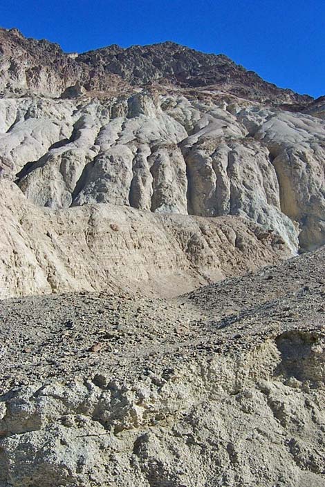
About 10 minutes up the narrows, which have been winding among mud hills in a fairly consistent direction, the canyon takes a sharp bend to the south (right). At this point, there was a little landslide of fine alluvial material that fell into the canyon from the north wall and blocked main wash (this would wash away during floods). Past the landslide, the narrow canyon cuts to the right, then bends more to the right, and then cuts back to the left (almost 90 degrees turns). It seems that a huge block of rock fell into the canyon and forced the water to flow around it. There are several sharp bends in this part of the canyon, and among them, there is a 10-ft pour-over that is fairly easy to climb (minimal 3rd class), but it looks awful high on the way down. After the pour-over, the route loops around, and continues up the canyon in the original direction. Above the crooks, there are two more pour-overs and a little scramble-up. |
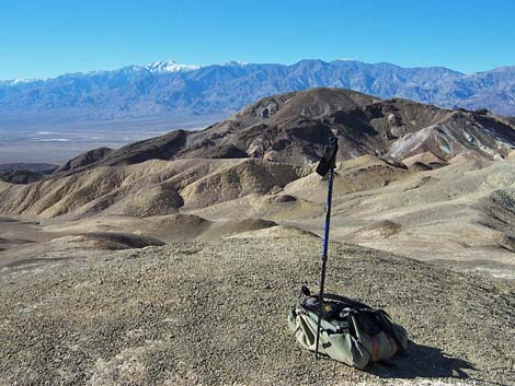
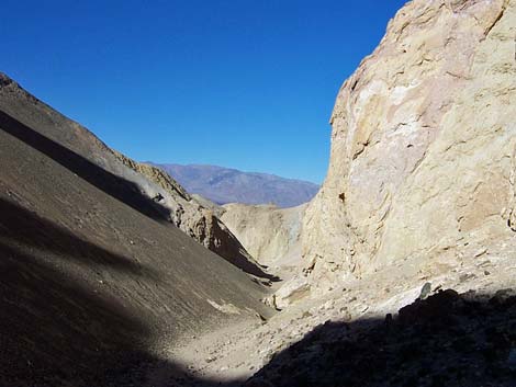
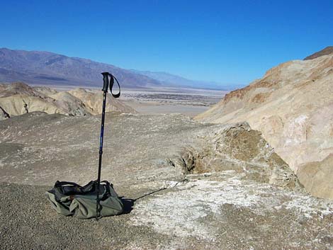
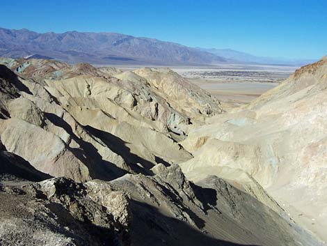 Promontory (view NW to Death Valley salt flats) |
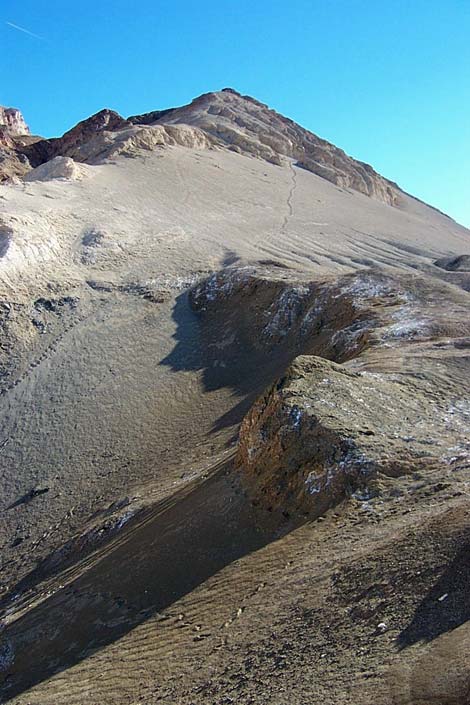
Just above the crooks, the canyon splits; the route goes south (right). A few minutes farther, the canyon forks again (Wpt. 28). The north (left) fork goes for a few more minutes to a 30-ft pour-over that blocks the canyon (Wpt. 27). The other fork leads up steep, sandy gullies to a promontory (Wpt. 29). Heading for the promontory, a use-trail runs steeply up a gully of fine volcanic-ash material that is almost like climbing a steep sand dune. From the promontory, you can look down on the 30-foot pour-over, and there are great views to the north up Death Valley; southwest to Telescope Peak and brown salt flats; and south to the Artists Drive area. |
 Promontory (view SW towards Telescope Peak) |
The views from the promontory are nice, but the last steep part adds a whole level of difficulty to the route. The walk to the 30-foot pour-over is pleasant, but the hike to the promontory is hard. Next time, I would just go to the pour-over and call it good. From the end of your route, retrace your footprints to the trailhead. On the way down, it might be interesting to investigate some of the side canyons. |
 |
 |
 |
 |
 |
 |
 |
 |
 |
 |
 |
 |
 |
 |
 |
|
 |
 |
 |
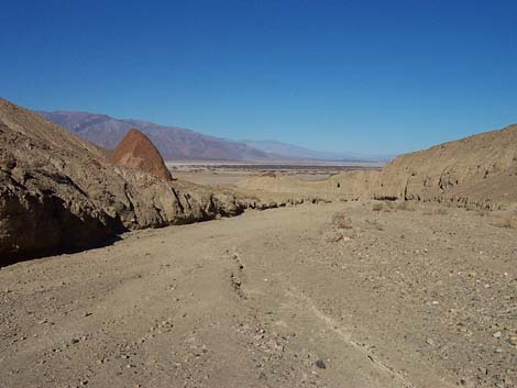 |
Table 1. Highway Coordinates (NAD27; UTM Zone 11S). Download Highway GPS Waypoints (*.gpx) file.
| Site | Location | Latitude (N) | Longitude (W) | Easting | Northing | Elevation (ft) | Verified |
|---|---|---|---|---|---|---|---|
| 0712 | Furnace Creek Visitor Center | 36.46159 | 116.86574 | 512030 | 4034954 | -186 | Yes |
| 0741 | Hwy 190 at Badwater Rd | 36.44841 | 116.85192 | 513271 | 4033494 | 4 | Yes-2 |
| 0743 | Hwy 178 at Desolation Cyn Rd | 36.39658 | 116.84650 | 513765 | 4027746 | -206 | Yes-2 |
| 0744 | Desolation Canyon Parking | 36.39575 | 116.83791 | 514536 | 4027655 | -106 | Yes-2 |
Table 2. Hiking Coordinates Based on GPS Data (NAD27; UTM Zone 11S). Download Hiking GPS Waypoints (*.gpx) file.
| Wpt. | Location | Easting | Northing | Elevation | Verified |
|---|---|---|---|---|---|
| 16 | Desolation Trailhead | 514563 | 4027659 | -106 | GPS |
| 17 | Toe of Hill | 514716 | 4027700 | -63 | GPS |
| 18 | Leave Old Road | 514813 | 4027660 | -46 | GPS |
| 19 | Main Wash | 514992 | 4027590 | -13 | GPS |
| 25 | Canyon Narrows | 515493 | 4027198 | 119 | GPS |
| 26 | On Route | 515784 | 4026838 | 289 | GPS |
| 27 | Route End, 30-ft pour-over | 516462 | 4026237 | 600 | GPS |
| 28 | Canyon Forks | 516297 | 4026314 | 553 | GPS |
| 29 | Route End, Promontory | 516447 | 4026187 | 712 | GPS |
Happy Hiking! All distances, elevations, and other facts are approximate.
![]() ; Last updated 240324
; Last updated 240324
| Death Valley | Hiking Around Las Vegas | Glossary | Copyright, Conditions, Disclaimer | Home |