Hiking Around Las Vegas, Death Valley National Park
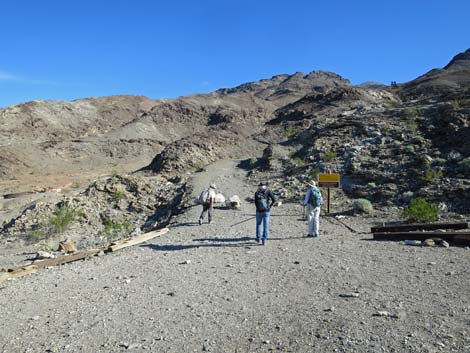 Hikers at the trailhead (view NE) Hikers at the trailhead (view NE) |
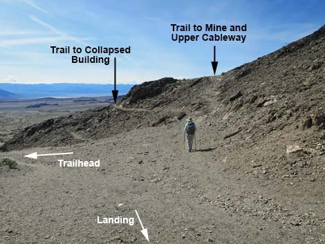
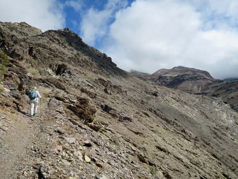
Overview This very strenuous, 3-mile, out-and-back trail runs up a steep, exposed ridge to an historical mine site with spectacular views from many places out across the Death Valley Wilderness Area. The trail runs a short distance to the Keane Wonder Mill Site, which is at the bottom of the cable tramway. Visiting the Mill Site is worth the drive and short walk, but hiking up the steep ridge, following the water pipe and cableway to Keane Wonder Mine is an accomplishment. The top of the cableway (below the mine) is in pretty good shape and makes for an interesting destination, and be sure to see the steam engine winch, which is also in pretty good shape. Hikers can continue up a steep trail to the Keane Wonder Mine, proper, near the top of the ridge (all fenced or grated), continue farther up the canyon to other mine sites, or even continue over the ridge to the north and descend past yet another mine area and loop back to the trailhead. Link to trail map. |
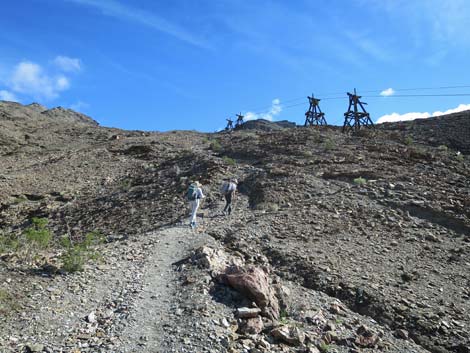
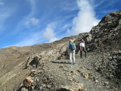
 Hikers departing the trailhead (view NE) |
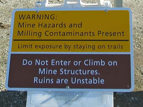
Watch Out Other than the standard warnings about hiking in the desert, ...this trail follows a steep ridge that has some exposure where a fall would prove damaging. The trail isn't dangerous, but don't stumble off the trail and over the edge. This is an historic mining area where mine shafts, adits, old buildings, and toxic muds pose potential hazards. It probably is best to stay off the tailings muds below the mill site, and the main mine openings are fenced or grated, so stay on the safe side of the fences. While hiking, please respect the land and the other people out there, and try to Leave No Trace of your passage. Also, this hike is tough, so be sure to bring the 10 Essentials. This hike goes into the Death Valley Wilderness Area, so pay particular attention to respecting the land. Please help protect this historical site by leaving what you find for others to discover and enjoy. |
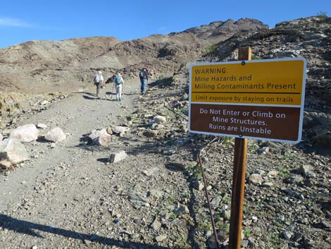
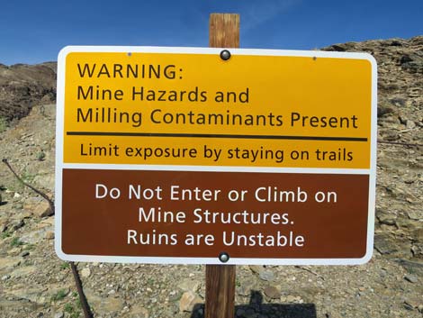 Warning sign at the trailhead (view NE) |
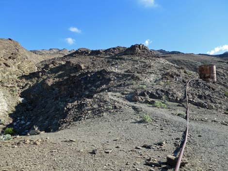
Getting to the Trailhead This hike is located in Death Valley National Park, about 2.5 hours northwest of Las Vegas. From town, drive out to Death Valley National Park. From the Furnace Creek Visitor Center, drive north on Highway 190 for 10.6 miles to Beatty Cutoff Road. Turn right towards Beatty, and drive northeast for 5.6 miles to Keane Wonder Mine Road. Turn right onto Keane Wonder Mine Road and drive southeast, then northeast, for 2.8 miles to the trailhead at the end of the road. Park here; this is the trailhead. |
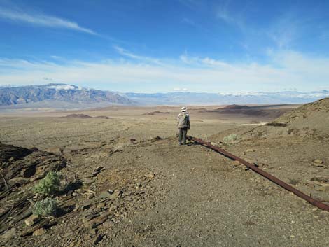
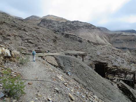
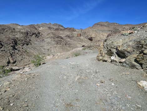 Start of the trail (view N) |
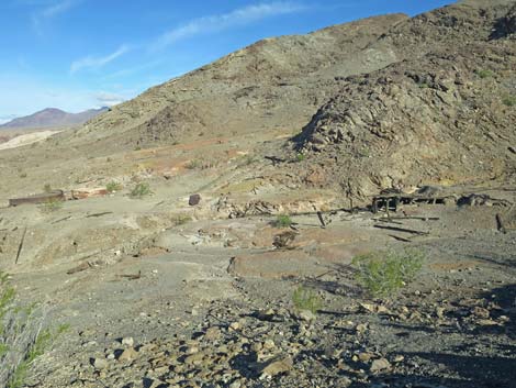
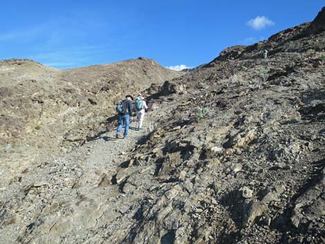
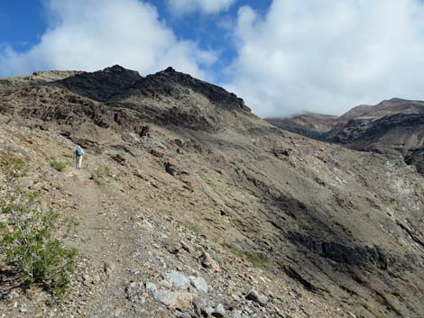
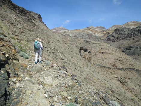
The Hike From the trailhead (Table 1, Site 01), some of the ore-bucket tram towers can be seen ahead far up on the mountain. The top of the tramway is nowhere near visible, but the trail runs all the way to the highest tower. For a bit of discouragement, hikers can recall this fact each time they see another tower farther up the mountain. Starting out, the trail follows an old road that runs north, then bends to run northeast as it climbs along the side of the ridge. On warm days, keep an eye out on the right side of the road for chuckwallas basking on the sunny rocks or chasing each other around. Off the left side of the trail, evidence of historical mining can be seen with various water tanks, settling basins, old metal pipes, old metal cans, and toxin laden tailings muds. The miners used acids, mercury, and cyanide to extract gold from the ore, so while interesting, it is not entirely safe to wander about on the tailings muds. |
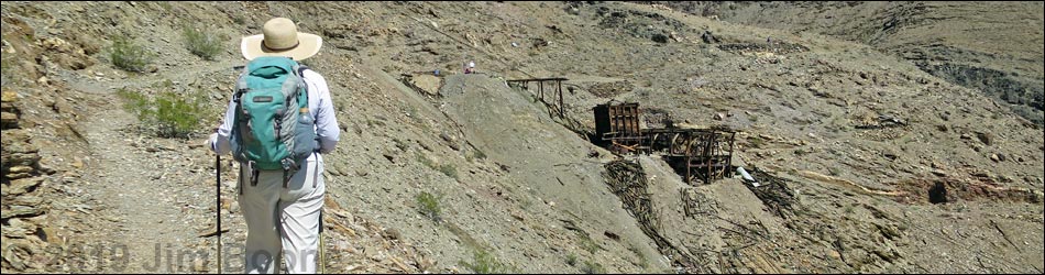
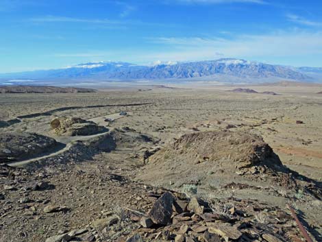
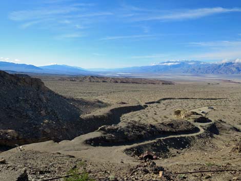
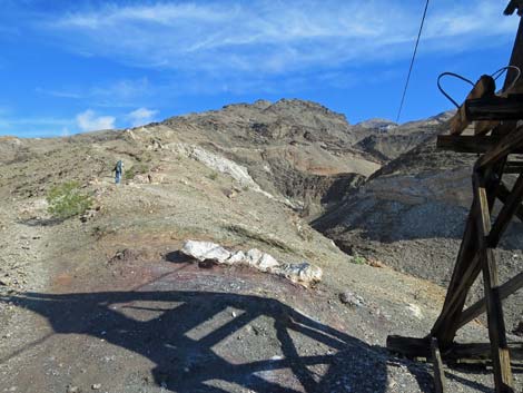
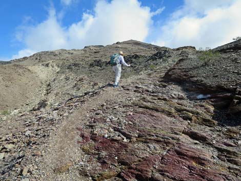
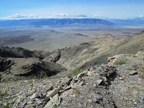
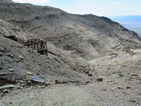
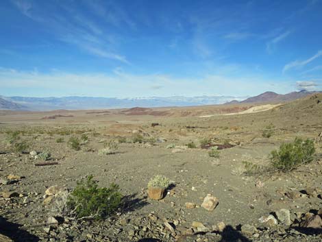 Mining debris and grand views spread out across the landscape |
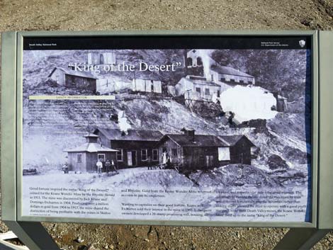
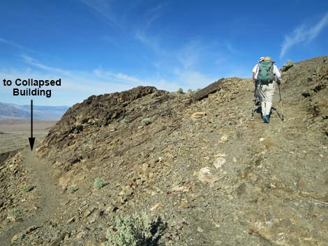
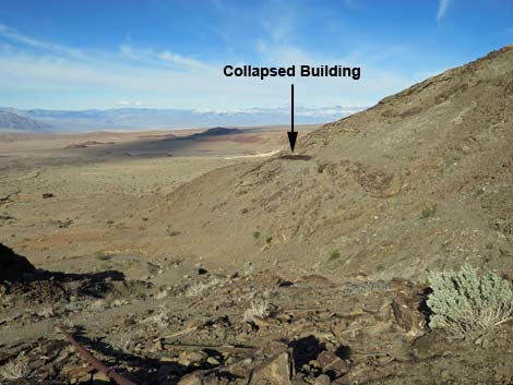
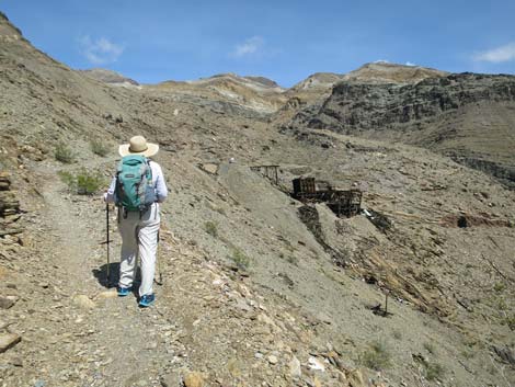
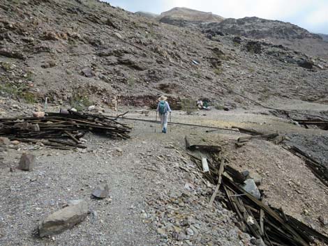
The trail bends to the right and runs northeast to a landing (Wpt. 02) just below the Keane Wonder Mill. Along this section, the trail climbs quickly, giving hikers a good look out across the mine works and toxic muds, plus grand views west across Death Valley. Off to the north, hikers can see a collapsed building in the not-too-far distance. From the landing, a spur trail runs out to the building and wraps around the corner into the next little canyon. On the landing (Wpt. 02), an interpretive sign has a photograph of the Keane Wonder Mill during operation and provides information about the site. The mine (high in the mountains) was discovered in 1903 by Jack Keane and Domingo Etcharren. They sold the mine in 1907, and the new owners built the tramway and 20-stamp mill. The mine was quite productive, producing more than one million dollars in gold by the time it closed in 1917. Hikers are invited to wander into the mill site, but be careful and don't climb on the structures or play in the mine tailings. |
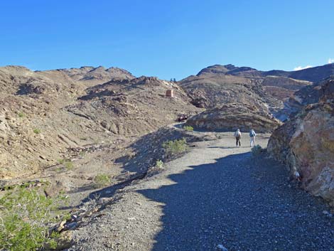 Initially the trail follows the old road to the mill (view NE) |
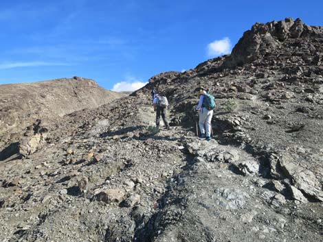
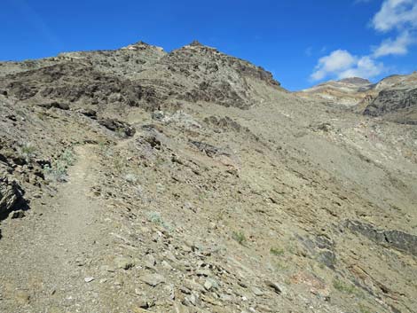
From the landing (Wpt. 02), the trail to the mine backtracks a few yards and turns north where three trails can be seen heading north: one lower, one about level, and one uphill. This route takes the upper of the three trails. The upper trail runs a few yards up to the skyline to another landing (Wpt. 03). Here, hikers can walk out to the edge and enjoy grand views west and south across Death Valley and the historical mining debris spread out below. The collapsed building can be seen off to the northwest. Among the "historical mining debris spread out below" is a water pipe that comes up the steep hillside and is first encountered by hikers on this landing. This pipe was used to pump water all the way to a galvanized water tank at the very top of the mine site, and for the most part, the trail follows this rusty old pipe all the way to the mine. |
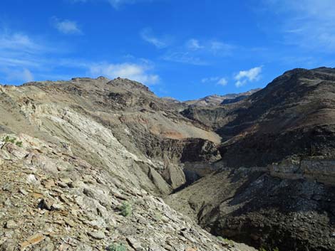
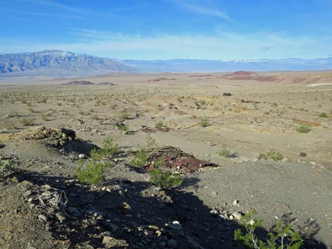 Mining debris and grand views spread out across the landscape |
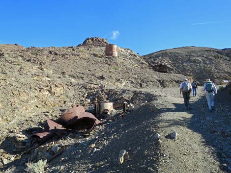
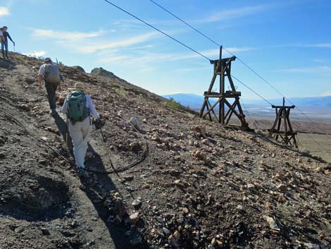
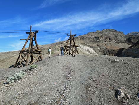
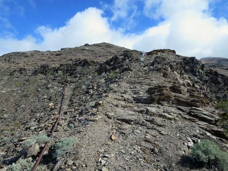
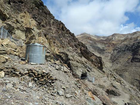
From the landing (Wpt. 03), a large galvanized water tank is visible just ahead up the ridge. The trail turns northeast and begins to switchback up the ridge, passing just left of the tank. A short spur trail (Wpt. 04) leads to the water tank. Past the galvanized tank, the trail continues steeply up the ridge, setting the pace for much of the rest of the hike. Apparently the miners were tough old goats who wanted the quickest (i.e., short and steep) route to the mine. The trail continues to climb steeply along the side of the ridge, and after hikers take a couple of short rest stops, the trail passes two tram towers, bends right to pass under the tram cables and over the water pipe. Notice the curious bends in the pipe. These allow the pipe to expand and contract without damaging the pipe. Finally, the trail arrives at two more tram towers (Wpt. 05). These four are the towers that could be seen from the trailhead parking and the two upper towers are the closest towers to the trail, providing the best opportunity for close examination. |
 Mining debris and grand views spread out across the landscape |
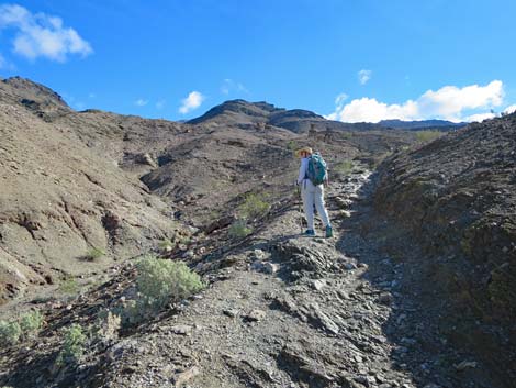
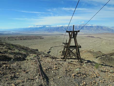
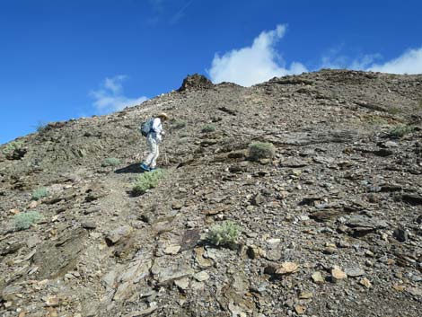
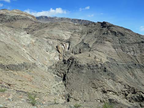
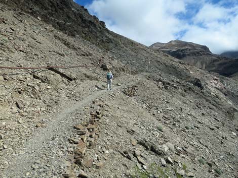
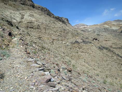
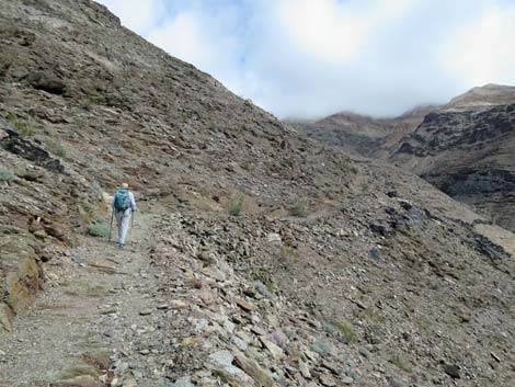
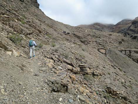
Spur trails here lead south to some diggings, and just to the east is a nice overlook into the canyon on the other side of the ridge. Also across and up the canyon, hikers can see more tram towers, cables linking the towers, and even some ore buckets hanging from the cables. Way far up the canyon, hikers can also see what appears to be the top of the tramway, but alas, it is just a tram tower with a much larger than usual base. Past the towers, the trail turns more due north and continues up the ridge following the old water pipe. Initially the grade is easy, but soon the trail steepens again. Angling up the left side of the ridge, the trail eventually makes a switchback to the right, crosses to the other side of the ridge, and resumes the steep grade. Following between a rock wall on the left and the water pipe on the right, a recent rockfall covered the trail with several large boulders. They can be more easily passed on the outside side of the trail, but as I almost learned, it isn't always worthwhile to take the easy but more dangerous path (the water pipe grabbed my foot). |
 Approaching the landing below the mill (view NE) |
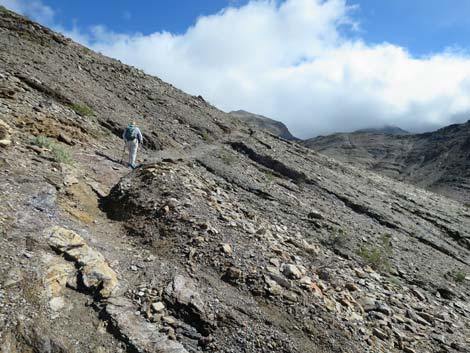
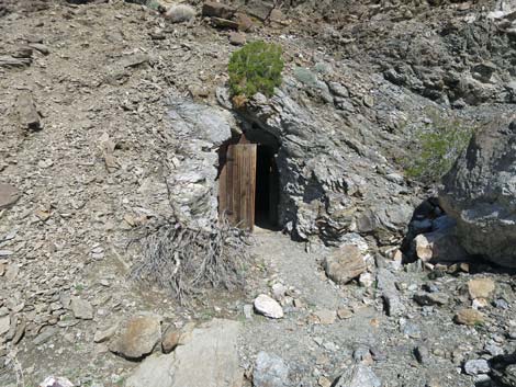
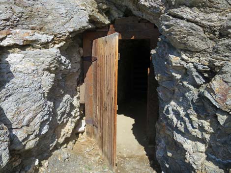
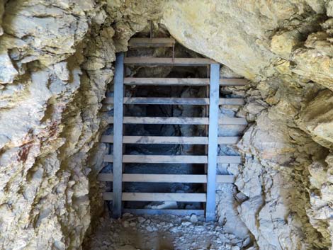
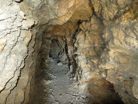
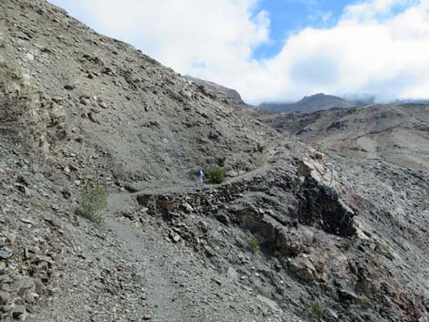
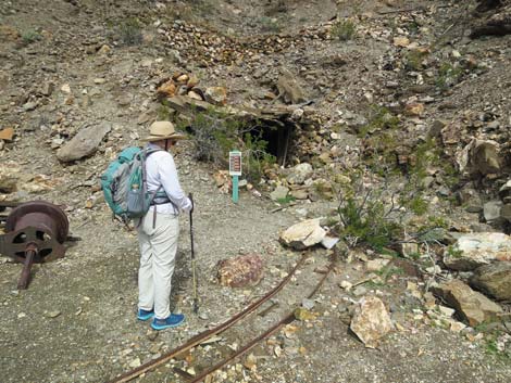
The trail continues very steeply up the rocky ridge (almost trail scrambling), but finally bends to the right and heads east at much more tolerable grades. The trail crosses a gully where flood waters have damaged the trail and quickly arrives at a mine entrance (an adit) on the left with a wooden door. For those who can't resist dark holes in the mountain, open the door and slip inside. While no hole in the ground is safe to enter, this one doesn't seem too bad, and the iron grating keeps wanderers from going too deep. Not far past the wooden-door mine, the trail leaves its trusty guide (the rusty water pipe) and traverses the hillside. The water pipe takes a higher route angling for the top of the mine, while the trail heads more-or-less across the slope heading towards the top of the tramway at the bottom of the mine area. While crossing rocky slopes, the trail forks (Wpt. 07). It would be fairly easy to take the right fork, the more obvious trail, but the right fork leads down into the bottom of the canyon. Staying left on the rocky trail, hikers begin to climb towards the tramway terminus. |
 Arriving at the landing below the mill (view NE) |
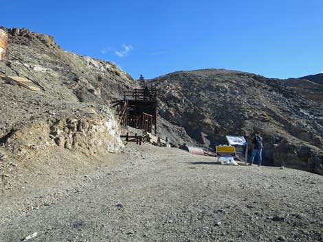
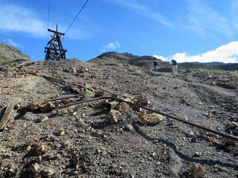
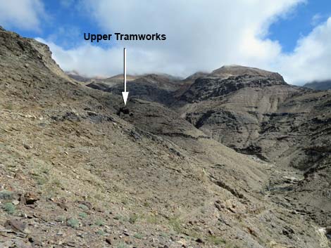
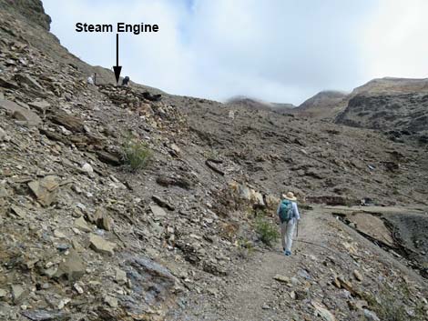
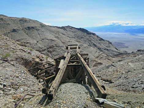
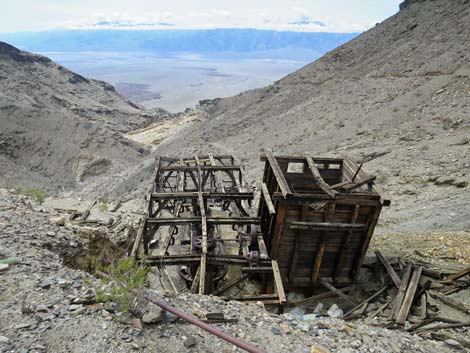
Although the trail keeps climbing towards the wooden structures ahead, given the past grades, the trail here feels like a gentle contour across the hillside. Approaching the mine, the tramway terminus lies below the trail, and the trail is heading towards a flat landing. Notice the rock wall above the trail. This supports a steam engine and spools of cable that were part of the tramway system, although the angles seem to be wrong. Even so, be sure to hike up and see the equipment before leaving. Below the trail, considerable debris lies strewn across the hillsides: collapsed tram towers, collapsed building, lots of miscellaneous mining debris, and tons of old cans (food and drink). Also below the trail are two buildings sitting side by side. The taller, square structure is an ore hopper, and the lower rectangular structure is the actual terminus of the tramway. Finally, the trail runs out onto a landing (Wpt. 08) at the bottom of the mine. Arriving on the landing, there is a collapsed building and another mine opening (an adit that has been grated) on the left, and rock walls and debris scattered about. Also on the landing are ore cart tracks and part of the trestle where the ore carts were run out to the top of the ore hopper. |
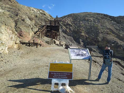 Signs on the landing: interpretive and cautionary (view NE) |
There is no interpretive information here, but this landing (Wpt. 08) likely is the destination for most hikers. Be sure to poke your nose into the adit, visit the steam engine, wander into the terminus structures, and contemplate the lives of the men and women who lived and worked here more than 100 years ago. These would have been our grandparents or great-grandparents. For other hikers, the Keane Wonder Mine stretches up the hillside to the crest of the ridge. The trail to the top starts past the wooden buildings heading southeast towards the crest of the next ridge. At the ridgeline, the trail turns back north and climbs steeply up the ridge. From the top of the mine, ambitions hikers can pick up an old road that contours east into the far back of the canyon to additional mines, and a miner's trail continues west past the top of the mine, up over the ridge, and down the next canyon to the north, passing the Big Bell Mine on the way, to make a big loop back to the trailhead (Wpt. 01). Otherwise, return to the trailhead by following your footprints in the dust back down. |
 Interpretive sign (view NE) |
 Cautionary sign (view NE) |
 Backtracking from the landing below the mill (view NW) |
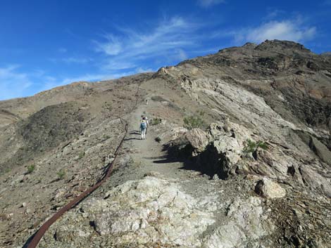
 Taking the high trail towards the skyline (view NW) |
 Hiker on edge of second landing (notice water pipe; view NW) |
 Grand scenery (view SW towards trailhead) |
 Grand scenery (view NW towards collapsed building) |
 Grand scenery (view SSW down Death Valley) |
 The trail follows the water pipe past the galvanized tank (view NE) |
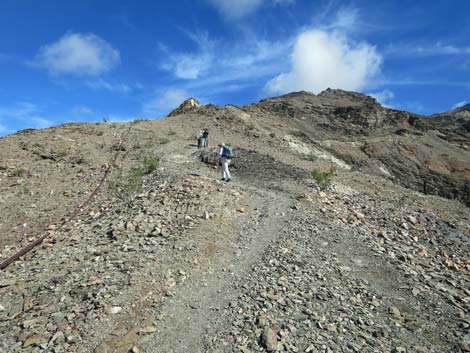
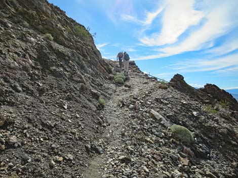
 Hikers on steep trail (view NE) |
 Steep, rocky trail (view NE) |
 Steep, rocky trail (view NE) |
 Steep, rocky trail approaching four tram towers (view NE) |
 Steep trail crossing under the cableway (view S) |
 Curious crook in the water pipe (view NE) |
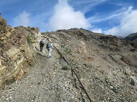
 Water pipe and tramway (view SW) |
 Water pipe and tramway (view NE) |
 Hikers between two tram towers (view N) |
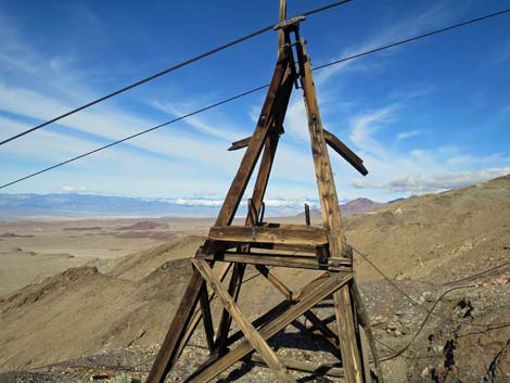 Tram tower with cables (view NW) |
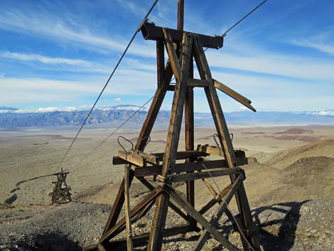 Tram towers with cables (view W) |
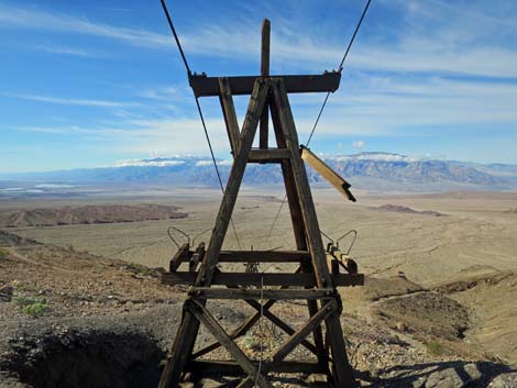 Tram tower with cables (view SW) |
 Hiker continuing past the towers (view N) |
 Apparent tram terminus (view NE) |
 Hikers and water pipe on relatively gentle ridgeline (view N) |
 Hikers and water pipe on steep ridgeline (view N) |
 Hikers at switchback to the right (view N) |
 Steep trail traversing up and around the ridge (view E) |
 Hikers approaching rockfall on the trail (view N) |
 The last steep section of trail (view NE) |
 The last steep section of trail continues (view NE) |
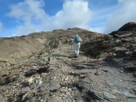
 Hiker near the top of the last steep section (view NE) |
 Hiker at switchback (view N) |
 Although no longer steep, the trail continues to climb (view NE) |
 Although no longer steep, the trail continues to climb (view NE) |
 Although no longer steep, the trail continues to climb (view NE) |
 Tram towers across the canyon (view SE) |
 Although no longer steep, the trail continues to climb (view NE) |
 Gully and washed out section of trail (view NE) |
 Wooden-Door Mine (view N from trail) |
 Wooden-Door Mine (view N) |
 Iron grate blocking human passage inside Wooden-Door Mine |
 Inside the Wooden-Door Mine (view through the grate) |
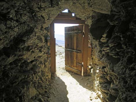 Inside the Wooden-Door Mine (view from the grate) |
 Hike on trail where the trusty guide (water pipe) departs |
 Trail on steep hillside held up by a stone wall (view NE) |
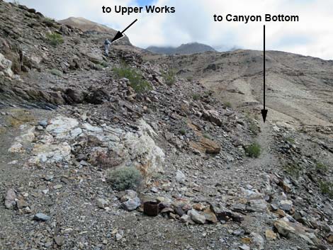 Fork in the trail; stay left (view NE) |
 Big views up the canyon to top of the tramway (view NE) |
 Big views down the canyon (view SW) |
 The trail mostly now runs at moderate grades (view NE) |
 The trail mostly now runs at moderate grades (view NE) |
 The upper end of the tramway is getting closer (view NE) |
 Hiker approaching the Upper Tramworks (view E) |
 Upper Tramworks in the near distance (view E) |
 Hiker on easy trail (view E) |
 Steam engine and cable spools above the trail (view E) |
 Hiker approaching the landing (view E) |
 Considerable mining debris below the trail (view S) |
 Hiker arriving on the landing (view E) |
 Ore cart track and mine opening on the landing (view N) |
 Terminus of the ore cart (view SW) |
 Upper Tramworks below the landing (more photos) |
 Water tank at end of rusty water pipe atop mine site (more photos) |
Table 1. Hiking Coordinates Based on GPS Data (NAD27; UTM Zone 11S). Download Hiking GPS Waypoints (*.gpx) file.
| Wpt. | Location | UTM Easting | UTM Northing | Elevation (ft) | Point-to-Point Distance (mi) | Cumulative Distance (mi) |
|---|---|---|---|---|---|---|
| 01 | Keane Wonder Trailhead | 508074 | 4057836 | 1,306 | 0.00 | 0.00 |
| 02 | Spur Trail to KW Mill | 508186 | 4057985 | 1,403 | 0.13 | 0.13 |
| 03 | Spur Trail to Overlook | 508130 | 4057998 | 1,419 | 0.04 | 0.16 |
| 04 | Spur to Lower Water Tank | 508145 | 4058013 | 1,444 | 0.02 | 0.18 |
| 05 | Tram Towers | 508317 | 4058220 | 1,735 | 0.23 | 0.41 |
| 06 | Wooden Door Mine | 508463 | 4058969 | 2,455 | 0.59 | 1.00 |
| 07 | Fork in the Trail | 508676 | 4059041 | 2,542 | 0.16 | 1.16 |
| 08 | Keane Wonder Upper Tramworks | 508897 | 4059345 | 2,719 | 0.28 | 1.44 |
| 01 | Keane Wonder Trailhead | 508074 | 4057836 | 1,306 | 1.44 | 2.88 |
Happy Hiking! All distances, elevations, and other facts are approximate.
![]() ; Last updated 240324
; Last updated 240324
| Death Valley | Hiking Around Las Vegas | Glossary | Copyright, Conditions, Disclaimer | Home |