Hiking Around Las Vegas, Death Valley National Park
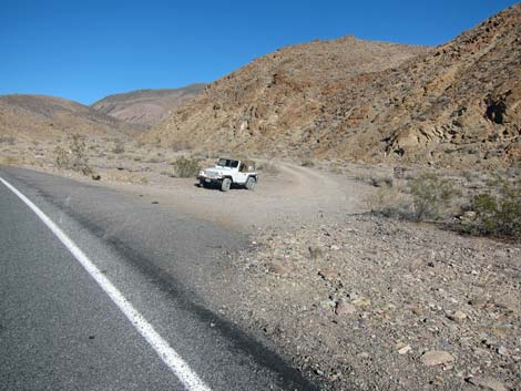
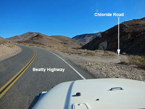 Beatty Highway at Chloride Road (view NE) Beatty Highway at Chloride Road (view NE) |
Overview Chloride Road is an occasionally graded dirt road with some rough spots, and Monarch Road is a two-track with a few rocks and some sandy spots. Together, these two roads provide access to a hike down Monarch Canyon where people can see interesting geology and historical mining structures. Chloride Road departs the pavement (Beatty Highway) and runs southeast over quite rough roads to the mining town of Chloride City. After about 2.3 miles and about 10 minutes, Chloride Road reaches Monarch Wash and turns upstream in the wash. In Monarch Wash, Monarch Road turns right and heads down Monarch Canyon. In about 0.7 miles, the road reaches a high pour-over where the road ends. Monarch Canyon Trail continues down the canyon following a miner's trail. Link to roads map. |
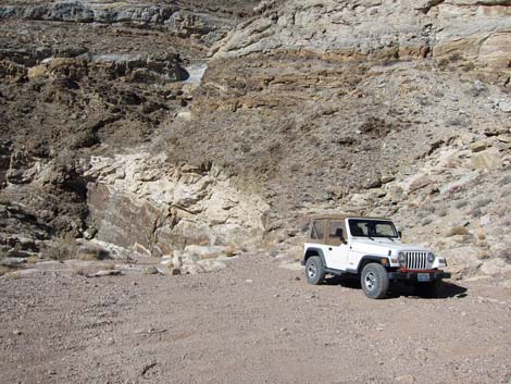
 Beginning of Chloride Road (view NE from Beatty Highway) |
Watch Out Other than the standard warnings about driving in the desert, there are no unusual hazards on these roads, except that Monarch Road ends (without signs) at the top of a high pour-over. Parts of Monarch Road are sandy. While hiking, please respect the land and the other people out there, and try to Leave No Trace of your passage. Also, although these roads are short, the area is remote, so be sure to bring the 10 Essentials. |
 Chloride Road information signs (view NE) |
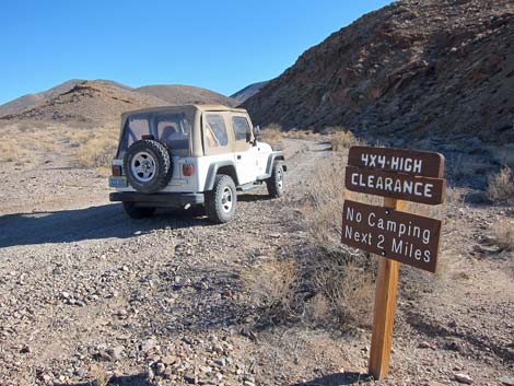
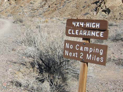
Getting to the Roadhead Chloride Road and Monarch Road are located in Death Valley National Park, about 2 hours northwest of Las Vegas. From town, drive out to Death Valley. From the Furnace Creek Visitor Center (Table 1, Site 0712), drive north on Highway 190 for 10.6 miles to the Beatty Cutoff (Site 0742). Turn northeast (right) towards Beatty, and drive for 9.9 miles to the Hell's Gate parking area (Site 0769), which is at the Y-intersection with the Daylight Pass Road (Hwy 374). From Hell's Gate, drive east towards Beatty for another 3.3 miles to the second dirt road on the south (right) side of the highway (Site 0753). This is the road to Chloride City, but the turnoff is marked by signs simply reading: "4x4 High Clearance" and "No Camping Next 2 Miles." For hikers arriving from Beatty (the shortest way from Las Vegas), the turnoff is 2.7 miles west of Daylight Pass. |
 Chloride Road information signs (view NE) |
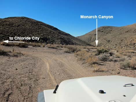
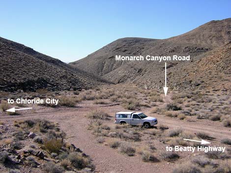
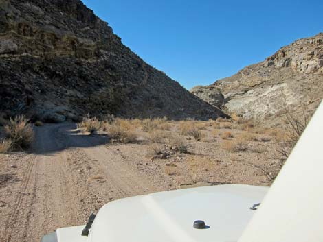
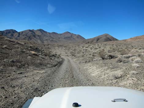
The Road From the pavement (Table 1, Site 0753), the rarely graded Chloride Road runs east up a valley, southeast over a saddle, and then south down the other side into Monarch Wash (Site 0857). The wash is 2.2 miles from the pavement. To this point, the road is fine except for some rocks to drive around and one hole from spinning times on a bump up, but a 2WD-HC vehicle should be fine if the road is dry. In Monarch Wash (Site 0857), the road forks. The main road, Chloride Road, bends left to run northeast up the wash; it is said to be a rough 4WD road. The right fork runs southwest down Monarch Canyon. |
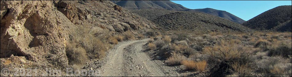
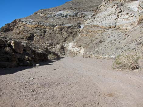
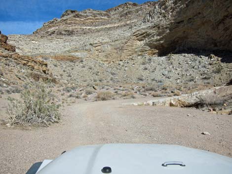
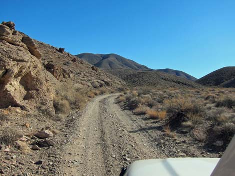 Chloride Road (view NE) |
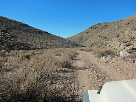
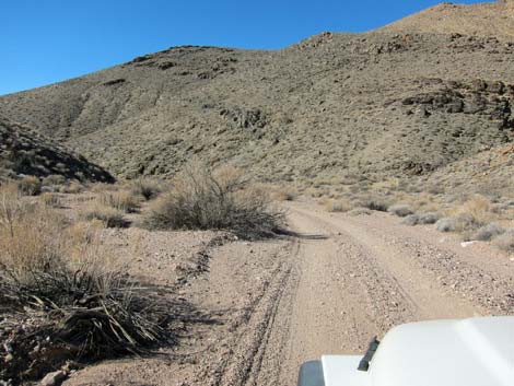
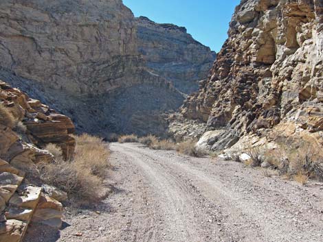
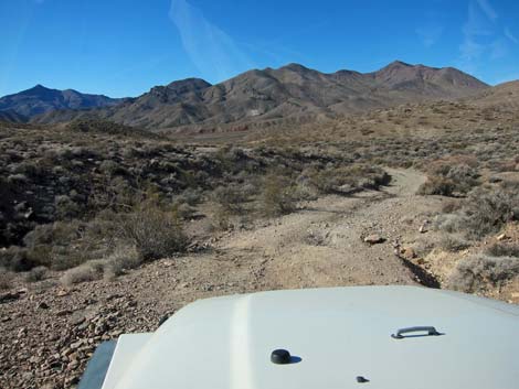
Monarch Canyon Road is a two-track that starts out running runs down the broad Monarch Wash. The canyon quickly begins to narrow and wind back and forth, but generally trending southwest. At about 0.6 miles out, the road follows the wash through a hairpin turn to the right with a few rocks in the road. If your vehicle is not 4WD, inspect the road before driving over the rocks. The road was fine for a 2WD-HC vehicle when I was last there, but driving downhill in a sandy wash is always easier than driving uphill. This rocky spot is a 1-minute walk from the end of the road, so if it looks bad, back up and park; it isn't worth the risk of getting stuck this close to the trailhead and this far from help. Coming out of the hairpin turn, the road bends back to the left and at about 0.7 miles out, ends atop a high pour-over (Site 0725). Don't drive too far or you will go over the edge. |
 Chloride Road (view NE) |
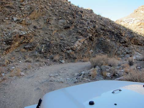
 Chloride Road (view SE) |
 Chloride Road (view SE) |
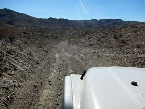 Chloride Road (view SE) |
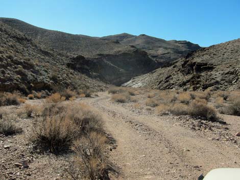
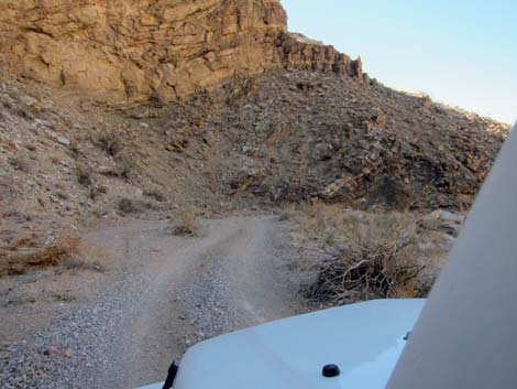
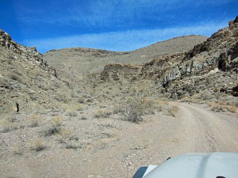
 Chloride Road (view S) |
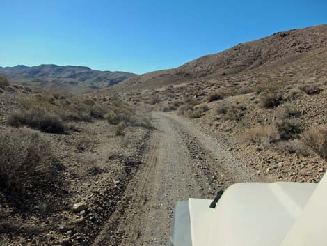 Chloride Road (view S) |
 Chloride Road (view S) |
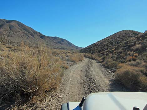
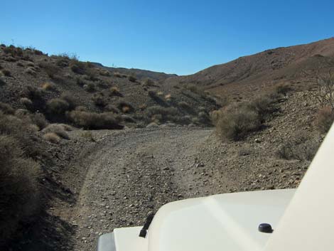
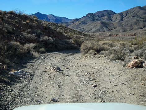
 Chloride Road at Monarch Wash (view S) |
Monarch Road
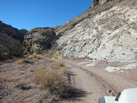
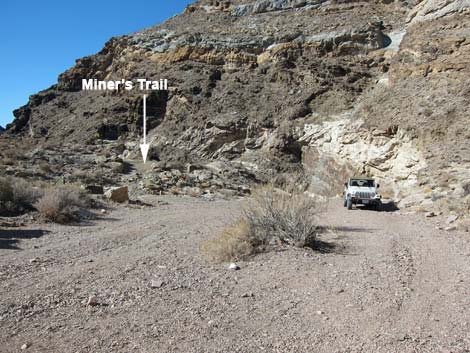
 Chloride City Road at Monarch Canyon Road (view SW) |
 Starting down Monarch Road (view SW) |
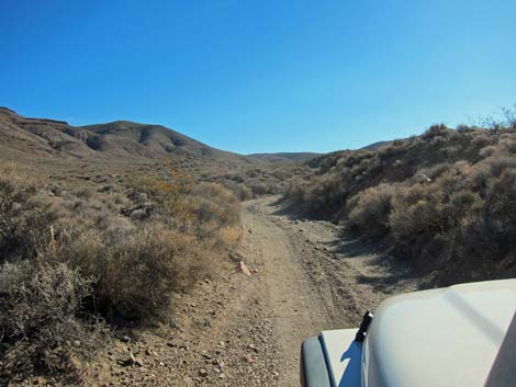
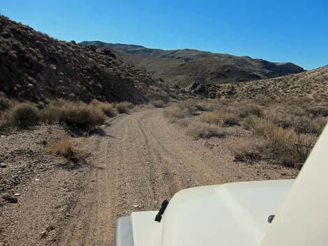
 Monarch Road (view SW) |
 Monarch Road (view S) |
 Monarch Road (view S) |
 Monarch Road (view SW) |
 Monarch Road (view SE) |
 Monarch Road (view S) |
 Monarch Road (view S) |
 Monarch Road (view SW) |
 End of Monarch Road (view SW) |
 Lower trailhead parking in Monarch Wash (view W) |
Returning to the Pavement
 Monarch Road departing the high pour-over (view NE) |
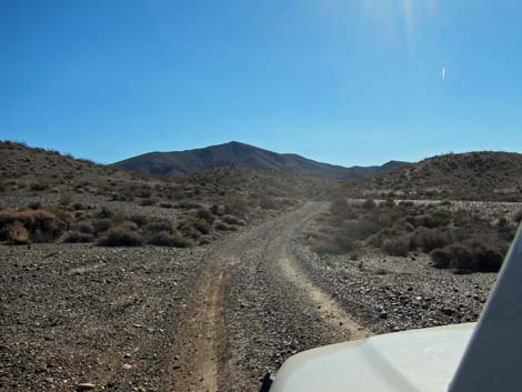
 Monarch Road (view NE) |
 Monarch Road (view N) |
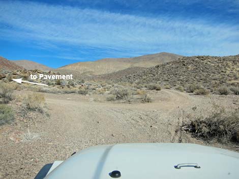 Monarch Road at Chloride Road (view NE) |
 Monarch Road (view NW) |
 Monarch Road (view NW) |
 Monarch Road descending towards Beatty Highway (view NW) |
 Monarch Road back to Beatty Highway (view NE) |
Table 1. Highway Coordinates based on GPS data (NAD27; UTM Zone 11S). Download Highway GPS Waypoints (*.gpx) file.
| Site # | Location | Latitude (N) | Longitude (W) | Easting | Northing | Elevation (ft) | Verified |
|---|---|---|---|---|---|---|---|
| 0712 | Furnace Creek Visitor Center | 36.46159 | 116.86574 | 512030 | 4034954 | -186 | Yes |
| 0725 | Monarch Canyon Parking | 36.72962 | 116.91589 | 507510 | 4064680 | 3,465 | Yes |
| 0742 | Hwy 190 at Beatty Cutoff | 36.58805 | 116.94240 | 505153 | 4048974 | -190 | Yes-2 |
| 0753 | Daylight Pass Rd at Chloride City Rd | 36.75059 | 116.93581 | 505730 | 4067005 | 3,385 | Yes |
| 0769 | Daylight Pass Rd at Beatty Cutoff (Hell's Gate) | 36.72392 | 116.97718 | 502038 | 4064044 | 2,289 | Yes |
| 0857 | Chloride Rd at Monarch Canyon wash | 36.73679 | 116.91169 | 507885 | 4065475 | 3,541 | Yes |
Happy Hiking! All distances, elevations, and other facts are approximate.
![]() ; Last updated 240324
; Last updated 240324
| Death Valley | Hiking Around Las Vegas | Glossary | Copyright, Conditions, Disclaimer | Home |