Hiking Around Las Vegas, Death Valley National Park
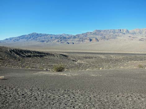
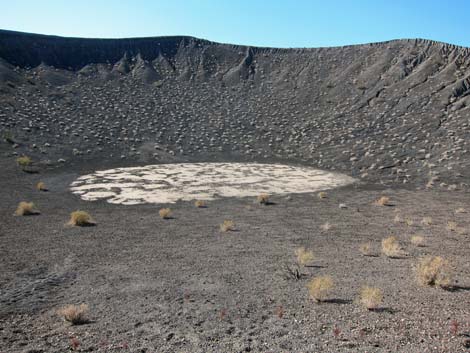
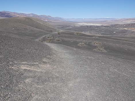
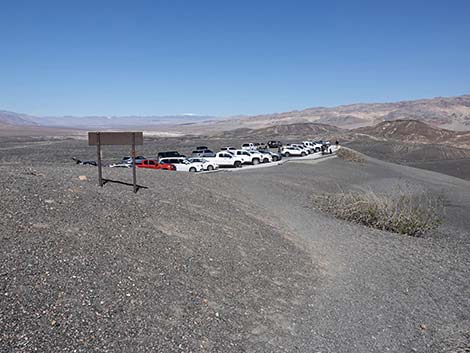
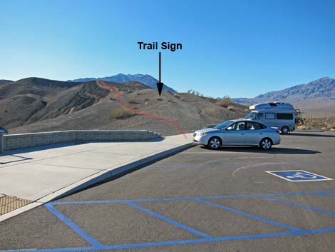 "Big" Ubehebe Crater Trailhead (view SW) |
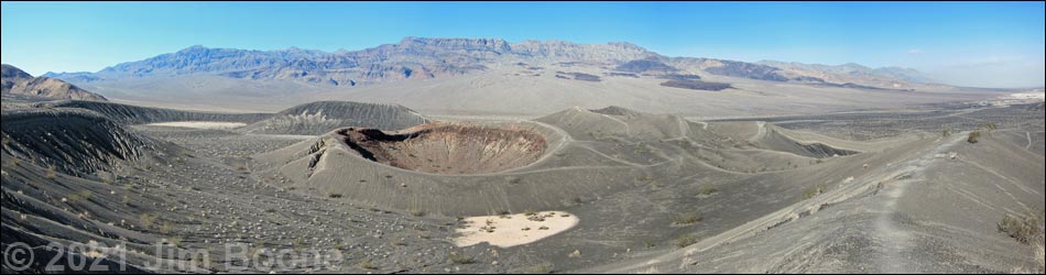
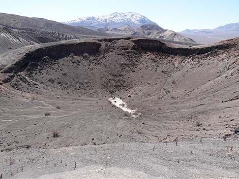
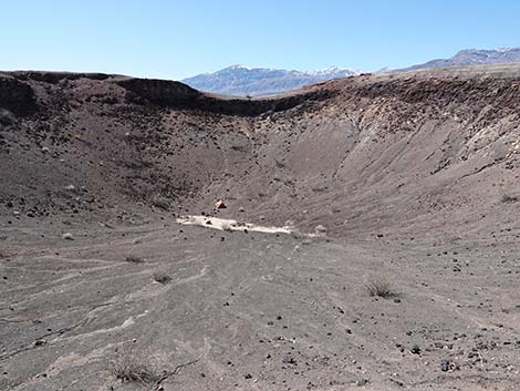
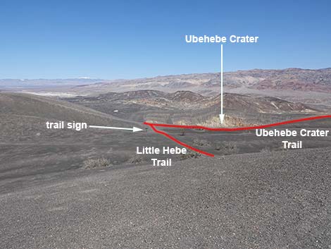
Overview This trail runs out the west side of "Big" Ubehebe Crater for 0.5 miles to Little Hebe Crater, a smaller crater behind Ubehebe crater, both of which are in the Death Valley Wilderness Area. The area is geologically interesting. The craters were formed when this area was volcanically active. Magma was moving towards the surface, and it might have erupted and formed a volcano or a cinder cone, but it encountered groundwater along the way. The hot magma superheated the groundwater, converting it to steam, and blew one giant hole (0.5 miles across) and several smaller holes in the ground. Even if you don't hike the trail, just seeing this place and imagining what it would have been like to see the blast is worth driving over here from the main road. The hike is fairly easy and provides great views of the crater and surrounding area. Link to map. |
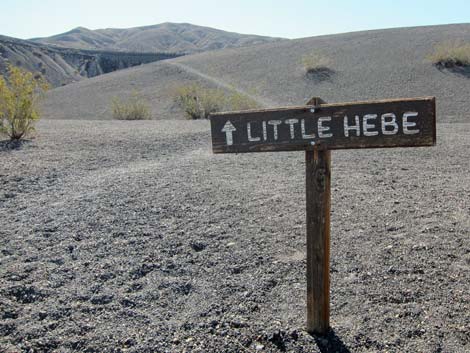
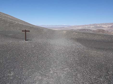
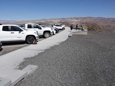
 Little Hebe Crater trailhead sign visible from parking area (view SW) |
Watch Out Other than the standard warnings about hiking in the desert, ...this is a fairly safe hike, but the sides of the crater are steep and loose, and a slip from the trail could make for a long slide into the crater. Stay back from the edge and watch your children. While hiking, please respect the land and the other people out there, and other than footprints in the sand, please try to Leave No Trace of your passage. Also, this hike is fairly short, so just bring what you need of the 10 Essentials. |
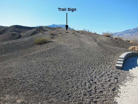
 Little Hebe Crater trailhead sign (view SW) |
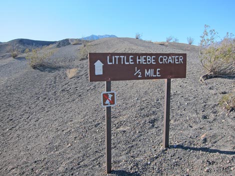
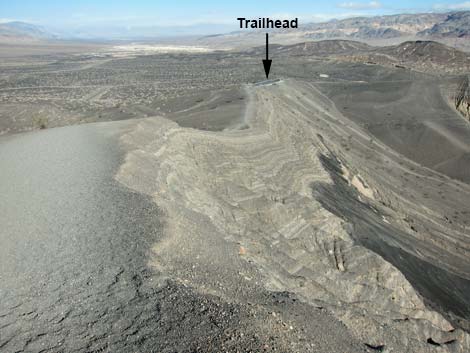
Getting to the Trailhead This hike is located in Death Valley National Park, about 4 hours northwest of Las Vegas. From town, drive out to Death Valley. From the Furnace Creek Visitor Center (Table 1, Site 712), drive north on Highway 190 for 17.4 miles to Scotty's Castle Road (Site 763). Turn right onto Scotty's Castle Road and drive north for about 33 miles to the Grapevine Entrance Station, which is a tollbooth in the middle of the road (with water and restrooms at the nearby ranger station). Continue north for 0.2 miles to Ubehebe Crater Road (Site 754). Turn left (west) onto Ubehebe Crater Road and drive northwest for 6.0 miles to the parking area at Ubehebe Overlook (Site 755). Stop here; this is the trailhead. |
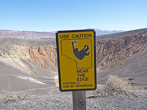 Caution sign: Use caution near the edge (view NE) |
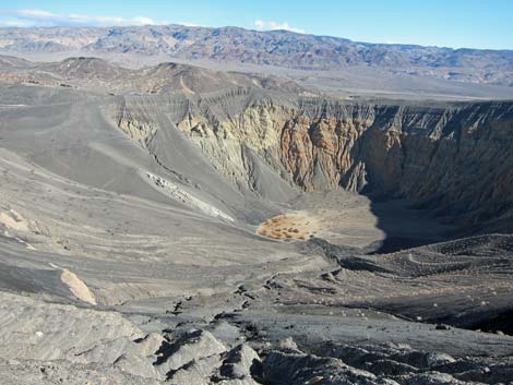
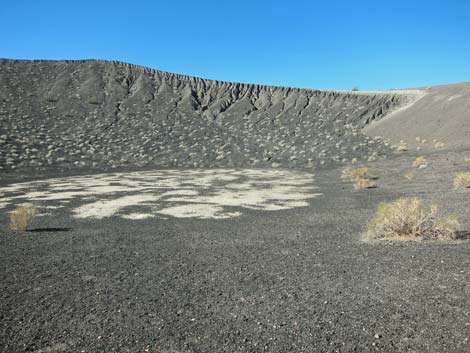
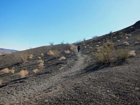
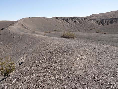
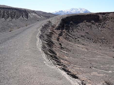
The Hike From the trailhead (Table 2, Waypoint 05), the trail runs south (right) along the rim of the crater. There are great views of the crater and the desert valley beyond from along this side. Despite the loose volcanic soils, the walking is fairly easy. The sparsely vegetated volcanic soils on the rim of the crater are dominated by creosote bush, desert trumpet, desert holly, and sandpaper bush. The soils are loose, so don't walk off trail or across the slopes, as doing so will leave tracks that will last for years. Along the edge of the rim, you can look into the crater and see rocks and sediments of various colors, including black and white banding, red cliffs, and what looks like white sediment from the bottom of the crater that was blasted up onto the side of the crater. There are many pocket gophers up here, and these little guys put white subsoil onto the black surface, giving the ground a speckled appearance in some areas. |
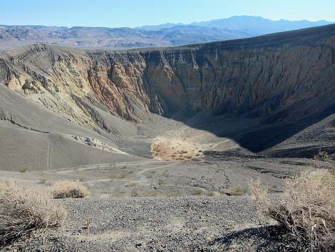 It would be a long tumble into Big Ubehebe Crater (view NE)! |
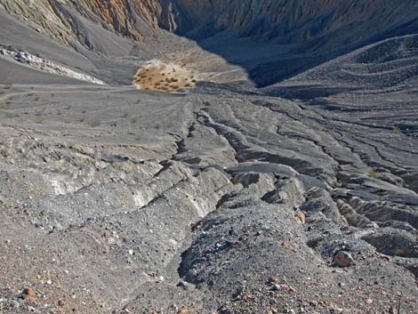
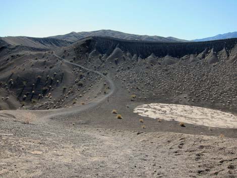
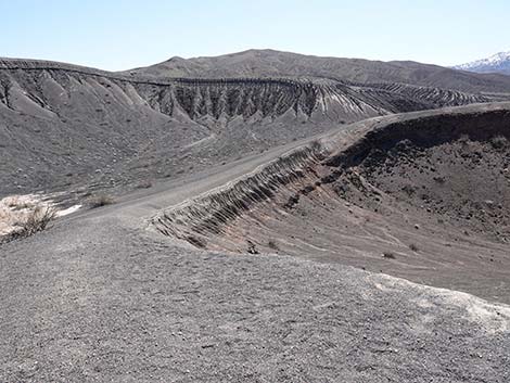
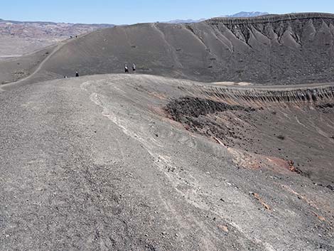
Walking along the rim, there are places where you can see thin layers of dark- and light-colored material, suggesting that there were many volcanic eruptions in this area that threw up clouds of ash and small rocks before Ubehebe blew. The trail runs along the rim and eventually climbs over a little hill (Wpt. 06). At about 0.5 miles out (Wpt. 07), a short spur trail leads (about 1.5 minutes) to the edge of Little Hebe Crater (Wpt. 08). Little Hebe is fairly shallow, and it is an easy scramble down into the bottom. |
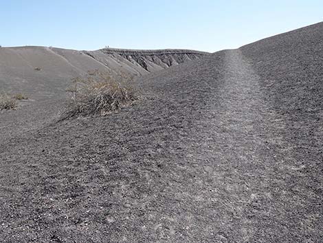
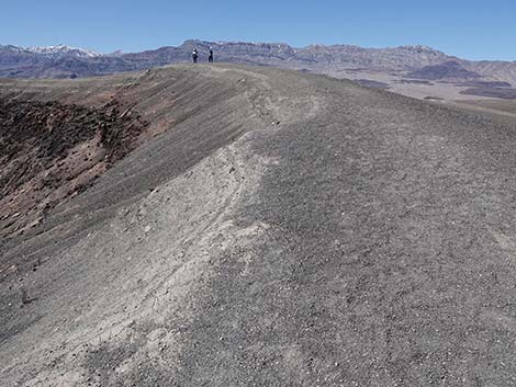
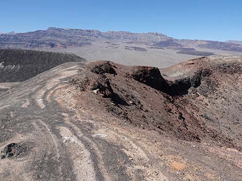
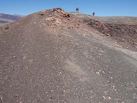
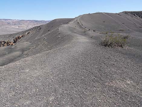
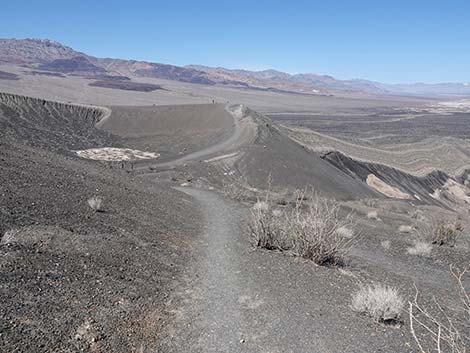
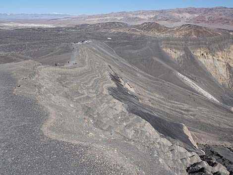
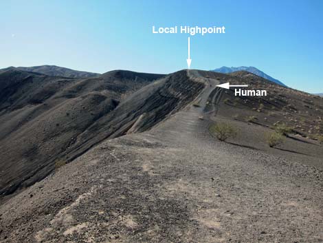 Ubehebe Trail runs on edge of crater to local highpoint (view S) |
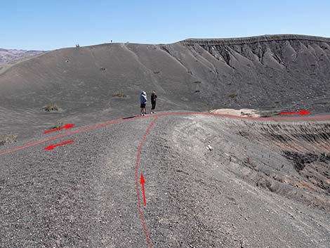
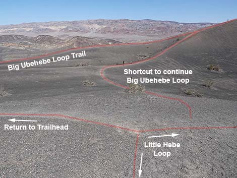
When you are ready to leave Little Hebe Crater, retrace your steps to the main trail and follow your footprints back to the trailhead. Alternatively, continue hiking up and around the main crater for another mile on the Ubehebe Crater Loop Trail. There are better overviews of Little Hebe from that trail than there are from the Little Hebe Trail. There are several trails down into the crater. These trails are steep and loose, and while the direct route down from the parking area might be a good way to get down, getting up that way looks pretty hard. One person, who was having trouble climbing back up that steep route, ended up crawling part way out. An alternative and less steep route out of the crater runs to the west (right on the way out) of the direct route (hits the rim at Wpt. 4). Take a look at this route before you go down so you will know an easier way to get back out. |
 Don't tumble into the crater (view NE)! |
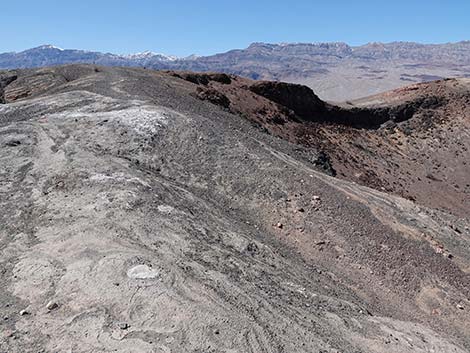
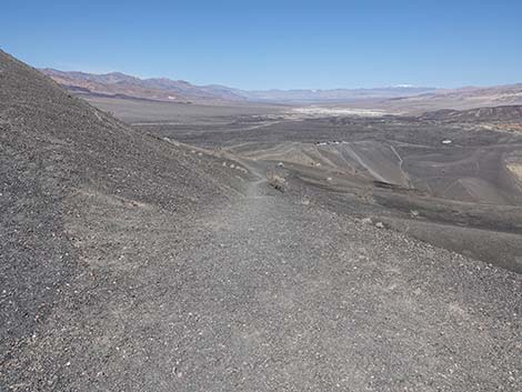
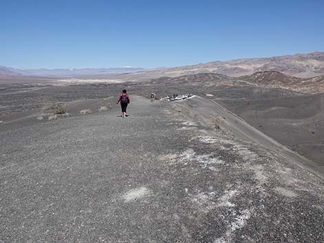
 From crater rim, gentle terrain outside the crater (view W) |
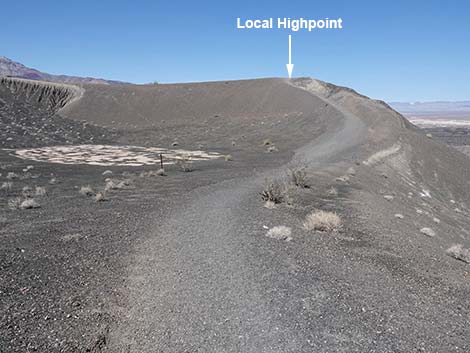
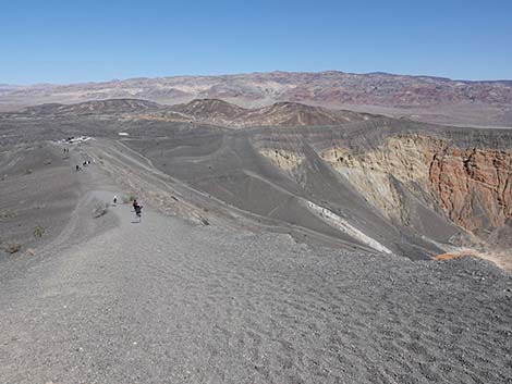
 Looking back from a highpoint: trail runs on lip of the crater (view N) |
 Ubehebe Trail descends from the local highpoint (view S) |
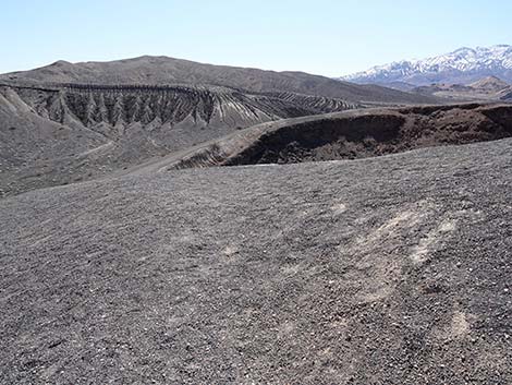
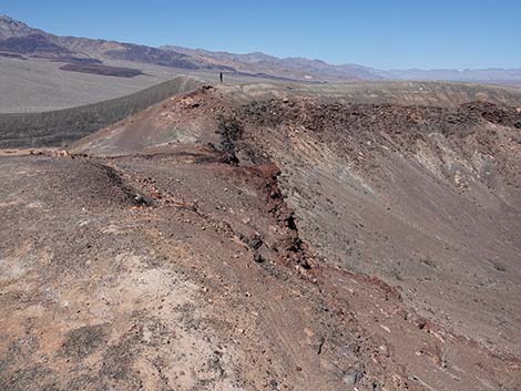
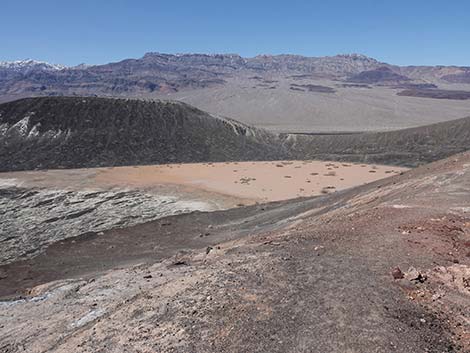
 Grand view into Big Ubehebe Crater (view NE) |
 Big Ubehebe Trail approaching a small crater on the right (view S) |
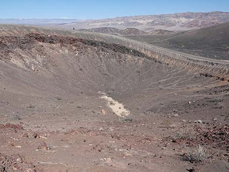
 Mud flat in the bottom of small crater (view SW) |
 Big Ubehebe Trail climbs onto a low ridge (view SE) |
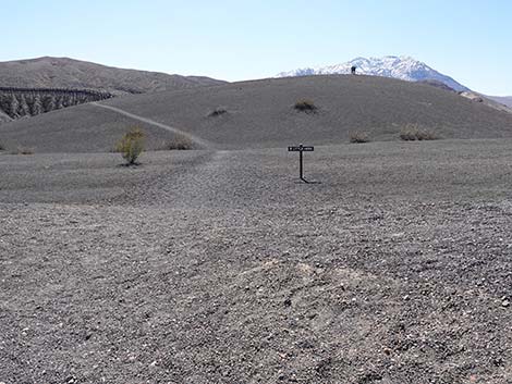 Cresting the low ridge, Little Hebe Trail sign comes into view (view S) |
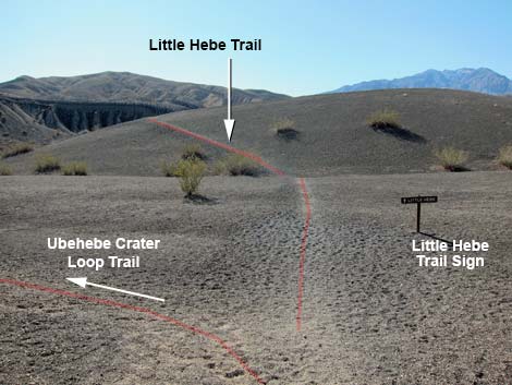 Trail junction: Little Hebe Trail stays right (view S) |
 Big Ubehebe Trail stays left on the edge of main crater (view SE) |
 Trail junction: Little Hebe Trail sign (view S) |
 Little Hebe Trail stays right, away from main crater rim (view S) |
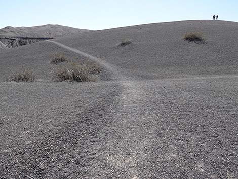
 Little Hebe Trail climbs towards Little Hebe crater rim (view S) |
 Arriving at the edge of Little Hebe Crater (view S) |
 Little Hebe Crater (view S) |
Circling Little Hebe Crater
 Hikers can circle Little Hebe Crater in either direction (view S) |
 Hikers can circle Little Hebe Crater in either direction (view W) |
 Staying left to circle Little Hebe Crater (view S) |
 Little Hebe Crater (view SW) |
 Circling Little Hebe Crater (view SW) |
 Circling Little Hebe Crater (view W) |
 Circling Little Hebe Crater (view NW; note human for scale) |
 Little Hebe Crater (view N; note human for scale) |
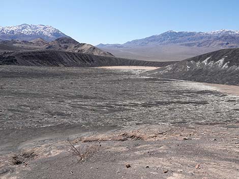 Little Hebe Crater Rim: view out towards next little crater (view SW) |
 Little Hebe Crater Rim: view out towards next little crater (view W) |
 Circling Little Hebe Crater (view N) |
 Looking back: south side of Little Hebe Crater (view SE) |
 Circling Little Hebe Crater (view NE) |
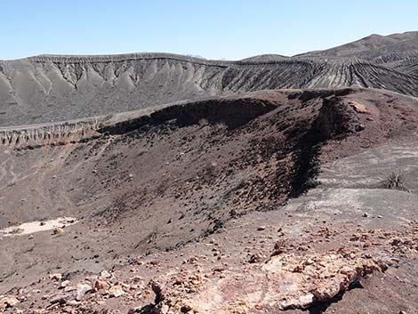
 Crest of Little Hebe Crater (view NE towards Big Ubehebe Crater) |
 Circling Little Hebe Crater (view NE) |
 Circling Little Hebe Crater: closing the loop (view E) |
 Trail junction on lip of Little Hebe (view NE) |
 Departing Little Hebe Crater rim towards the trailhead (view N) |
Returning to the Trailhead
 Approaching Little Hebe sign and Big Ubehebe Trail (view NE) |
 Returning to Big Ubehebe Trail; note hikers on shortcut (view E) |
 Beginning the descent on the Big Ubehebe Trail (view NE) |
 Descending towards the small crater outside the main crater (view N) |
 Approaching small crater and climb to local high point (view N) |
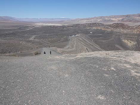 Atop local high point, looking down towards trailhead (view N) |
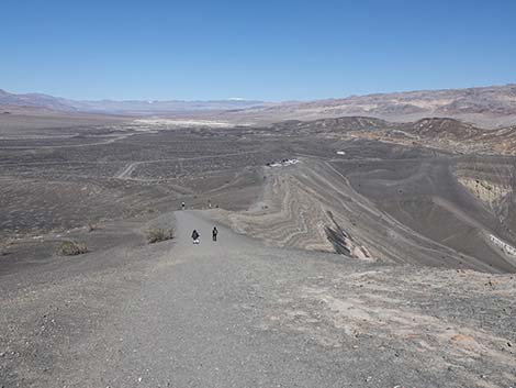 Descending from the local highpoint (view N) |
 Hiking down, it is more obvious that the trail runs on crater lip |
 Continuing down the steep part (view NE) |
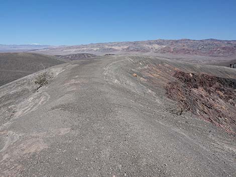
 Descending more gentle terrain towards the trailhead (view NE) |
 Descending the Big Ubehebe Crater Trail (view NE) |
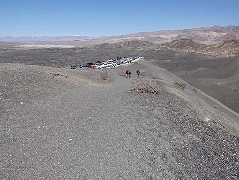
 Big Ubehebe Crater Trail approaching the trailhead (view NE) |
 Big Ubehebe Crater Trail returning to the trailhead (view NE) |
 More to come ... |
Table 1. Highway Coordinates Based on GPS Data (NAD27; UTM Zone 11S). Download Highway GPS Waypoints (*.gpx) file.
| Site # | Location | Latitude (N) | Longitude (W) | Easting | Northing | Elevation (ft) | Verified |
|---|---|---|---|---|---|---|---|
| 0712 | Furnace Creek Visitor Center | 36.46159 | 116.86574 | 512030 | 4034954 | -186 | Yes |
| 0754 | Scotty's Castle Rd at Ubehebe Rd | 36.99863 | 117.36605 | 467429 | 4094580 | 2,292 | Yes |
| 0755 | Ubehebe Crater Parking | 37.01086 | 117.45395 | 459614 | 4095970 | 2,616 | Yes |
| 0763 | Hwy 190 at Scotty's Castle Rd | 36.63910 | 117.03531 | 496843 | 4054636 | 104 | Yes-2 |
Table 2. Hiking Coordinates Based on GPS Data (NAD27, UTM Zone 11S). Download Hiking GPS Waypoints (*.gpx) file.
| Wpt. | Location | Time | Easting | Northing | Elevation (ft) | Verified |
|---|---|---|---|---|---|---|
| 05 | Ubehebe Crater trailhead | 1517 | 459614 | 4095970 | 2,550 | GPS |
| 06 | Little hilltop | 1528 | 459693 | 4095463 | 2,682 | GPS |
| 07 | Trail junction | 1530 | 459828 | 4095358 | 2,756 | GPS |
| 08 | Edge of Little Hebe Crater | 1532 | 459871 | 4095287 | 2,782 | GPS |
Happy Hiking! All distances, elevations, and other facts are approximate.
![]() ; Last updated 240324
; Last updated 240324
| Death Valley | Hiking Around Las Vegas | Glossary | Copyright, Conditions, Disclaimer | Home |