Hiking Around Las Vegas, Desert National Wildlife Refuge
 Trailhead parking (view NW) |
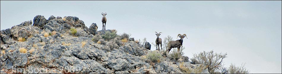
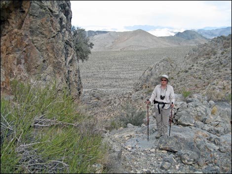
Overview This is a long drive to a short hike, but the bit of history, challenging terrain, grand vistas, scenery at the spring, and the chance to watch wildlife come to drink (including desert bighorn sheep) makes this an interesting site to visit. The route is quite steep, rising at a rate of 2,000 feet per mile, but it is only 1/4 miles to the spring. Climb up here, walk away from the spring, sit back, and enjoy the vistas and wildlife. Link to a map or elevation profile. For general information on camping, regulations, other issues, and the natural history of the Wildlife Refuge, see the Desert National Wildlife Refuge -- Area Overview page. |
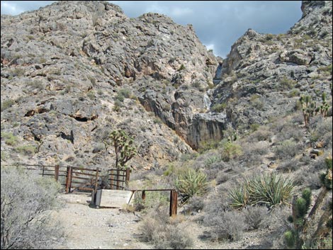 Corral at the end of the road (view NE) |
Watch Out Other than the standard warnings about hiking in the desert, ... parts of this hike are steep and rocky. A bit of rock scrambling is required, but it barely exceeds Class-2. Depending on recent weather conditions, a 2WD-HC vehicle should make it to the trailhead, but call the refuge manager if you have questions. While hiking, please respect the land and the other people out there, and try to Leave No Trace of your passage. Also, even though this hike is fairly short, it is remote, so be sure to bring the 10 Essentials. This is a wildlife refuge, so pay extra attention to respecting the land. Please, don't bother the bighorn sheep. They have a hard enough time making a living in these desert lands; they don't need extra stress from people hanging around the water hole. |
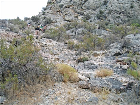
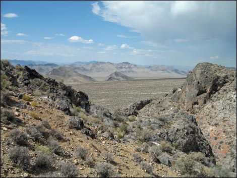
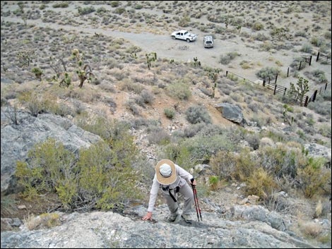 Scrambling up cliffs above trailhead (view W) |
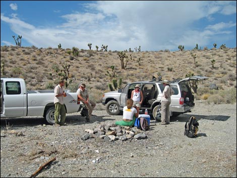
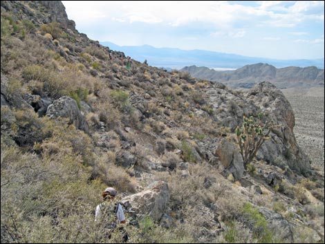
Getting to the Trailhead This hike is located on the Desert National Wildlife Refuge, about 1.5 hours north of town. From town, drive out to Corn Creek Field Station and continue east a few yards to a T-intersection. Turn left onto Alamo Road and drive north for 8.7 miles to Cow Camp Road. Turn right onto Cow Camp Road and drive east towards the mountains. The road runs through a gap in the Black Hills and on towards the base of the Sheep Range. At a fork in the road 5.2 miles out, stay right onto Cow Camp Corral Road and continue eastward for another 0.5 miles to the end of the road at the base of the cliffs. Park here by the old corral; this is the trailhead. The Hike From the trailhead (Table 1, Waypoint 01), the route runs east and up the steep hillside to the south of the rocky gully. Some of this section is steep, but the rock is limestone, the rough texture of which makes it easy to climb. At about the skyline, the route cuts over into the gully, staying above the bottom on the south side. |
 |
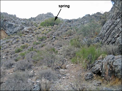
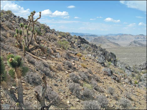
When the cliffs give way to more gently sloping hillsides, the route continues up and slightly to the south, aiming for a very large willow tree high on the hillside. Beneath the willow tree is an old bathtub (Wpt. 02) that is used to contain water piped down a short way from the spring box (Wpt. 03), which is buried at the base of rocks just up the hill and grown over with common reed. This area is entirely within the Upper Sonoran (Mojave Desert Scrub) Life Zone. Common species in this area include Blackbrush, Mormon tea, and lots of threadleaf snakeweed [small-headed matchweed]. Because this hike is so short, you might wander up the hillside to Rye Patch Spring (see map), or just wander over the hillsides. When ready to return to the trailhead, follow the ascent route back down the canyon. However, there are inviting game trails that lead out to the top of the cliffs above the trailhead where grand views are to be had. |
 Atop the cliffs (view NW) |
 Easier terrain leading to the spring and willow tree (view SE) |
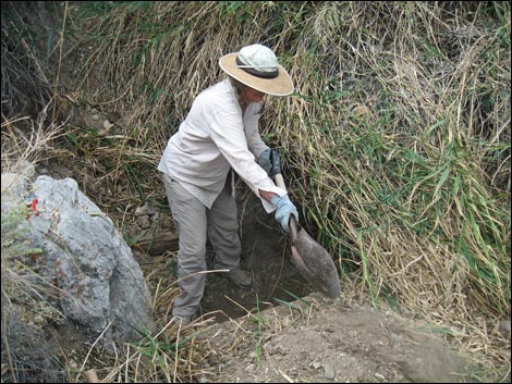 Cleaning out the springbox |
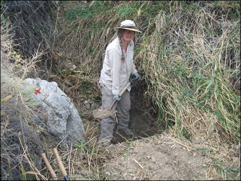 Cleaning out the springbox |
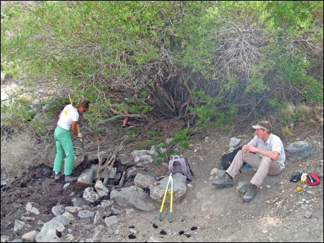 Rehabilitating the guzzler (view E) |
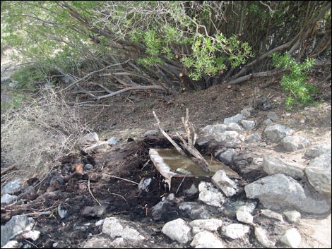 Rehabilitated guzzler (view E) |
 View up the hillside above the spring (view SE) |
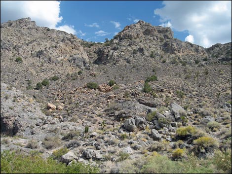
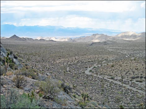
 View out across the desert (view NW) |
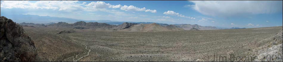
Indeed, sit back and enjoy the view!
Descending from the Spring
 |
 |
 |
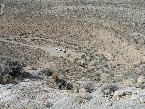 |
Table 1. Hiking Coordinates Based on GPS Data (NAD27, UTM Zone 11S). Download Hiking GPS Waypoints (*.gpx) file.
| Wpt. | Location | Easting | Northing | Elevation (ft) | Point-to-Point Distance (mi) | Cumulative Distance (mi) | Verified |
|---|---|---|---|---|---|---|---|
| 01 | Trailhead | 651250 | 4049944 | 5,239 | 0.00 | 0.00 | GPS |
| 02 | Cow Camp Spring (tub) | 651529 | 4049838 | 5,689 | 0.26 | 0.27 | GPS |
| 03 | Cow Camp Spring (spring box) | 651536 | 4049816 | 5,741 | 0.01 | 0.28 | GPS |
| 01 | Trailhead | 651250 | 4049944 | 5,239 | 0.27 | 0.55 | GPS |
Happy Hiking! All distances, elevations, and other facts are approximate.
![]() ; Last updated 240324
; Last updated 240324
| Hiking Around DNWR | Hiking Around Las Vegas | Glossary | Copyright, Conditions, Disclaimer | Home |