Hiking Around Las Vegas, Grand Canyon National Park
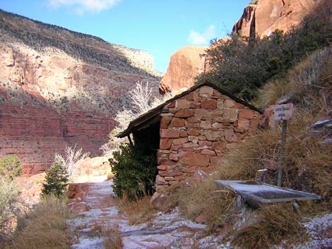
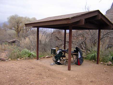
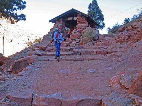
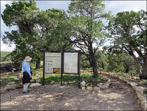 Hermit trailhead information sign (view SW) |
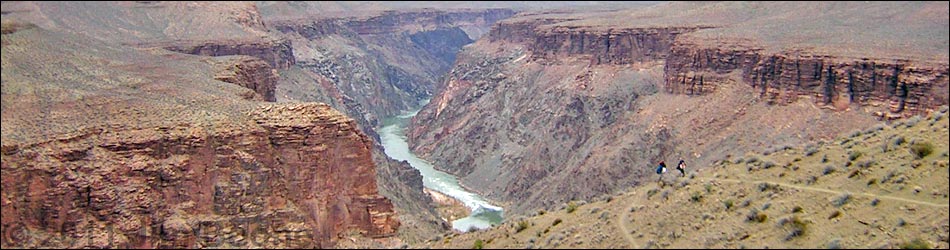
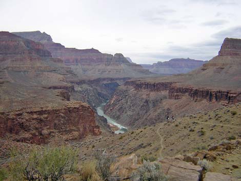
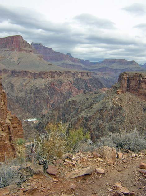
Overview The Tonto Trail is a truly spectacular hike that runs some 80 miles on the Tonto Platform from near Desert View in the east to Bass Canyon in the west. The trail runs in and out of every side canyon along the way, and although there is little overall elevation change, there is a tremendous amount of up and down. There are many great views of the Inner Gorge, the Colorado River, and the towering canyon walls. This 27-mile loop starts at Hermits Rest on the South Rim and runs down the Hermit Trail to the Tonto West Trail. From there, it runs east on a 14.5-mile segment of the Tonto West Trail to Havasupai Garden. Finally, the route returns to South Rim Village via the Bright Angel Trail. The Loop winds around three major side canyons, but with one notable exception (the 15-minute climb out of Monument Creek), this segment of the Tonto Trail is delightfully easy. Link to map. |
 |
Backpackers do this loop as a 3- or 4-day trip. Including Hermit Camp (which is slightly off-route), there are six designated backcountry campgrounds and several places with permanent water. The route is described from west to east, the way I hiked it, which seems to be a good direction for the loop trip because the Bright Angel is an easy trail to hike up. The loop is a popular, so plan ahead and make backcountry reservations early. The Tonto Trail has a reputation for being difficult and obscure. This is true for western and eastern portions of the Tonto, but the segment from Hermit Camp to Havasupai Garden generally is wide, gentle, and easy to follow; not once on this segment did I stop and look for the trail, only to realize that I was still standing on it. |
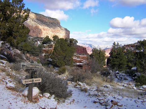 Waldron Basin at Hermit-Boucher junction (view NW) |
Watch Out Other than the standard warnings about hiking in the desert, ...this is a fairly safe trail, although there are many places where hikers could stumble off the trail and fall into the abyss never be seen again. Some parts of the Tonto Trail are little used, obscure, and hard to follow, but not this segment; here the trail generally is wide, flat, and well defined; however, just east of the Hermit-Tonto trail junction, an unusually narrow section of trail cuts across a steep dirt slope that could be slippery if wet, and if it were slippery, it could be treacherous. Permanent drinking water is available in a few places, but ask the rangers about seasonal water sources. Plan to carry plenty of water just in case the next water hole is dry. Also, there is an old uranium mine (now closed) in the upper reaches of Horn Canyon that has contaminated the water in Horn Creek -- play it safe and don't drink from Horn Creek. While hiking, please respect the land and the other people out there, and please try to Leave No Trace of your passage. This is a long hike, so be sure to bring the 10 Essentials. Make sure this route of the appropriate difficulty for your skills. |
 Santa Maria Spring and rest house (view N) |
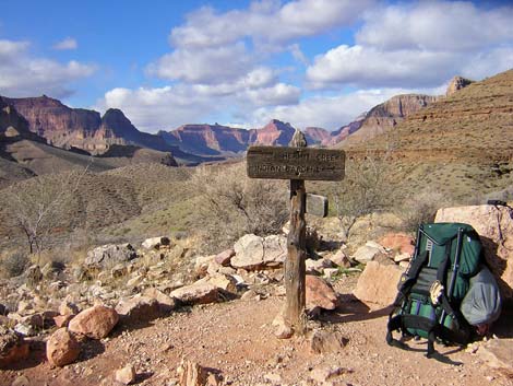
Getting to the Trailhead This hike is located on the South Rim of the Grand Canyon, about 5 hours southeast of Las Vegas. From Las Vegas, drive out to the South Rim of Grand Canyon National Park. The trailhead for this segment of the Tonto Trail is another trail, either the Hermit Trail or the Bright Angel Trail, depending on which way you hike this segment. From the South Rim Visitor Center (Table 1, Site 811), ride the shuttle bus or drive to the Bright Angel trailhead (Site 0814) or the Hermit trailhead (Site 0815). For details of the trailheads, see those trail descriptions. |
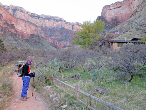
 Hermit-Tonto trail junction (view W) |
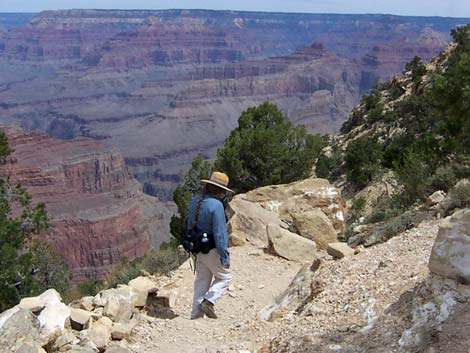
The Hike Hermits Rest Trailhead to Tonto Trail -- 5.8 miles (for details, see Hermit Trail) From Hermits Rest Trailhead (Table 2, Waypoint H-01), the Hermit Trail switchbacks quickly down through the Kaibab Limestone. This part of the trail is steep and rocky, but the pinyon-juniper forest provides shade. Below the Kaibab Limestone, the trail passes the Toroweap Formation and comes to the Coconino Sandstone. In the lower Coconino (1.1 miles out), just above the bottom of the canyon, there are fossilized reptile tracks (Wpt. H-02) in sandstone slabs adjacent to the trail. Don't step on the fossils because it will cause them to erode more quickly. The Hermit Trail drops into the Hermit Shale at Waldron Basin, a fairly broad, open, and well-vegetated basin in the bottom of Hermit Canyon. The trail hits the bottom of the canyon and runs downhill along the wash. After hiking through the cliffs, this area feels quite forested. About 10 minutes below the fossil tracks, the Waldron Trail forks to the right and heads south up the canyon. |
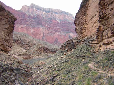
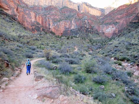
 Looking back: Tonto Trail beyond the Hermit Creek drainage (view SW) |
About 0.25 miles beyond the Waldron Trail junction, the Dripping Springs-Boucher Trail forks to the southwest (Wpt H-03). The Hermit Trail continues down the bottom of the canyon to arrive at a pour-over with a great view down Hermit Canyon. The trail runs down a few switchbacks and continues north on the side of Hermit Canyon. About 0.5 miles below the trail junction, the Hermit Trail arrives at Santa Maria Spring (Wpt. H-04), a stone resthouse at the spring with benches, shade, and a restroom (below the trail). Beyond Santa Maria, the Hermit Trail runs along the Supai Formation for about 3.3 miles, staying atop the Redwall until arriving at the Cathedral Stairs, a steep break in the Redwall (Wpt. H-05). The Cathedral Stairs is a set of many steep, short switchbacks with spectacular views down the hillside and out into the canyon. It takes about 20 minutes to descend through the Redwall. Below the Cathedral Stairs, the Hermit Trail runs straight and steeply down across the west side of Cope Butte to a final set of switchbacks and drop onto the Tonto Platform and the Tonto West Trail (Wpt. T-16). |
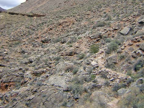
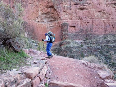
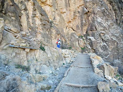
 Narrow trail on steep slope wet of Hermit Canyon (view E) |
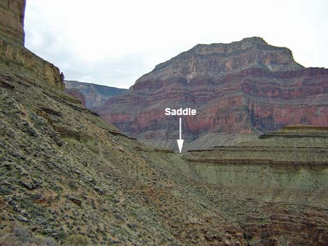
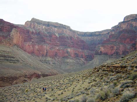
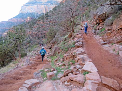
Hermit-Tonto Trail Junction to Monument Creek -- 2.3 miles From the Hermit-Tonto West trail junction, it is about 2 hours to Monument Creek, the first water source and legal camping area to the east. Note that if you started the day hiking down the Hermit Trail, you've already hiked 5.8 miles to this point, and if you started at Hermit Creek campground, you've already hiked 1.5 miles. From the Hermit-Tonto West junction (Wpt. T-16; 1116 hrs), the trail runs north at moderate grade for about 5 minutes to a saddle with a nice view of Hermit Rapids on the Colorado River [1121 hrs]. This is a good place to look back up at the Cathedral Stairs, but the view makes one wonder how a trail came down it. From the saddle, the trail leaves the Hermit Creek drainage and drops at a fair grade across a steep sidehill beneath the north face of Cope Butte. Here, the trail runs on a narrow, out-sloping, dirt tread. It takes about 25 minutes to cross this exciting bit of trail and climb onto the next saddle (Wpt. T-15; 1145 hrs), which is on the main ridge below Cope Butte. If you are running late, there is a nice illegal campsite just west of the saddle. |
 Looking back at hikers climbing towards ridge that divides Hermit and Monument Creek drainages (view W) |
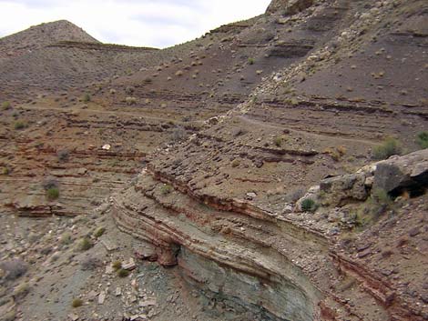
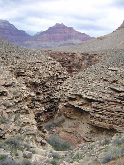
From the saddle [1156 hrs], the trail crosses into the Monument Canyon drainage and runs more-or-less straight down the slope to the rim of Monument Canyon [1200 hrs]. From the edge of the cliffs, which have a great view of the canyon and the rim, the rocky trail turns south and runs across a steep sidehill and in and out of little side canyons with steep, but short, bits of up and down [1209 hrs]. This is followed by a short bit of nice trail that runs into the back of a side canyon. The trail then drops off the Tonto Platform and makes a steep, rocky descent through the Tapeats Sandstone to the bottom of the side canyon [1230 hrs]. As the trail drops into the side canyon, it degrades into a steep, washed-out rubble field with lots of boulders to work around, but it only takes a few minutes to get to the wash at the bottom [1236 hrs]. For hikers heading west, hike up the side canyon until just before several huge boulders that block the wash. At that point, cairns mark the route up the north side of the canyon; it doesn't look like a trail. Heading east, there is a real trail all the way down the side canyon and up to the campground, so you don't have to boulder-hop down the wash (although there is a cairn trail in the wash). |
 Same hikers starting into Monument Canyon (view SE) |
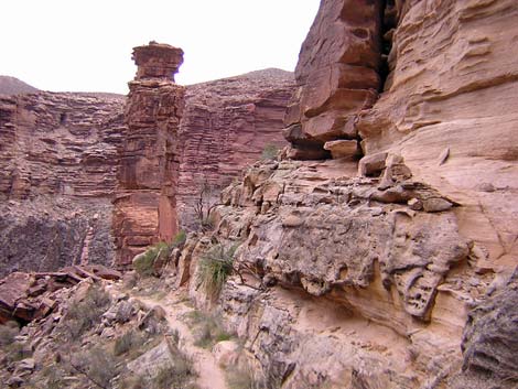
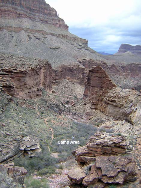
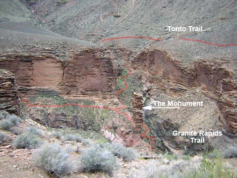
The trail runs down the side canyon and reaches Monument Canyon at "the Monument," a 200-foot high, freestanding pillar of Tapeats Sandstone [1248 hrs]. There is a species of yucca growing along this section that I didn't see elsewhere on the Tonto Trail (probably Sacahuista, Nolina microcarpa). The Monument marks that start of the Granite Rapids Trail. This trail runs for about 1.5 miles to the Colorado River. I've not hiked this trail, but campers at Monument Creek said that it is a nice walk. From the Monument, the trail turns south and runs up along the west side of Monument Canyon beneath highly sculpted Tapeats Sandstone cliffs. It takes only a few minutes on an easy trail to get to the campground (Wpt. T-14; 1253 hrs). The trail enters the north end of the campground by a 2-seat outhouse. The campground stretches up the canyon for a few minutes walk from there. The camp area is in a mesquite thicket, but the north end burned, so sites there are in full sun while others are sheltered under the trees. The southern-most campsite is located under a large rock overhang on the west side of the creek. Water is available from springs in the creek bed just downstream from the campground. |
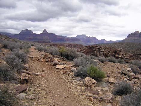
 The trail and scenery (view NE) |
The campground is in a narrow gorge below the Tonto Platform and the views down the canyon are limited. However, there are nice views of the Redwall Limestone cliffs and Mohave Point, and the sculpted Tapeats Sandstone is quite interesting. Also, just below the springs, the creek flows out of the Tapeats Sandstone and into a narrow, water polished, gorge in the Vishnu Schist, which is quite pretty. The polished rocks are not slippery, and scrambling a short way down the canyon is easy. Monument Creek to Cedar Spring -- 1.3 miles From Monument Creek (Wpt. T-14), it is about 45 minutes to Cedar Spring, the next water source and camping area to the east. Except for getting out of Monument Canyon, this segment of the trail is quick and easy and has nice views up to Mohave Point. The trail to the east starts at the south end of Monument Creek Campground [0649 hrs]. The trail crosses the wash at the upstream end of the camp area and starts into a shallow side canyon. About 20 feet beyond the edge of the wash, a good trail turns to the south and cuts up the south side of the side canyon. The trail runs up a number of short, steep, rocky switchbacks as it climbs through the Tapeats Sandstone cliffs and quickly gets back onto the Tonto Platform [0706 hrs]. Above cliffs, the trail turns and runs north towards the river. After running along the contour, the trail turns east and runs up a shallow side canyon to a saddle with nice views. The trail then runs out to another higher saddle (Wpt. T-13; 0726 hrs). This part of the trail is a little steep, but not bad, and it begins to turn to the north side of Mohave Point. |
 The Monument at Monument Creek (view E from side canyon) |
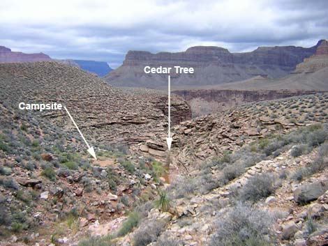
From the higher saddle (Wpt. T-13), the trail runs along the hillside to Cedar Spring (Wpt. T-12; 0734 hrs). Heading east, nothing (not even the cedar tree) is obvious until the campground sign. The cedar tree is located down the wash at the top edge of the Tapeats Sandstone cliffs, and water runs over the rocks at the edge. There are small campsites just below the trail, and there is a larger campsite on the west side of the wash near the tree. Two use-trails run up the hill above the trail, so there might be campsites up there too. Cedar Spring to Salt Creek -- 2.1 miles From Cedar Spring, it is about 1 hour to Salt Creek, the next water source and camping area to the east. This segment of the trail is fast, wide, and easy, and the views above and below the trail are truly spectacular. |
 Monument Creek campground area in bottom of canyon (view SE) |
From Cedar Spring (Wpt. T-12; 0734 hrs), an easy trail runs to the east over a low ridge and into the next side canyon [0745 hrs] where the marks of a recent flash flood dramatically show the power of fast-moving water. From the side canyon, the trail runs northeast on a cliffy section to a point on a ridge overlooking the river (Wpt. T-11; 0801 hrs). There are awesome views from edge of cliffs straight down to the Colorado River from here. A few minutes farther, the trail turns a corner to the southeast and starts into the Salt Canyon drainage system [0806 hrs]. For much of the way, the trail runs along the edge of the Tapeats Sandstone cliffs, and there are more spectacular views. After winding around a shallow side canyon, the trail arrives at a trail junction leading to Salt Creek Campground [0828 hrs]. The campsites are a short distance farther up the canyon, uphill from the Tonto Trail. There is a pit toilet, which is a seat with a grand view (no walls). From the trail junction, the Tonto Trail drops at a moderate grade into Salt Creek on a trail (Wpt. T-10), then climbs back out on an easy ramp. |
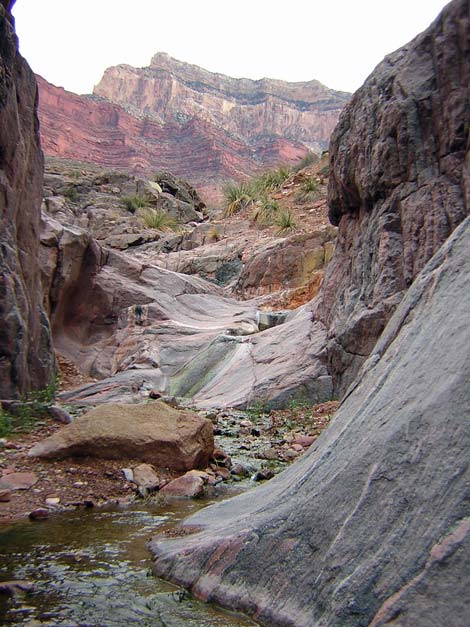 Monument Creek as it starts into the Vishnu Schist (view SE) |
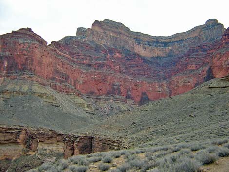
From the top of the cliffs east of Monument Creek to the back of Salt Canyon, the trail is easy, fast, and wide, but with a few rocky spots. The back of Salt Canyon is quite spectacular. The Redwall limestone cliffs above the trail are very red, close in, and wrap around to form a big cirque with Mohave Point on the west and Hopi Point on the east. This area, "the Inferno," is well named by the red walls, and I can imagine that during summer, the color only adds to the temperature. The white sandstone cliffs and the green ponderosa pine trees above the Redwall accent the red color. Salt Creek to Horn Creek -- 4.8 miles From Salt Creek, it is about 2.5 hours to Horn Creek, the next camping area to the east. There is no drinkable water along this segment or at Horn Creek. This segment of the Tonto Trail loops around Dana Butte, which is on the ridge below Hopi Point. As before, this segment of the trail is fast, wide, and easy, with many grand views above and below the trail. From the junction of the trail to Salt Creek Campground [0828 hrs], which is on the west edge of the Salt Creek gorge, the Tonto Trail turns east and switchbacks at a moderate grade down through the Tapeats Sandstone on a good trail to the bottom of Salt Canyon (Wpt. T-10; 0832 hrs). The trail then turns north and climbs back out of the gorge on an easy ramp to regain the top of the Tonto Platform [0836 hrs]. The trail here is good, and this is one of the easiest major crossings along the Tonto West Trail. The trail continues running generally northeastward, winding in and out of three side canyons: turning into the first [0844 hrs], crossing the back of the second [0850 hrs], and in the back of the third [0900 hrs]. Along here, the good but a bit rocky, trail runs high across the slope. Coming out of the last side canyon, there are nice cliffy sections with great views into the Inner Gorge, but the river isn't visible. |
 Monument Creek campground (view NW atop cliffs) |
The trail then begins to turn out of the Salt Creek drainage system. Just before the point, there are some awesome views down the river [0925 hrs]; and out on the point, hikers get more of that "same old grand view down the river" (Wpt T-09; 0927 hrs). On the saddle below the northwest toe of Dana Butte, there is an illegal campsite where people caught out late can safely spend the night [0934 hrs]. The trail continues eastward and climbs to the next saddle, which is out under the northeast toe of Dana Point [0945 hrs]. This is the high point on the trail between Salt and Horn creeks, and it provides more spectacular views to the east. The last bit up to the saddle is a fair uphill run on a rocky trail, but it is still pretty easy. From the saddle, the trail runs straight down the hillside to the southeast in a rocky erosion gully. Just east of the saddle, there is another nice point with an illegal campsite [0951 hrs]. Beyond the saddle, the trail runs around a side canyon and up to a low saddle. From there, hikers can look up Horn Canyon and see Hopi Point (above Dana Butte) and Maricopa Point on the rim. Between the two, scaffolding left from an old uranium mining operation is visible. The mine is actually on the side of the cliffs about 1,000 feet below the rim. The water in Horn Creek is contaminated with uranium from the mine. From the turn, hikers can also see Grandview Tower (far to the east) and the communications towers above the South Rim Village area. After a few days in the wilderness, these are disturbing signs of civilization. From the low saddle, the trail turns south into the Horn Creek drainage system [1029 hrs]. Getting down off the saddle, the trail runs down another rocky erosion gully, but then it becomes a gentle easy trail, and there is a long straight piece of trail that is like nothing else on the route. This must have been an old fenceline or a road; it is too straight and long for a trail. The trail then runs out to the edge of the Tapeats Sandstone and follows it around to the back of the Horn Canyon. The trail along here is exceptionally pleasant, and only last few minutes were rocky. The trail crosses the West Horn of Horn Creek (Wpt. T-07; 1053 hrs), which is easy, and then runs over to the East Horn (Wpt. T-06; 1103 hrs), which is another easy crossing. |
 Trails in Monument Canyon (view W from atop the cliffs) |
There is a nice campsite under a tree on the east edge of the streambed, and there is an outhouse up the hill just west of the creek. From the number of cairns and hand-drawn signs, it seems that people have trouble finding the outhouse. Water runs in the creek about 50 yards up from the trail crossing, which I found suitable for bathing, but I didn't drink it. Horn Creek to Havasupai Garden Campground -- 2.5 miles From Horn Creek, it is about 1.5 hours to Havasupai Garden Campground, the next water source and camping area to the east. This segment of the Tonto Trail loops around the ridge below Maricopa Point and enters Bright Angel Canyon. As before, this segment of the trail is fast, wide, and easy, with many grand views. |
 Cedar Spring (view NW) |
From the East Horn of Horn Creek (Wpt. T-06; 1155 hrs), the Tonto Trail runs northeast, curving around a small side canyon and then a larger side canyon on an easy grade [1203 hrs]. The trail runs close to the edge of the cliffs (Wpt. T-05), giving nice views down into Horn Canyon. After running on the contour most of the way out of Horn Canyon, the trail turns east and cuts up the hillside at fair grade on a rocky trail. The trail then abruptly turns north [1223 hrs] and runs along the contour again. Out on the point, the trail curves to the east, goes over a ridge, and turns out of the Horn Canyon drainage (Wpt. T-04; 1230 hrs]. From the ridge, the trail gradually climbs at an easy grade as it runs east across the side-slope below Maricopa Point [1237 hrs]. There are only a few rocky spots along this part of the trail. The trail then turns a corner and starts into Bright Angel Canyon (Wpt. T-03; 1243 hrs). From this corner, hikers can see down to the Plateau Point Trail (to the north) and up to the Bright Angel buildings on rim. The trail continues around the corner and runs gently downhill to a junction with the Plateau Point Trail (Wpt. T-02; 1248 hrs). |
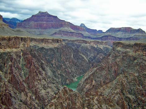 Green water and Vishnu Schist in the Inner Gorge (view N) |
From the trail junction, hikers can look up Bright Angel Canyon and see trees at Havasupai Garden, but they are farther than they look because the trail winds in and out of several little gullies, and the campground is towards the far end of the trees. The Tonto West and Plateau Point trails run concurrently on a gentle uphill grade towards Havasupai Garden. The trail is broad (6 to 8 feet wide) and flat, and the walking is easy. It takes about 10 minutes to get to the cottonwood trees, which are along Bright Angel Creek [1300 hrs], and the sounds of running water are particularly soothing after spending days walking across the desert. |
 Getting back in Salt Canyon: The Inferno (view SE) |
In another five minutes, hikers arrive at the Bright Angel Creek crossing, where the trail enters civilization at the mule corrals (Wpt. B-10; 1306 hrs). The campground (Wpt. B-09) is a few minutes uphill from there [1313 hrs]. Havasupai Garden is an interesting place with a long history. The area was originally settled by Native American farmers. Later, the area was taken over for a tourist camp that was run by an unsavory character. The Park Service took it over, cleaned up the area, and developed a ranger station, trail crew quarters (corrals and bunkhouses), and a campground. The campground is nice and has running water, composting toilets, and covered picnic tables that make passable rain shelters. Rodents are a problem, but the Park Service put poles in each campsite where you can hang your pack. |
 Salt Canyon (view N) |
Havasupai Garden Campground to Bright Angel Trailhead -- 4.6 From Havasupai Garden Campground, the Bright Angel Trail runs for 3 relatively easy hours to the trailhead on the rim. From Havasupai Garden, the trail runs at gentle grades up the canyon to the base of the Redwall. Although imposing, the trail climbs through the Redwall to 3-Mile Resthouse and then 1.5-Mile Resthouse at fairly gentle grades. The remaining 1.5 miles include some long steep parts, but they are interspersed with more gentle sections. The Bright Angel Trail leads out of Havasupai Garden Campground (Wpt. B-09; 0848) and uphill past the Ranger Station at a fairly gentle grade, running straight up the canyon parallel to the creek. The trail is rocky, wide, and well-trodden by mules and hikers. Eventually the trail turns east into side canyon (Wpt. B-08; 0905) and the grade starts to increase. It isn't long before hikers reach the bottom of the cliffs [0913] and the switchbacks begin into the Redwall. At the maximum point into the back of the canyon [0928], the Redwall is quite spectacular. Switchbacks lead up through the Red Wall Limestone to 3-Mile Rest House (Wpt. B-07), a stone cabin with indoor seating and toilets out back. During warmer weather, water is available here. It is worth taking a minute and walking out beyond the toilets to the edge of the canyon, which has grand views back down the canyon. This is the top of the cableway that was used to sling materials (even a car) down to Havasupai Garden. Departing 3-Mile Rest House [0945], the trail contours around to the top of Redwall [0951] where it cuts through a gap in the cliffs along Bright Angel Creek. After two more sets of switchbacks, the trail crosses Bright Angel Creek [1019] to the west side of the canyon. In short order, however, the trail switchbacks (2-Mile Switchback; Wpt. B-06) to again cross over Bright Angel Creek [1025] and return to the east side of the canyon. A trail sign says: 2 miles to the top, 2.5 miles to Havasupai Garden. |
 Tonto Trail departing Salt Creek (view NE) |
From 2-Mile Switchback (Wpt. B-06), the trail swings far to the east at a very easy grade, then switchbacks up to 1.5-Mile Restrooms [1040] and 1.5-Mile Resthouse (Wpt. B-05; 1041), which also has seasonal water. Above 1.5-Mile Resthouse [1047], the grade of the trail gets a little steeper, but the trail is still easy. The trail runs back into the back of the canyon at the bottom of the Coconino Sandstone [1055]. A series of switchbacks run up through a gap in the Coconino cliffs, the top of which is marked by the Lower Tunnel (Wpt. B-04; 1120], which is in the Kaibab Limestone. The Lower Tunnel also marks the end of the generally easy grades, as the trail climbs rather steeply on another long switchback. Fortunately, the distal end of the long switchback [1141], is the last long grade. From that switchback, the trail climbs more gently to Second Switchback (Wpt. B-03), now running east just below the rim of the canyon. The trail passes through the Upper Tunnel (Wpt. B-02; 1149) where there are lots of fossils in the limestone walls. The trail makes one more switchback and climbs to rim of the Canyon and the Bright Angel Trailhead (Wpt. B-02; 1153). |
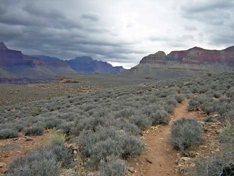
 Good, clear trail (view NE) |
 Plateau Point on the horizon at edge of Inner Gorge (view E) |
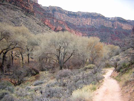 Cottonwoods along Bright Angel Creek below Havasupai Garden (view S) |
 Winter in Havasupai Garden Campground (view NE) |
 Hiker passing Havasupai Garden Ranger Station (view S) |
 Trail runs along Garden Wash (view SW) |
 First Redwall switchback (view SW) |
 Hiker at 3-Mile Resthouse (view NE) |
 Lots of gentle switchbacks (view NE) |
 1.5 Mile Emergency Phone and Resthouse (view SW) |
 Short switchbacks through the Coconino Sandstone Wall (view SW) |
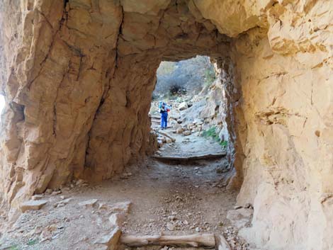 Second Tunnel (view NE) |
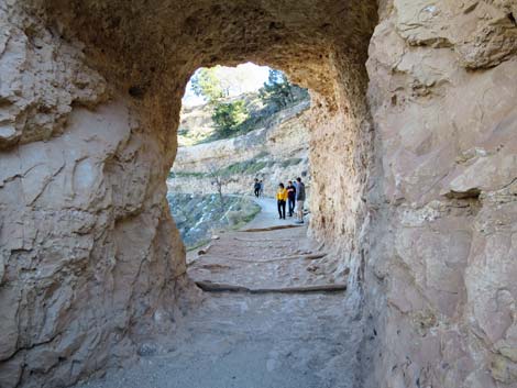 First Tunnel (view E) |
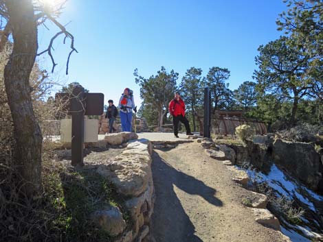 Arriving at Bright Angel Trailhead (view SW) |
Table 1. Highway Coordinates based on GPS Data (NAD27, UTM Zone 12S). Download Highway GPS Waypoints (gpx) file.
| Site # | Location | Latitude (°N) | Longitude (°W) | UTM Easting | UTM Northing | Elevation (feet) | Verified |
|---|---|---|---|---|---|---|---|
| 811 | Visitor Center, Canyon View Information Plaza | 36.05897 | 112.10847 | 400166 | 3990857 | 7,092 | Yes |
| 814 | Bright Angel Trailhead | 36.05725 | 112.14286 | 397067 | 3990702 | 6,870 | Yes |
| 815 | Hermits Rest trailhead | 36.06053 | 112.21155 | 390885 | 3991141 | 6,642 | Yes |
Table 2. Hiking Coordinates and Distances based on GPS Data (NAD27; UTM Zone 11S). Download Hiking GPS Waypoints (gpx) file.
| Wpt. | Location | UTM Easting | UTM Northing | Elevation (ft) | Point-to-Point Distance (mi) | Cumulative Distance (mi) |
|---|---|---|---|---|---|---|
| H-01 | Hermit Rest | 390879 | 3991142 | 6,640 | 0.00 | 00.00 |
| H-02 | Fossil Tracks | 390117 | 3990538 | 5,600 | 1.23 | 01.23 |
| H-03 | Hermit-Boucher Junction | 389772 | 3990629 | 5,240 | 0.32 | 01.55 |
| H-04 | Santa Maria Spring | 390002 | 3991107 | 5,000 | 0.49 | 02.04 |
| H-05 | Cathedral Stairs | 392103 | 3993543 | 4,420 | 3.22 | 05.26 |
| T-16 | Tonto-Hermit Trail Junction | 391681 | 3994130 | 3,215 | 1.07 | 06.33 |
| T-15 | Saddle below Cope Butte | 392445 | 3994573 | 3,389 | 0.75 | 07.08 |
| T-14 | Monument Creek | 393273 | 3993511 | 2,995 | 1.42 | 08.50 |
| T-13 | West Arm of the Alligator | 393441 | 3994173 | 3,420 | 0.83 | 09.33 |
| T-12 | Cedar Spring Wash | 394001 | 3994224 | 3,360 | 0.43 | 09.76 |
| T-11 | Below east arm Alligator | 394573 | 3994939 | 3,450 | 0.78 | 10.54 |
| T-10 | Salt Creek | 395442 | 3993767 | 3,410 | 1.29 | 11.83 |
| T-09 | Northwest ridge of Dana Butte | 396333 | 3995629 | 3,700 | 2.15 | 13.98 |
| T-08 | Trail leaves edge of cliffs | 397325 | 3994549 | 3,620 | 1.22 | 15.20 |
| T-07 | West Horn of Horn Canyon | 396738 | 3993897 | 3,500 | 0.67 | 15.87 |
| T-06 | East Horn of Horn Canyon | 397074 | 3993761 | 3,520 | 0.37 | 16.24 |
| T-05 | Cliff with view | 397567 | 3994179 | 3,630 | 0.56 | 16.80 |
| T-04 | Ridge | 398009 | 3994469 | 3,770 | 0.41 | 17.21 |
| T-03 | Turn out of BA drainage | 398363 | 3994211 | 3,805 | 0.36 | 17.57 |
| T-02 | Plateau Point - Tonto West Jct | 398829 | 3993857 | 3,700 | 0.43 | 18.00 |
| B-10 | Plateau Point Trail Junction | 398562 | 3993031 | 3,771 | 0.76 | 18.76 |
| B-09 | Havasupai Garden Trail Junction | 398399 | 3992794 | 3,790 | 0.19 | 18.95 |
| B-08 | Side Canyon | 397953 | 3991736 | 4,400 | 0.83 | 19.78 |
| B-07 | 3-Mile Resthouse Junction | 397736 | 3991599 | 4,700 | 0.71 | 20.49 |
| B-06 | 2-Mile Switchback | 397196 | 3991309 | 5,440 | 1.01 | 21.50 |
| B-05 | 1.5-Mile Resthouse | 397464 | 3991050 | 5,700 | 0.45 | 21.95 |
| B-04 | Second Tunnel | 396957 | 3990893 | 6,160 | 0.72 | 22.67 |
| B-03 | Second Switchback | 396802 | 3990896 | 6,873 | 0.46 | 23.13 |
| B-02 | First Tunnel | 397032 | 3990731 | 6,788 | 0.24 | 23.37 |
| B-01 | Bright Angel trailhead | 397064 | 3990712 | 6,880 | 0.16 | 23.53 |
Happy Hiking! All distances, elevations, and other facts are approximate.
![]() ; Last updated 240326
; Last updated 240326
| Hiking the Grand Canyon | Hiking Around Las Vegas | Glossary | Copyright, Conditions, Disclaimer | Home |