Hiking Around Las Vegas, Grand Canyon National Park
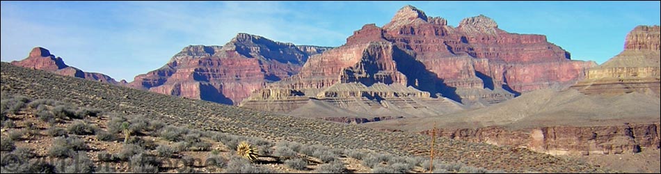
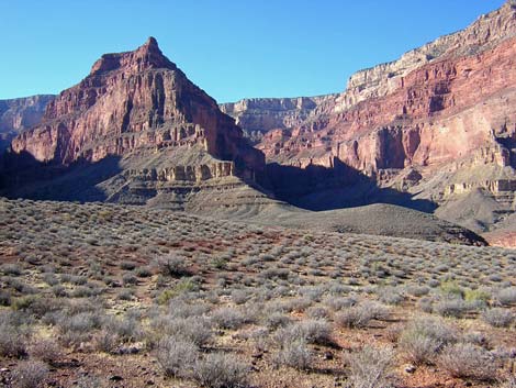
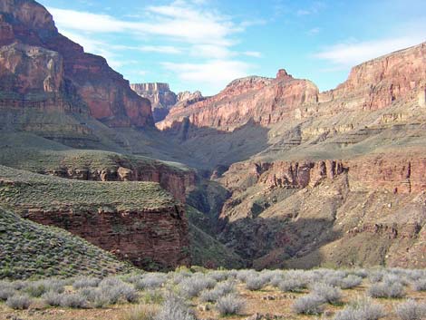
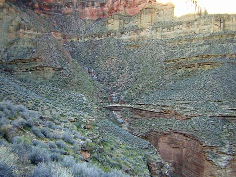
 One of the most beautiful places on earth (view SE) |
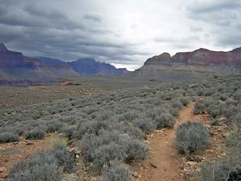
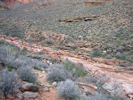
Overview The Tonto is a truly spectacular trail that runs through the Grand Canyon for some 90 miles from the Red Canyon in the east to Bass Canyon in the west. Other trails lead even farther in both directions. In many places, the trail runs along the lip of the Inner Gorge, providing great views of the Colorado River; and from everywhere, there are always great views of the rock walls towering above the trail. The logistics can be complicated, but overall, this is a delightful hiking trail. The Tonto Trail is divided into two parts, the Tonto East (Red Canyon to Bright Angel Canyon; 40 miles) and the Tonto West (Bright Angel Canyon to Bass Canyon; 50 miles). Functionally, the Tonto West is two parts: the well-traveled trail from Bright Angel Canyon to Boucher (pronounced Boo-shay) Canyon, and the remote and seldom-used trail west of Boucher. Link to map. Download Entire Route Waypoint (gpx) file. |
 Tonto Platform (view SE from W of Boucher Canyon) |
I've organized my description of the Tonto West Trail into two parts. Here I describe the entire Tonto West Trail from Bright Angel Canyon to Bass Canyon (east to west), dividing it into canyon-to-canyon segments. I have also described the Tonto West portion of the loop from the Hermits Rest Trailhead to Monument Creek, to Havasupai Garden, to the Bright Angel Trailhead (west to east) because this is a popular loop, and it is easier to follow descriptions going forward than going backwards. The Tonto West Trail generally stays on the Tonto Platform, running in and out of every side canyon and little gully along the way. There is little overall elevation change on the Tonto Platform, but there is a tremendous amount of up and down on the trail. Few parts of the trail are truly strenuous, but there are several places to lose the trail, and bushwhacking across the hillsides looking for the trail can be quite strenuous and even dangerous. Much of the trail is rocky, making it difficult to set a good stride and make good time on the trail. |
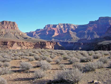
 The Monument in Monument Creek (view E) |
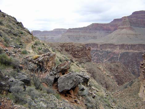
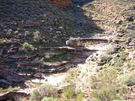
The Tonto Trail has a reputation for being difficult and obscure. Although the trail from Bright Angel Canyon to Boucher Canyon is wide and easy to follow, the trail to the west of Boucher always is narrow, faint, and very obscure in places. Cairns help in many places, but helpful hikers have erected many off-route cairns, some of which led me astray a couple of times, including into difficult boulder fields and 4th-class cliffs with a full backpack. There were places where I thought I was off-route, but when I stopped to look for the trail, I realized that I was still standing on it or that I was within a bush or two of it. I've tried to give more detailed descriptions of the problem areas. I've walked the Tonto West from Hermit Canyon to Bass Canyon in both directions, and for the most part, it is easier to follow the trail when hiking east. I think this is because hikers heading east set more strategic cairns. |
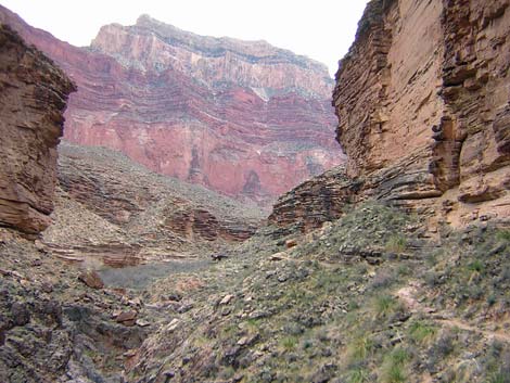
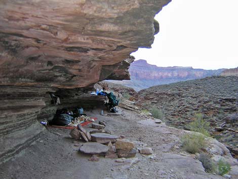
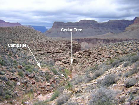
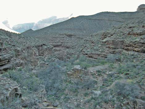
 Campsite with a roof in Turquoise Canyon |
Few people hike west of Boucher Canyon, so there is little need to plan ahead for backcountry permits for that area. West of Hermit Canyon, within Backcountry Use Zones BN9 (Boucher), BO9 (Slate), BP9 (Ruby) and BQ9 (Bass), camping is at-large, so people can camp anywhere. From Hermit Canyon east to Bright Angel Canyon, camping is permitted only in designated backcountry campsites and advanced reservations are a good idea. Permanent water is available near the trail only in a few places: Bright Angel Creek, Cedar Spring, Monument Creek, Hermit Creek, Boucher Creek, Slate Spring, and Turquoise Spring, and at the Colorado River down Bass Canyon. Water may be available in the major side canyons during winter and spring, but don't ever count on finding water in Travertine, Agate, Jasper, Jade, or Quartz canyons. |
 Hermit-Tonto trail junction |
Watch Out Other than the standard warnings about hiking in the desert, ...the Tonto Trail is a wild and remote place. Don't expect to see a ranger or anyone else to offer help if you get in trouble. If you hike the Tonto west of Boucher, expect to be alone. Don't go there if you don't know how to stop arterial bleeding or splint broken bones. Heart attack or heat stroke: kiss your ass goodbye. Much of the trail west of Boucher Creek is little used, obscure, and hard to follow. There are many places to stumble off the trail, fall into the abyss, and never be seen again. Carry enough water to travel between permanent water sources unless you get specific and timely information about seasonal streams. The inner canyon can be very hot; plan accordingly. In general, the trail west of Boucher is too faint to follow at night with headlamps or flashlights. Be sure to find a campsite before it gets dark. I have noted the locations of most campsites along the trail. There is too much brush and cactus to camp in most places; even sleeping on the trail is often out of the question. While hiking, please respect the land and the other people out there, and please try to Leave No Trace of your passage. This is a long hike, so be sure to bring the 10 Essentials. Cell phones don't work down in the canyon, so bring a signal mirror, beacon, or satellite phone if you hike west of Boucher Canyon. Make sure this route is of the appropriate difficulty for your skills. |
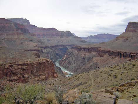
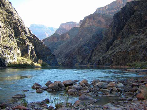 Boucher Rapids (view upstream) |
Getting to the Trailhead This hike is located on the South Rim of the Grand Canyon, about 5 hours southeast of Las Vegas. From Las Vegas, drive out to the South Rim of Grand Canyon National Park. From the South Rim Visitor Center (Table 1, Site 811), ride the shuttle bus or drive to one of the three main trailheads: Bright Angel Trailhead (Site 814) -- Ride the shuttle bus or drive to the Bright Angel Lodge bus stop or the Village Transfer bus stop. The Bright Angel trailhead is located on the rim of the canyon between these two shuttle bus stops. The trailhead is marked with signs and a round, stone mule corral. The closest public parking is a few minutes walk to the southeast, across the road and railroad tracks from the Bright Angel Lodge. |
 Campsite above Slate Canyon |
Hermits Rest Trailhead (Site 815) -- This trailhead is just west (past) of the Hermits Rest buildings on the Hermit Road. When the shuttle bus is running (spring through fall), take it to Hermits Rest. Walk past the tourist facilities and past the employee housing area to the end of the road. Either walk past the restrooms and down the gravel road, or walk past the Hermits Rest building and out the trail along the rim. It is about 0.25 miles from the bus stop to the trailhead. When the shuttle is not running, drive to the trailhead or arrange for a taxi. It costs about $15 for one person to take the taxi from the Bright Angel Lodge to Hermits Rest. Bass Canyon Trailhead (Site 942) -- This trailhead is located about 2 hours west of the South Rim Village area on Pasture Wash Road (Forest Service Road FS#328), which is rough under the best conditions and requires 4WD when muddy or snowy. Get driving directions to the old Pasture Wash Ranger Station from the Park Rangers and inquire about current road conditions. Part of the Pasture Wash Road crosses Havasupai tribal land, and the boundary is sometimes staffed by Havasupai rangers who charge $25 to drive across their land. The trailhead is about 3.6 miles north of the old ranger station. |
 |
The Hike 1. Havasupai Garden Campground to Horn Creek Overview: From Havasupai Garden Campground, it is about 2.5 miles and 1.5 hours to the east horn of Horn Creek, the first legal camping area along the trail. Drinking water is available only at Havasupai Garden Campground. Water flows in Horn Creek, but it is contaminated with uranium from the old mine at the head of the canyon, so don't drink the water. This segment of the Tonto Trail exits Bright Angel Canyon, loops west around the ridge below Maricopa Point, and runs up into Horn Canyon. This segment of the trail is fast, wide, easy, and provides many grand views. Havasupai Garden Campground is in Backcountry Use Zone ICG (camping only in the campground), and Horn Creek is in Zone BL4 (camping only in designated campsites). (details) |
 |
2. Horn Creek to Salt Creek Overview: From the east horn of Horn Creek, it is about 4.8 miles and 2.5 hours to Salt Creek, the first camping area to the west. There is no drinkable water along this segment. This segment of trail runs out the west side of Horn Creek, loops around Dana Butte (on the ridge below Hopi Point), and runs back into Salt Creek. The trail is fast, wide, easy, and provides many grand views above and below the trail. Horn Creek is in Backcountry Use Zone BL4 (camping only in designated campsites), and Salt Creek is in Zone BL5 (camping only in designated campsites). (details) |
 |
3. Salt Creek to Cedar Spring Overview: From Salt Creek, it is about 2.1 miles and 1 hour to Cedar Spring, the next water source and camping area to the west. This segment of the trail runs out the west side of Salt Creek and loops around the east arm of the Alligator (one of the ridges below Mohave Point), to Cedar Spring. The trail is fast, wide, and easy (but with a few rocky spots), and the views above and below the trail are truly spectacular. Salt Creek is in Backcountry Use Zone BL5 (camping only in designated campsites), and Cedar Spring is in Zone BL6 (camping only in designated campsites). (details) |
|
|
4. Cedar Spring to Monument Creek Overview: From Cedar Spring, it is about 1.3 miles and 45 minutes to Monument Creek, the next water source and camping area to the west. This segment of the trail runs around the west arm of the Alligator, one of the ridges below Mohave Point, and back into Monument Canyon. Except for getting down the Tapeats cliffs to Monument Creek, this segment of the trail is easy, fast, and wide, but with a few rocky spots. The trail down into Monument gorge is steep and rocky, but it is a fine trail. There are many grand views. Water is available at Cedar Spring and Monument Creek. Cedar Spring is in Backcountry Use Zone BL6 (camping only in designated campsites), and Monument Creek is in Zone BL7 (camping only in the campground). (details) |
 |
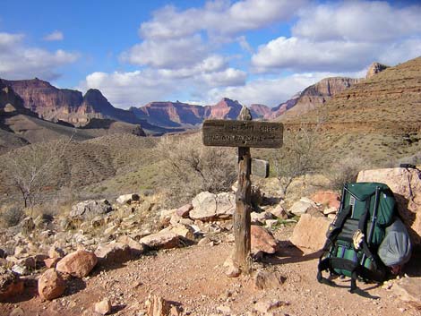
5. Monument Creek to Tonto-Hermit Trail Junction Overview: From Monument Creek, it is about 2.3 miles and 1.25 hours to the Tonto-Hermit Trail junction. This segment of the trail climbs a side canyon to get out of Monument gorge, runs west around Cope Butte (the ridge below Pima Point), climbs over another saddle, and turns back into Hermit Canyon. The trail crosses a fairly long steep hillside on a narrow, dirt trail that could be hazardous when muddy. Water is available only at Monument Creek. The campground at Monument Creek (Backcountry Use Zone BL7) is the only legal camping area on this segment, although there are several illegal campsites at the Tonto-Hermit Trail Junction. (details) |
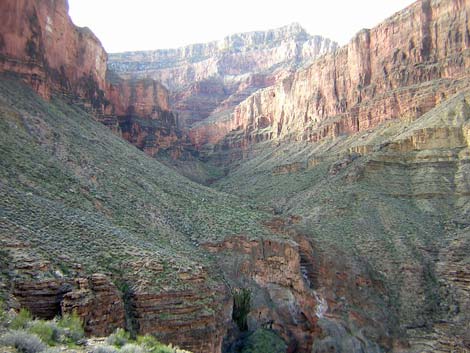
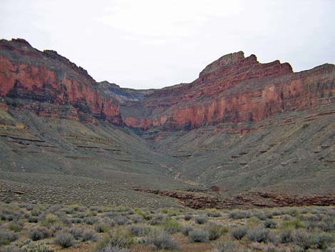
 Hermit Canyon |
6. Tonto-Hermit Trail Junction to Hermit Creek Overview: From the Tonto-Hermit Trail junction, it is about 1.5 miles and 30 minutes to Hermit Creek Campground, the first camping area to the west. Permanent water is available in Hermit Creek. This segment of the trail runs back into Hermit Canyon, passing the Hermit Rapids Trail junction and the old Santa Fe Railroad tourist camp. Legal camping is only permitted at the Hermit Creek campground (Backcountry Use Zone BM7), although there are several illegal campsites at the Tonto-Hermit Trail junction. (details) |
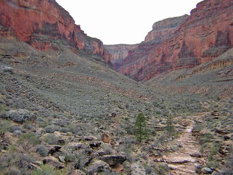
 Travertine Canyon |
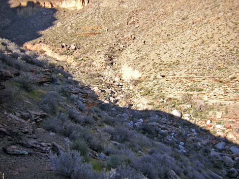
7. Hermit Creek to Travertine Canyon Overview: From Hermit Creek Campground, it is about 2.6 miles and 1.75 hrs to the wash in Travertine Canyon. Drinking water is available only in Hermit Creek. This segment of the trail runs from the back of Hermit Canyon out to a point overlooking Hermit Canyon and the Inner Gorge that boasts one of the most beautiful views on the entire Tonto West Trail. From there, the trail turns west to cross the north face of Yuma Point, which is a bit exhilarating because this is one of the few places along the entire Tonto West Trail where you really feel as though you might slip and fall into the river. From Yuma Point, the trail turns and runs up into Travertine Canyon, which is the second-hardest canyon to cross on the entire Tonto West Trail (Boucher is the hardest). Hermit Creek is in Backcountry Use Zone BM7 (camping only in the campground), and Travertine Canyon is in Zone BN9, where camping is at large (you can camp anywhere). (details) |
 |
8. Travertine Canyon to Boucher Trail Junction Overview: From the wash in Travertine Canyon, it is about 2.2 miles and 1.25 hours to the Tonto-Boucher trail junction. There is no water along this segment. This segment of the trail runs out the west side of Travertine Canyon, loops around White's Butte (ridge below Cocopa Point), and turns into the Boucher drainage system. The trail getting out of the Travertine drainage system is a bit rough, and there are some airy spots on steep sideslopes, but it is short. There are more airy (but more secure) spots overlooking the river before the trail turns into the Boucher drainage system, and then a delightful trail runs across the Tonto Platform to the Boucher Trail junction. This segment of trail runs through Backcountry Use Zone BN9, where camping is at large (you can camp anywhere). (details) |
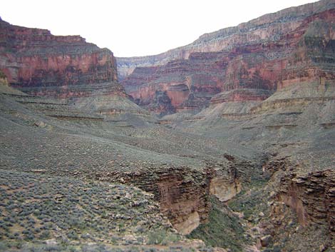
 Boucher Canyon |
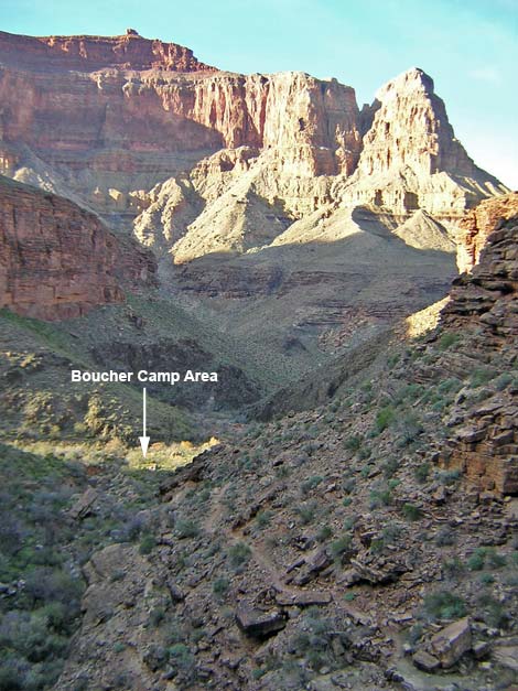
9. Boucher Trail Junction to Boucher Creek Overview: From the Tonto-Boucher trail junction, it is about 0.3 miles and 0.25 hours to the camping area on Boucher Creek. Water is available in Boucher Creek. This segment of the trail winds down a steep side canyon and drops steeply through the Tapeats Sandstone to Boucher Creek. The trail is slow and rocky, but it is short and rewards the hiker with a cool creek and the remains of old-man Boucher's cabin. Boucher Creek is in Backcountry Use Zone BN9. (details) |
 Slate Canyon |
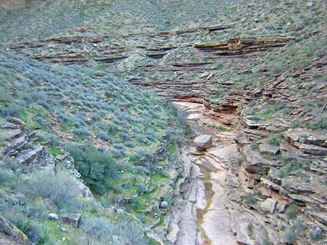
10. Boucher Creek to Slate Canyon Overview: From the camping area on Boucher Creek, it is about 5.2 miles and 2.75 hours to the wash in Slate Canyon. Water is available in Boucher Canyon and from a spring below the trail in Slate Canyon; seasonal water may be available at Slate Wash. This segment of the trail climbs steeply out of Boucher Canyon, runs down along the edge of the Inner Gorge beneath Marsh Butte (ridge below Dana Temple), and then runs back into Slate Canyon. The trail is always faint, and hikers should expect to spend some time off-route and looking for the trail. Boucher Creek is in Backcountry Use Zone BN9 (at-large camping), and after turning out of the Boucher drainage, the trail runs through Zone BO9 (at-large camping). (details) |
 Agate Canyon |
11. Slate Canyon to Agate Canyon Overview: From the wash in Slate Canyon, it is about 4.7 miles and 2.5 hours to the wash in Agate Canyon. Water is available from a spring below the trail in Slate Canyon; seasonal water may be available at Slate Wash. Expect no water at Agate Wash. This segment of the trail runs northeast to the edge of the Inner Gorge, runs west under the toe of Geikie Peak (on the ridge below Pollux Temple), and then turns south and runs back into Agate Canyon. The trail is always faint and hikers should expect to spend some time off-route and looking for the trail. This segment of trail is in Backcountry Use Zone BO9 (at-large camping). (details) |
 Sapphire Canyon |
12. Agate Canyon to Sapphire Canyon Overview: From the wash in Agate Canyon, it is about 1.8 miles and 1 hour to the wash in Sapphire Canyon. Seasonal water is available in Sapphire Wash. This segment of the trail runs out of Agate Canyon, loops around Pollux Temple, and runs back into Sapphire Canyon. The trail is always faint, and hikers should expect to spend some time off route and looking for the trail. This segment of the trail is in Backcountry Use Zone BO9 (at-large camping). (details) |
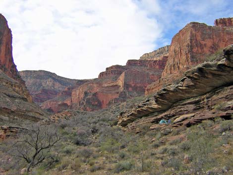
 Turquoise Canyon |
13. Sapphire Canyon to Turquoise Canyon Overview: From the wash in Sapphire Canyon, it is about 2.7 miles and 1.5 hours to the wash in Turquoise Canyon. Seasonal water is available in Sapphire Wash, and springs and seasonal water provide water in Turquoise Canyon. This segment of the trail runs out of Sapphire Canyon, runs northwest along the Inner Gorge passing below Castor Temple, and then runs back into Turquoise Canyon. The trail is always faint, but except for one spot getting out of Sapphire, there is a good, easy, well-cairned route all the way from Sapphire Wash to Turquoise Wash. This segment of the trail is in Backcountry Use Zone BO9 (at-large camping). (details) |
 Jasper Wash |
14. Turquoise Canyon to Jasper Canyon Overview: From the wash in Turquoise Canyon, it is about 2.4 miles and 1.5 hours to the wash in Jasper Canyon. Water is available from springs in Turquoise Canyon; expect no water in Jasper. This segment of the trail runs out of Turquoise Canyon, runs west along the Inner Gorge across the Shaler Plateau, and then runs back into Jasper Canyon. The trail is always faint, but it is almost entirely good and easy-to-follow the entire way. The "almost entirely" is the kicker; expect to spend some time off route and looking for the trail. Turquoise Canyon is in Backcountry Use Zone BO9 (at-large camping), and Jasper Canyon is in Zone BP9 (at-large camping). (details) |
 Jade Wash |
15. Jasper Canyon to Jade Canyon Overview: From the wash in Jasper Canyon, it is about 1.2 miles and 0.75 hours to the wash in Jade Canyon. Water is not available on this segment. This short segment runs out of Jasper Canyon, over a saddle on a ridge, and then runs back into Jade Canyon. The trail is always faint, but it is fairly easy to follow the entire way. This segment of trail is in Backcountry Use Zone BP9 (at-large camping). (details) |
 Ruby Wash |
16. Jade Canyon to Ruby Canyon Overview: From the wash in Jade Canyon, it is about 2.3 miles and 2 hours to the wash in Ruby Canyon. Seasonal water is available in Ruby Wash. This segment of the trail runs east out of Jade Canyon, turns north and runs across the Le Conte Plateau overlooking the Inner Gorge, then turns west and runs back into Ruby Canyon. The trail is always faint, but it is fairly easy to follow most of the way. This segment of trail is in Backcountry Use Zone BP9 (at-large camping). (details) |
 Quartz Canyon |
17. Ruby Canyon to Quartz Canyon Overview: From the wash in Ruby Canyon, it is about 1.8 miles and 1 hour to the wash in Quartz Canyon. Seasonal water is available in Ruby Wash. This short segment runs northeast out of Ruby Canyon, around a point on a ridge below Havasupai Point, and back northwest into Quarts Canyon. The trail is always faint, but it is fairly easy to follow. This segment of trail is in Backcountry Use Zone BP9 (at-large camping). (details) |
 Emerald Canyon (slickrock horn) |
18. Quartz Canyon to Emerald Canyon Overview: From the wash in Quartz Canyon, it is about 1.9 miles and 1.25 hours to the wash in Emerald Canyon. Water is not available on this segment. This segment runs northeast out of Quartz Canyon, crosses a ridge below the south toe of Havasupai Point, then runs north below the point, crosses a ridge below the north toe of Havasupai Point, and runs west into the north and south horns of Emerald Canyon. The trail is always faint, but it is fairly easy to follow. The trail between the two horns of Emerald Canyon is a bit airy. This segment of trail is in Backcountry Use Zone BP9 (at-large camping). (details) |
 Serpentine Canyon |
19. Emerald Canyon to Serpentine Canyon Overview: From the wash in Emerald Canyon, it is about 1.2 miles and 0.75 hours to the wash in Serpentine Canyon. Seasonal water is available in Serpentine Canyon. This short segment of trail runs northeast out of Emerald Canyon, crosses a ridge below Havasupai Point, and turns back and runs west into Serpentine Canyon. The trail is always faint, but it is fairly easy to follow. This segment of trail is in Backcountry Use Zone BP9 (at-large camping). (details) |
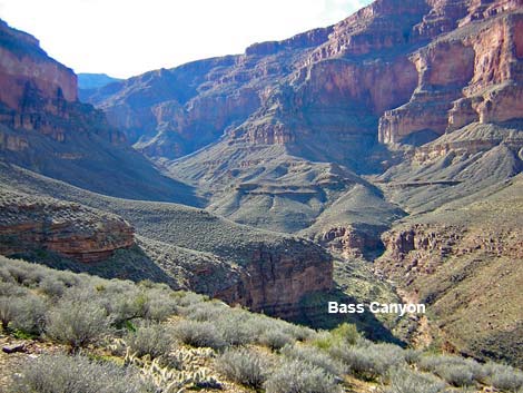 Bass Canyon |
20. Serpentine Canyon to Bass Canyon Overview: From the wash in Serpentine Canyon, it is about 4.4 miles and 1.75 hours to the Tonto-Bass Canyon trail junction (near the wash in Bass Canyon). Seasonal water is available in Serpentine and Bass canyons. This segment runs east out of Serpentine Canyon, turns north and runs along the Inner Gorge to the Grand Scenic Divide, then turns west and runs back into Bass Canyon. The Grand Scenic Divide is a ridge that blocks views up and down the canyon. The trail is always faint, but it is fairly easy to follow. The east side of the Grand Scenic Divide is in Backcountry Use Zone BP9 (at-large camping), and the west side is in BQ9 (at-large camping). (details) |
Table 1. Highway Coordinates (NAD27, UTM Zone 12S).
| Site # | Location | Latitude (°N) | Longitude (°W) | UTM Easting | UTM Northing | Elevation (feet) | Verified |
|---|---|---|---|---|---|---|---|
| 811 | Visitor Center, Canyon View Information Plaza | 36.05897 | 112.10848 | 400166 | 3990857 | 7,092 | Yes |
| 814 | Bright Angel Trailhead | 36.0574 | 112.1429 | 397067 | 3990721 | 6,870 | Yes |
| 815 | Hermits Rest Trailhead | 36.06044 | 112.21170 | 390870 | 3991131 | 6,642 | Yes |
| 942 | Bass Canyon Trailhead | 36.1838 | 112.3757 | 376294 | 4005014 | 6,649 | Yes |
Happy Hiking! All distances, elevations, and other facts are approximate.
![]() ; Last updated 240326
; Last updated 240326
| Hiking Around Grand Canyon | Hiking Around Las Vegas | Glossary | Copyright, Conditions, Disclaimer | Home |