Hiking Around Las Vegas, Gold Butte National Monument

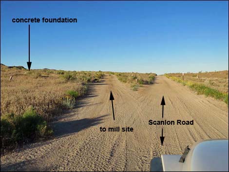 Scanlon Road at turnoff to the mill site (view SW) |
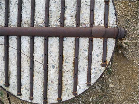
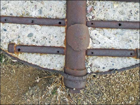
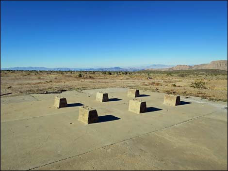
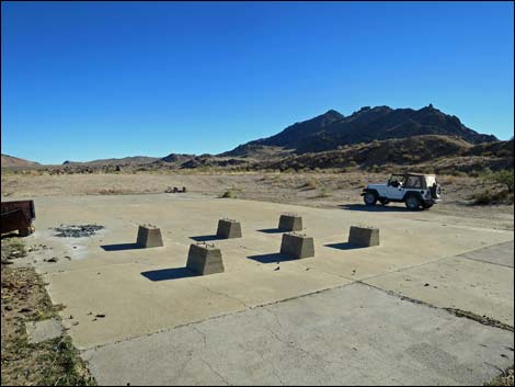
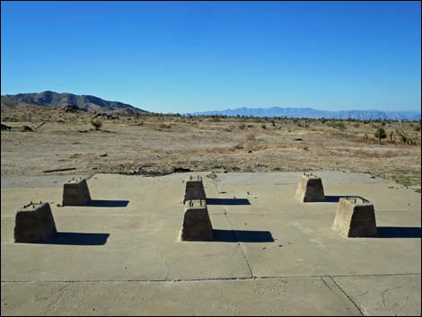
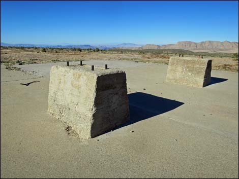
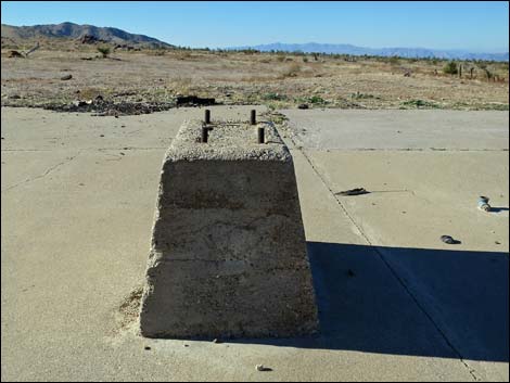
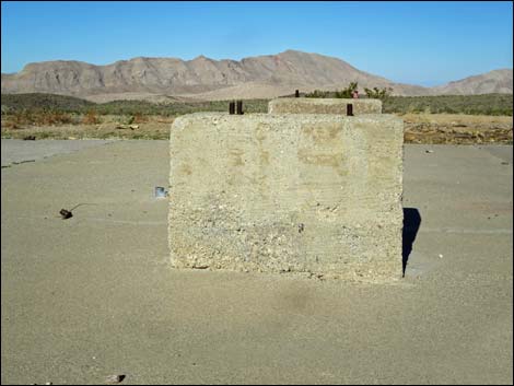
Overview The Gold Butte Mill Site, part of the Gold Butte Townsite, is the site of a mill that was built on desert flats below the boulder strewn Gold Butte Peak. Gold Butte Townsite was the center of mining activity in the region with a town of some 2,000 souls in 1905. The town dried up and blew away in 1907, but apparently mining interest remained because this mill was built long after 1907, perhaps as part of renewed mining interests in the 1950s. Little remains, and the main feature is the concrete foundation of the mill with six concrete pedestals that would have supported machinery, perhaps a stamp mill. All of the equipment is gone, but there are a few pieces of rusting debris lying about. Below the foundation, there are two dugout areas that would have been used as settling ponds. Above the foundation, there is a large pile of gravel bulldozed up from the surrounding area. An open mine shaft, about 50 yards northeast from the foundation, is a hazard. Link to map. |
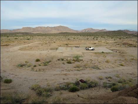
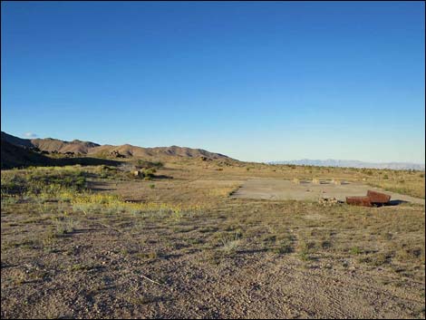 Mill site and flat areas (view W) |
Watch Out Other than the standard warnings about hiking in the desert, ... there is an open, unmarked mine shaft about 50 yards northeast of the concrete pad. The shaft is surrounded by a low, earthen berm, but be careful in that area. This is a wild and remote area without services of any kind (no restrooms, no water, no gas, no food). Bring what you need to survive. Be prepared and be self-reliant. Someone will find you eventually if you stay on a main road, but be prepared to survive alone for a day or two. Cell phones only work along parts of the paved road. While visiting the Townsite area, please respect the land and the other people out there, and try to Leave No Trace of your passage. Also, this is a remote area, so be sure to bring the 10 Essentials, even if you leave them in the car. Be sure to bring trash bags to clean up after people who care less about wild places than you do. |
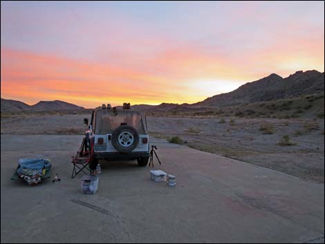 The concrete pad makes a nice campsite (view W) |
Getting to the Gold Butte Mill Site Gold Butte Mill Site is located out in Gold Butte National Monument at the northeast end of Lake Mead, about 3 hours northeast of Las Vegas in a wild, remote, and scenic area. From town, drive out to Gold Butte National Monument, and then down the paved Gold Butte Road for 21 miles to Whitney Pocket where the pavement ends. Continue south on the unpaved Gold Butte Road for 19.8 miles to a cattle guard that marks entry into the Townsite area. At about 0.4 miles past the cattle guard (20.2 miles total), Gold Butte Townsite Road East forks left into the Townsite area, proper. Just ahead, Red Bluff Spring Road branches to the right. Continue straight on Scanlon Road. About 0.6 miles past Red Bluff Spring Road, the road forks (Site 1704). Scanlon Road stays straight (right), while a lesser road bends left and runs up to the old concrete foundation (Site 1769). This side road is about 0.2-miles-long and loops back to intersect Scanlon Road (Site 1705). |
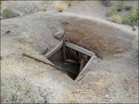 Nearby open mine shaft |
Gold Butte Mill Site Set below Gold Butte Peak, Gold Butte Mill Site sits on gently sloping desert flats with grand views north and west. For campers, this is a great place for sunsets. The concrete foundation is 80 ft by 40 ft with a 24 ft by 20 ft "patio" off one side. The six pedestals are on the west end, and each has four bolts to which machinery would have been bolted on. There is a bit of historic mining equipment debris scattered around. These items, even the large ones, seem to be disappearing, so be careful with what you clean up and don't remove items of historic interest. About 50 yards northeast of the foundation, there is an open mine shaft surrounded by a low earthen berm. Wooden timbers that held the shaft open are rotting away. While interesting, be careful around the mine shaft. |
 Concrete pad as seen from spoils pile (view N) |
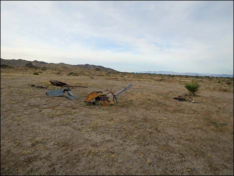 Mining equipment debris |
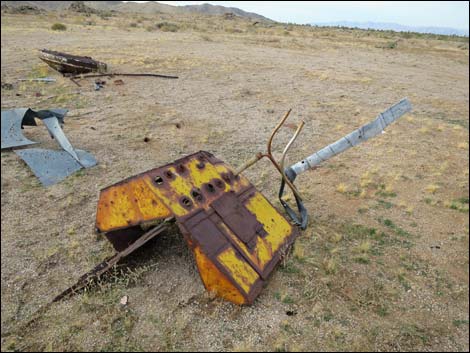 Mining equipment debris |
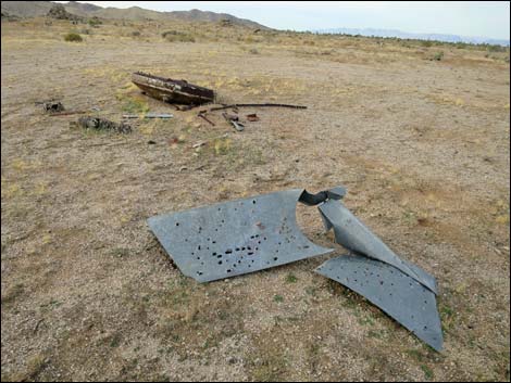 Mining equipment debris |
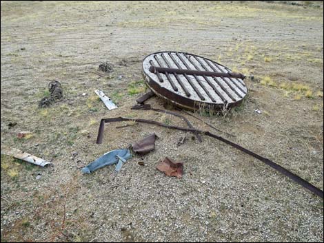 Mining equipment debris |
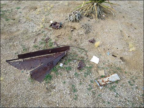 Mining equipment debris |
 Mining equipment debris |
 Mining equipment debris (close-up) |
 |
 |
 |
 |
 |
 |
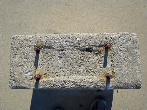 Concrete pedestal (view down) |
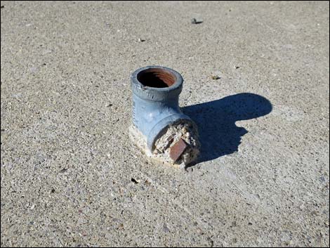 Plumbing (metal pipe) |
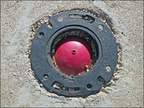 Plumbing (toilet set) |
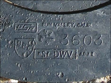 The toilet set probably can be dated from this information |
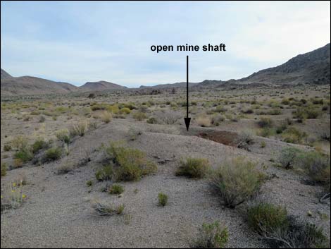 Open mine shaft (view NE) |
Open mine shaft |
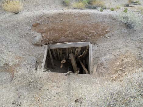 Open mine shaft |
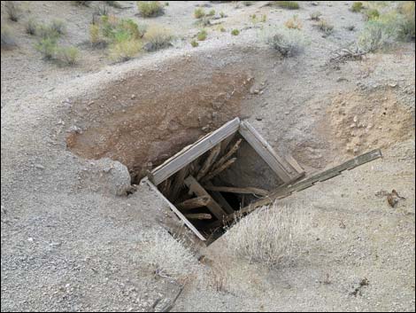 Open mine shaft |
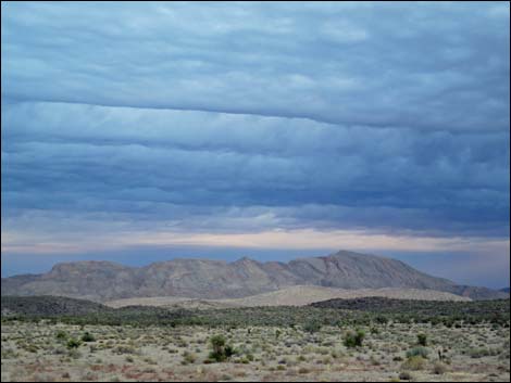 Dawn on a stormy day (view NW to Lime Ridge) |
 More to come ... |
Table 1. Highway Coordinates Based on GPS Data (NAD27; UTM Zone 11S). Download Highway GPS Waypoints (*.gpx) file.
| Site | Location | UTM Easting | UTM Northing | Latitude (N) | Longitude (W) | Elevation (ft) |
|---|---|---|---|---|---|---|
| 1705 | Scanlon Rd at Mill Site Rd W | 750593 | 4017727 | 36.27380 | 114.21030 | 3,280 |
| 1704 | Scanlon Rd at Mill Site Rd E | 750767 | 4017873 | 36.27507 | 114.20832 | 3,694 |
| 1769 | Gold Butte Mill Site | 750670 | 4017712 | 36.27364 | 114.20945 | 3,776 |
Happy Hiking! All distances, elevations, and other facts are approximate.
![]() ; Last updated 240325
; Last updated 240325
| Hiking Around Gold Butte | Hiking Around Las Vegas | Glossary | Copyright, Conditions, Disclaimer | Home |