Backroads Around Las Vegas, Gold Butte
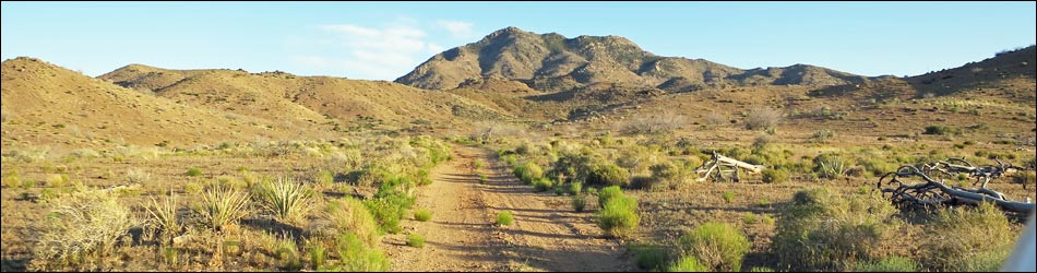
 Vermiculite Mine Road (view S from Gold Butte Road) |
Overview Vermiculite Mine Road is located out in the heart of Gold Butte. A side road off Gold Butte Road near Gold Butte Townsite, this little used road runs 1.4 miles to dead end at an overlook, passing several spur roads, the historic Vermiculite Mine site, and the Mica Peak Trailhead along the way. Vermiculite Mine Road is fairly smooth and without too many rocks. It probably is passable in a 2WD-HC vehicle, but it is safer in a 4WD vehicle because of one steep section. There are several side roads, but the "main" road generally is obvious. Link to Vermiculite Mine Road Map. |
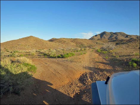
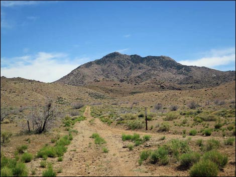 Vermiculite Mine Road (view S, arriving from the north) |
Watch Out Other than the standard warnings about driving in the desert, ... this is a wild and remote area without services of any kind (no restrooms, no water, no gas, no food). Bring what you need to survive. Be prepared and be self-reliant. It is a big place, but someone will eventually find you if you stay on a main road, but be prepared to survive alone for a day or two, or even longer on side roads. Consider signaling the tourist helicopters that traverse the area coming and going from the Grand Canyon. While out, please respect the land and the other people out there, and try to Leave No Trace of your passage. Also, this is a remote area, so be sure to bring the 10 Essentials. |
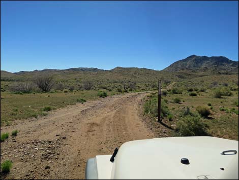 Vermiculite Mine Road (view S, arriving from the south) |
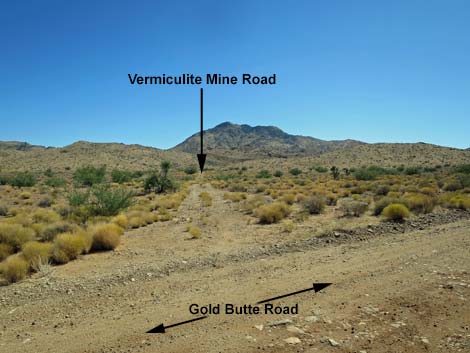
Getting to Vermiculite Mine Road Vermiculite Mine Road is located out in Gold Butte at the northeast end of Lake Mead, about 3 hours northeast of Las Vegas. From Las Vegas, drive out to Whitney Pocket, then continue south on the unpaved Gold Butte Road towards Gold Butte Townsite. At 16.5 miles out the dirt road, the road forks. Devils Cove Road goes left, while Gold Butte Road continues to the right. In about 2 more miles, at 17.9 miles on the dirt, Vermiculite Mine Road turns left. Watch for "designated road" signs. |
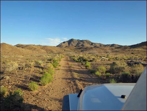 Vermiculite Mine Road runs across burned desert flats (view S) |
The Road From Gold Butte Road (Site 1696), Vermiculite Mine Road turns left to run south towards Mica Peak, which dominates the southern skyline in this perspective. At about 0.2 miles out, Bills Spring Road branches to the left. Continuing straight, Vermiculite Mine Road continues south, bending a bit right, paralleling a wash. The road crosses the wash, then forks. Vermiculite Mine Road stays left, while the side road goes right and drops back into the wash. Staying left, Vermiculite Mine Road climbs steeply across the hillside heading southeast. The road eventually levels out, then forks. Again, Vermiculite Mine Road stays left, while the side road can be seen to split and run in both directions across a hillside; these roads are part of the mine system. |
 Bills Spring Road branches left (view S) |
Climbing more gently across the next hillside, the road runs through a gap between the hills and into the Vermiculite Mine site, which still hold some large pieces of rusty equipment. Just past the mine site, the road bends left where a wide spot on the right serves as a campsite and the trailhead (Site 1696; 1.1 miles out) for Mica Peak via the North Ridge. Vermiculite Mine Road bends left and continues past a designated road sign as a lesser-used road for another 0.3 miles to a dead end at an overlook; an overlook that would not be a vacation destination. |
|
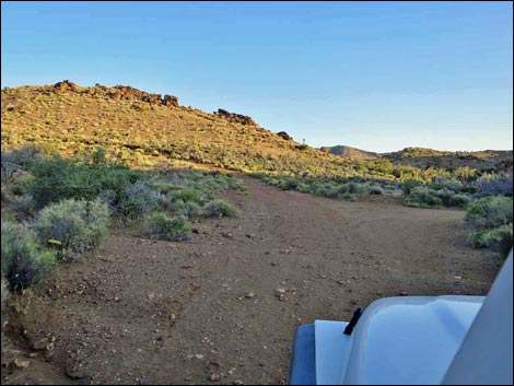
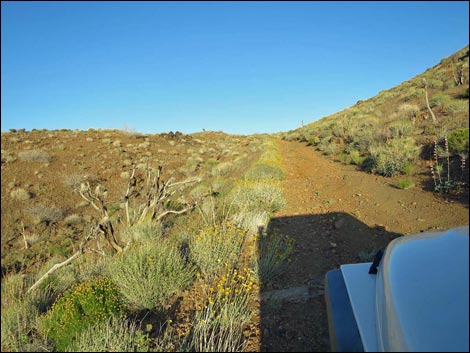
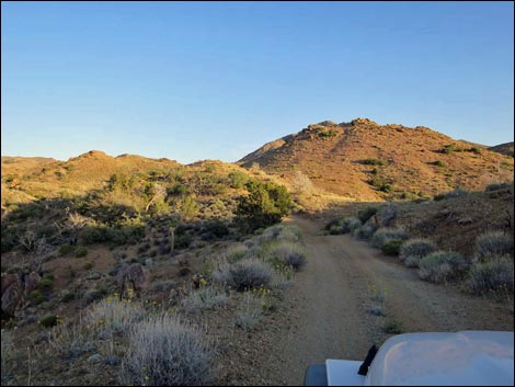
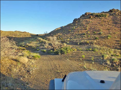
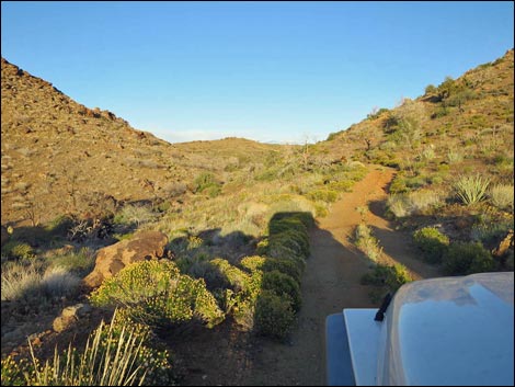
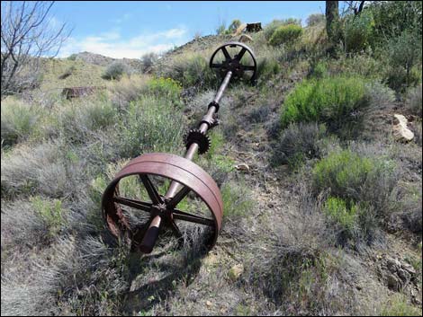
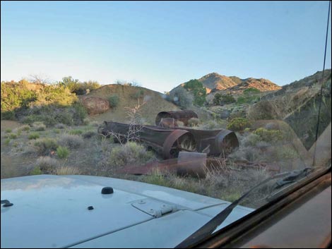
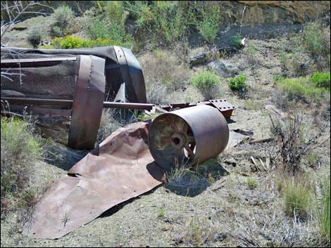
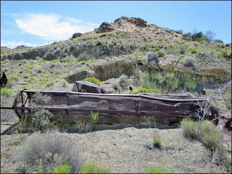
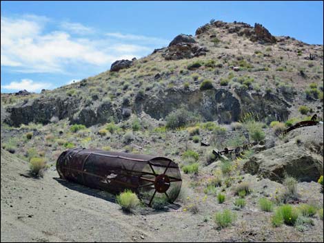
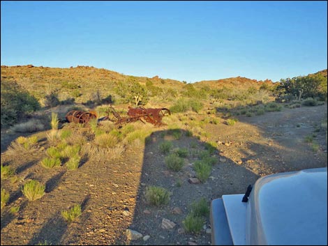
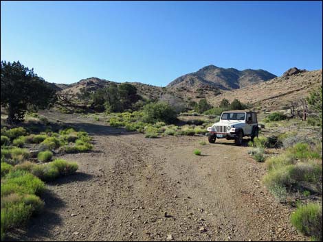
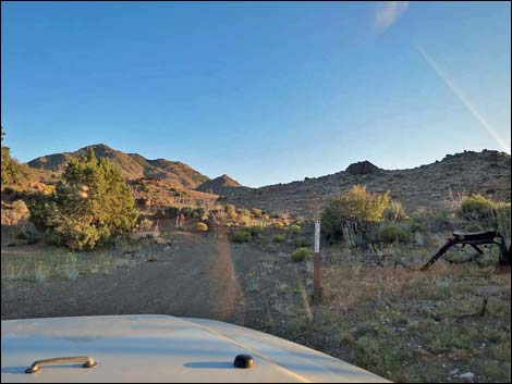
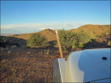
Table 1. Highway Coordinates Based on GPS Data (NAD27; UTM Zone 11S). Download Highway GPS Waypoints (*.gpx) file.
| Wpt. | Location | Latitude (N) | Longitude (W) | Elevation (ft) | Point-to-Point Distance (mi) | Cumulative Distance (mi) | Verified |
|---|---|---|---|---|---|---|---|
| 1696 | Gold Butte Road at Vermiculite Mine Road | 36.29655 | 114.16610 | 3,723 | 0.00 | 0.00 | Yes |
| 1697 | Vermiculite Mine Road at Mica Peak Trailhead | 36.28548 | 114.15740 | 4,029 | 1.09 | 1.09 | Yes |
Happy Hiking! All distances, elevations, and other facts are approximate.
![]() ; Last updated 240326
; Last updated 240326
| Backroads Around Las Vegas | Hiking Around Las Vegas | Glossary | Copyright, Conditions, Disclaimer | Home |