Hiking Around Las Vegas, Lake Mead National Recreation Area
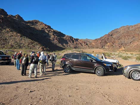 Hikers at parking area (view W) |
Overview This hike is an off-trail scramble in the River Mountains that runs through a deep and narrow canyon blocked by many pour-overs, that is, blocked by "many falls." The exact number of pour-overs depends on how, exactly, they are counted, but regardless, this canyon makes for a good scramble on volcanic rock. Some of the pour-overs are Class 2, but many are Class 3 and Class 4. Some of the pour-overs can be bypassed, but make no mistake, this is a scrambling route. This hike is described as a return route from Seven Falls Canyon, therefore it is described in reverse, that is, from out in the desert back to the trailhead. Link to map. |
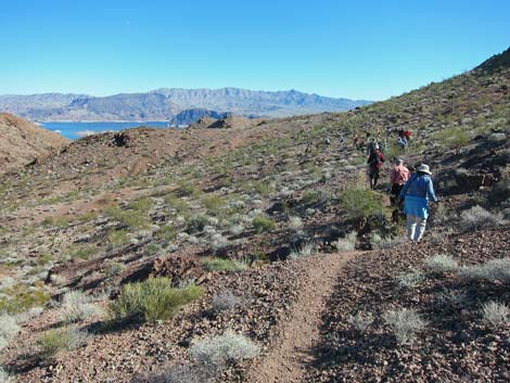
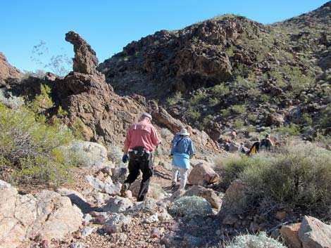
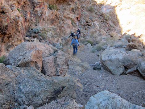
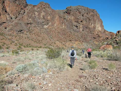
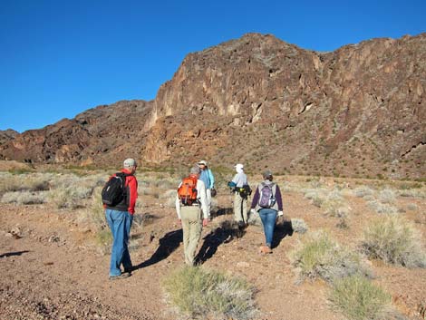 Hikers departing the trailhead (view W) |
Watch Out Other than the standard warnings about hiking in the desert, ...this is a scrambling route with plenty of Class 3 and Class 4 pour-overs. Be extra careful when high enough to fall and get hurt as a rescue from this canyon would be difficult and uncomfortable. A rope might be useful at some of the pour-overs, but experienced hikers probably won't need one. While hiking, please respect the land and the other people out there, and try to Leave No Trace of your passage. Also, this hike goes into difficult country, so be sure to bring the 10 Essentials. |
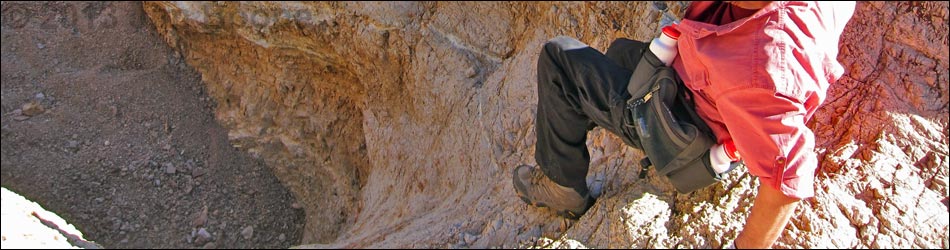
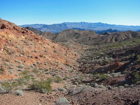
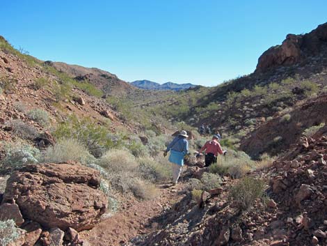
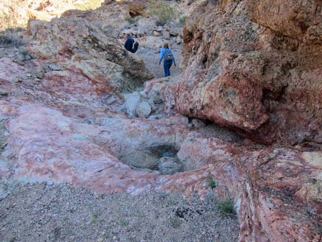
 Canyon narrows (view SW) |
Getting to the Trailhead This hike is located in Lake Mead National Recreation Area, not far from the Visitor Center and directly up the hill from Boulder Beach. From town, drive out to the Boulder Beach area at Lake Mead. From Lakeshore Road at Mile Post 2, drive up to the Brown Tank Trailhead. Park here; this is the trailhead. |
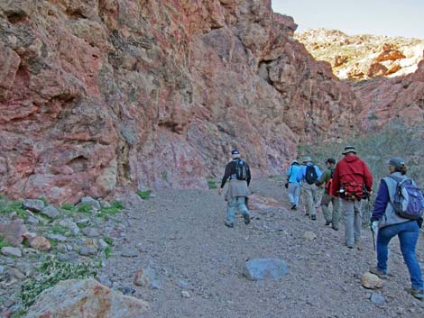
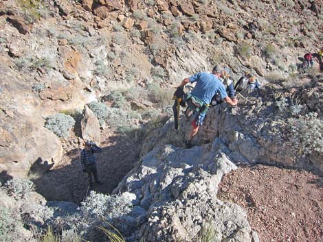
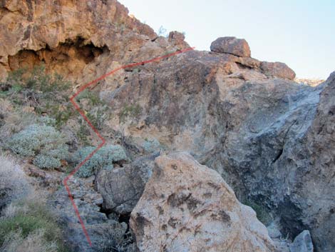
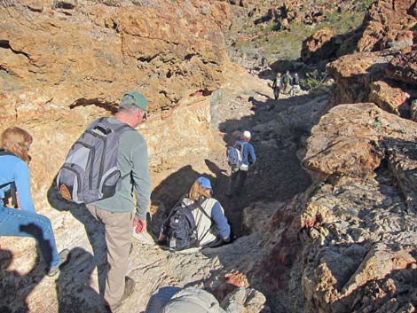
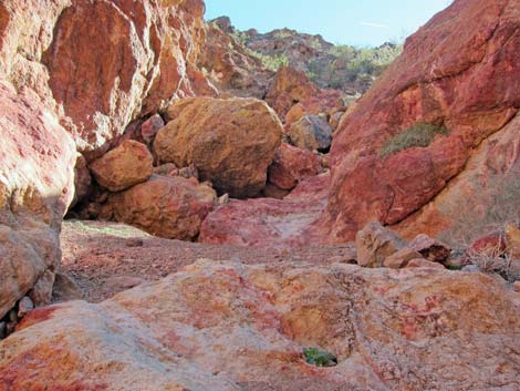
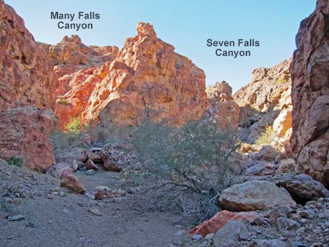 Canyon forks (Wpt. 02; view W) |
The Hike From the saddle at the head of Seven Falls Canyon (Table 1, Waypoint 13), the route runs southeast along the ridgeline following a game trail past a few highpoints and into the next major saddle (Wpt. 14). Hikers ascending Seven Falls Canyon who wish to minimize unnecessary hiking might consider leaving Seven Falls Canyon at the last bend in the canyon (Wpt. 12). These hikers can either hike south and up a side-wash directly onto a saddle (Wpt. 14), or they can hike east-southeast on faint game-trails over a low saddle directly into Many Falls Wash (Wpt. 17). [Note: I have no personal knowledge of these alternatives.] |
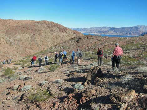
 Seven Falls Canyon (Wpt. 13; view E from saddle) |
From this saddle (Wpt. 14), the route continues southeast following game-trails on the south side of the ridge to avoid highpoints. The game-trail becomes faint in a rocky gully, but the best game-trail continues across the gully, dropping in elevation only 3-4 feet, to continue across the hillside on the contour. The terrain is a bit dicey here (scree on bedrock), so scan the hillside ahead looking for the game-trail before getting into the gully. The game-trail improves and continues across the hillside into the next saddle (Wpt. 15), then continues southeast along the north side of the ridge. At this point, the route is high on the ridge above Many Falls Canyon. Hikers can choose any point to descend into the wash below, but a low ridge (Wpt. 16) make a good route into the bottom of the canyon (Wpt. 17). |
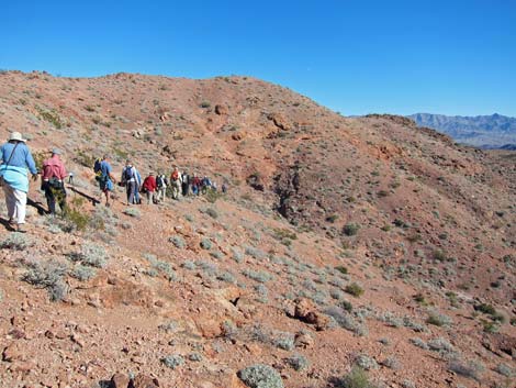 Hikers on game-trail (between Wpt. 14 and Wpt. 15; view ESE) |
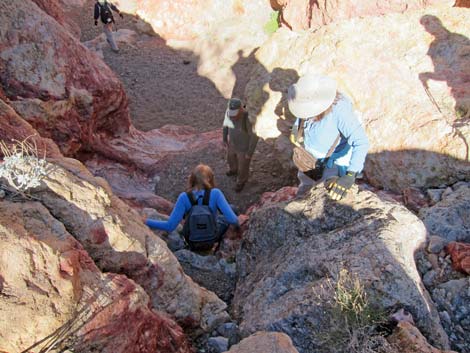
In the bottom of the canyon, the route runs east and downhill where the hiking is easy until reaching the first pour-over (Wpt. 18). The 2nd, 3rd, and 4th pour-overs (Wpt. 19-21) come in quick succession, followed by relatively easy hiking. Another set of three pour-overs (5th, 6th, 7th; Wpt. 22-24) is quickly followed by another (8th; Wpt. 25) pour-over. Relatively easy hiking is again interrupted by the 9th pour-over (Wpt. 26) where the canyon turns to run north. Scrambling northward, the relatively easy passage is again interrupted by the 10th pour-over (Wpt. 27), and this is quickly followed by a series of three pour-overs (11th, 12th; 13th; Wpt. 28) and finally, two more pour-overs (14th, 15th; Wpt. 29) before hikers drop out of the narrow canyon at the confluence with Seven Falls Canyon (Wpt. 02). Continuing down the gravel wash, the route eventually returns to the trailhead (Wpt. 01). |
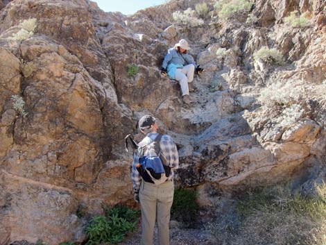
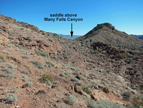 Hikers at saddle above Many Falls Canyon (Wpt. 15; view E) |
 Game-trail above Many Falls Wash (view E) |
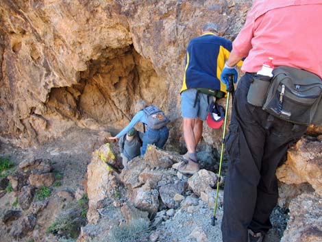
 Hikers descending into Many Falls Wash (view NE) |
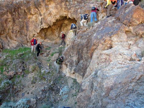
 Hikers in Many Falls Wash (view E) |
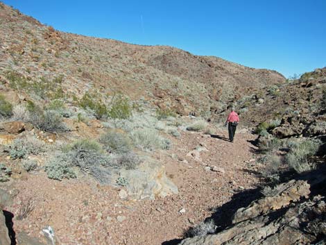 Hiker in Many Falls Wash (view E) |
 1st Pour-Over (Wpt. 18; view down) |
 1st Pour-Over (Wpt. 18; view up) |
 2nd Pour-Over (Wpt. 19; view down) |
 2nd Pour-Over (Wpt. 19; view across) |
 2nd Pour-Over (Wpt. 19; view up) |
 Hikers in Many Falls Wash with nature art (view E) |
 Hikers in Many Falls Wash (view E) |
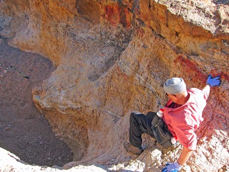
 8th Pour-Over (Wpt. 25; view down) |
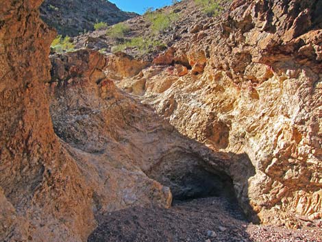
 Colorful pour-overs in volcanic rock (view E) |
 9th Pour-Over (Wpt. 26; view down) |
 9th Pour-Over (Wpt. 26; view down) |
 9th Pour-Over (Wpt. 26; view up) |
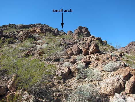 Small arch on northwest skyline |
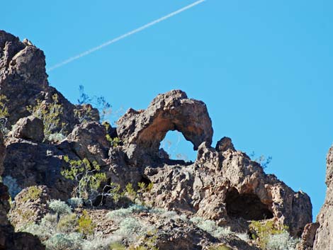 Small arch on northwest skyline (zoom) |
 Hikers descending steep wash (view N) |
 14th and 15th pour-overs (view down) |
 Colorful pour-overs in volcanic rock (view S) |
 Hikers in wash below the narrows (view NE) |
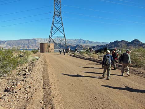
 Hikers in wash passing gravel quarry (view E) |
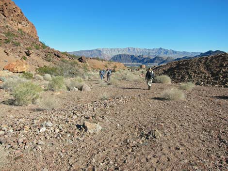
 Hikers returning to the trailhead (view E) |
 More to come ... |
Table 1. Hiking Coordinates Based on GPS Data (NAD27; UTM Zone 11S). Download Hiking GPS Waypoints (*.gpx) file.
| Wpt. | Location | UTM Easting | UTM Northing | Elevation (ft) | Point-to-Point Distance (mi) |
Cumulative Distance (mi) |
Verified |
|---|---|---|---|---|---|---|---|
| 12 | Wash Forks | 695176 | 3989038 | 2,245 | . | . | GPS |
| 13 | Saddle | 694908 | 3989052 | 2,383 | 0.00 | 0.00 | GPS |
| 14 | High Saddle | 695203 | 3988870 | 2,330 | 0.12 | 0.22 | GPS |
| 15 | Saddle | 695360 | 3988838 | 2,298 | 0.12 | 0.34 | GPS |
| 16 | Depart Game-Trail | 695467 | 3988803 | 2,283 | 0.07 | 0.41 | GPS |
| 17 | Bottom of Canyon | 695483 | 3988896 | 2,207 | 0.06 | 0.47 | GPS |
| 18 | 1st Pour-Over | 695926 | 3989075 | 1,995 | 0.39 | 0.86 | GPS |
| 19 | 2nd Pour-Over | 695973 | 3989034 | 1,966 | 0.05 | 0.91 | GPS |
| 20 | 3rd Pour-Over | 695994 | 3989032 | 1,954 | 0.02 | 0.93 | GPS |
| 21 | 4th Pour-Over | 696011 | 3989040 | 1,930 | 0.01 | 0.94 | GPS |
| 22 | 5th Pour-Over | 696184 | 3989085 | 1,856 | 0.14 | 1.08 | GPS |
| 23 | 6th Pour-Over | 696203 | 3989073 | 1,849 | 0.02 | 1.10 | GPS |
| 24 | 7th Pour-Over | 696220 | 3989062 | 1,838 | 0.02 | 1.12 | GPS |
| 25 | 8th Pour-Over | 696300 | 3989091 | 1,804 | 0.07 | 1.19 | GPS |
| 26 | 9th Pour-Over | 696534 | 3989055 | 1,708 | 0.20 | 1.39 | GPS |
| 27 | 10th Pour-Over | 696577 | 3989185 | 1,657 | 0.14 | 1.53 | GPS |
| 28 | 11th-13th Pour-Overs | 696602 | 3989196 | 1,639 | 0.04 | 1.57 | GPS |
| 29 | 14th-15th Pour-Overs | 696623 | 3989208 | 1,625 | 0.02 | 1.59 | GPS |
| 02 | Confluence | 696654 | 3989234 | 1,581 | 0.05 | 1.64 | Yes |
| 01 | Trailhead | 697353 | 3989405 | 1,473 | 0.53 | 2.17 | Yes |
Happy Hiking! All distances, elevations, and other facts are approximate.
![]() ; Last updated 240326
; Last updated 240326
| Hiking Around Lake Mead | Hiking Around Las Vegas | Glossary | Copyright, Conditions, Disclaimer | Home |