Hiking Around Las Vegas, Other Areas
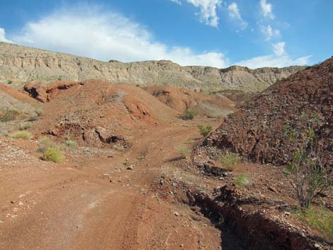
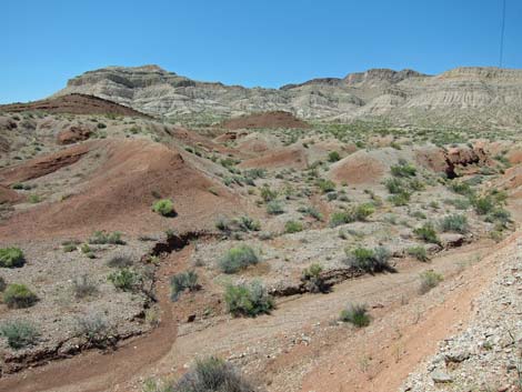
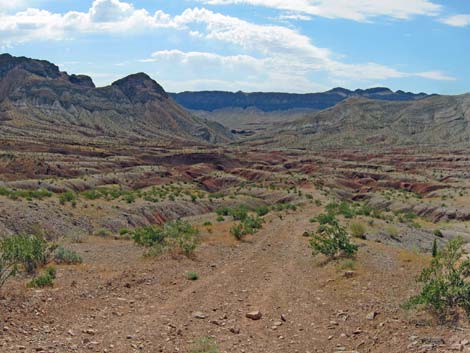
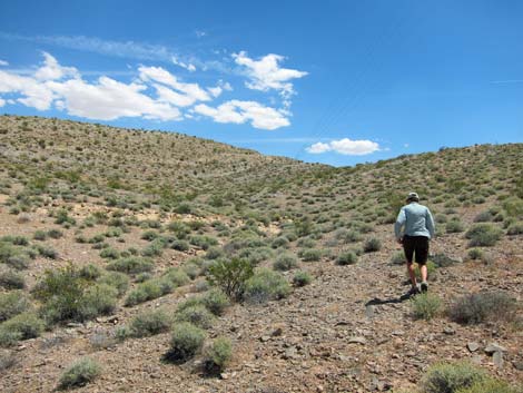
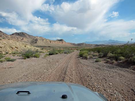 Typical Weiser Wash Road (view N) |
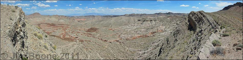
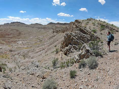
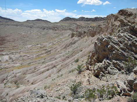
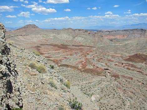
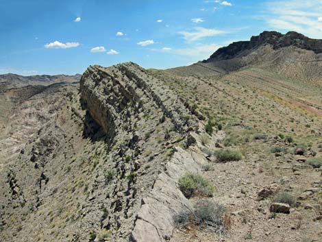
Overview Weiser Bowl, also known as "The Bowl," is an odd, bowl-shaped geological feature in the northern Muddy Mountains, northeast of Las Vegas near Moapa and Glendale. The Bowl is a curiously eroded over-thrust fault where the walls of the bowl are layers of limestone that literally folded over and turned up-side-down during thrust faulting in this region. High limestone walls surround the bowl everywhere except for the outlet wash, which provides access for hikers into the bowl. Two spots on the west rim of the bowl provide vehicle access with short walks to overlooks. Roads into the bowl require a high-clearance vehicle, although 4WD would be safer. The road onto the ridge would be better in a high-clearance vehicle, but it might be passable in a carefully driven sedan. |
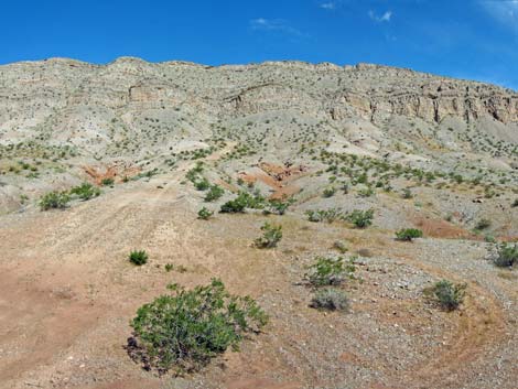
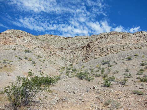
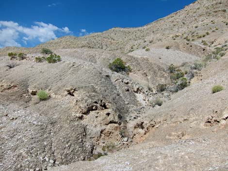
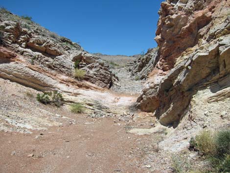 Trailhead for hike into Weiser Bowl (view W) |
Link to Overview Map or Route Map. In most thrust faults, when the land surface is compressed, the land on one side of a fault is forced up and over the land on the other side of the fault. This is how Red Rock Canyon NCA was formed, and it explains why old limestone rock sits atop younger sandstone rock. In the case of Weiser Bowl, however, the land got caught and did not slide easily. As a result of continuing thrusting, the land buckled behind the caught edge and literally folded over. Erosion has now exposed these upside-down rocks in the wall of the oddly formed bowl. |
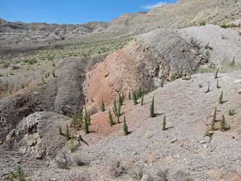
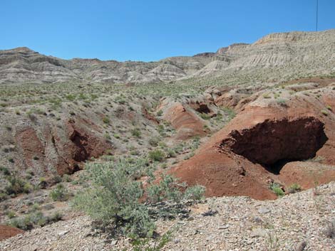
 Narrows open into Weiser Bowl (view W) |
Watch Out Other than the standard warnings about hiking in the desert, ...this is a safe area with few unusual hazards. Both viewpoints are atop high cliffs with lots of loose scree, so be careful around edges with falling hazards. While hiking, please respect the land and the other people out there, and try to Leave No Trace of your passage. Also, even though these hikes are short, this is a remote area, so bring the 10 Essentials. |
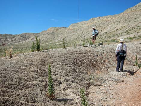
 ATV trail through mud hills inside Weiser Bowl (view NW) |
Getting to the Trailheads Weiser Bowl is located northeast of Las Vegas near Moapa and Glendale. There are two access points: one for the bottom of the bowl, and the other for the ridge overlooking the bowl. For the hike into the bottom of the bowl, from Las Vegas, drive north on Interstate-15 for 38 miles to the Ute Exit (Site 1147). Exit the highway to the east (right). Unfortunately, Ute Road through California Ridge washed out badly during the winter of 2022-2023, and now it is passable only in a modified 4WD vehicle. For people with regular 4WD vehicles, Ute Road is unusable. For the drive to the overlook at the top of the bowl, from Las Vegas, drive north on Interstate-15 for 46 miles to the Hidden Valley Exit (Site 1156). Exit the highway to the east (right). |
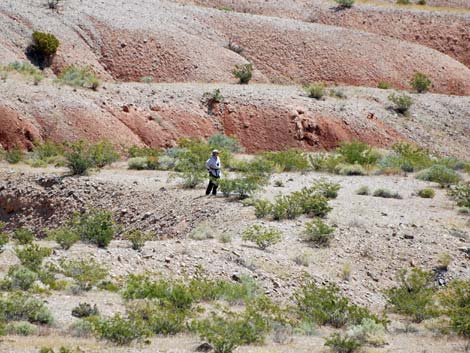
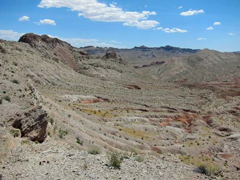
 Grand scenery inside Weiser Bowl (view S) |
Trailhead --The Bowl from Below For the hike into the bowl, exit I-15 at Ute Exit (Site 1147) and drive east on Ute Road. Note that sometimes this road is closed near the exit. Stay on the pavement and continue past "No Trespassing" signs. My understanding is that the Federal Trust Lands (Indian Reservation) on both sides of the paved road are closed to the public, but the paved road is right-of-way across the reservation to public lands beyond. At about 4.8 miles from the Interstate, the pavement ends where Ute Road passes through a narrow gap in California Ridge. Beyond the gap, the pavement resumes and eventually runs out to an old quarry site. |
 Old road runs up onto the west wall of Weiser Bowl (view W) |
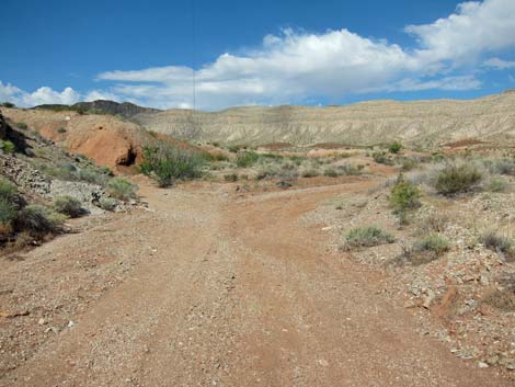
At 6.1 miles from the Interstate (Site 1148), the paved road is crossed by a designated BLM dirt road. There are large parking or staging areas on both sides of the pavement at this point, evidence of considerable use. Turning left (Site 1148) and driving northeast, watch for carsonite signs marking the dirt road (Bowl Trail and Hawkins Trail). The road leads about 200 yards to a wash (Site 1149), which serves as another dirt road. Continuing straight leads to a rough road. A better route turns left and runs down the wash for about 150 yards to another intersection (Site 1150). Turn right and follow this road northeast. The road runs up the valley to a low saddle, then continues northeast. Side roads come and go, but the main road in the bottom of the valley is always obvious. After 4.2 miles on this dirt road, a side road (Site 1151) forks hard to the left and runs up a major side-wash. |
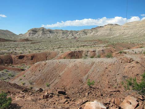
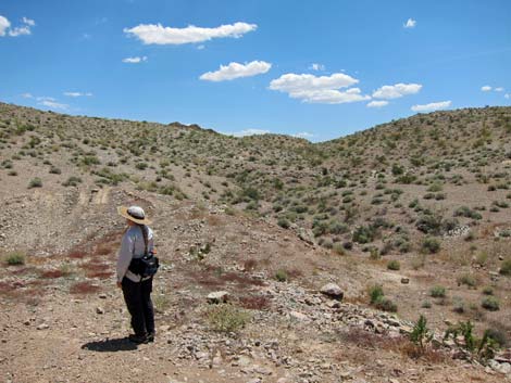
 Gypsum soils in the bowl support odd plants (view S) |
Turn left and drive southwest up the wash (Bowl Trail) for about 1.0 miles into a narrow canyon blocked by a 2-ft pour-over (Site 1152). A steep road climbs out of the wash and around the narrows, but for hikers, this is the place to stop. Park here (Site 1152) in the bottom of the wash; this is the trailhead for hiking into the bottom of the bowl. The Hike -- The Bowl from Below From the trailhead (Table 2, Waypoint 01), the route follows the wash up the narrow canyon to the northwest. Shortly, the narrows open onto The Bowl with grand views of turned-over cliffs all around. At about 0.14 miles out, the main wash forks (Wpt. 02). ATVs and a few jeeps make it in here, and following tracks in the wash to the left leads to a loop into the southwest corner of the bowl (Wpt. 05) and back to this point in about 1.5 miles. |
 Hiker inside Weiser Bowl Hiker inside Weiser Bowl |
Staying to the right in the wash, following the road for another 0.13 miles, tracks in the sand again fork to the left (Wpt. 03). This is the other end of the southwestern loop. Again staying to the right, the road runs out another 0.42 miles to a turn-around on the west wall of the bowl (Wpt. 04). This point gives grand views back towards the entrance to the bowl. This is a good place to turn around and hike back to the trailhead, enjoying the scenery in the other direction. For those interested, hikers can traverse the slopes of the bowl to the south and hike to Wpt. 05, joining an old road before getting there. From Wpt. 05, hikers can return down the old road to the trailhead (Wpt. 01), making a 2.2-mile loop. Trailheads -- Viewing the Bowl from Above From Interstate-15 at the Hidden Valley Exit (Site 1156), turn east (right) and drive over the cattle guard and across an old, paved road into a large, dirt parking area. Staying slightly to the left, California Ridge Road can be seen running southeast out into the desert. |
 Inside the Bowl (view SW) |
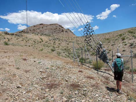
Before leaving the parking area, take a moment to look for the two, extremely tall radio towers on California Ridge to the southeast. The goal is to get to the base of these towers. The graded California Ridge Road runs southeast, bends more to the south, and then bends again to the southwest. At about 1.3 miles from the pavement, the main road takes a hard turn to the left. A faint road continues straight, so this curve sneaks up on you. The road runs southeast and begins to climb into the mountains. Parts of this road are quite steep, and it is in these steep sections where drivers in sedans might have some trouble. At 3.2 miles out, the main road passes a side road to the left. As can be seen from the intersection, this road leads to a gate and the base of the first radio tower. Pass this side road and continue southwest to a second side road to the left (Site 1157). Turn left and follow this road around the hill to the base of guy wires for the tower (Site 1157). Park here, this is the trailhead for the northern overlook. The anchor is inside a fence: don't mess with the guy wires. |
 Inside the Bowl (view SW) |
For the southern overlook, continue south on the main dirt road as it winds around heading towards the second radio tower. About 1.5 miles past the first tower, the road reaches a gate just before the second tower. View the tower and area from the gate, then turn around and drive back north about 100 yards (Site 1159). Pick a wide spot without blocking the road. Park here; this is the trailhead for the southern overlook. The Hikes -- Viewing the Bowl from Above Northern Overlook: From the end of the road (Site 1158) by the guy wire supporting the northern tower (Wpt. 06), the route runs up the wash heading southeast towards a low point on the skyline about 0.13 miles out. The route leaves the wash and climbs onto the ridgeline, which is the Northern Overlook (Wpt. 07). Southern Overlook: From the main road (Site 1159) about 100 yards before the southern gate (Wpt. 08), the route runs southeast for 0.13 miles to the base of guy wires supporting the radio tower. Don't mess with the guy wires, but continue another 0.03 miles to the edge of the ridge, which is the Southern Overlook (Wpt. 09) |
 Inside the Bowl (view W) |
 Inside the Bowl (view E) |
 Inside the Bowl (view SW) |
 Palmer's Phacelia inside Weiser Bowl (view S) |
Northern Overlook
 Route to Northern Overlook (view SE from trailhead) |
 Guy wire anchor for the northern tower (view N) |
 Northern Overlook (view S across the Bowl) |
 Northern Overlook (view S) |
 Northern Overlook (view SE) |
 More to come ... |
Southern Overlook
 Route to Southern Overlook (view SE from trailhead) |
 Southern Overlook (view NE across the Bowl) |
Southern Overlook (view NE) |
 Southern Overlook (view S) |
Table 1. Highway Coordinates Based on GPS Data (NAD27; UTM Zone 11S). Download Driving GPS Waypoints (*.gpx) file.
| Site # | Location | UTM Easting | UTM Northing | Latitude (N) | Longitude (W) | Elevation (ft) | Verified |
|---|---|---|---|---|---|---|---|
| 1147 | I-15 at Ute Exit | 706380 | 4047490 | 36.55238 | 114.69418 | 1,844 | GPS |
| 1148 | Ute Rd at Weiser Wash Rd | 715185 | 4046499 | 36.54151 | 114.59616 | 2,417 | GPS |
| 1149 | Weiser Wash Road 1 | 715255 | 4046634 | 36.54270 | 114.59534 | 2,418 | GPS |
| 1150 | Weiser Wash Road 2 | 715150 | 4046644 | 36.54283 | 114.59651 | 2,410 | GPS |
| 1151 | Weiser Wash Road at Bowl Road | 717614 | 4052242 | 36.59269 | 114.56742 | 1,961 | GPS |
| 1152 | Weiser Bowl Parking | 716141 | 4051790 | 36.58895 | 114.58401 | 2,134 | GPS |
| 1153 | Weiser Wash Rd at RR Tracks | 719449 | 4057779 | 36.64214 | 114.54535 | 1,519 | GPS |
| 1154 | Weiser Wash Road at Town | 718439 | 4058692 | 36.65059 | 114.55638 | 1,512 | GPS |
| 1155 | I-15 at Glendale Exit East | 717981 | 4060302 | 36.66520 | 114.56104 | 1,545 | GPS |
| 1156 | I-15 at Hidden Valley Exit | 714717 | 4057072 | 36.63685 | 114.59844 | 1,740 | GPS |
| 1157 | Weiser Bowl Upper Road North | 715696 | 4053051 | 36.60041 | 114.58862 | 2,447 | GPS |
| 1158 | Weiser Bowl Overlook Parking N | 715805 | 4052897 | 36.59900 | 114.58745 | 2,460 | GPS |
| 1159 | Weiser Bowl Overlook Parking S | 714708 | 4051659 | 36.58809 | 114.60005 | 2,642 | GPS |
| Gate North | Gate to North Radio Tower | 715908 | 4053216 | 36.60185 | 114.58621 | 2,494 | GPS |
| Gate South | Gate to South Radio Tower | 714664 | 4051557 | 36.58719 | 114.60057 | 2,680 | GPS |
| Tower North | North Radio Tower | 716001 | 4053105 | 36.60083 | 114.58521 | 2,687 | GPS |
| Tower South | South Radio Tower | 714690 | 4051301 | 36.58487 | 114.60035 | 2,697 | GPS |
Table 2. Hiking Waypoints Based on GPS Data (NAD27; UTM Zone 11S). Download Hiking GPS Waypoints (*.gpx) file.
| Wpt. | Location | UTM Easting | UTM Northing | Elevation (ft) | Point-to-Point Distance (mi) | Cumulative Distance (mi) |
|---|---|---|---|---|---|---|
| 01 | Trailhead into Bowl | 716138 | 4051792 | 2,124 | 0.00 | 0.00 |
| 02 | Loop Route | 715966 | 4051921 | 2,179 | 0.15 | 0.15 |
| 03 | Loop Route | 715762 | 4051940 | 2,181 | 0.13 | 0.28 |
| 04 | End of Road | 715256 | 4052247 | 2,358 | 0.42 | 0.70 |
| 05 | Far End of Loop | 715065 | 4051466 | 2,411 | 0.77 | 1.47 |
| 02 | Loop Route | 715966 | 4051921 | 2,179 | 0.72 | 2.19 |
| 01 | Trailhead into Bowl | 716138 | 4051792 | 2,124 | 0.14 | 2.33 |
| . | . | . | . | . | . | . |
| 06 | Upper Trailhead North | 715804 | 4052895 | 2,477 | 0.00 | 0.00 |
| 07 | Overlook North | 715864 | 4052737 | 2,499 | 0.13 | 0.13 |
| 06 | Upper Trailhead North | 715804 | 4052895 | 2,477 | 0.13 | 0.26 |
| . | . | . | . | . | . | . |
| 08 | Upper Trailhead South | 714709 | 4051658 | 2,639 | 0.00 | 0.00 |
| 09 | Overlook South | 714852 | 4051494 | 2,741 | 0.16 | 0.16 |
| 08 | Upper Trailhead South | 714709 | 4051658 | 2,639 | 0.16 | 0.32 |
Happy Hiking! All distances, elevations, and other facts are approximate.
![]() ; Last updated 240328
; Last updated 240328
| Hiking Around Las Vegas | Glossary | Copyright, Conditions, Disclaimer | Home |