Hiking Around Las Vegas, Mojave National Preserve
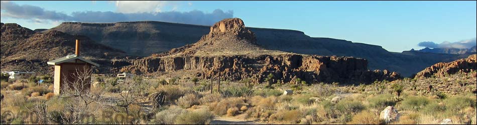
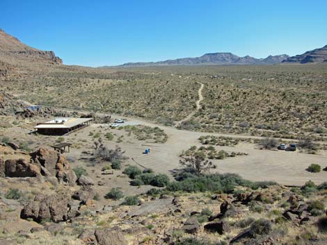
 Banshee Peak above Visitor Center (view SW) |
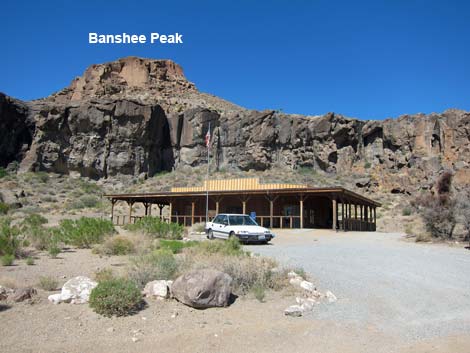
Overview Banshee Peak is the eye-catching craggy peak above Banshee Canyon and Hole in the Wall Visitor Center. This short route runs 0.3 miles up the east side of the peak to the summit ridge. Views from the summit ridge are grand, but hikers can scramble (Class 3 and Class 4) onto higher ledges on the east and west sides of the peak, but technical climbing gear is required to safely climb onto the summit. It is, however, hard to imagine that views from the summit are any better than those from the summit ridge. Link to map. |
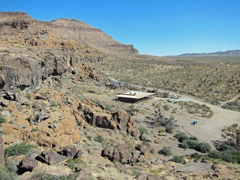
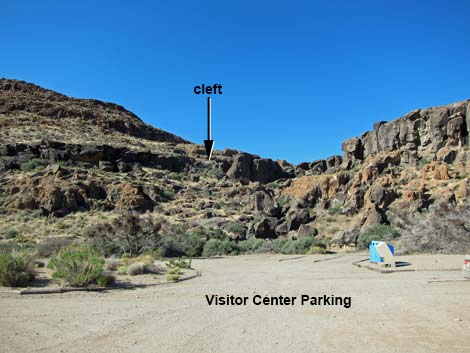 Trailhead in Visitor Center parking lot |
Watch Out Other than the standard warnings about hiking in the desert, ... this off-trail hike and scramble leads into steep and loose, rocky territory. Be extra careful near edges, and don't climb anything you don't want to climb down (which is always harder than climbing up). Hikers are almost always in sight of the visitor center, so hikers in trouble might be able to call for help. While hiking, please respect the land and the other people out there, and try to Leave No Trace of your passage. Also, even though this hike is short, be sure to bring what you need of the 10 Essentials. Getting to the Trailhead This hike is located in Mojave National Preserve, about 2 hours south of Las Vegas. From town, drive out to Mojave National Preserve and the Hole in the Wall Visitor Center, which is about 85 miles south of town. Park in the Visitor Center parking area. Park here; this is the trailhead. |
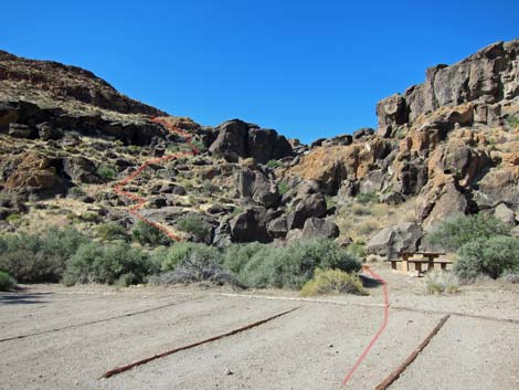 Route starts by picnic table |
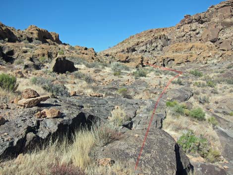
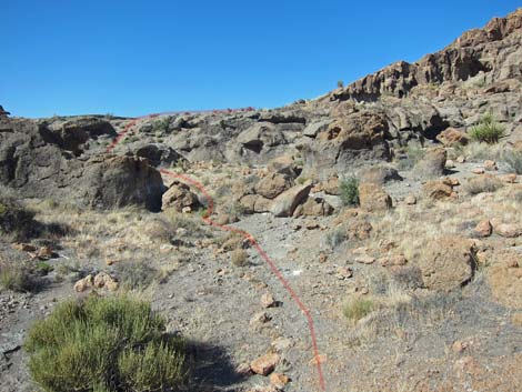
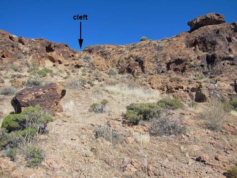
The Hike From the Hole-in-the-Wall Visitor Center parking lot (Table 1; Waypoint 01), the route passes a picnic table and starts up towards an obvious cleft in the cliffs. The route, however, bypasses the obvious cleft because the cliffs are too high, and instead runs up through the next cleft in the cliffs to the left. Atop the first band of cliffs (Wpt. 02), the route angles back into the main drainage (above the obvious cleft) and follows the wash uphill. A band of cliffs is passed at a low pour-over (Wpt. 03) in the wash. The next band of low cliffs is passed left of the wash, and this brings hikers onto a saddle (Wpt. 04) with nice views south to a working cattle ranch in Wild Horse Canyon and north to the campground. |
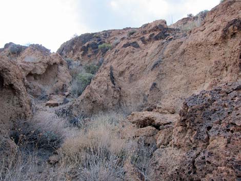
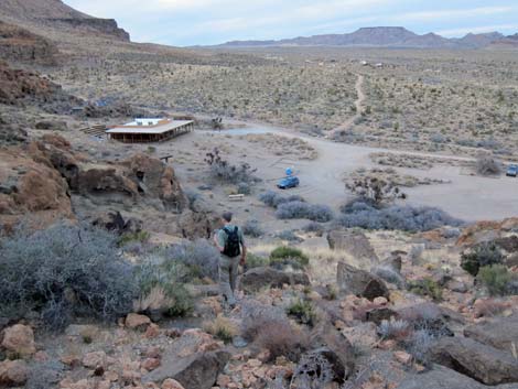
 Climbing towards first band of cliffs (view S) |
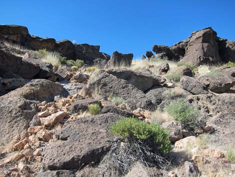
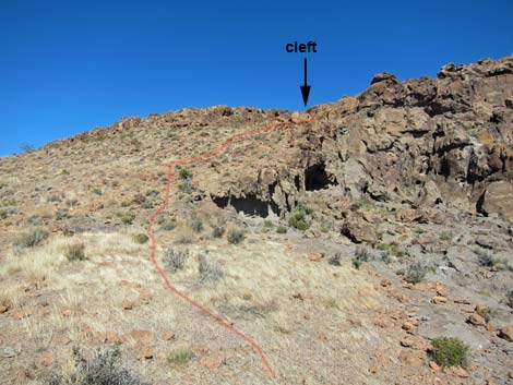
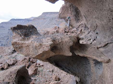
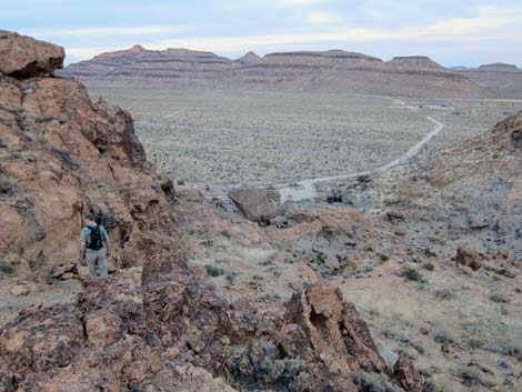
From the saddle (Wpt. 04), the route turns west and runs up the steep hillside where hikers will find faint use-trails aiming for a cleft in the ridgeline above and left of the peak. After climbing the steep hillside, the route passes another band of cliffs in a rocky gully that suddenly ends (Wpt. 05) when hikers look down the west-facing cliffs. Carefully turning north on the narrow ridgeline, hikers can scramble onto higher ledges. On the east face of the peak, ledges run a short distance to grand views overlooking the campground. Ledges on the west face lead all the way around to the north side of the peak. Return to the trailhead by retracing the route, always using care when high enough to fall and get hurt. |
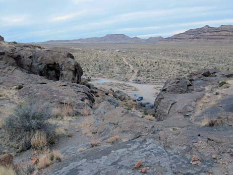
 Visitor Center (view N from atop first band of cliffs) |
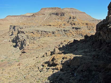
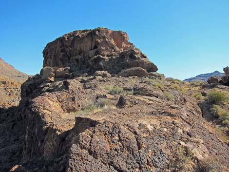
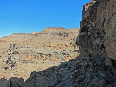
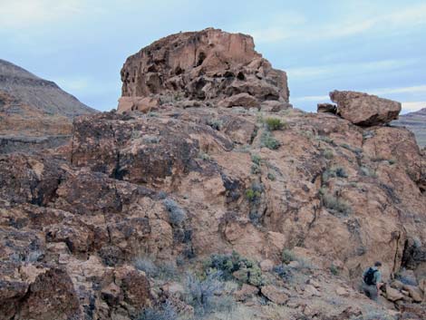
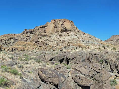 Banshee Peak (view SW from atop 1st band of cliffs) |
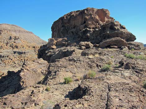
 Above first band of cliffs (view SW) |
 Approaching 1st and 2nd bands of cliffs (view SW) |
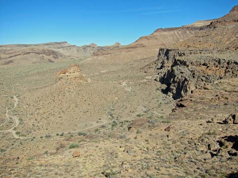
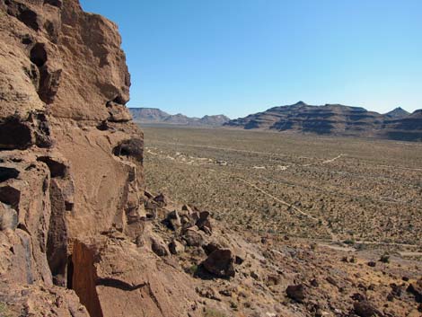
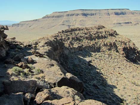
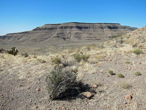 Saddle (view S towards cattle ranch) |
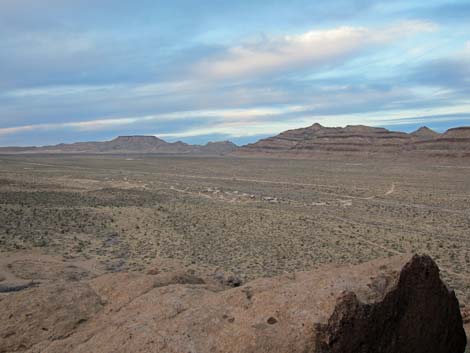
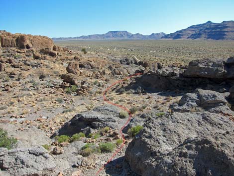 Saddle (view N towards campground and route) |
 Route towards summit ridge (view W) |
 Approaching cleft in summit ridge (view W) |
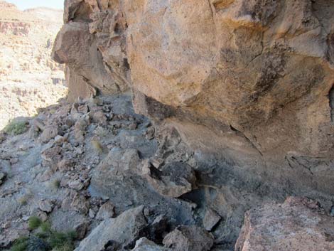
 Rocky gully below cleft in summit ridge (view W) |
 First look over west-facing cliffs (view W) |
 First look over west-facing cliffs (view N) |
 Not so easy to get there (view N) |
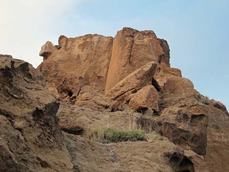
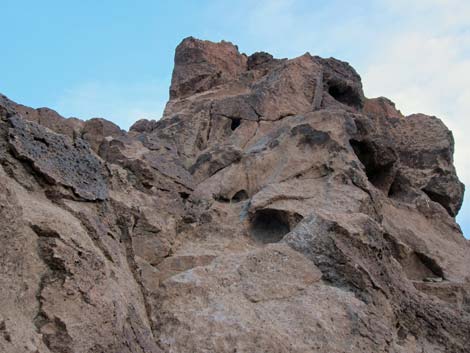
 Summit block (view N) |
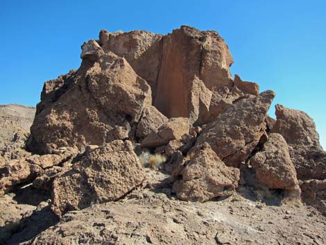 Summit block (view N) |
 Summit block (view N towards south-face) |
 Campground (view NE from atop east-facing cliffs) |
 Campground (view NE from atop east-facing cliffs) |
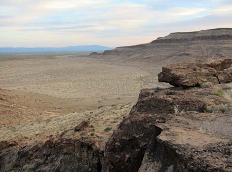 View SE from atop east-facing cliffs |
 Ledge on west-facing side of summit block (view N) |
 Ledge on west-facing side of summit block (view N) |
 Eroded cliffs on west-facing side of summit (view N) |
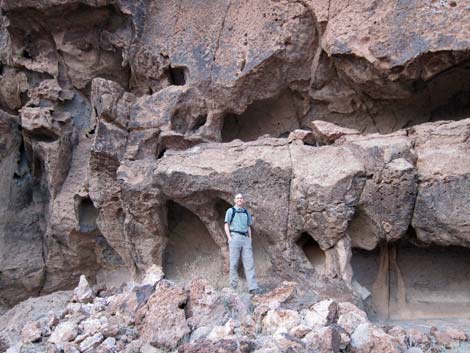 Eroded cliffs on west-facing side of summit (view N) |
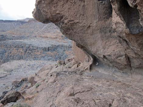 Ledge leading to view of N side of summit block (view N) |
 North side of summit block looks 5th-class (view S [up!]) |
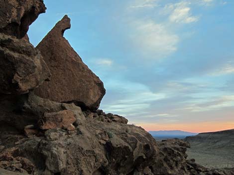 Sunset (view SW from west-facing ledges) |
 Departing west-facing ledges (view S) |
 Hiker descending rocky gully (view N) |
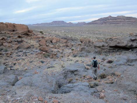
 Hiker descending steep hillside (view NE) |
 Hiker descending 3rd rocky band (view N) |
 Bypassing obvious cleft above Visitor Center (view N) |
 Visitor Center (view N from above 1st band of cliffs) |
 Hiker descending below 1st rocky band (view N) |
Table 1. Hiking Coordinates Based on GPS Data (NAD27; UTM Zone 11S). Download Hiking GPS Waypoints (*.gpx) file.
| Wpt. | Location | UTM Easting | UTM Northing | Elevation (ft) | Point-to-Point Distance (mi) | Cumulative Distance (mi) | Verified |
|---|---|---|---|---|---|---|---|
| 01 | Trailhead | 646404 | 3878700 | 4,253 | 0.00 | 0.00 | GPS |
| 02 | Above First Cliff | 646404 | 3878626 | 4,298 | 0.07 | 0.07 | GPS |
| 03 | Low Pour-Over | 646337 | 3878606 | 4,306 | 0.05 | 0.12 | GPS |
| 04 | Saddle | 646321 | 3878570 | 4,320 | 0.03 | 0.14 | GPS |
| 05 | Summit Ridge | 646224 | 3878592 | 4,431 | 0.08 | 0.22 | GPS |
| 06 | Route End | 646221 | 3878695 | 4,453 | 0.10 | 0.32 | GPS |
| 01 | Trailhead | 646404 | 3878700 | 4,253 | 0.32 | 0.64 | GPS |
Happy Hiking! All distances, elevations, and other facts are approximate.
![]() ; Last updated 240328
; Last updated 240328
| Hiking Around Mojave Preserve | Hiking Around Las Vegas | Glossary | Copyright, Conditions, Disclaimer | Home |